About the Author
Kev Reynolds is a freelance travel writer and lecturer who lives in the Kent countryside when not trekking in distant mountain ranges. Walks and Climbs in the Pyrenees was first published by Cicerone Press in 1978, and the authors love of the mountains now spans 50 years. Some of his adventures when researching routes for this guide appear in A Walk in the Clouds , a collection of short stories celebrating his life among mountains worldwide, which includes the Alps, Atlas Mountains of Morocco, Andes of Peru and the Himalayan regions of Nepal, Sikkim and Bhutan. In 2015 Cicerone published his memoir of trekking adventures in Nepal, entitled bode of the Gods.
Elected an honorary member of the Outdoor Writers & Photographers Guild, SELVA (the Socit d'Etude de la Littrature de Voyage du monde Anglophone) and the British Association of International Mountain Leaders (BAIML), his enthusiasm for the countryside in general, and mountains in particular, remains undiminished after a lifetimes activity. During the winter months he regularly travels throughout Britain to share that enthusiasm through his lectures.
Check him out on www.kevreynolds.co.uk.
Other Cicerone guides by the author
100 Hut Walks in the Alps
Abode of the Gods
A Walk in the Clouds
Chamonix to Zermatt
Everest: a Trekkers Guide
The Bernese Oberland
The Cotswold Way
Swiss Alpine Pass Route Via Alpina Route 1
The Bernese Oberland
The Cotswold Way
The Mountain Hut Book
The North Downs Way
The Pyrenees
The South Downs Way
Tour of the Jungfrau Region
Tour of the Oisans: The GR54
Tour of the Vanoise
Trekking in the Alps
Trekking in the Himalaya
Trekking in the Silvretta & Rtikon Alps
Walking in Austria
Walking in Kent
Walking in Sussex
Walking in the Alps
Walking in the Valais
Walks and Climbs in the Pyrenees
Walks in the Engadine
Walks in the South Downs National Park
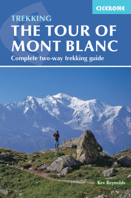
TOUR OF MONT BLANC
by Kev Reynolds
JUNIPER HOUSE, MURLEY MOSS,
OXENHOLME ROAD, KENDAL, CUMBRIA LA9 7RL
www.cicerone.co.uk
Kev Reynolds 2011
Fourth edition 2015 Reprinted 2016, 2017, 2018 and 2019 (with updates)
ISBN 9781783621569
Third edition 2011
ISBN 9781852846725
Second edition 2007
ISBN 9781852845322
First edition 2002
ISBN 1852843586
Printed in China on behalf of Latitude Press Ltd.
A catalogue record for this book is available from the British Library.
 The routes of the GR, PR and GRP paths in this guide have been reproduced with the permission of the Fdration Franaise de la Randonne Pdestre holder of the exclusive rights of the routes. The names GR, PR and GRP are registered trademarks. FFRP 2015 for all GR, PR and GRP paths appearing in this work.
Dedication
This book is dedicated to the memory of Andrew Harper (19302001), author of the first English-language guide to the Tour of Mont Blanc.
Updates to this Guide
While every effort is made by our authors to ensure the accuracy of guidebooks as they go to print, changes can occur during the lifetime of an edition. Any updates that we know of for this guide will be on the Cicerone website (www.cicerone.co.uk/779/updates), so please check before planning your trip. We also advise that you check information about such things as transport, accommodation and shops locally. Even rights of way can be altered over time. We are always grateful for information about any discrepancies between a guidebook and the facts on the ground, sent by email to updates@cicerone.co.uk or by post to Cicerone, Juniper House, Murley Moss, Oxenholme Road, Kendal LA9 7RL, United Kingdom.
Register your book: To sign up to receive free updates, special offers and GPX files where available, register your book at www.cicerone.co.uk.
Front cover: Mont Blanc from the Grand Balcon Sud between La Flgre and Le Brvent
CONTENTS

On the path from the Col de la Seigne to Rifugio Elisabetta
INTRODUCTION
Were it to stand alone with no near neighbour to lend it scale, the great snow- and ice-crusted dome of Mont Blanc would still lay claim to the title of Monarch of the Alps. At 4807m (15,771ft) the summit stands a good 3700m (12,000ft) above Chamonix, and is 3km higher than the nearest habitation on the Italian flank. On blue-sky days it dazzles in the sunshine or floats on a raft of cloud, commanding ones attention with its dominating height, for it has a regal presence equal both to its appearance and its stature. That presence is not always benign, of course, for the mountain also dictates the weather and controls the climate of its surrounding valleys. But catch it in a benevolent mood, and those valleys bask in its glory.
Mont Blanc does not stand alone, however, and the large number of attendant peaks and aiguilles, savage rock walls, ridges and tumbling glaciers, rather than detract from its grandeur, simply add to it with their own individuality courtiers whose impressive company would grace any massif anywhere in the world. The Grandes Jorasses, Aiguille Noire, the Verte and Drus, Aiguille du Midi, Mont Maudit and Mont Dolent, on which the borders of three countries meet, each of these (and there are many more) would stand out in any mountain crowd. Here they attend court, subdued only by altitude.

The summit of Le Brvent rewards with a direct view of Mont Blanc across the valley
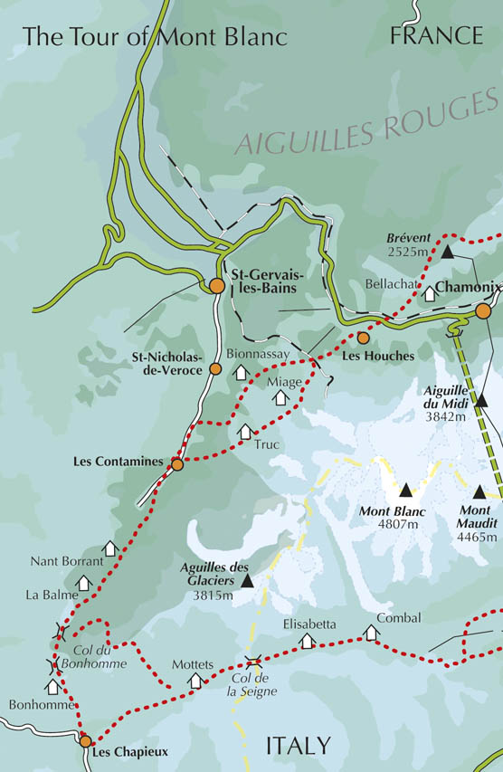
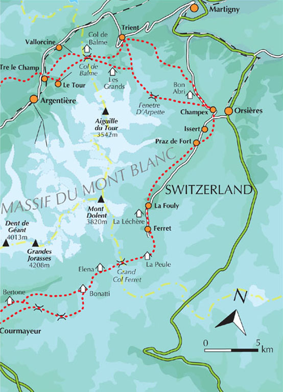
Mont Blanc then is more than just the highest mountain in Europe west of the Caucasus. Indeed, its more than a big mountain massif, its a mountain range, compact and complete in itself. According to Roger Frison-Roche, this beautiful 25km-long wall of rock, snow and ice has some 400 summits and more than 40 glaciers that scour the heartland and add lustre to every scene. Carrying the frontiers of three countries, France, Italy and Switzerland, it is moated by seven valleys those of the Arve, Montjoie, des Glaciers, Veni, the two Vals Ferret (one Italian, the other Swiss), and the Valle du Trient valleys that define the limits of the range, and through which winds the route of the Tour of Mont Blanc (TMB), a trekkers route that revels in some of the most exquisite mountain scenery of all.
The Tour of Mont Blanc
Over a period of 10 to 12 days the TMB entices walkers on a circuit of this magnificent mountain block, making a journey of around 170km (105 miles), with an accumulated height gain and loss of something like 10,000m (32,800ft). Depending on the precise route taken (for there are variations), there are 10 or 11 passes to cross as the tour progresses from one valley to the next. Each of these valleys enjoys unforgettable views, and each has its own individual character the bustling, tourist-centred Valle de lArve (the Chamonix valley), the sparsely inhabited Valle des Glaciers, the pastoral Swiss Val Ferret, to name but three.





 The routes of the GR, PR and GRP paths in this guide have been reproduced with the permission of the Fdration Franaise de la Randonne Pdestre holder of the exclusive rights of the routes. The names GR, PR and GRP are registered trademarks. FFRP 2015 for all GR, PR and GRP paths appearing in this work.


