Transcription:
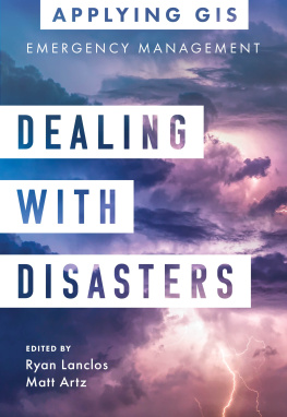
Dealing with Disasters: GIS for Emergency Management (Applying GIS series)
Discover a modern approach to understanding threats and hazards that are more complex, costly, and devastating than ever before.
Dealing with Disasters: GIS for Emergency Management explores a collection of real-life case studies about emergency management agencies successfully using GIS for real and potential hazards. Each of the three themed partsDisaster Preparedness, Disaster Response, and Disaster Recoveryalso includes a getting started with GIS section that provides ideas, strategies, tools, and actions to help jump-start your own use of GIS for emergency management. A collection of online resources, including additional stories, videos, new ideas and concepts, and downloadable tools and content, complements this book.
Edited by Ryan Lanclos, the director of public safety solutions at Esri, and Matt Artz, an Esri content strategist.
Applying GIS
The Applying GIS series explains how to become a spatial thinker, with ideas and strategies for building location intelligence into your profession, industry, or discipline. Each pocket-size book is divided into relevant topic areas that include a set of case studies and a road map for getting started with GIS.

Esri Press, 380 New York Street, Redlands, California 92373-8100
Copyright 2021 Esri
All rights reserved.The information contained in this document is the exclusive property of Esri unless otherwise noted. This work is protected under United States copyright law and the copyright laws of the given countries of origin and applicable international laws, treaties, and/or conventions. No part of this work may be reproduced or transmitted in any form or by any means, electronic or mechanical, including photocopying or recording, or by any information storage or retrieval system, except as expressly permitted in writing by Esri. All requests should be sent to Attention: Contracts and Legal Services Manager, Esri, 380 New York Street, Redlands, California 92373-8100, USA.The information contained in this document is subject to change without notice.US Government Restricted/Limited Rights: Any software, documentation, and/or data delivered hereunder is subject to the terms of the License Agreement. The commercial license rights in the License Agreement strictly govern Licensees use, reproduction, or disclosure of the software, data, and documentation. In no event shall the US Government acquire greater than RESTRICTED/LIMITED RIGHTS. At a minimum, use, duplication, or disclosure by the US Government is subject to restrictions as set forth in FAR 52.227-14 Alternates I, II, and III (DEC 2007); FAR 52.227-19(b) (DEC 2007) and/or FAR 12.211/12.212 (Commercial Technical Data/Computer Software); and DFARS 252.227-7015 (DEC 2011) (Technical DataCommercial Items) and/or DFARS 227.7202 (Commercial Computer Software and Commercial Computer Software Documentation), as applicable. Contractor/Manufacturer is Esri, 380 New York Street, Redlands, CA 92373-8100, USA.@esri.com, 3D Analyst, ACORN, Address Coder, ADF, AML, ArcAtlas, ArcCAD, ArcCatalog, ArcCOGO, ArcData, ArcDoc, ArcEdit, ArcEditor, ArcEurope, ArcExplorer, ArcExpress, ArcGIS, arcgis.com, ArcGlobe, ArcGrid, ArcIMS, ARC/INFO, ArcInfo, ArcInfo Librarian, ArcLessons, ArcLocation, ArcLogistics, ArcMap, ArcNetwork, ArcNews, ArcObjects, ArcOpen, ArcPad, ArcPlot, ArcPress, ArcPy, ArcReader, ArcScan, ArcScene, ArcSchool, ArcScripts, ArcSDE, ArcSdl, ArcSketch, ArcStorm, ArcSurvey, ArcTIN, ArcToolbox, ArcTools, ArcUSA, ArcUser, ArcView, ArcVoyager, ArcWatch, ArcWeb, ArcWorld, ArcXML, Atlas GIS, AtlasWare, Avenue, BAO, Business Analyst, Business Analyst Online, BusinessMAP, CommunityInfo, Database Integrator, DBI Kit, EDN, Esri, Esri CityEngine, esri.com, EsriTeam GIS, EsriThe GIS Company, EsriThe GIS People, EsriThe GIS Software Leader, FormEdit, GeoCollector, Geographic Design System, Geography Matters, Geography Network, geographynetwork.com, Geoloqi, Geotrigger, GIS by Esri, gis.com, GISData Server, GIS Day, gisday.com, GIS for Everyone, JTX, MapIt, Maplex, MapObjects, MapStudio, ModelBuilder, MOLE, MPSAtlas, PLTS, Rent-a-Tech, SDE, See What Others Cant, SML, SourcebookAmerica, SpatiaLABS, Spatial Database Engine, StreetMap, Tapestry, the ARC/INFO logo, the ArcGIS Explorer logo, the ArcGIS logo, the ArcPad logo, the Esri globe logo, the Esri Press logo, The Geographic Advantage, The Geographic Approach, the GIS Day logo, the MapIt logo, The Worlds Leading Desktop GIS, Water Writes, and Your Personal Geographic Information System are trademarks, service marks, or registered marks of Esri in the United States, the European Community, or certain other jurisdictions. Other companies and products or services mentioned herein may be trademarks, service marks, or registered marks of their respective mark owners.For purchasing and distribution options (both domestic and international), please visit esripress.esri.com.On the cover: Photograph by Felix Mittermeier.174579
Introduction
Creating safer, less vulnerable communities requires a modern approach to understanding threats and hazards that are more complex, costly, and devastating than ever before. Agencies around the world rely on geographic information systems (GIS) every day to plan for and mitigate complex threats and hazards and coordinate response and recovery efforts when disasters and emergencies occur. With location intelligence, youll develop a deeper understanding of risk in any situation, and gain real-time data insights for faster, more effective decisions.
Part 1: Disaster preparedness
To effectively plan for, mitigate, and reduce risks, emergency management professionals must incorporate real-time data, big data, and other critical data feeds into their analysis. Data-driven insights help communities effectively prepare for worst-case scenarios. In part 1, well explore real-world examples of organizations using GIS for visualizing and analyzing risk, performing real-time analytics, managing mitigation projects, and communicating with the public.
Part 2: Disaster response
Emergency management professionals must become more agile and informed at all points during response efforts. Successfully planning for and responding to growing threats requires agility and effective communication throughout an event. In part 2, well look at the ways that GIS tools have been used for robust situational awareness, rapid impact analysis, deploying resources, and communicating with the public.
Part 3: Disaster recovery
Recovery efforts can take years, and its critical to avoid missteps that delay progress. Its essential to provide emergency management professionals with tools to prioritize work and deliver on every recovery dollar invested in a community. In part 3, well see how GIS can be used for better documentation and management of debris removal, distribution of resources, and transparent recovery monitoring.
Thanks to location technology and the internet, we have never had a better ability to model, measure, and map fast-developing events like hurricanes, tornadoes, earthquakes, fires, or floods. The understanding that comes from this ability allows us to get inside the turning radius of the big challenges we face as a people. So, instead of merely reacting as we chase after a problem, were actually anticipating and getting ahead of the problem. We are modeling, we are measuring what works, and we are sharing with everyone in real time the latest emerging truth on a map.






 Esri Press, 380 New York Street, Redlands, California 92373-8100