Frederick Dellenbaugh - A Canyon Voyage: The Story of John Wesley Powell and the Charting of the Grand Canyon
Here you can read online Frederick Dellenbaugh - A Canyon Voyage: The Story of John Wesley Powell and the Charting of the Grand Canyon full text of the book (entire story) in english for free. Download pdf and epub, get meaning, cover and reviews about this ebook. year: 2017, publisher: Skyhorse, genre: Home and family. Description of the work, (preface) as well as reviews are available. Best literature library LitArk.com created for fans of good reading and offers a wide selection of genres:
Romance novel
Science fiction
Adventure
Detective
Science
History
Home and family
Prose
Art
Politics
Computer
Non-fiction
Religion
Business
Children
Humor
Choose a favorite category and find really read worthwhile books. Enjoy immersion in the world of imagination, feel the emotions of the characters or learn something new for yourself, make an fascinating discovery.
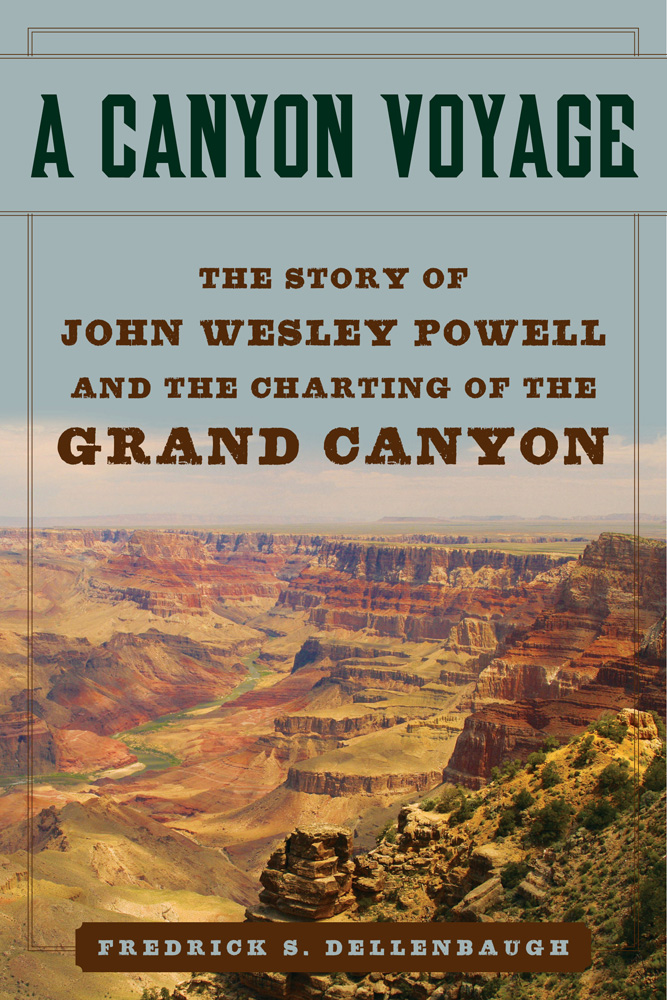
- Book:A Canyon Voyage: The Story of John Wesley Powell and the Charting of the Grand Canyon
- Author:
- Publisher:Skyhorse
- Genre:
- Year:2017
- Rating:4 / 5
- Favourites:Add to favourites
- Your mark:
A Canyon Voyage: The Story of John Wesley Powell and the Charting of the Grand Canyon: summary, description and annotation
We offer to read an annotation, description, summary or preface (depends on what the author of the book "A Canyon Voyage: The Story of John Wesley Powell and the Charting of the Grand Canyon" wrote himself). If you haven't found the necessary information about the book — write in the comments, we will try to find it.
Frederick Dellenbaugh: author's other books
Who wrote A Canyon Voyage: The Story of John Wesley Powell and the Charting of the Grand Canyon? Find out the surname, the name of the author of the book and a list of all author's works by series.


A Canyon Voyage: The Story of John Wesley Powell and the Charting of the Grand Canyon — read online for free the complete book (whole text) full work
Below is the text of the book, divided by pages. System saving the place of the last page read, allows you to conveniently read the book "A Canyon Voyage: The Story of John Wesley Powell and the Charting of the Grand Canyon" online for free, without having to search again every time where you left off. Put a bookmark, and you can go to the page where you finished reading at any time.
Font size:
Interval:
Bookmark:


The Grand Canyon
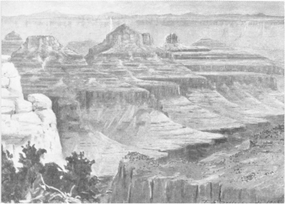
Looking south from the Kaibab Plateau, North Rim, near the head of Bright Angel Greek, the canyon of which is seen in the foreground. The San Francisco Mountains are in the distance. On the South Rim to the right, out of the picture, is the location of the Hotel Tovar. The width of the canyon at top in this region is about twelve miles with a depth of near 6000 feet on the north side, and over 5000 on the south. Total length, including Marble Canyon division, 283 miles. Sketch made in colour on the spot by F. S. Dellenbaugh, June 4, 1903.
Copyright 1908 by Frederick S. Dellenbaugh
First Skyhorse Edition Copyright 2017
All rights reserved. No part of this book may be reproduced in any manner without the express written consent of the publisher, except in the case of brief excerpts in critical reviews or articles. All inquiries should be addressed to Skyhorse Publishing, 307 West 36th Street, 11th Floor, New York, NY 10018.
Skyhorse Publishing books may be purchased in bulk at special discounts for sales promotion, corporate gifts, fund-raising, or educational purposes. Special editions can also be created to specifications. For details, contact the Special Sales Department, Skyhorse Publishing, 307 West 36th Street, 11th Floor, New York, NY 10018 or .
Skyhorse and Skyhorse Publishing are registered trademarks of Skyhorse Publishing, Inc., a Delaware corporation.
Visit our website at www.skyhorsepublishing.com.
10 9 8 7 6 5 4 3 2 1
Library of Congress Cataloging-in-Publication Data is available on file.
Cover design by Tom Lau
Print ISBN: 978-1-5107-2449-5
Ebook ISBN: 978-1-5107-2451-8
Printed in the United States of America.
CONTENTS

ILLUSTRATIONS
Looking south from the Kaibab Plateau, North Rim, near the head of Bright Angel Creek, the canyon of which is seen in the foreground. The San Francisco Mountains are in the distance. On the South Rim to the right, out of the picture, is the location of the Hotel Tovar. The width of the canyon at top in this region is about twelve miles, with a depth of near 6000 feet on the north side, and over 5000 on the south. Total length, including Marble Canyon division, 283 miles.
Sketch made in colour on the spot by F. S. Dellenbaugh, June 4, 1903.
Unidentified skeleton found April, 1906, by C. C. Spaulding in the Grand Canyon 300 feet above the river, some miles below Bright Angel trail. There were daily papers in the pocket of the clothes of the early spring of 1900.
Photograph by Kolb Bros. 1906, Grand Canyon, Arizona.
Photograph by E. O. Beaman, 1871.
The dark box open. Andy, Clem, Beaman, Prof. Steward, Cap., Frank, Jones, Jack, the Major, Fred, Caonita, Emma Dean, Nellie Powell.
Photograph by E. O. Beaman, 1871.
The beginning of the Colorado River Canyons, N. E. Utah.
Photograph by E. O. Beaman, 1871.
Photograph by E. O. Beaman, 1871.
Photograph by E. O, Beaman, 1871.
Ashley Falls from below.
Photograph by E. O. Beaman, 1871.
Photograph by E. O. Beaman, 1871.
Just inside the gate.
Photograph by E. O. Beaman, 1871.
Low water.
Photograph by J. K. Hillers, 1874.
F. S. Dellenbaugh.
Photograph by E. O. Beaman, 1871.
2800 feet above river.
Photograph by E. O. Beaman, 1871.
Jones, Hillers, Dellenbaugh.
Photograph by E. O. Beaman, 1871.
Mouth of Yampa River in foreground, Green River on right.
Photograph by E. O. Beaman, 1871.
Mouth of Bishop CreekFourth of July camp.
Photograph by E. O. Beaman, 1871.
Photograph by E. O. Beaman, 1871.
Steward.
Photograph by E. O. Beaman, 1871.
Photograph by the Denver, Colorado Canyon and Pacific Railway Survey under Robert Brewster Stanton, 1889.
Near mouth of San Rafael.
Photograph by E. O. Beaman, 1871.
The great loop is behind the spectator.
Photograph by E. O. Beaman, 1871.
Photograph by E. O. Beaman, 1871.
Clement Powell
Photograph by E. O. Beaman, 1871.
Photograph by E. O. Beaman, 1871.
Photograph by Best Expedition, 1891.
Photograph by the Brown Expedition, 1889.
Photograph by E. O. Beaman, 1871.
Cut through homogeneous sandstone.
Photograph by J. K. Hillers, U. S. Colo. Riv. Exp.
A typical Navajo. Tom became educated and no longer looked like an Indian.
Photograph by Wittick.
Sentinel Rockabout 300 feet high.
Photograph by E. O. Beaman, 1871.
From Havasupai Point, South Rim, showing Inner Gorge.
From a sketch in colour by F. S. Dellenbaugh, 1907.
From South Rim near Bright Angel Creek.
From part way down south side above Bright Angel Creek.
Photograph by II. Arthur Pomroy, 1903.
Photograph by H. Arthur Pomroy, 1903.
Photograph by J. K. Hillers, 1872.
Photograph by J. K. Hillers, 1872.
Photograph by J. K. Hillers.
Tributary of Fremont River.
Photograph by J. K. Hillers.
Near mouth of Shinumo Creek. The river is in flood and the water is colorado.
Sketch made in colour on the spot by F. S. Dellenbaugh. July 26, 1907.
Thompson.
Photograph by J. K. Hillers, 1872.
Photograph by C. Barthelmess.
From just below the Little Colorado,
Photograph by J. K. Hillers, 1872.
Running the Sockdologer.
From a sketch afterwards by F. S. Dellenbaugh.
From top of Granite, south side near Bright Angel Creek.
Character of river in rapids.
Photograph by F. S. Dellenbaugh, 1907.
At a rapidlow water.
At the bottom near foot of Bass Trail.
From north side near foot of Toroweap Valley, Uinkaret District.
Photograph by J. K. Hillers.
Storm effect from South Rim.
INTRODUCTION
A LMOST four hundred years ago, in 1540 to be exact, Don Garcia Lopez de Cardenas discovered the Grand Canyon of the Colorado River of the West in what is now Arizona.
With twelve companions he stood on the South Rim, doubtless in awe at the singular magnificence of the scene and the magnitude, the first Europeans ever to look upon it. What were his exact feelings cannot be stated, for no writing of his on the subject is known and the notes made by Petro de Sotomayor, the chronicler of this particular sub-expedition, and given to the general, Coronado, have never been seen in our time.
Therefore historical data concerning this important exploratory event must be derived from the manuscript copy made in 1596 of the record written by Pedro de Castaeda, another chronicler of the Coronado gold-hunting foray to which Cardenas was attached. Now, thanks to the foresight and the generosity of James Lenox, Castaedas account is in the manuscript department of the New York Public Library. This manuscript in old Spanish is not easy to read, even by the most accomplished Spanish scholar, for not only has the language changed considerably since the time of its writing but the manuscript has no punctuation and few capitals; it just runs on and on page after page.
Next pageFont size:
Interval:
Bookmark:
Similar books «A Canyon Voyage: The Story of John Wesley Powell and the Charting of the Grand Canyon»
Look at similar books to A Canyon Voyage: The Story of John Wesley Powell and the Charting of the Grand Canyon. We have selected literature similar in name and meaning in the hope of providing readers with more options to find new, interesting, not yet read works.
Discussion, reviews of the book A Canyon Voyage: The Story of John Wesley Powell and the Charting of the Grand Canyon and just readers' own opinions. Leave your comments, write what you think about the work, its meaning or the main characters. Specify what exactly you liked and what you didn't like, and why you think so.