IMAGES
of America
AROUND NIWOT
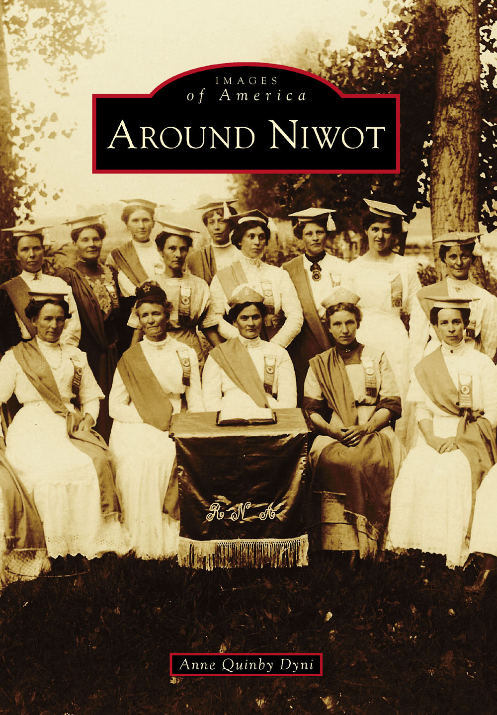
ON THE COVER: The Niwot chapter of the Royal Neighbors of America regularly met upstairs in Nelson Hall, but its members chose this shady glen to pose in all their regalia for Boulder photographer Ed Tangen in 1912. (Courtesy of the Niwot Historical Society.)
IMAGES
of America
AROUND NIWOT
Anne Quinby Dyni

Copyright 2015 by Anne Quinby Dyni
ISBN 978-1-4671-3324-1
Ebook ISBN 9781439651636
Published by Arcadia Publishing
Charleston, South Carolina
Library of Congress Control Number: 2015937265
For all general information, please contact Arcadia Publishing:
Telephone 843-853-2070
Fax 843-853-0044
E-mail
For customer service and orders:
Toll-Free 1-888-313-2665
Visit us on the Internet at www.arcadiapublishing.com
This book is dedicated to the pioneers who settled the Left Hand Valley, fulfilled its agricultural potential, and developed the town of Niwot.
CONTENTS
ACKNOWLEDGMENTS
Unless otherwise noted, all images in this book appear courtesy of the Niwot Historical Society, whose large archive contains photographs donated by former merchants, retired teachers, a newspaper editor, and pioneer descendants who shared their collections in an effort to preserve the history of Niwot. This book is a testament to their generosity and dedication.
My gratitude goes to Arthur Wainwright for digitizing the many images in this book. The diverse quality of the photographs chosen for publication presented a challenge, which he skillfully met.
Thank you to Wendy Hall and Susan Becker with the Carnegie Branch Library for Local History in Boulder, Colorado, for archiving the many oral history interviews I conducted with Niwot farmers, students, merchants, pioneer descendants, and residents. This process began over 25 years ago with rural mailman Clarence Conilogue and farmer Evan Gould. The audiotapes, DVDs, and transcripts are archived with the Maria Rogers Oral History Program and are available for viewing or listening online.
INTRODUCTION
The Left Hand Valley, site of the unincorporated town of Niwot, lies along the foothills north of Boulder, Colorado, within the drainages of St. Vrain and Left Hand Creeks. The area has a long history, dating to prehistoric times, when Native Americans hunted and fished along the streams flowing down from the Rocky Mountains to the west. Even today, as winds scour rocky outcrops, exposing arrowheads and spear points, and modern-day excavations unearth fire pits and teepee rings, evidence of their early presence is revealed to archaeologists.
The town of Niwot takes its name from Chief Niwot, leader of the Southern Arapaho tribe, which hunted and fished at the time of the 1858 Pikes Peak Gold Rush. They were camped near Rabbit and Haystack Mountains when Capt. Thomas Aikins and his 23-member Nebraska City Party crossed the Left Hand Valley en route to the Gold Hill mining district above Boulder City.
Chief Niwot, whose name means left hand in the Arapaho language, welcomed the prospectors, although they were clearly trespassing on Indian land. The Arapaho Nation had been guaranteed the right to remain on their land by the Fort Laramie Treaty of 1851, a governmental agreement that was short-lived.
By the mid-1860s, many disillusioned miners had returned empty-handed to their families in the Midwest. It had not taken them long to realize that gold nuggets were not strewn on the mountainsides for easy picking. There were others, however, who chose to remain in Colorado Territory to find their fortunes on the plains. Many of them had been farmers before heading to the gold fields and saw the potential for supplying agricultural products to the more successful miners and their draft animals. In addition, with the Homestead Act of 1862 offering 160 acres of free land to anyone 21 years of age or older, their dreams of starting a new life on the frontier seemed within reach.
Tilling the fertile soils along the Front Range presented both opportunities and challenges for those willing to learn the techniques of farming in the arid Colorado climate. This included breaking up the sod and selecting crops and livestock that could tolerate growing conditions unlike those they had left back east. All that was missing was a reliable source of water. Capturing snow runoff and spring rains in reservoirs for use later in the growing season was a new concept for many, as was digging irrigation ditches to channel water to fields far from the rivers and creeks.
Much of the land in the Left Hand Valley had been claimed by the time railroads arrived in Boulder County. At the urging of the Boulder City town fathers, two railroad companies pushed into the county in 1873. Rails had already been laid west into Weld County in 1871 from the Denver-Pacific line, which connected Denver to the transcontinental railroad in Wyoming. They needed the coal being mined near Erie, Colorado, to power their giant steam locomotives. The Boulder Valley Railroad completed the route into Boulder City in 1873, with depots located in Erie, Canfield, Valmont, and Boulder.
That same year, the Colorado Central Railroad extended its tracks from Denver to Boulder, then north to Longmont. The 14-mile section between Boulder and Longmont passed through the Left Hand Valley, which was already under cultivation. Railroad rights-of-way were purchased from several farmers along the route, with a guarantee that cattle guards would be installed at all road crossings and existing fences would not be disturbed.
Property owners Porter Hinman and Ambrose Murray envisioned creating a railhead on their land from which local agricultural products could be shipped to distant markets. They each contributed 20 acres immediately north of the railroad section house, and in March 1875, they officially registered their plat for the town of Niwot. Until that date, the closest settlements on the new Colorado Central tracks were Boulder City to the southwest and Longmont to the northeast. Boulder, a mining supply town, lay at the mouth of Boulder Canyon, and Longmont was the new Chicago Colony settlement directly across St. Vrain Creek from Burlington.
Niwot was typical of small frontier towns that grew as settlers arrived, but it had the advantage of an existing consumer base, since many families were already farming nearby when the railroad came through the valley. As time went on, additional businesses opened in town. A meeting hall, barbershop, caf, pool hall, pharmacy, post office, two churches, and even a hotel were operating by 1907. Several fraternal organizations established chapters in Niwot, enhancing the social life of town and country folk alike.
Then, 50 years later, in 1957, Niwot found itself at the center of a population boom when technology giant IBM purchased land only a mile away for a new electronics plant. At the same time, the Colorado Department of Highways made plans to expand Colorado State Highway 119 between Boulder and Longmont and had already begun buying up rights-of-way for its construction along the railroad tracks. With the influx of transplanted IBM employees, Niwot was soon flanked by housing developments on the east and to the south, where an area known as Gunbarrel was rapidly sprouting homes, shops, and restaurants.
By 1990, merchants along Second Avenue had grown tired of flooded streets and decaying sidewalks that detracted from an emerging contemporary shopping district. Because Niwot was unincorporated and under the jurisdiction of the Boulder County commissioners, business owners worked with the county to create an improvement district and design a street and drainage project for Second Avenue. They even agreed to levy a half-percent sales tax within the district to help fund it. In order to guarantee the security of its financial investment, the county designated the first block of Second Avenue a historic district and established architectural guidelines to preserve its integrity. In so doing, they created the first local historic district in Boulder County. Today, Niwot remains the only community in Boulder County founded solely for access to the railroad.
Next page

