IMAGES
of America
EARLY KIRKLAND

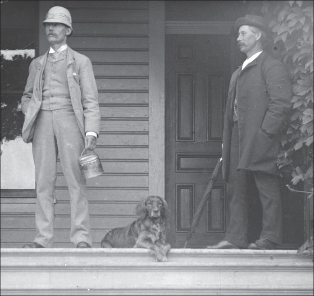
Kirkland namesake Peter Kirk, left, is seen around 1889 with his right-hand man, Walter Williams, his UK corporations secretary who joined him in launching his US ventures. Visionary salesmans salesman S.J. Leigh HuntHunts Point namesake, Post-Intelligencer newspaper owner, and political bosspersuaded Kirk to locate his steel mill and company town on Lake Washington, envisioning a Pittsburgh of the Pacific. (Kirkland Heritage Society.)
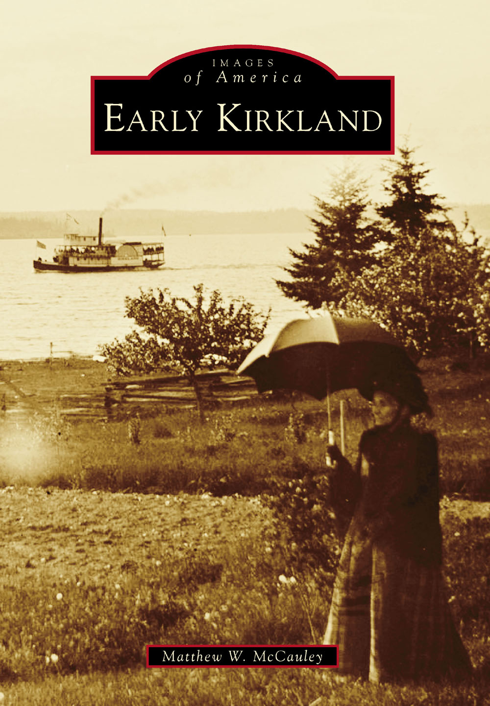
ON THE COVER: Houghton pioneer Caroline French (18271909) poses with an umbrella as the 96.5-foot steamboat Kirkland chugs southward. French, her husband, Samuel Foss Foster, and grown son Harry came to the Washington Territory in 1872. Their house was located at 10120 NE Sixty-Third Street. This shot may have been taken in February 1889, when the Kirkland transported a US Navy commission on a tour to determine Lake Washingtons suitability as a navy yard. The Navy eventually chose Bremerton instead. (Kirkland Heritage Society.)
IMAGES
of America
EARLY KIRKLAND
Matthew W. McCauley

Copyright 2017 by Matthew W. McCauley
ISBN 978-1-4671-2757-8
Ebook ISBN 9781439663271
Published by Arcadia Publishing
Charleston, South Carolina
Library of Congress Control Number: 2017952565
For all general information, please contact Arcadia Publishing:
Telephone 843-853-2070
Fax 843-853-0044
E-mail
For customer service and orders:
Toll-Free 1-888-313-2665
Visit us on the Internet at www.arcadiapublishing.com
For Sarah.
CONTENTS
ACKNOWLEDGMENTS
I would like to thank Sarah and Benjamin Behrendt, and Dave Behrendt for his editorial assistance; Cameron and Jake McCauley, and William J. McCauley for his editorial assistance; Glenn Landguth and the Kirkland Heritage Society (KHS) for access to its collection; and in particular, Loita Hawkinson of KHS for her fact-checking, and photograph and editorial assistance. Thanks go to Mike and Vicki Elwell and the Higginbotham family; Jana Robertson; Anita Maxwell and the Gilbert family; Barbara Loomis and the late Bob Burke; Rob Butcher and Kirklandviews.com; Mary Harris and Rebecca Willow of Parkplace Books; Alan Stein; Eastside historian Tom Hitzroth for sharing photographs, documents, and his amazing research; Molly (McAuliffe) Bishop, Janice (McAuliffe) La Haye, and the McAuliffe family; Sue and Santos Contreas; Dr. Lorraine McConaghy; the late Russ McClintick Sr.; the late Geneva Hutchinson; Grant Barrie and the late Mabel and Don Barrie; the late Dorris (Forbes) Beecher, JoAnne (Forbes) Deligan, and the Forbes family; Dave Davis and the French family; Jan (Etzler) Strode and the Etzler family; Doug Williams and the Williams family; Deb Healy and the Burke family; Patty (Fessenden) Sullivan Behrendt, Warren Fessenden and the Clark/Patty family; Laurie Klemmedson and the Brooks family; Doug Morgan and the late Florence and Chuck Morgan; Sonia and Brian Curtis and the Curtis and Northup families; the late Arline Andre; the late Dick and Patty Shinstrom; the late Al Locke; Kent Sullivan, Northern Pacific Railway Historical Association (NPHA.org); Rebecca Pixler and Janette Gomes, King County Archives; Julie Irick, Seattle Municipal Archives; and the City of Kirkland, particularly Mark Padgett of Public Works.
The Kirkland Heritage Societys collection served as the primary source of images for Early Kirkland. Other images in this volume appear courtesy of the King County Archives (KCA), the Seattle Municipal Archives (SMA) and the Northern Pacific Railroad Historical Association (NPRHA). Unless otherwise noted, all images are courtesy of the Kirkland Heritage Society.
INTRODUCTION
Today, Kirkland is a city of nearly 88,000, situated opposite Seattle on the eastern side of the states second largest lake, Lake Washington. While conforming to the realties of tremendous regional population growth, it has retained its small town feel in its downtown business district and boasts an impressive roster of nearly 50 parks. Churches of many faiths, a keen interest in public and private art, strong public school and youth athletics programs, numerous community festivals and celebrations, a robust collection of service clubs, avid volunteerism, lively local politics, and a sense of civic pride all contribute to Kirklands high quality of life today.
Kirkland lies in the Puget Sound Lowland, a topographic basin situated between the Cascade and Olympic mountain ranges. Over the past 2.5 million years, massive glaciers have scoured the land, deposited debris, and retreated in a slow, repeating cycle. Geologists call the most recent ice sheet that covered the Puget Sound Lowland the Puget Lobe of the Cordilleran Ice Sheet. The lobe filled the Lowland basin about 17,500 years ago and retreated about 1,000 years later during what they term the Vashon period of the Fraser glaciation. Scientists believe at its thickest point, the ice blanketing the Kirkland area was about 3,000 feet thickabout equivalent to five Seattle Space Needles stacked atop one another.
The glaciers gouged out a series of deep troughs, which trend north-south. Puget Sound, Lake Washington, the Sammamish Valley, and Lake Sammamish were all scoured by vast quantities of meltwater beneath the glaciers. As the ice withdrew, piles of soil and rock, called till and drift, were deposited as north-south ridges. We have assigned names to those ridgesBig Finn Hill, Little Finn Hill, and Rose Hill, among others.
Geologists who have studied core samples taken from the bottom of Lake Washington believe there was a period after the ice withdrew during which the lake was a marine embaymentthat it was salt-water filled, and connected to Puget Sound at its south end by a trough running west to the saltwater-filled trough that became the Duwamish River Valley, which was then an extension of Elliott Bay. Eventually, the Cedar River deposited sufficient material at the lakes south end to create a large delta that ended the saltwater incursion. As today, the lake was then fed with fresh water at the north by the Sammamish River and rising freshwater created an outflow, later called the Black River, at the south end, which flowed into the Duwamish River and then into Puget Sound.
As the ice receded, the exposed till and drift were quite barren, but over time, hearty plants sprung up in ever increasing numbers, and soon, animals followed to feed on those. Scientists believe that humans, descendants of people who had earlier crossed into North America from Asia, arrived here about that time as well and over time the harsh conditions softened and likely became an open parkland of lodgepole pine and spruce, grasses, and bracken fern, interspersed with hazel and cedar. About 7,800 years ago, the climate shifted and became cooler and moister. That change resulted in a dense, closed canopy forest of western red cedar, western hemlock, and Douglas fir, with cottonwood on the floodplains.
The indigenous peoples adapted to these changes and over millennia developed cultures centered on hunting, fishing, and gathering. There is still much for researchers to learn about how they lived and organized their societies. Three small native settlement sites have been reported in todays Kirkland: at the mouth of Juanita Creek, downtown Kirkland, and on Yarrow Bay. (In 1993, the author interviewed the late Dorris [Forbes] Beecher. She grew up during the 19101920s in the Forbes House, at todays Juanita Beach Park, and described finding arrowheads in that area.)
Next page


