Friends enjoyed his outdoor adventure stories; one even suggested he write a book. He pursued his friends idea and soon parlayed his love of the outdoors into an occupation. The results of his efforts are over sixty-five books and guides. His writings include hiking guidebooks, camping guidebooks, paddling guidebooks, comprehensive guidebooks about a specific area, and true outdoor adventure books covering all or parts of twenty-six states.
Though primarily involved with book publications, Molloy writes for magazines and websites. Furthermore, he is an outdoors columnist and feature writer for his local paper, the Johnson City Press. He continues writing and traveling extensively throughout the United States, endeavoring in a variety of outdoor pursuits.
A Christian, Johnny is an active member of First Presbyterian Church in Johnson City, Tennessee. He is also a Gideon. His non-outdoor interests include reading, Christian studies, and University of Tennessee sports. For the latest on Johnny, please visit www.johnnymolloy.com.
Thanks to all the people of Cincinnati who shared their favorite places to hike. Thanks to Serra Designs for providing me with a quality tent for camping between hikes. Thanks also to the folks at FalconGuides.
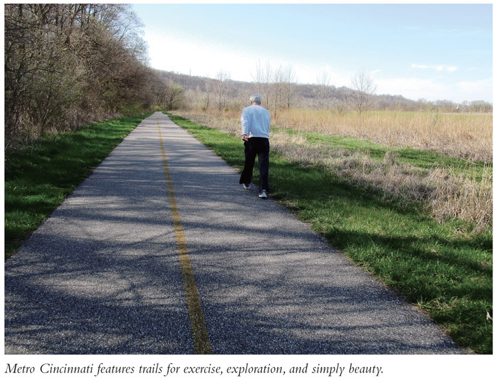
A s the name implies, Metro Cincinnati includes the heart of the urban area and populated areas on the periphery. These hikes include Cincinnati city parks as well as the fine Hamilton County park system. The steep terrain created by the Ohio River figures into many of these hikes, and the river highlands present great views of the valley and beyond. These metro hikes vary in distance and difficulty and make for quick getaways that in-town and suburban residents can use. History and panoramas meet at Shawnee Lookout Park. Rock-hop a scenic and wildflower-laden stream at French Creek Park. New places await your discovery.
Hikes of Shawnee Lookout Park
Shawnee Lookout Park features three rewardingbut relatively shortloop hikes. Though each one is individually worthwhile, their close proximity allows you to make a hikers triple play. First visit extensive Paleo-Indian earthworks located atop a ridge dividing the Great Miami River and Ohio River and travel to a stellar vista where you can see the confluence of the rivers and three states at onceOhio, Kentucky, and Indiana. Next, enjoy more river vistas of both the Great Miami and Ohio Rivers on the last two hikes, adding up to nearly 5 miles of walking pleasure.
Start: Shawnee Lookout Trailhead
Distance: 1.4-, 2.0-, and 1.2-mile loops
Hiking time: About 4 to 5 hours
Difficulty: Moderate
Trail surface: Mostly natural surface paths in forested woods, pea gravel in places
Best season: Year-round
Other trail users: None
Canine compatibility: Leashed dogs permitted
Land status: County park
Fees and permits: Parking fee required
Schedule: Open daily year-round sunrise to sunset
Maps: Shawnee Lookout Park; USGS Lawrenceburg, Hooven
Trail contacts: Shawnee Lookout Park, 2008 Lawrenceburg Rd., North Bend, OH 45052; (513) 941-0120; www.greatparks.org
Finding the trailhead: From exit 21 on I-275 west of downtown, take Kilby Road south for 1.0 mile to US 50. Turn right onto US 50 west and follow it 1.7 miles to Lawrenceburg Road. Turn left onto Lawrenceburg Road and follow it 0.7 mile, crossing the Great Miami River. Reach a T intersection. Turn right, still on Lawrenceburg Road, and follow it 0.5 mile to Shawnee Lookout Park, on your left. Turn into the park and climb away from the ranger station, tracing the main park road to dead-end at the trailhead after 1.9 miles. To reach the second and third trailheads, you will have to drive 1.2 miles back toward the park entrance. Trailhead GPS: N39 7.236' / W84 48.516'
The Hike
Shawnee Lookout Park, location of the following hikes, is simply one of the most scenic hiking destinations in greater Cincinnati. Your first trek, to the Shawnee Lookout on the Miami Fort Trail, takes you uphill into thousands years of Ohio Indian life. Trailside information signage helps explain the human and natural history of this strategic location. If you are ever going to read trailside interpretive information, do it here and now, even if it is not entirely correct and espouses now controversial theories as to the existence of the fort.
In summer, the ridgetop forest will be quite thick with cherry, locust, and walnut, under which grows copious small pawpaw trees, partially obscuring the earthworks and surrounding views of the Great Miami River and the Ohio River. If you come when the leaves are off the trees, you will be rewarded with not only better river views but also a better lay of the earthworks, which by any measure were done with nearly incomprehensible amounts of human labor, perhaps over many centuries.
The trail leads to the main earthworks, where you make a loop. Undulate along a ridgeline dropping toward the Great Miami River. After leaving the main earthworks, the path continues westerly toward the point of the ridge and views that await you. The first vista overlooks a large wetland of the Great Miami River. Shawnee Lookout Park protects over 250 acres of seasonally flooded riparian habitat along with nearly a thousand additional acres of wetlands below. These wetlands provide habitat for area wildlife as well as migratory waterfowl that use the Ohio River flyway. The best view of all lies at trails endShawnee Lookout. Take a seat on the bench and scan westward. The Ohio River and its wooded ramparts are easily identifiable. Kentucky rises on the south bank. Below, you can see the Great Miami River meandering to add its flow to the Ohio. An imaginary north-south line divides the Buckeye State from Indiana. It runs just below Shawnee Lookout. Anything you see west of the Great Miami River will be the Hoosier State. Given the lay of the land, it is easy to see this area as a highly defensible positionif the earthworks were indeed a fort.
Your return trip takes you by more earthworks. Imagine all the work in moving the soil by hand! At this point you are probably coming down on one side or another of the theories as to why these earthworks were established. No matter your theory, we can all agree that Shawnee Lookout is a great park and hiking destination.
After driving to the second trailhead, you will pick up the Little Turtle Trail, the first hiking trail constructed at Shawnee Lookout Park. The pea gravel path, named after a Miami Indian chief, meanders through level woods of white ash, locust, hackberry, and more. If you think you are walking in a circle, you are three-quarters right. The trail curves three-fourths of the way around a field for reasons known only to the trail builders.


