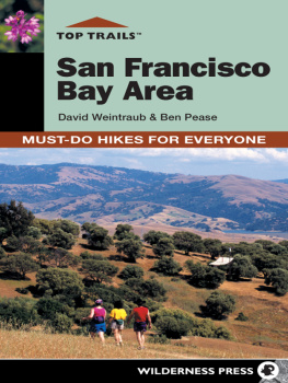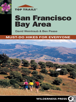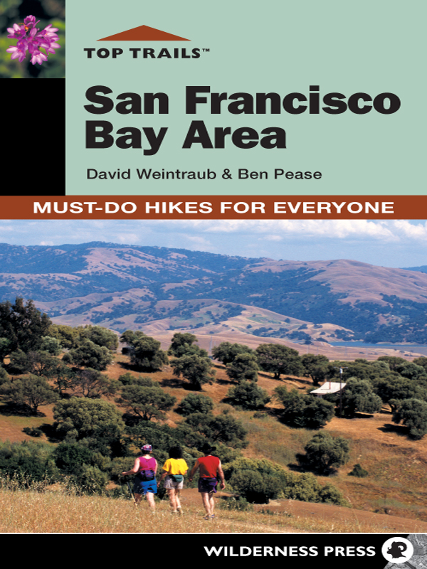

Top Trails San Francisco Bay Area: Must-Do Hikes for Everyone
1st EDITION 2004
2nd EDITION 2009
Copyright 2009 by David Weintraub and Ben Pease
All photos, except where noted, copyright by David Weintraub
Maps: Pease Press and Fineline Maps
Cover design: Frances Baca Design and Andreas Schueller
Interior design: Frances Baca Design
Typesetting and composition: Lapiz Digital
ISBN: 978-0-89997-484-2
Manufactured in Canada
| Published by: | Wilderness Press |
| Keen Communications |
| PO Box 43673 |
| Birmingham, AL 35243 |
| (800) 443-7227; FAX (205) 326-1012 |
| www.wildernesspress.com |
Visit our Web site for a complete listing of our books and for ordering information.
Cover photos: Pleasanton Ridge () and bluedicks (inset) copyright 2009 by David Weintraub
All rights reserved. No part of this book may be reproduced in any form, or by any means electronic, mechanical, recording, or otherwise, without written permission from the publisher, except for brief quotations used in reviews.
SAFETY NOTICE : Although Wilderness Press and the authors have made every attempt to ensure that the information in this book is accurate at press time, they are not responsible for any loss, damage, injury, or inconvenience that may occur to anyone while using this book. You are responsible for your own safety and health. The fact that a trail is described in this book does not mean that it will be safe for you. Be aware that trail conditions can change from day to day. Always check local conditions, know your own limitations, and consult a map.
The Top Trails Series
Wilderness Press
When Wilderness Press published Sierra North in 1967, no other trail guide like it existed for the Sierra backcountry. The first print run sold out in less than two months, and its success heralded the beginning of Wilderness Press. Since we were founded more than 40 years ago, we have expanded our territories to cover California, Alaska, Hawaii, the US Southwest, the Pacific Northwest, the Midwest, the Southeast, New England, Canada, and Baja California.
Wilderness Press continues to publish comprehensive, accurate, and readable outdoor books. Hikers, backpackers, kayakers, skiers, snowshoers, climbers, cyclists, and trail runners rely on Wilderness Press for accurate outdoor adventure information.
Top Trails
In its Top Trails guides, Wilderness Press has paid special attention to organization so that you can find the perfect hike each and every time. Whether youre looking for a steep trail to test yourself on or a walk in the park, a romantic waterfall or a city view, Top Trails will lead you there.
Each Top Trails guide contains trails for everyone. The trails selected provide a sampling of the best that the region has to offer. These are the must-do hikes, walks, runs, and bike rides, with every feature of the area represented.
Every book in the Top Trails series offers:
- The Wilderness Press commitment to accuracy and reliability
- Ratings and rankings for each trail
- Distances and approximate times
- Easy-to-follow trail notes
- Maps and permit information
Using Top Trails
Organization of Top Trails
Top Trails is designed so you can find the perfect trail and make every outing a success and a pleasure. With this guide youll find its a snap to find the right trail, whether youre planning a major hike or just a sociable stroll with friends.
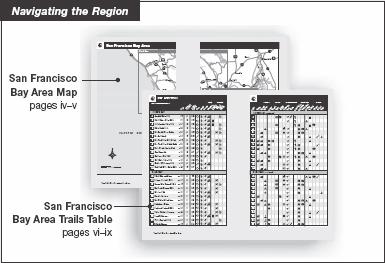
The Region
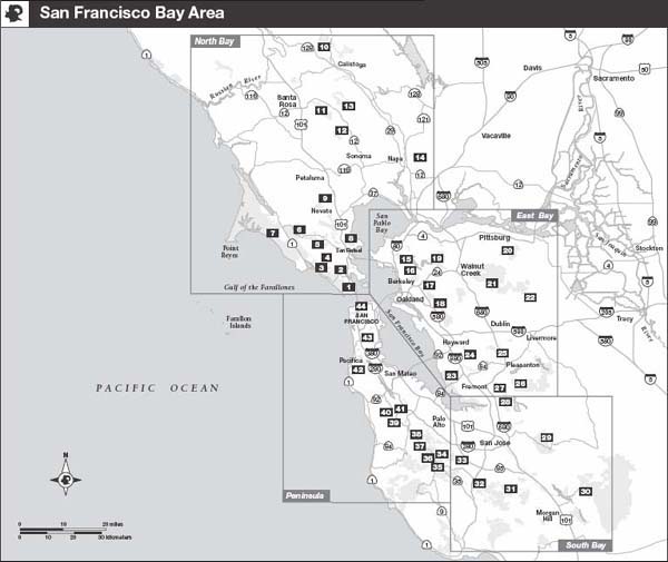
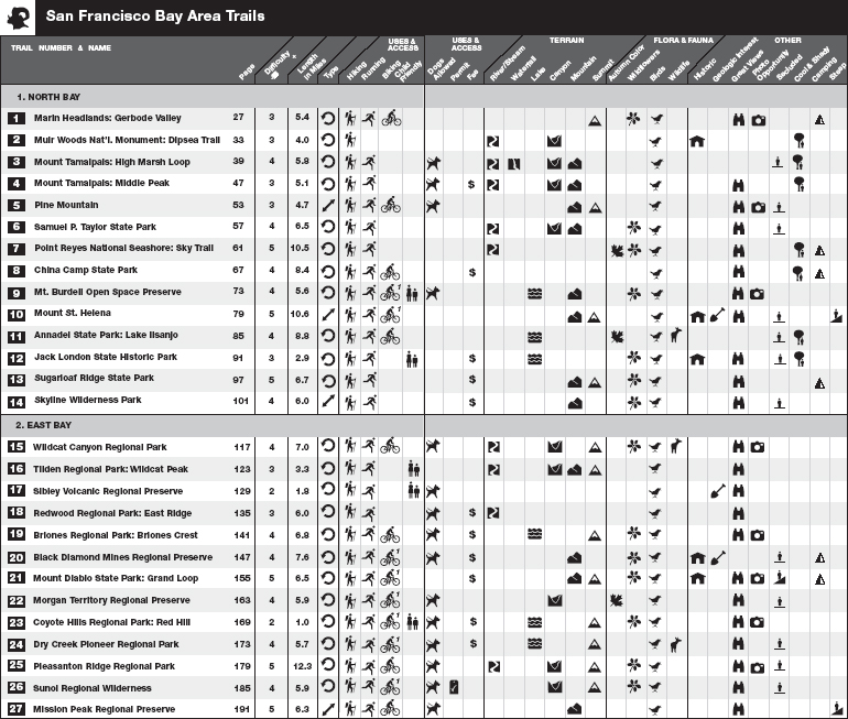
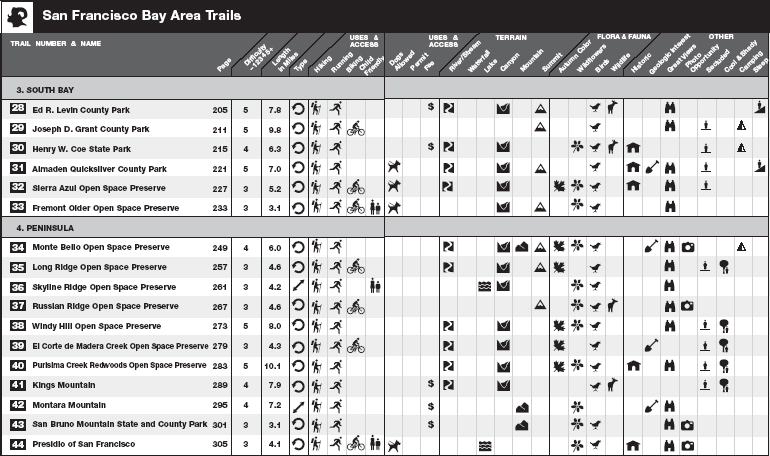
At the very front of this guide, the San Francisco Bay Area regional map provides a geographic overview of the lists every trail covered in this guide along with attributes for each trail. A quick reading of the regional map and the trails table gives you a quick overview of the entire region covered by the guide.
The Areas
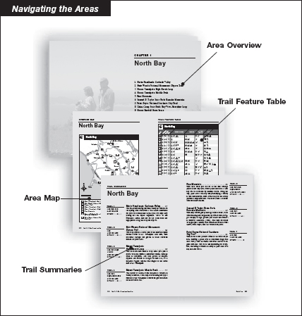
The region covered in each guide is divided into areas, with each chapter corresponding to one area in the region. Each area chapter starts with information to help you choose and enjoy a trail every time out. Use the table of contents or the regional map to identify an area of interest, then turn to the area chapter to find the following information:
- An overview of the areas parks and trails
- An area map showing trail locations
- A trail feature table providing trail-by-trail details
- Trail summaries highlighting each trails special features
The Trails
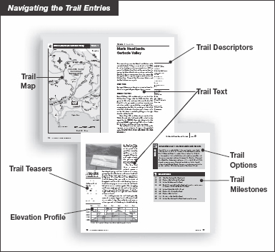
The basic building block of the Top Trails guide is the trail entry. Each one is arranged to make finding and following the trail as simple as possible, with all pertinent information presented in this easy-to-follow format:
- A detailed trail map
- Trail descriptors covering difficulty, length, and other essential data
- A written trail description
- Trail milestones providing easy-to-follow, turn-by-turn trail directions
Some trail descriptions offer additional information:
- An elevation profile
- Trail options
- Trail highlights
In the margins of the Trail Entries, keep your eyes open for graphic icons that signal features mentioned in the text.
Choosing a Trail
Top Trails provides several different ways of choosing a trail, using easy-to-read tables and maps.
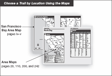
Location
If you know in general where you want to go, Top Trails makes it easy to find the right trail in the right place. Each chapter begins with a large-scale map showing the starting point of every trail in that area.
Features
This guide describes the top trails of the San Francisco Bay Area. Each trail has been chosen because it offers one or more features that make it interesting. Using the trail descriptors, summaries, and tables, you can quickly examine all the trails to find out what features they offer, or seek a particular feature among the list of trails. Included here is information about park fees. Some parks charge fees seasonally or only when the parks entrance kiosk is attended; others have self-registration stations. Where dogs are allowed, there may be an additional fee.
Best Time
Time of year and current conditions can be important factors in selecting the best trail. For example, an exposed grassland trail may be a riot of color in early spring, but an oven-baked taste of hell in midsummer. Other trails may be cool and shady all year. Where relevant, Top Trails identifies the best and worst conditions for the trails you plan to visit.

