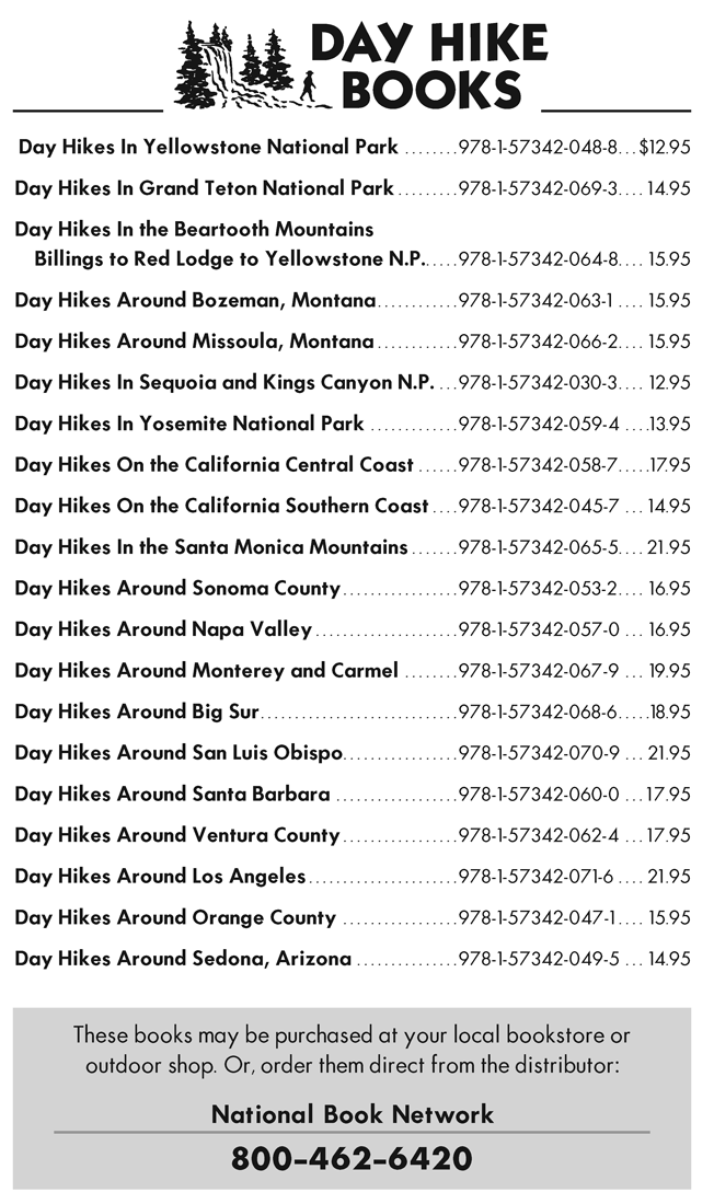
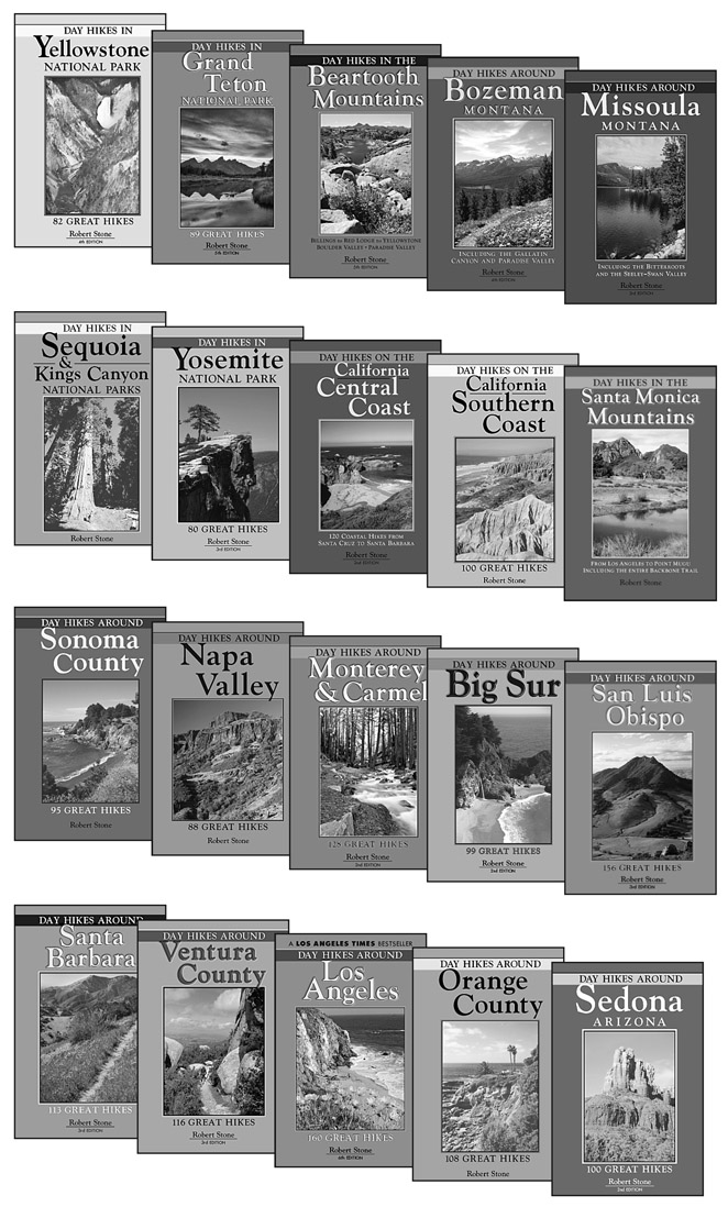
Stone - Day Hikes Around Los Angeles: 160 Great Hikes, 6 edition
Here you can read online Stone - Day Hikes Around Los Angeles: 160 Great Hikes, 6 edition full text of the book (entire story) in english for free. Download pdf and epub, get meaning, cover and reviews about this ebook. City: California--Los Angeles., Los Angeles (Calif.), year: 2015, publisher: Day Hike Books, genre: Home and family. Description of the work, (preface) as well as reviews are available. Best literature library LitArk.com created for fans of good reading and offers a wide selection of genres:
Romance novel
Science fiction
Adventure
Detective
Science
History
Home and family
Prose
Art
Politics
Computer
Non-fiction
Religion
Business
Children
Humor
Choose a favorite category and find really read worthwhile books. Enjoy immersion in the world of imagination, feel the emotions of the characters or learn something new for yourself, make an fascinating discovery.

- Book:Day Hikes Around Los Angeles: 160 Great Hikes, 6 edition
- Author:
- Publisher:Day Hike Books
- Genre:
- Year:2015
- City:California--Los Angeles., Los Angeles (Calif.)
- Rating:3 / 5
- Favourites:Add to favourites
- Your mark:
Day Hikes Around Los Angeles: 160 Great Hikes, 6 edition: summary, description and annotation
We offer to read an annotation, description, summary or preface (depends on what the author of the book "Day Hikes Around Los Angeles: 160 Great Hikes, 6 edition" wrote himself). If you haven't found the necessary information about the book — write in the comments, we will try to find it.
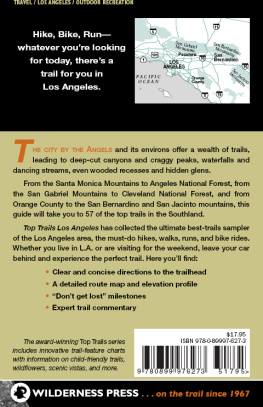
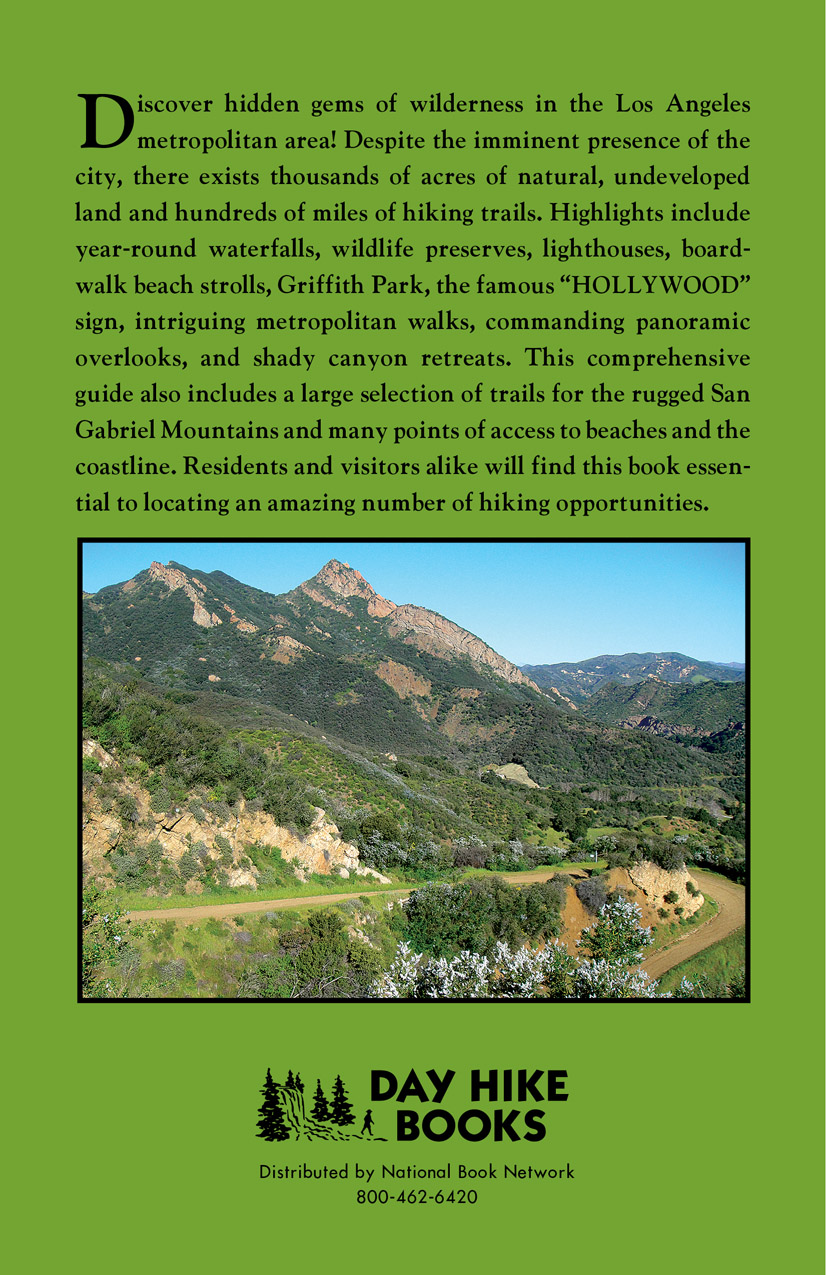
Despite the widespread presence of the Los Angeles metropolis, there exists thousands of acres of natural, undeveloped land and countless out-of-way hiking trails. Hikes range from boardwalk strolls along the ocean to shady canyon trails that lead to far-reaching overlooks. Highlights include year-round waterfalls, wildlife preserves, lighthouses, Griffith Park (the countrys largest municipal park), the famous HOLLYWOOD sign, quiet canyon trails, panoramic vistas of the city and coastline, the rugged terrain of the San Gabriel Mountains, and hikes along the entire length of the Santa Monica Mountains. Intriguing metropolitan walks are also included. All levels of hiking are accommodated, with an emphasis on a mid-range hikes.
Companion guides include Day Hikes Around Orange County (south of LA), Day Hikes Around Ventura County (north of LA), Day Hikes On the Southern California Coast, and Day Hikes In the Santa Monica Mountains.
Stone: author's other books
Who wrote Day Hikes Around Los Angeles: 160 Great Hikes, 6 edition? Find out the surname, the name of the author of the book and a list of all author's works by series.


Day Hikes Around Los Angeles: 160 Great Hikes, 6 edition — read online for free the complete book (whole text) full work
Below is the text of the book, divided by pages. System saving the place of the last page read, allows you to conveniently read the book "Day Hikes Around Los Angeles: 160 Great Hikes, 6 edition" online for free, without having to search again every time where you left off. Put a bookmark, and you can go to the page where you finished reading at any time.
Font size:
Interval:
Bookmark:
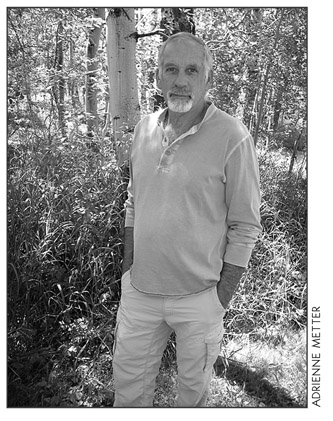
Since 1991, Robert Stone has been writer, photographer, and publisher of Day Hike Books. He is a Los Angeles Times Best Selling Author and an award winning journalist of Rocky Mountain Outdoor Writers and Photographers, the Outdoor Writers Association of California, the Northwest Outdoor Writers Association, the Outdoor Writers Association of America, and the Bay Area Travel Writers.
Robert has hiked every trail in the Day Hike Book series With 20 hiking guides in the series, many in their fourth and fifth editions, he has hiked thousands of miles of trails throughout the western United States. When Robert is not hiking, he researches, writes, and maps the hikes before returning to the trails. He spends summers in the Rocky Mountains of Montana and winters on the California Central Coast.
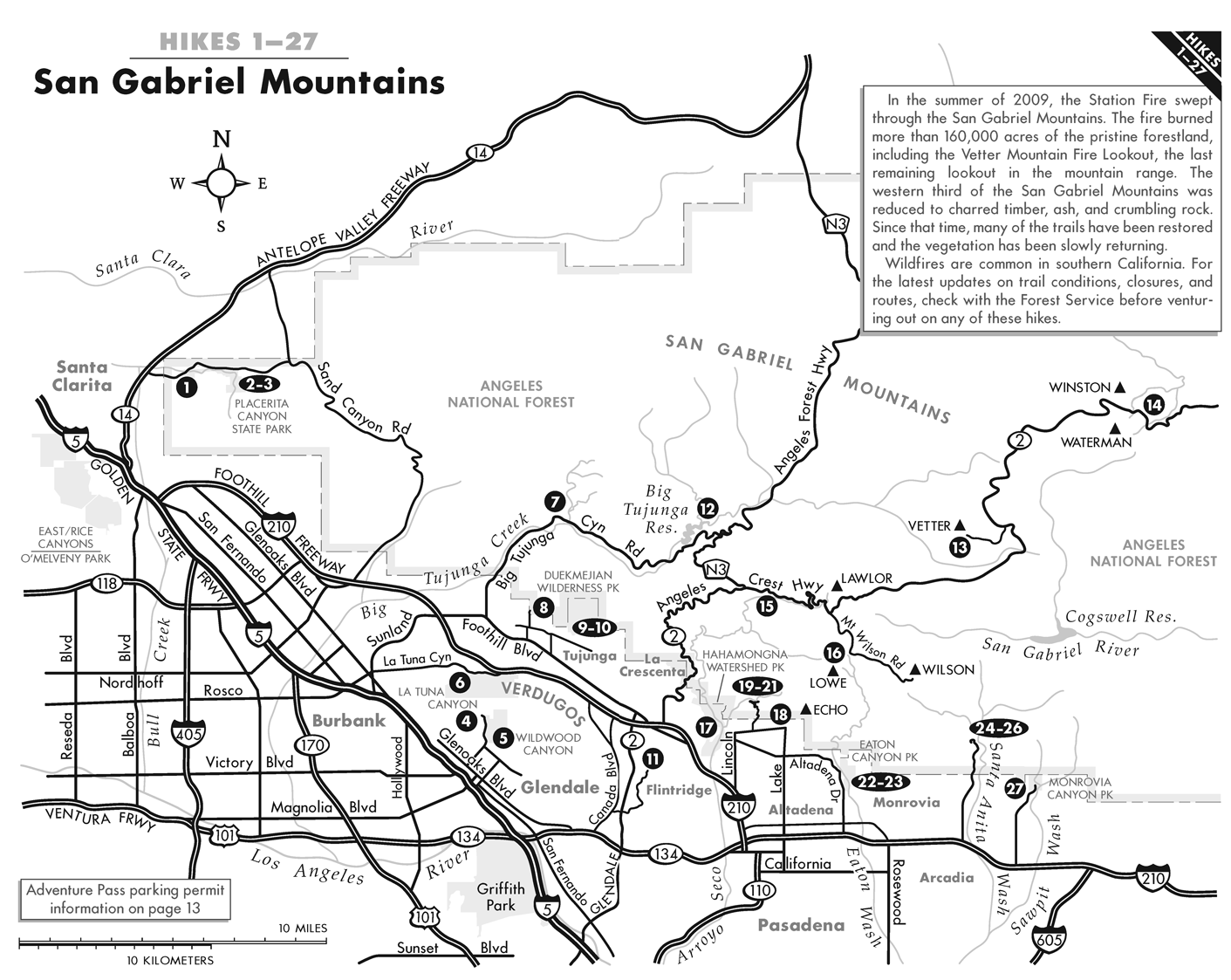
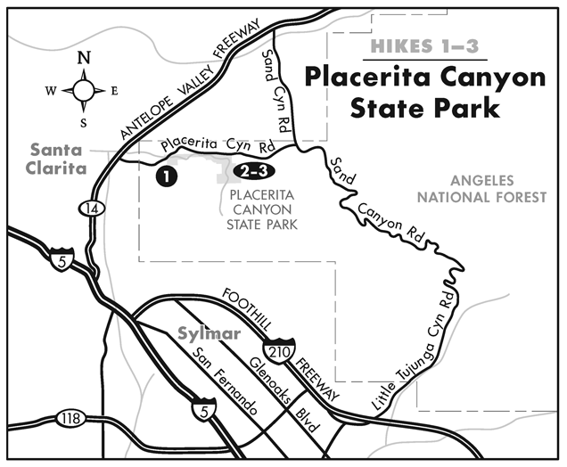
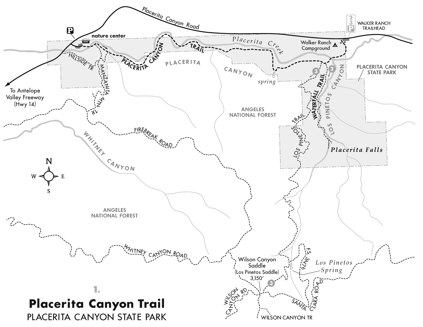
19152 Placerita Canyon Road Newhall
Hiking distance: 4 miles round trip
Hiking time: 2 hours
Configuration: out-and-back
Elevation gain: 250 feet
Exposure: mostly shaded canyon
Difficulty: easy
Dogs: allowed
Maps: U.S.G.S. Mint Canyon Harrison: Angeles Front Country Trail Map Placerita Canyon Natural Area Map
Placerita Canyon State Park is a designated state historic landmark. The canyon is the site of the original gold discovery in California, dating back to 1842, six years prior to the famous discovery of gold by John Marshall at Sutters Mill in the northern town of Coloma. This 350-acre natural area is located on the north slope of the San Gabriel Mountains, overlooking the Santa Clarita Valley. The park sits in a transition zone between the San Gabriel Mountains and the Mohave Desert. The east-west running canyon links the Angeles National Forest with the Santa Susana Mountains, the Simi Hills, and the Santa Monica Mountains. Placerita Canyon is home to sandstone formations, seasonal streams, and riparian woodlands with stands of oaks, sycamores, cottonwoods, and willows.
This hike begins at the nature center and follows the picturesque canyon and meandering creek east into the Walker Ranch Campground. The camp is named for Frank Walker, who built his home on the historic ranch in the 1920s.
To the trailhead
From the Golden State Freeway (I-5) in Newhall, take the Antelope Valley Freeway (H-14) east. Continue 3 miles and exit on Placerita Canyon Road. Turn right and drive 1.4 miles to the signed Placerita Canyon State Park on the right. Turn right and continue 0.1 mile to the nature center. Park in the spaces on the left. An Adventure Pass is required for parking.
The hike
From the nature center, cross the drainage to a junction. The Hillside Trail climbs the hill to the south. Stay in Placerita Canyon and continue up canyon to the east. Follow the rock-lined path on the south edge of the seasonal creek under oaks, willows, cottonwoods, alders, and sycamores. The rock-walled drainage narrows to a gorge, and the footpath crosses the transient drainage four times. Pass through a beautiful oak grove and a seasonal drainage on the right by a 10-foot ephemeral waterfall at one mile. The canyon widens out and the grade remains relatively level. Climb a short slope and curve left by signpost 19 at a bubbling spring with a mixture of oil and water (known as white oil) on the right. At two miles enter the Walker Ranch Campground on a grassy flat covered in majestic oaks, reaching a signed junction with Los Pinetos Trail and the Placerita Waterfall Trail (Hikes 1 and 2).
To extend the hike, continue with Hike 2 to Placerita Falls or Hike 3 to the crest of the San Gabriel Mountains, overlooking the San Fernando Valley.
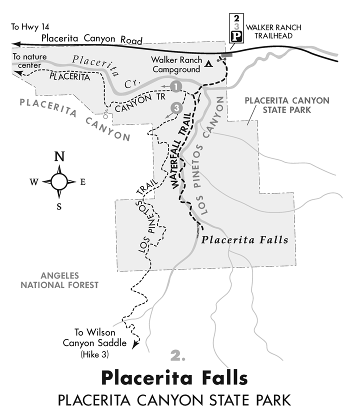
Hiking distance: 1.5 miles round trip
Hiking time: 1 hour
Configuration: out-and-back
Elevation gain: 250 feet
Exposure: mostly shaded canyon
Difficulty: easy
Dogs: allowed
Maps: U.S.G.S. Mint Canyon and San Fernando Harrison: Angeles Front Country Trail Map Placerita Canyon Natural Area Map
Placerita Falls is a 25-foot seasonal waterfall tucked into a cool, rock-enclosed grotto in Placerita Canyon State Park. (The falls is generally active between January and May.) The easy hike into narrow Los Pinetos Canyon follows Placerita Creek through the shaded gorge under a canopy of live oak, big leaf maple, and big cone spruce trees. An understory of moist ferns surrounds the path. The trail begins at the Walker Ranch Campground by historic remnants of a settlers cottage built in the early 1900s. The cement foundation and chimney are still intact. En route, the trail meanders along the waterway, crossing the ephemeral creek seven times. The path scrambles over water-polished metamorphic rock to the trails end in a steep-walled box canyon, where the creek slides over the rock wall.
To the trailhead
From the Golden State Freeway (I-5) in Newhall, take the Antelope Valley Freeway (H-14) east. Continue 3 miles and exit on Placerita Canyon Road. Turn right and drive 3.1 miles to the signed Walker Ranch Trailhead parking area on the right. An Adventure Pass is required for parking.
The hike
Pass through the vehicle gate and walk down the dirt road. Descend and cross the seasonal stream into the Walker Ranch Campground to the Placerita Canyon Trail (Hike 1). Veer right a few yards to the Placerita Waterfall Trail on the left. Pass a small rock wall and head up the oak-dotted canyon on the west side of the transient creek. The Los Pinetos Trail (Hike 3) can be seen perched on the west canyon wall. Climb steps and traverse the oak-covered hillside just above the canyon floor. The canyon narrows and follows the edge of the seasonal stream to a rock grotto and pool. Curve left and cross the stream for the first of seven crossings. At the fifth crossing, the canyon bends left. The trail ends in a box canyon with vertical rock walls. The vernal falls drops down the face of the cliff.
Hiking distance: 4.7 miles round trip
Hiking time: 3 hours
Configuration: out-and-back with small loop atop saddle
Font size:
Interval:
Bookmark:
Similar books «Day Hikes Around Los Angeles: 160 Great Hikes, 6 edition»
Look at similar books to Day Hikes Around Los Angeles: 160 Great Hikes, 6 edition. We have selected literature similar in name and meaning in the hope of providing readers with more options to find new, interesting, not yet read works.
Discussion, reviews of the book Day Hikes Around Los Angeles: 160 Great Hikes, 6 edition and just readers' own opinions. Leave your comments, write what you think about the work, its meaning or the main characters. Specify what exactly you liked and what you didn't like, and why you think so.