
Top Trails Los Angeles
1st edition 2004
2nd edition 2010
Copyright 2010 by Jerry Schad
Front cover photos copyright 2010 by Jerry Schad
Interior photos, except where noted, by Jerry Schad
ISBN 978-0-89997-627-3
Manufactured in the United States of America
| Published by: | Wilderness Press |
| 1345 8th Street |
| Berkeley, CA 94710 |
| (800) 443-7227; FAX (510) 558-1696 |
| info@wildernesspress.com |
| www.wildernesspress.com |
Visit our website for a complete listing of our books and for ordering information
Distributed by Publishers Group West
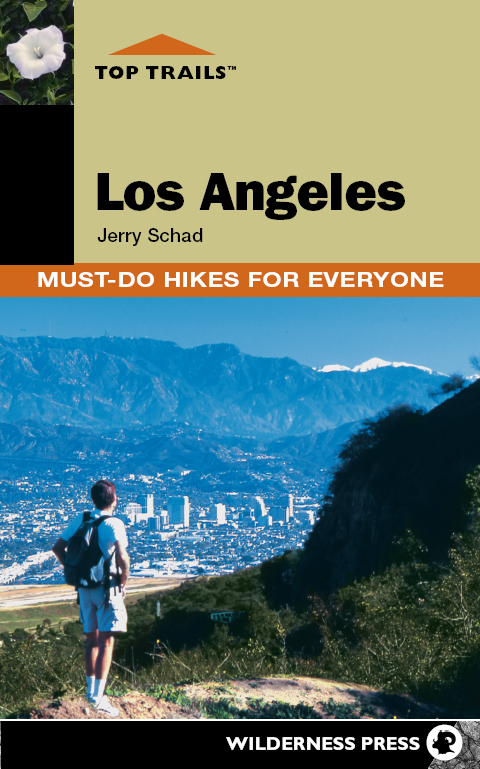
| Cover photo: | Atop Mount Lee in Griffith Park () |
All rights reserved. No part of this book may be reproduced in any form, or by any means electronic, mechanical, recording, or otherwise, without written permission from the publisher, except for brief quotations used in reviews.
SAFETY NOTICE: Although Wilderness Press and the author have made every attempt to ensure that the information in this book is accurate at press time, they are not responsible for any loss, damage, injury, or inconvenience that may occur to anyone while using this book. You are responsible for your own safety and health. The fact that a trail is described in this book does not mean that it will be safe for you. Be aware that trail conditions can change from day to day. Always check local conditions and know your own limitations.
Appendix
Major Public Agencies
Santa Monica Mountains National Recreation Area
(a unit of the National Park Service dedicated to preserving open space and facilitating recreational use in the Santa Monica Mountains)
401 W. Hillcrest Dr.
Thousand Oaks, CA 91360
(805) 370-2301
www.nps.gov/samo/
Santa Monica Mountains Conservancy
(a state-funded agency that acquires property for public open space and manages parkland in the Santa Monica Mountains/Rim of the Valley areas)
2600 Franklin Canyon Dr.
Beverly Hills, CA 90210
(310) 589-3200
www.lamountains.com
Angeles National Forest
(encompasses nearly all of the San Gabriel Mountains)
701 N. Santa Anita Ave.
Arcadia, CA 91006
(626) 574-1613
www.fs.fed.us/r5/angeles/
San Bernardino National Forest
(encompasses the San Bernardino and San Jacinto mountains, and the easternmost San Gabriel Mountains)
602 S. Tippecanoe Ave.
San Bernardino, CA 92408
(909) 382-2600
www.fs.fed.us/r5/sanbernardino/
Cleveland National Forest
(encompasses the Santa Ana Mountains, plus certain mountainous sections of San Diego County)
10845 Rancho Bernardo Road, Ste 200
San Diego, CA 92127
(858) 673-6180
www.fs.fed.us/r5/cleveland/
County of Los Angeles Department of Parks and Recreation
(manages park land throughout Los Angeles County)
500 W. Temple St.
Los Angeles, CA 90012
(213) 974-1311
parks.lacounty.gov
Orange County Parks
13042 Old Myford Rd.
Irvine, CA 92602
(714) 973-6865
www.ocparks.com/
Author

Jerry Schad
Jerry Schads several parallel careers have encompassed interests ranging from astronomy and teaching to photography and writing. He teaches astronomy and physical science at San Diego Mesa College, and currently chairs the Physical Sciences Department there.
Schad is author of Wilderness Presss Afoot and Afield hiking guidebooks for Los Angeles, Orange County, and San Diego, as well as 101 Hikes in Southern California , and Trail Runners Guide San Diego . For Top Trails Los Angeles , his 14th book, he traveled north to revisit some of his favorite trails in the foothills and mountains of the City of Angels.
Introduction
T he Los Angeles region is geographically schizophrenic. The teeming world down in the Basin looks inward toward itself. The world just outside, in the hills and mountains, rises above the noise and the haze, and embraces the earth and the sky. In this outside world you will find deep-cut canyons and craggy peaks hewn in sandstone and volcanic rock (Santa Monica Mountains); bold promontories and canyon walls fashioned from shattered granitic and metamorphic rock (San Gabriel Mountains); and waterfalls, dancing streams, wooded recesses and hidden glens in places often unbelievably close to the city.
Geography
Although this book focuses primarily on the L.A-bordering Santa Monica and San Gabriel mountain ranges, selective trips are included elsewhere in the region. This books geographic range goes as far west as eastern Ventura County and as far east as San Gorgonio Mountain and San Jacinto Peak, which are the loftiest peaks in Southern California. Coverage from north to south stretches from the Santa Clarita Valley to beyond Orange County.
Administratively, nearly all recreational areas in the San Gabriel, San Bernardino, and San Jacinto Mountains are part of either the Angeles National Forest or the San Bernardino National Forest. The Santa Monica Mountains lie in an administrative hodgepodge of county, state, and federal lands known collectively as the Santa Monica Mountains National Recreation Area. Orange Countys public spaces are managed primarily by its county-parks system and (higher in the Santa Ana Mountains) by the Cleveland National Forest.
Flora
With a topographical relief of over 10,000 feet, its not surprising that parts of the Los Angeles region could experience sub-zero winter temperatures at high elevations, and 100F-plus temperatures in the low interior valleys. The regions varied climate, topography, and geology have, in turn, resulted in a remarkable diversity of native flora. Since many animals prefer specific habitats, the fauna of the L.A. region is also quite diverse.
Lets first take a brief, descriptive tour of the three most common plant communities, or assemblages you will likely encounter on your backcountry explorations:
The sage-scrub (or coastal sage-scrub) community lies mostly below 2000 feet elevation, on the south-facing slopes of the coastal mountains, and to some extent the San Gabriel Mountains. The dominant plants are small shrubs, typically California sagebrush, black sage, white sage, and California buckwheat. Two larger shrubs often present are laurel sumac and lemonade berry, which, like poison oak, are members of the sumac family. In some areas along the coast, prickly-pear cactus thrives within this community. Much of this sage-scrub vegetation is summer-deciduousdormant and dead-looking during the warmer part of the year, lush green and aromatic during the cooler, wetter four to six months of the year. Wildflowers growing amid the sage scrub are particularly striking in March and April.
The chaparral community is commonly found between 1000 and 5000 feet elevation just about anywhere theres a slope that hasnt burned recently. Were it not for roads, firebreaks, and other interruptions, the chaparral would run in wide unbroken swaths along the flanks of most Southern California mountains. The chaparral plants are tough and intricately branched, evergreen shrubs with deep root systems that help the plants survive during the long, hot summers. Dominant chaparral plants include chamise, scrub oak, manzanita, toyon, mountain mahogany, yucca, and various forms of ceanothus (wild lilac). Chaparral is sometimes referred to as elfin foresta good description of a mature stand. Without benefit of a trail, travel through mature chaparral, which is often 15 feet high and incredibly dense all the way up from the ground, is almost impossible.

