About the Author
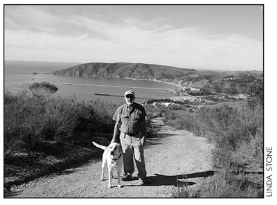
Since 1991, Robert Stone has been writer, photographer, and publisher of Day Hike Books. He is a Los Angeles Times Best Selling Author and an award-winning journalist of Rocky Mountain Outdoor Writers and Photographers, the Outdoor Writers Association of California, the Northwest Outdoor Writers Association, the Outdoor Writers Association of America, and the Bay Area Travel Writers.
Robert has hiked every trail in the Day Hike Book series. With 20 hiking guides in the series, many in their fourth and fifth editions, he has hiked thousands of miles of trails throughout the western United States. When Robert is not hiking, he researches, writes, and maps the hikes before returning to the trails. He spends summers in the Rocky Mountains of Montana and winters on the California Central Coast.
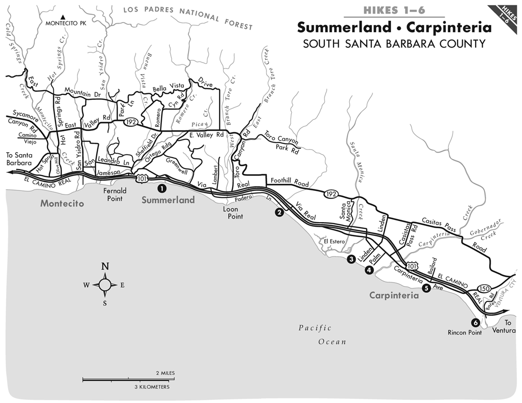
Summerland Beach Lookout Park
Hiking distance: 1-mile loop
Hiking time: 30 minutes
Elevation gain: 50 feet
Maps: U.S.G.S. Carpinteria
Santa Barbara Front Country and Paradise Road
Montecito Trails Foundation map
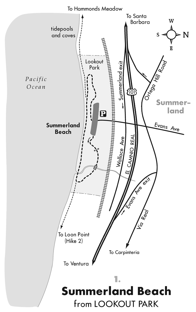
Summary of hike: Lookout Park is a beautiful grassy flat along the oceanfront cliffs in Summerland. From the four-acre park perched above the sea, paved walkways and natural forested trails lead down to a sandy beach, creating a one-mile loop. There are tidepools and coves a short distance up the coast from the beach.
Driving directions: VENTURA . From Ventura, drive northbound on Highway 101 to Summerland, and take the Evans Avenue exit. Turn left (south), cross under Highway 101 and over the railroad tracks, and go one block to Lookout Park. Park in the parking lot.
SANTA BARBARA . From Santa Barbara, drive southbound on Highway 101 and take the Summerland exit. Turn right (south), crossing the railroad tracks in one block, and park in the Lookout Park parking lot.
Hiking directions: From the parking lot, head left (east) through the grassy flat along the cliffs edge to an open gate. A path leads through a shady eucalyptus forest. Cross a wooden bridge and head to the sandy shoreline. At the shore, bear to the right, leading to the paved walkways that return up to Lookout Park.
To extend the walk, continue along the coastline to the west. At low tide, the long stretch of beach leads to coves, rocky points, and tidepools. The beach continues west past charming beachfront homes, reaching Eucalyptus Lane and the Hammonds Meadow Trailhead at 2 miles. From Lookout Park, the beach heads 1.5 miles east to Loon Point (Hike 2).
Loon Point
Hiking distance: 3 miles round trip
Hiking time: 1.5 hours
Elevation gain: Near level
Maps: U.S.G.S. Carpinteria
Santa Barbara Front Country and Paradise Road
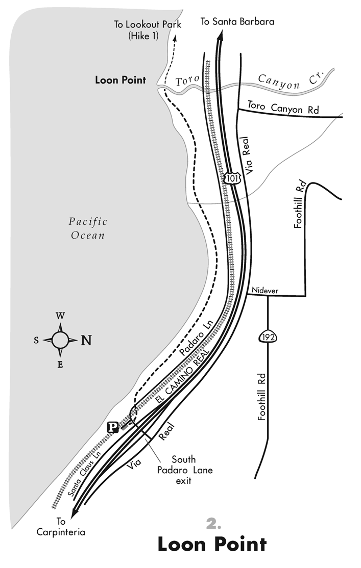
Summary of hike: Loon Point sits between Summerland and Carpinteria at the mouth of Toro Canyon Creek. Dense stands of sycamores, coastal oaks, Monterey cypress, and eucalyptus trees line the creek. The path to Loon Point follows an isolated stretch of coastline along the base of steep 40-foot sandstone cliffs.
Driving directions: VENTURA . From Ventura, drive northbound on Highway 101 to Summerland, and take the Padero Lane exit. Turn left on South Padero Lane, and drive 0.4 miles, crossing Highway 101 and curving east, to the signed Loon Point Beach parking lot on the left.
SANTA BARBARA . From Santa Barbara, drive southbound on Highway 101 to Summerland, and exit on Padero Lane south. Turn right and drive 0.2 miles to the signed Loon Point Beach parking lot on the left.
Hiking directions: Take the signed Loon Beach access trail parallel to the railroad tracks. Curve to the left, under the Padaro Lane bridge, past a grove of eucalyptus trees. The path descends through a narrow drainage between the jagged, weathered cliffs to the shoreline. Bear to the right on the sandy beach along the base of the sandstone cliffs. Loon Point can be seen jutting out to sea. Follow the shoreline, reaching large boulders at Loon Point in 1.5 miles. At high tide, the water level may be too high to reach the point. At a lower tide, the beach walk can be extended from Loon Point to Lookout Park (Hike 1), an additional 1.5 miles west.
Carpinteria Salt Marsh Nature Park
Hiking distance: 1.4 miles round trip
Hiking time: 45 minutes
Elevation gain: Level
Maps: U.S.G.S. Carpinteria
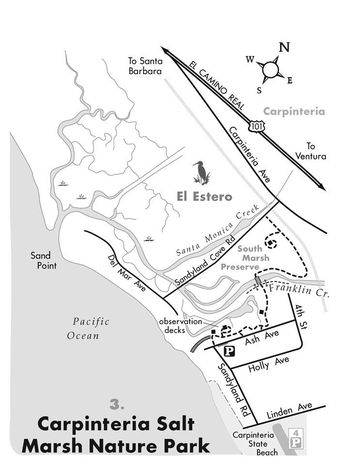
Summary of hike: The Carpinteria Salt Marsh, historically known as El Estero (the estuary), is one of Californias last remaining wetlands. The area was once inhabited by Chumash Indians. The 230-acre estuary is fed by Franklin Creek and Santa Monica Creek. The reserve is a busy, healthy ecosystem with an abundance of sea and plant life. It is a nesting ground for thousands of migratory waterfowl and shorebirds. The Carpinteria Salt Marsh Nature Park sits along the east end of the salt marsh with a trail system, interpretive panels, and several observation decks. Dogs are not allowed.
Driving directions: VENTURA . From Ventura, drive northbound on Highway 101 to Carpinteria, and exit on Linden Avenue. Drive 0.6 miles south on Linden Avenue to Sandyland Road, the last corner before reaching the ocean. Turn right and continue 0.2 miles to Ash Avenue. Park alongside the road by the signed park.
SANTA BARBARA . From Santa Barbara, drive southbound on Highway 101 to Carpinteria, and exit on Linden Avenue. Turn right and drive 0.6 miles south on Linden Avenue to Sandyland Road, the last corner before reaching the ocean. Turn right and continue 0.2 miles to Ash Avenue. Park alongside the road by the signed park.
Hiking directions: From the nature trail sign, walk 20 yards to the west, reaching an observation deck with a group of interpretive panels. A boardwalk to the left leads to the ocean. Take the wide, meandering path to the right. Walk through the coastal scrub vegetation, parallel to Ash Avenue and the salt marsh, while passing additional interpretive panels. At the north end of the park, curve left to another overlook of the wetlands. A short distance ahead is a T-junction. The left and right forks extend a few yards; they have been fenced off to protect the fragile habitat. Cross the bridge straight ahead over 60-foot-wide Franklin Creek. After crossing, go to the right. Parallel the west side of Franklin Creek, with views into the South Marsh Preserve. Just shy of the railroad tracks, veer left and follow the north edge of the preserve to a trail split. The left fork leads a short distance to a rock platform. The right fork ends at Sandyland Cove Road. Return along the same path.


