Published by Day Hike Books, Inc.
P.O. Box 865 Red Lodge, Montana 59068
www.dayhikebooks.com
Distributed by National Book Network
800-462-6420
Photographs by Robert Stone
Layout/maps by Paula Doherty
The author has made every attempt to provide accurate information in this book. However, trail routes and features may changeplease use common sense and forethought, and be mindful of your own capabilities. Let this book guide you, but be aware that each hiker assumes responsibility for their own safety. The author and publisher do not assume any responsibility for loss, damage, or injury caused through the use of this book.
Copyright 2012 by Day Hike Books, Inc.
1st Edition
ISBN: 978-1-57342-065-5
eISBN: 978-1-57342-218-5
All rights reserved
Printed in the United States of America
Library of Congress Control Number: 2011940532
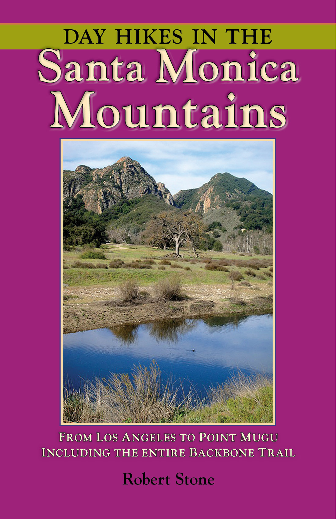
Cover photo:
Goat Buttes in Malibu Creek State Park, Hikes 67 and 72
Back cover photo:
Sandstone formations along Saddle Peak Trail,
Section 5 of the Backbone Trail
I wish to thank the following people from the
Santa Monica Mountains National Recreation Area.
Their tireless dedication and achievements to the expanding Backbone Trail system is a gift to all of us that will remain for many years to come.
Thank you for your helpful assistance, trail updates, and clarifications:
Sheila Braden
Melanie Beck
Ken Low

A LSO BY R OBERT S TONE
Day Hikes On the California Central Coast
Day Hikes On the California Southern Coast
Day Hikes Around Sonoma County
Day Hikes Around Napa Valley
Day Hikes Around Big Sur
Day Hikes Around Monterey and Carmel
Day Hikes In San Luis Obispo County, California
Day Hikes Around Santa Barbara
Day Hikes In the Santa Monica Mountains
Day Hikes Around Ventura County
Day Hikes Around Los Angeles
Day Hikes Around Orange County
Day Hikes In Sedona, Arizona
Day Hikes In Yosemite National Park
Day Hikes In Sequoia & Kings Canyon Natl. Parks
Day Hikes In Yellowstone National Park
Day Hikes In Grand Teton National Park
Day Hikes In the Beartooth Mountains
Day Hikes Around Bozeman, Montana
Day Hikes Around Missoula, Montana

Santa Monica Mountains
T he Santa Monica Mountains are a 50-mile-long range that parallels the coastline in Southern California, dividing the Pacific coast from the interior valleys. The mountains stretch from the Hollywood Hills in Los Angeles to Point Mugu at the Pacific Ocean, sloping into the Oxnard Plain in Ventura County. As the range travels northwest from Los Angeles to Point Mugu, the urban areas gradually get replaced by thousands of acres of undeveloped land.
The Santa Monica Range reaches a width of ten miles at its broadest and covers 200,000 acres. The altitude across most of the range is from 1,0002,000 feet, although the highest peaks reach just over 3,000 feet. The southern half of the range divides the San Fernando Valley from the Los Angeles Basin, while the northern half of the mountains divides the Conejo Valley from Malibu and Santa Monica Bay.
Most of the range is located within the Santa Monica Mountains National Recreation Area, the largest urban national park in the world. The parkland, which covers 150,000 acres, is a patchwork of land managed by more than twenty federal, state and municipal parks, including the National Park Service, Santa Monica Mountains Conservancy, California State Parks, and numerous county and municipal agencies.
The Santa Monica Mountains have four centerpiece parks that anchor the major trail systems: Griffith Park, the nations largest municipal park, covers 4,300 acres on the east end of the range. Topanga State Park, at 11,000 acres, is the largest park within city limits. The 7,000-acre Malibu Creek State Park is located near the middle of the range. Point Mugu State Park stretches across 16,000 acres on the western tip of the mountain range.
The Santa Monica Mountains are well-known for being the backdrop to Hollywood, Beverly Hills, and Malibu. Since the earliest days of Hollywood, the mountains have been used in making films (especially westerns). Paramount and Twentieth Century Fox even owned movie ranches. The television and motion picture industry continues to film in these mountains.
A great route to experience the Santa Monica Mountains is the Mulholland Scenic Corridor. The road was built in the 1920s to take Angelinos from the city to the ocean. The corridor runs 50 miles along the mountain crest, from Griffith Park to Leo Carrillo State Beach at Sequit Point. The automobile route is comprised of Mulholland Drive (from Hollywood to the 405 Freeway) and Mulholland Highway (the western rural portion). An 11 -mile unpaved stretch known as Dirt Mulholland (open only to pedestrians, equestrians, and cyclists) lies between the two sections. From the corridor are panoramic vistas of the ocean, access to the steep canyons and rocky ridges of the mountains, and views of the cities on both sides of the range.
This hiking guide includes 125 hikes throughout the mountain range. The 69-mile Backbone Trail, which runs along the crest, is completely covered in an additional section of 13 day hikes. A variety of hikes accommodates every level of hiking, from short strolls along boardwalks to all-day coast-to-peak hikes. Highlights include fantastic sandstone landscapes, cool retreats along stream-fed canyons, gorges, waterfalls, coastal bluffs, filming locations, historic sites, and numerous 360- degree overlooks. Several hikes are found in Los Angeles Griffith Park, including a hike up to the famous HOLLYWOOD sign.
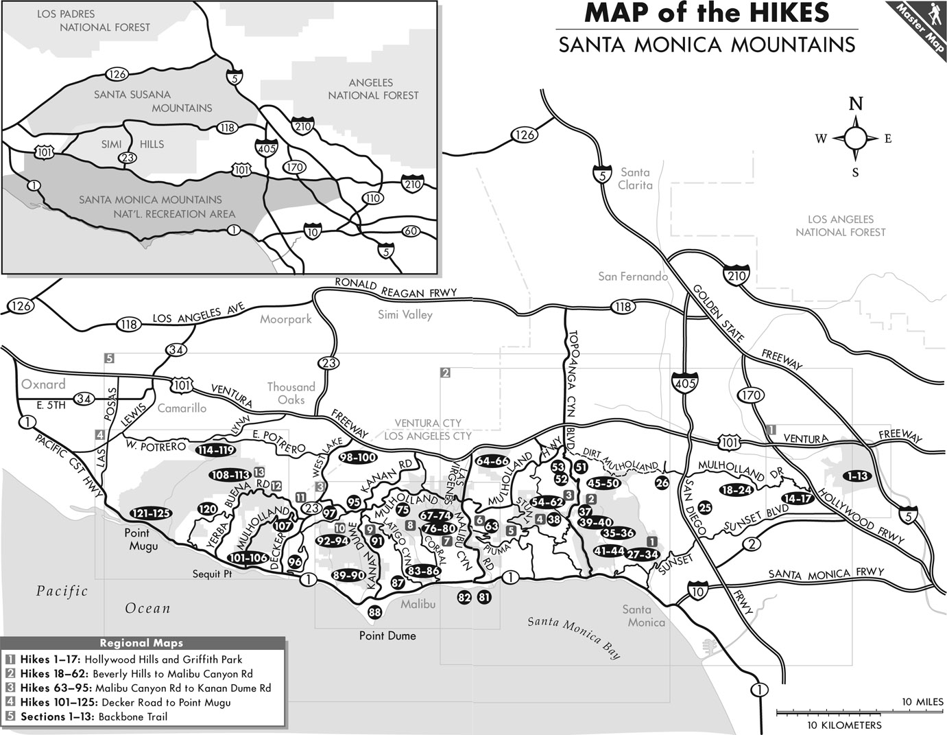
A map on the following page shows the main access roads to all of the hikes. The Santa Monica Range generally lies between Highway 1(Pacific Coast Highway) and Highway 101 (Ventura Freeway). Major arteries that connect the two highways are Topanga Canyon Boulevard, Malibu Canyon Road/Las Virgenes Road, and Kanan Dume Road/Kanan Road. The roads follow along Topanga Canyon and Malibu Canyon, water ways which have cut gorges hundreds of feet deep en route to the Pacific. The western half of the mountain range contains a network of canyons that run south to the ocean, with rolling hills, live oak woodlands, and rocky peaks. The west end of the range is the most remote, least developed, and most dramatic, with secluded gorges, sycamore-lined streams, native grasslands, and the highest peaks.
All of these hikes can be completed within a day. A quick glance at the summaries will allow you to choose a hike that is appropriate to your ability and intentions. Wear supportive, comfortable hiking shoes and layered clothing. Take along hats, sunscreen, sunglasses, drinking water, snacks, and appropriate outerwear. Ticks may be prolific and poison oak flourishes in the canyons and shady moist areas. Exercise caution by using insect repellent and staying on the trails.
Use good judgement about your capabilitiesreference the hiking statistics for an approximation of difficulty and allow extra time for exploration.
. San Vicente Mountain Park and Nike site
from Mulholland Scenic Overlook and Dirt Mulholland
17500 Mulholland Drive Encino
Hiking distance: 2 miles round trip
Next page


