The earlier lessons in the series are very foundational,designed to improve the readers technical ability and understanding beforegoing on to later lessons which are more project-based and written assumingtechnical skills have already been developed. If youre an absolute beginnerits recommended that you proceed from Volume 1 as that will ensure yourunderstanding of how to use the techniques employed in later lessons asoccasionally these lessons will refer to principles and skills taught inprevious volumes.
This book includes Volumes 7, 8, 9 and 10. The purpose ofthese lessons is to continue the discussion from the previous volumes onsketching by applying that skill to different genres. Specifically, Volume 7is a lesson on sketching the land, water and sky. Volume 8 continues with alesson on sketching plants. Volume 9 is a lesson on sketching people andanimals, and Volume 10 is a lesson on sketching buildings. The concepts ineach lesson are explained thoroughly and many examples are given, opportunitiesto practice are also included to help you master the skill taught in eachsection. These are the last of the strictly skill development lessons,completing them in addition to all the previous lessons will prepare you forthe more advanced project-based lessons in the volumes that follow.
Help Support someone in need.
10%of all profits are donated to organizations giving humanitarian assistance.
Land Water and Sky
Welcome to Volume 7 where we will focus on the basics ofsketching the land, water and sky.
The ability to look at a scene, sketch it quickly, anddetermine if its balanced is a good skill to have; the key is knowing how to identifymajor features, shapes and tonal depth. This is important for all sketches butespecially for landscapes. Because very few small details are needed in thesesketches, the major features are much more important.
Sketching land features becomes simple when you realize thereare only a handful of things you need to know to be successful.
To begin with, land can be broken down into three maincategories, rugged mountains/rock formations, rolling hills and plains orvalleys. A landscape can contain features from one, two or all three of thecategories. Once the category of each land feature is identified, the nextstep is to determine the dominant ground cover. Typically itll either be a rockysandy terrain, vegetated terrain consisting of trees, shrubs and grass, or acombination of both. In simple steps, identify the shape of each landmass andsketch it, identify its covering and add the appropriate tone, and lastly,sketch any minor details that may be important.
Water comes in the form of rivers, lakes and oceans, or on asmaller scale, puddles and streams. Lakes oceans and puddles are very similar;the water is usually flat and reflects the image of whats around it. Thereflection can be broken and distorted depending on the number and size ofwaves and ripples or it can be clear as glass if the waters surface is flatand smooth. Rivers and streams can either flow relatively fast, in which caselines can be used to show its speed and direction, or they can flow slow andsmooth and be more reflective like a lake.
To sketch the sky there are two main things to identify. First,identify the tone of the sky. This will depend on the time of day. Second,check for cloud cover. There are two basic cloud configurations to know forsketching. Clouds will either be rounded and fluffy, or theyll be thin and wispy. Either the sky or the clouds will be darker depending on the type of clouds andtime of day, take note of which is darker and shade accordingly.
Once you have a handle on identifying the features of alandscape, making an accurate sketch should be fast and easy.
Each part of the landscape will now be discussed in greaterdetail.
Land
As mentioned before, there are three major land structures;rugged mountains and rock formations, rolling hills, and plains and valleys. These features are the foundation for many sketches because most things are influencedby the type of land around them. Plants, animals, water, buildings, and eventhe sky are all influenced by the land.
Many different techniques can be used to sketch land. Contourand blind contour sketching are good ways to start; its also possible to startwith one of the tonal techniques, hatching or shading. (See Volume 5 for anexplanation of these techniques.)
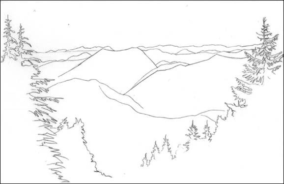
When using the contour method to sketch the land, an outlineis drawn for each major landmass. Starting with a blind contour sketch firstwill help you notice all the ups and downs to each mountain, hill, plain orvalley, and how they relate to each other. After completing a blind contourdrawing, regular contour drawings should be done as well.
Contour drawings should include contours for major changesin vegetation. If a tree line ends in the middle of a mountain, or if amountain has snow on it, there should be a line to show the change in tone. Ifa plain has groups of dark trees or areas of light grass or dirt, these should alsohave their own contour lines.
After completing a contour sketch the next step is to fillit in with tone. An important concept to understand is that as objects get fartheraway they lose detail and tones look more faded. Mountains and hills that arefar away will typically be sketched using a single tone for each mountain whileareas that are closer may have some details in the rocks and vegetation. Thishappens because particulates like dust and water are always in the air. Thefarther away one looks, the more particulate they have to look through andfewer details will be visible. Also, objects that are farther away will lookmore blue, violet and grey because the red, yellow and green tones are thefirst to get filtered out through the atmosphere.
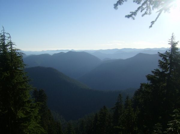
Figure 7-1. Rugged hills
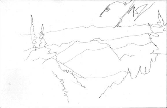
Figure 7-2. Rugged hills, blind contour sketch

