LOOKING DOWN ON WAR
EASTERN FRONT IMAGES
Imagery from WWII and Cold War Intelligence files
Colonel Roy M. Stanley II, USAF (ret.)
Other Books by the Author
Second World War Photo Intelligence
Prelude To Pearl Harbor
To Fool A Glass Eye
Asia From Above
V-Weapons Hunt
Axis Warships
The Normandy Invasion
Evolution of Airborne Ops
Chasing SAM
First published in Great Britain in 2016 by
PEN & SWORD AVIATION
an imprint of
Pen & Sword Books Ltd,
47 Church Street,
Barnsley, South Yorkshire
S70 2AS
Copyright Colonel Roy M. Stanley II 2016
ISBN 978 1 47388 349 9
eISBN 978 1 47388 351 2
Mobi ISBN 978 1 47388 350 5
The right of Colonel Roy M. Stanley II to be identified as Author of this Work has been asserted by him in accordance with the Copyright, Designs and Patents Act 1988.
A CIP record for this book is available from the British Library.
All rights reserved. No part of this book may be reproduced or transmitted in any form or by any means, electronic or mechanical including photocopying, recording or by any information storage and retrieval system, without permission from the Publisher in writing.
Pen & Sword Books Ltd incorporates the Imprints of
Pen & Sword Aviation, Pen & Sword Family History, Pen & Sword Maritime, Pen & Sword Military, Pen & Sword Discovery, Wharncliffe Local History, Wharncliffe True Crime, Wharncliffe Transport, Pen & Sword Select, Pen & Sword Military Classics, Leo Cooper, The Praetorian Press, Remember When, Seaforth Publishing and Frontline Publishing.
For a complete list of Pen & Sword titles please contact
PEN & SWORD BOOKS LIMITED
47 Church Street, Barnsley, South Yorkshire, S70 2AS, England
E-mail:
Website: www.pen-and-sword.co.uk
ACKNOWLEDGEMENTS
As usual, my wife and tireless caregiver/editor, Mary Ellen and Susan Strange, friend and NARA researcher extraordinaire ( www.StrangeArchives.com ). Others who made specific contributions are cited in footnotes.
DEDICATION
To:
All those who served their country from vaults without windows and kept their secrets.
FOREWORD
Even casual readers of World War II history will know of Barbarossa, code name for the German invasion of the Soviet Union begun on 22 June 1941. It was the largest single military operation ever mounted, involving 800,000 men on one side and just under three million on the other. Sheer hubris of an attack along an 1800 mile front is astounding.
Im not going to attempt to retell the story of Barbarossa. Its been covered at length and in depth in books by commanders and soldiers who were there and serried ranks of historians who werent. Think about what you know about that momentous operation. Names like Leningrad, Stalingrad and Sevastopol spring to mind. You may know of Gorki, Kiev, Kazan, Rostov and others but chances are all you have are words. Do you have any idea what any of them LOOKED like, what they looked like to Intelligence Services of the advancing German army?
This isnt a book about strategy, soldiers, tactics or equipment. My Barbarossa survivors are photographs, mostly aerial photoreconnaissance. It is a book about materials collected for use by military Intelligence between 1941 and 1945. Almost all of the photos included here are from German sources captured during and at the end of WW II. Others are from retired US Army and Navy Intelligence imagery holdings. A few pictures from open sources (magazines, newspapers, non-DoD archives) have been added to fill out the story in places.
I will show you examples of what German army and Luftwaffe Intel personnel saw, what they used for planning, what their targeting materials looked like, and what tactical operations sources looked like in their field headquarters. As a former aerial photo interpreter (PI) I know what the imagery meansI can read them. I know what the target materials meanIve made studies like them. These pages will use Luftwaffe aerial reconnaissance and ground photos taken by soldiers and combat photographers to show you what terrain, selected places and situations in the Soviet Union looked like during the conflict. Those will be photos collected by the Allies at the end of WW II.
During early days of the Cold War, PIs and targeteers in Britain and the US exploited many of those same German aerial and ground photos for reasons identical to their original use. They were invaluable for Target Studies and maps. It is no surprise that this imagery survived into the 1960s. After that, survival became more problematic. Intelligence is perishable and other sources were coming into play.
This book is about Barbarossa but ultimately it is about the photosand I will tell you how they survived into the present. Ill tell you what I see on that imagery as if you and I were sitting in my study going through stacks of prints.
Roughly 80 per cent of the images are negs I had printed nearly four decades ago. When I decided to write this book I was fortunate to meet Ms Susan Strange, a professional researcher at NARA. She has been my eyes at the Archives. She sends me plots I need to see and scans the images I want to look at. Her help has been invaluable in filling gaps in my collection.
Finally, while writing this I realized it is possible to respect, even admire, professionalism, skill, courage, determination and sacrifice on both sideswithout approving of the eithers politics.
In 1977 I assisted FBI prosecutions of war criminals using WW II German aerial imagery of Poland, searching for possible mass grave sites matching witness descriptions.
were an invaluable source for using this imagery. They are the same maps used to plot GX in the 1950s.
Chapter I
INTRODUCTION
By inclination, Intelligence organizations are peopled by pack-rats. Everything that comes in is kept because it may be of use in the future. That works for a given conflict, but Intelligence is perishable. When the old stuff obviously has less (if any) usefulness it is usually stuck in boxes and filed. The bulk of it, and there is a LOT, is sometimes eventually destroyed. Old Intelligence materials are like old buildings. If they survive long enough to be considered historic they may be kept. If not they will be removed to make room for newer items.
During World War II, German Intelligence collected a large volume of ground and aerial photos, including those of their invasion of the Soviet Union.
German Photo Interpreters (PIs) were experienced and, evidence shows, quite good.
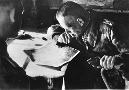
Many senior German officers regularly relied on aerial imagery.
Some of that material was captured by the Allies at the end of World War II and quickly recognized as a valuable source of Targeting and Cartographic Intelligence for the Cold War. Some of the ground shots showed key buildings, construction of bridges, location of factories and rail yards.
Luftwaffe imagery of Russia was the only source of aerial photo coverage prior to the U-2 in 1957 and Corona satellites in the 1960s.
Twenty tons of German photoreconnaissance results and ground photography were found in eleven different locations in Germany. In June 1945 the mother lode, the German Army Print Library, was found in a barn 8 miles south west of Salzburg. A few of those boxes of original German contact prints contained paper traces showing where the mission went. That was something we had to know, so the prints were taken to the Aeronautical Chart and Information Center (ACIC) in St Louis, MO and plotted at a scale of 1:250,000. Those plots, made in the Standard Indexing System (SIS), were the retrieval tools for the imagery.
Next page
