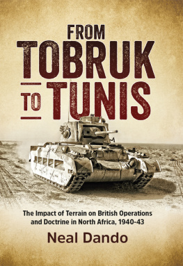
This book focuses on the extent to which the physical terrain features across Egypt, Libya and Tunisia affected British operations throughout the campaign in North Africa during the Second World War. One main theme of the work analyses the terrain from the operational and tactical perspective and argues that the landscape features heavily influenced British operations and should now be considered alongside other standard military factors. The work differs from previous studies in that it considers these additional factors for the entire campaign until the Axis surrender in May 1943. Until now it has been widely assumed that much of the Western Desert coastal plateau was a broadly level, open region in which mobile armoured operations were paramount. However this work concentrates on the British operations to show they were driven by the need to capture and hold key features across each successive battlefield. At the operational level planning was also led by the need to hold key ground across Libya and especially the province of Cyrenaica during the crucial middle period of the campaign.
A secondary theme of the work argues that British forces began to improvise certain tactical doctrines, which altered the early practice of combined arms assaults into one of Infantry and Armoured formations fighting largely separated battles until the autumn of 1942. Other developments in doctrine which were affected by the terrain included the practice of unit dispersal to hold key ground and the use of temporary units such as Jock columns to harass and engage the enemy. The two themes are interlinked and contribute fresh insights to the debate on British methods of warfare.
The author has consulted key documents, reports, war diaries and published memoirs, from major UK archives and compared these with the campaign historiography to develop the main themes of the work. These include the National Archives, the Churchill Archives Centre, the Liddell-Hart Centre for Military History, the National Army Museum, John Rylands Centre, Imperial War Museum at London and Duxford and London and the Tank Museum Archives at Bovington. The sources include many of the key published and some unpublished memoirs. His text is supported by a large number of specially-commissioned colour maps.
Neal Dando has been interested in the study of military history from an early age. He followed this with an Army scholarship and subsequent training. Before returning to academic study, Neal Dando worked as a retail manager for various national companies. He then completed his PhD in March 2014 at Plymouth University, where his research focussed on the North African campaign, 1940-1943. He has been an Associate Lecturer at Plymouth and is currently an Associate Lecturer at the University of Exeter, and also taught for two years at an Independent School in Devon. His current research continues to focus on the development of tactical doctrine, training and command amongst Divisions of the British Army and the Empire, during the early period of the Second World War. He is married and lives in Devon.
FROM TOBRUK TO TUNIS
From Tobruk to Tunis
The Impact of Terrain on British Operations and Doctrine in North Africa, 1940-1943
Wolverhampton Military Studies No.16
Neal Dando
Helion & Company Limited
26 Willow Road
Solihull
West Midlands
B91 1UE
England
Tel. 0121 705 3393
Fax 0121 711 4075
Email:
Website: www.helion.co.uk
Twitter: @helionbooks
Visit our blog http://blog.helion.co.uk/
Published by Helion & Company 2016
Designed and typeset by Mach 3 Solutions Ltd, Bussage, Gloucestershire
Cover designed by Paul Hewitt, Battlefield Design ( www.battlefield-design.co.uk )
Text Neal Dando 2016
Maps drawn by George Anderson Helion & Company Ltd 2016
Every reasonable effort has been made to trace copyright holders and to obtain their permission for the use of copyright material. The author and publisher apologize for any errors or omissions in this work, and would be grateful if notified of any corrections that should be incorporated in future reprints or editions of this book.
ISBN 978-1-910294-00-0
eISBN 978-1-912174-42-3
Mobi ISBN 978-1-912174-42-3
British Library Cataloguing-in-Publication Data.
A catalogue record for this book is available from the British Library.
All rights reserved. No part of this publication may be reproduced, stored in a retrieval system, or transmitted, in any form, or by any means, electronic, mechanical, photocopying, recording or otherwise, without the express written consent of Helion & Company Limited.
For details of other military history titles published by Helion & Company Limited contact the above address, or visit our website: http://www.helion.co.uk .
We always welcome receiving book proposals from prospective authors.
List of Maps
2:1 Egypt and the Libyan frontier.
2:2 Egypt and Cyrenaica.
2:3 Tripolitania.
2:4 Eastern Tunisia.
2:5 The Egyptian frontier sector.
3:1 Operation Compass; the assault on the Italian camps.
3:2 Italian Defences at Tobruk, January 1941.
3:3 Sidi Saleh and Beda Fomm, February 1941.
4:1 The First Retreat, April 1941.
4:2 The Second Retreat, January 1942.
5:1 Operation Brevity, 15 May 1941.
5:2 Operation Battleaxe 15-17 June 1941.
6:1 Crusader, Sidi Rezegh, November-December 1941.
7:1 The Gazala line, May-June 1942.
7:2 Operation Aberdeen, 5-6- June 1942.
8:1 Matruh defences and minefields, 26 June 1942.
8:2 First Alamein, 30 June-27 July 1942.
9:1 Alam Halfa, 30 August-3 September 1942.
9:2 Second Alamein, 23 October-4 November 1942.
10:1 Medenine, 6 March 1943.
10:2 The Mareth Line, 20-26 March 1943.
10:3 Wadi Akirit, 6 April 1943.
10:4 The final assault on Tunis, 6-13 May 1943.
Glossary
1. Local Names and Terms
Crater-like and often large depressions with edges raised about ground level; the edges offered a defensive position and often overlooked the surrounding lower terrain. Some were over a mile wide and therefore offered useful forming up places for formations.
Low limestone ridges, either sharply defined to one side, or broader in width. They were stony covered or with a thin layer of gravel/sand which proved difficult to dig into. They offered important artillery observation places and from which the surrounding ground could be dominated and were therefore the key features over which many of the battles were fought.
Desert tracks, often up to 100 yards wide, which rapidly turned to fine dust or winter mud due to the sheet volume of vehicles using them.
ditches or a wide river bed, mostly dry but often flooded by winter rains.
2. Military Glossary
Army Group Royal Artillery; a group of Regiments of Artillery, designed to give large concentrations of fire where needed.
weapon designed to engage armour.
these were the British supply units for each Regiment. They moved constantly between the frontline units and the Field Supply Depots.
Massed Artillery fire which targets an enemy position or unit.
Army Infantry unit, usually of four companies and an HQ averaging 400-700 men.
Artillery unit of 4-8 guns, often three to an Artillery Regiment, 250 men each.
Next page
