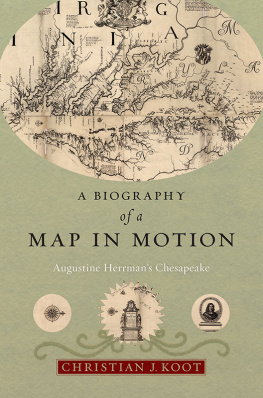
A Biography of a Map in Motion
A Biography of a Map in Motion
Augustine Herrmans Chesapeake
Christian J. Koot
NEW YORK UNIVERSITY PRESS
New York
NEW YORK UNIVERSITY PRESS
New York
www.nyupress.org
2018 by New York University
All rights reserved
References to Internet websites (URLs) were accurate at the time of writing. Neither the author nor New York University Press is responsible for URLs that may have expired or changed since the manuscript was prepared.
ISBN : 978-1-4798-3729-8
For Library of Congress Cataloging-in-Publication data, please contact the Library of Congress.
New York University Press books are printed on acid-free paper, and their binding materials are chosen for strength and durability. We strive to use environmentally responsible suppliers and materials to the greatest extent possible in publishing our books.
Manufactured in the United States of America
10 9 8 7 6 5 4 3 2 1
Also available as an ebook
For Jennifer
Contents
- Figure I.1. Augustine Herrman, Virginia and Maryland As it is Planted and Inhabited this present Year 1670 Surveyed and Exactly Drawne by the Only Labour & Endeavour of Augustin Herrman Bohemiensis; W. Faithorne, sculpt. London, 1673.
- Figure 1.1. Map of the Mid-Atlantic in the Seventeeth Century
- Figure 1.2. Clothes Press or Cupboard, 16801700, Williamsburg or Eastern Shore, Virginia.
- Figure 1.3. Kas, Unknown Maker, 16501700, New York.
- Figure 1.4. Augustine Herrmans property in Maryland as seen in Augustine Herrman, Virginia and Maryland.
- Figure 2.1. John Smith, Virginia Discouvered and Discribed by Captayn John Smith Graven by William Hole. London, 1612 [1624].
- Figure 2.2. Nova Terra-Mari Tabula. [London, 1635.]
- Figure 2.3. Ralph Hall, Virginia, in Historia mundi; or, Mercators Atlas. London, 1635.
- Figure 2.4. John Ferrar, A mapp of Virginia discouered to ye Hills, and in its Latt: From 35 deg: & 1/2 neer Florida to 41 deg: bounds of new England. London, 1651.
- Figure 2.5. Novi Belgii Novque Angli: Nec non partis Virgini tabula. Amsterdam, 1655 [1685].
- Figure 2.6. A Draught of the Sea Coast and Rivers, of Virginia, Maryland, and New England, Taken from the latest Surveys. London, [1672].
- Figure 2.7. Robert Morden and William Berry, A New Map of the English Plantations in America both Continent and Ilands, Shewing their true Situation and distance, from England or one with another. London, [1673].
- Figure 2.8. Robert Dudley, Carta Particolare Della Virginia Vecchia e Nuoua, in DellArcano del Mare, vol. 2. Florence, 1646
- Figure 2.9. Soundings in Augustine Herrman, Virginia and Maryland
- Figure 2.10. Indications of underwater features in Augustine Herrman, Virginia and Maryland
- Figure 2.11. Lucas Janszoon Waghenaer, The mariners mirrour. London, 1588
- Figure 2.12. Johannes Vingboons, Carte vande Svydt Rivier in Niew Nederland, 1639.
- Figure 2.13. Johannes Vingboons, Pascaert van Nieuw Nederlandt, Virginia, ende Nieuw-Engelandt, 1639.
- Figure 2.14. William Reid, A map of the Rariton River, Milstone River, South River, 1685.
- Figure 2.15. View of New Amsterdam (New York) made on the spot, ca. 1650, perhaps by Augustine Herrman
- Figure 2.16. Manuscript chart of Maryland, 1677
- Figure 2.17. Manuscript chart of Virginia, 1677.
- Figure 2.18. Richard Norwood, Mappa Aestivarum Insularum alian Bermudas dictarum. [London, 1626.]
- Figure 2.19. Mountserrat Island, 1673
- Figure 4.1. Advertisement for Virginia and Maryland from the London Gazette, March 30April 2, 1674.
- Figure 4.2. Frontispiece by William Faithorne, after Gilbert Soest, to John Kerseys The Elements of that Mathematical Art Commonly Called Algebra, 1673.
- Figure 4.3. The Workshop of an Engraver, ca. 1600.
- Figure 4.4. Forms of graving-tools, and the manner of holding the graver, William Faithorne (16161691), plate 9, from The Art of Graveing and Etching. London, 1662.
- Figure 4.5. William Faithorne, portrait miniature of Augustine Herrman, Virginia and Maryland (detail)
- Figure 4.6. Self-Portrait of Wenceslaus Hollar, 1647.
- Figure 4.7. Theodor de Bry, title page from A briefe and true report of the new found land of Virginia. Frankfurt, 1590
- Figure 5.1. A plan of the cities of London and Westminster. London, 1746
- Figure 5.2. John Dunstall and John Sellers, Scenes of the Plague in London with Statistical breakdown by parish for the years 1625, 1636, and 1665. London, 16651666
- Figure 5.3. David Loggan, Triumphal arch; near the Royal Exchange [second arch] in Cornhill, in John Ogilby, The Entertainment of his Most Excellent Majestie Charles II, in his Passage through the City of London to his Coronation. London: Thomas Roycroft, 1662.
- Figure 5.4. View of Pepyss library in Buckingham Street.
Original spellings have been preserved except in the use of interchangeable letters like i/j and u/v. In these cases spellings have been modernized. Abbreviations have also been silently expanded for clarity. In the text, dates have been modernized as per the Dutch seventeenth-century usage, though the notes preserve original dates. Like many seventeenth-century Europeans names, Augustine Herrmans name appears spelled differently in period sources, and this has carried over to modern historical works. In the text I have chosen the spelling that appears on his map but have maintained original spellings in quotations and in the notes.
Located in the back of the second court of Magdalene College in Cambridge, England, and accessed through a cloister that runs by the colleges formal dining room is the Pepys Library, an early eighteenth-century building that holds Samuel Pepyss library. Famous for the meticulous diary he kept from 1660 to 1669 capturing the daily life and political intrigue of Restoration London, Pepys was a government bureaucrat and voracious consumer of Londons high and low cultural attractions. Bequeathed at his death to the college he attended, Pepyss collection numbers more than three thousand volumes and includes his diary. The volumes are housed in a second floor reading room, where they are encased in a series of twelve book presses that Pepys had built specially for them. The room is wide and shallow; five windows span the front side, and the book presses line the back wall. At the center of the room is a large desk that may have been Pepyss own. The librarys contents match Pepyss various interests and range from poetry and political treatises to popular ballads and sheet music. Particularly notable are Pepyss holdings relating to the growth of Englands navy, which include more than one thousand seventeenth-century maps and charts. Among these maps is one of five extant copies of Virginia and Maryland as it is Planted and Inhabited (1673) (Figure I.1). Reproduced widely in the seventeenth and eighteenth centuries, Virginia and Maryland is one of the most famous images of the Chesapeake, but its story has never been told.
Created by a colonial merchant, planter, and diplomat named Augustine Herrman and engraved by Londoner William Faithorne, this extraordinary map depicts the seventeeth-century Mid-Atlantic stretching from what is today southern New Jersey to northern North Carolina. While early modern European nations rushed to make maps as they expanded their empires overseas, the colonial Chesapeake engendered few distinct cartographic depictions. Its waterways were complex and difficult to chart; so, too, were its imperial permutations as the Dutch, English, and Swedes jockeyed for control of the Native American lands that surrounded the bay. The imperial rivalry between the Dutch and English ultimately led to

