Taylor Morrison - The Coast Mappers
Here you can read online Taylor Morrison - The Coast Mappers full text of the book (entire story) in english for free. Download pdf and epub, get meaning, cover and reviews about this ebook. year: 2011, publisher: Houghton Mifflin Harcourt Trade and Reference;Houghton Mifflin Harcourt, genre: Art. Description of the work, (preface) as well as reviews are available. Best literature library LitArk.com created for fans of good reading and offers a wide selection of genres:
Romance novel
Science fiction
Adventure
Detective
Science
History
Home and family
Prose
Art
Politics
Computer
Non-fiction
Religion
Business
Children
Humor
Choose a favorite category and find really read worthwhile books. Enjoy immersion in the world of imagination, feel the emotions of the characters or learn something new for yourself, make an fascinating discovery.

- Book:The Coast Mappers
- Author:
- Publisher:Houghton Mifflin Harcourt Trade and Reference;Houghton Mifflin Harcourt
- Genre:
- Year:2011
- Rating:4 / 5
- Favourites:Add to favourites
- Your mark:
The Coast Mappers: summary, description and annotation
We offer to read an annotation, description, summary or preface (depends on what the author of the book "The Coast Mappers" wrote himself). If you haven't found the necessary information about the book — write in the comments, we will try to find it.
In the mid-nineteenth century, little was known of the west coast and waterways. The ships that sailed those waters did so at a considerable risk, sometimes depending on only a school atlas to navigate and all too often crashing into the rocks. So the U.S. Coast Survey, whose purpose was to map every mile of American shoreline, commissioned George Davidson to chart all of the major points on the coast and all of the waterways in between. In this beautifully illustrated book, Taylor Morrison chronicles the challenges and adventures Davidson and his team faced and the methods they used to accomplish this monumental, and essential, task.
Taylor Morrison: author's other books
Who wrote The Coast Mappers? Find out the surname, the name of the author of the book and a list of all author's works by series.


The Coast Mappers — read online for free the complete book (whole text) full work
Below is the text of the book, divided by pages. System saving the place of the last page read, allows you to conveniently read the book "The Coast Mappers" online for free, without having to search again every time where you left off. Put a bookmark, and you can go to the page where you finished reading at any time.
Font size:
Interval:
Bookmark:
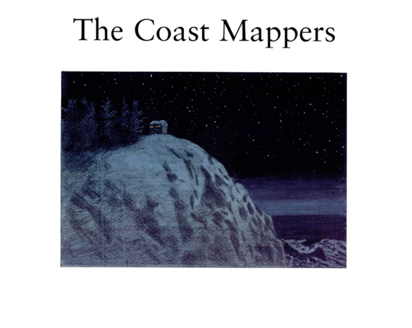
The Coast Mappers
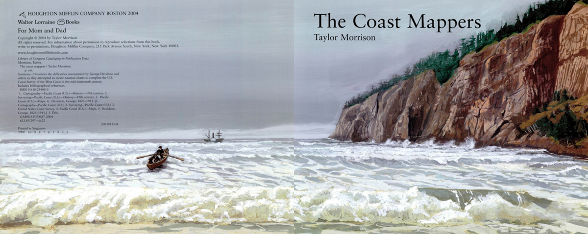
HOUGHTON MIFFLIN COMPANY BOSTON 2004
Walter Lorraine Books
For Mom and Dad
Copyright 2004 by Taylor Morrison
All rights reserved. For information about permission to reproduce selections from this book,
write to permissions, Houghton Mifflin Company, 215 Park Avenue South, New York, New York 10003.
www.houghtonmifflinbooks.com
Library of Congress Cataloging-in-Publication Data
Morrison, Taylor.
The coast mappers / Taylor Morrison,
p. cm.
Summary: Chronicles the difficulties encountered by George Davidson and
others as they attempted to create nautical charts to complete the U.S.
Coast Survey of the West Coast in the mid-nineteenth century.
Includes bibliographical references.
ISBN 0-618-25408-0
I. CartographyPacific Coast (U.S.)History19th century. 2.
SurveyingPacific Coast (U.S.)History19th century. 3. Pacific
Coast (U.S.)Maps. 4. Davidson, George, 1825-1911. [1.
CartographyPacific Coast (U.S.) 2. SurveyingPacific Coast (U.S.) 3.
United States Coast Survey. 4. Pacific Coast (U.S.)Maps. 5. Davidson,
George, 1825-1911.] I. Title.
GA408.S. P 33 M 67 2004
623.89'297dc22
2003013534
Printed in Singapore
TWP 10 9 8 7 6 5 4 3 2
The Coast Mappers
Taylor Morrison
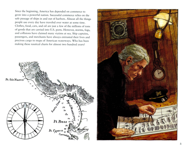
Since the beginning, America has depended on commerce to grow into a powerful nation. Successful commerce relies on the safe passage of ships in and out of harbors. Almost all the things people use every day have traveled over water at some time. Clothes, food, cars, and oil are just a few of the millions of tons of goods that are carried into U.S. ports. However, storms, fogs, and collisions have claimed many victims at sea. Ship captains, passengers, and merchants have always entrusted their lives and precious cargo to maps of American waterways. Who has been making these nautical charts for almost two hundred years?
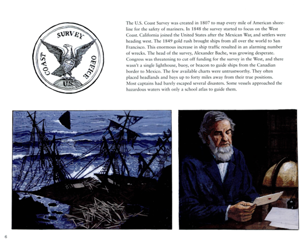
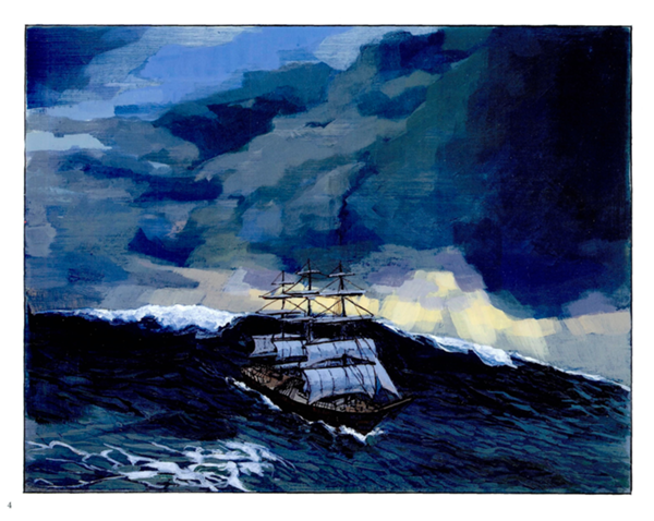
The U.S. Coast Survey was created in 1807 to map every mile of American shoreline for the safety of mariners. In 1848 the survey started to focus on the West Coast. California joined the United States after the Mexican War, and settlers were heading west. The 1849 gold rush brought ships from all over the world to San Francisco. This enormous increase in ship traffic resulted in an alarming number of wrecks. The head of the survey, Alexander Bache, was growing desperate. Congress was threatening to cut off funding for the survey in the West, and there wasn't a single lighthouse, buoy, or beacon to guide ships from the Canadian border to Mexico. The few available charts were untrustworthy. They often placed headlands and bays up to forty miles away from their true positions. Most captains had barely escaped several disasters. Some vessels approached the hazardous waters with only a school atlas to guide them.
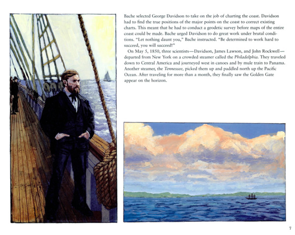
Bache selected George Davidson to take on the job of charting the coast. Davidson had to find the true positions of the major points on the coast to correct existing charts. This meant that he had to conduct a geodetic survey before maps of the entire coast could be made. Bache urged Davidson to do great work under brutal conditions. "Let nothing daunt you," Bache instructed. "Be determined to work hard to succeed, you will succeed!"
On May 5, 1850, three scientistsDavidson, James Lawson, and John Rockwelldeparted from New York on a crowded steamer called the Philadelphia. They traveled down to Central America and journeyed west in canoes and by mule train to Panama. Another steamer, the Tennessee, picked them up and paddled north up the Pacific Ocean. After traveling for more than a month, they finally saw the Golden Gate appear on the horizon.
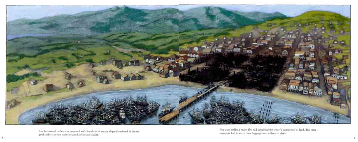
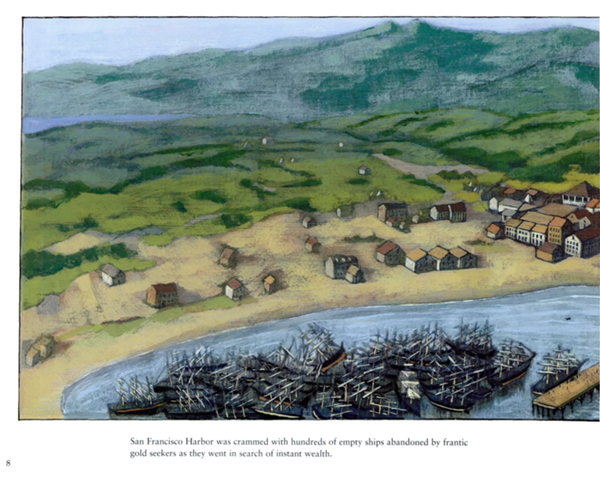
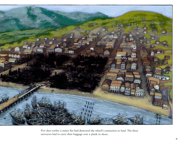
San Francisco Harbor was crammed with hundreds of empty ships abandoned by frantic gold seekers as they went in search of instant wealth.
Five days earlier a major fire had destroyed the wharf's connection to land. The three surveyors had to carry their baggage over a plank to shore.
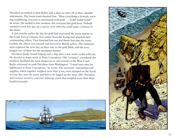
Davidson scrambled to find shelter and a place to store all of their valuable instruments. The boom town shocked him. "Here everything is feverish, exciting, maddening, everyone is intoxicated with gold ... Gold! Gold! Gold!" he wrote. He needed to hire workers, but everyone had gold fever. Nobody wanted to earn low pay on a survey crew when he could make a fortune in the mines.
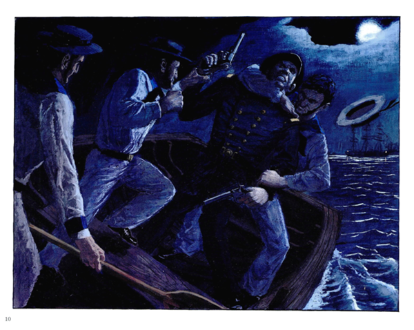
A few months earlier the lust for gold had motivated the worst mutiny in the Coast Survey's history. Five sailors from the Ewing had attacked their commanding officer. They knocked him out and threw him into the water. Luckily, the officer was rescued and revived by British sailors. The mutineers were captured the next day on their way to the gold fields, and the navy hanged two of them for the attempted murder.
Davidson finally found lodging and a ship after a few weeks in the wild city. He decided to begin work at Point Conception. Old "coasties" considered this southern headland the most dangerous to sail around on the West Coast. Bache continued to push Davidson from Washington. "I must have sites for lighthouses at Point Conception," he wrote. The surveyors' instruments and supplies, which together weighed more than a ton, were dumped on the beach at Cojo Bay near the point and had to be lugged up the steep cliffs. Davidson and Lawson carried a cast-iron telescope stand that weighed more than three hundred pounds.
Font size:
Interval:
Bookmark:
Similar books «The Coast Mappers»
Look at similar books to The Coast Mappers. We have selected literature similar in name and meaning in the hope of providing readers with more options to find new, interesting, not yet read works.
Discussion, reviews of the book The Coast Mappers and just readers' own opinions. Leave your comments, write what you think about the work, its meaning or the main characters. Specify what exactly you liked and what you didn't like, and why you think so.