Contents
All water activities carry risk and sailing, cruising in particular, is no exception. Royal Yachting Association training courses and publications emphasise the need for preparation before going to sea. In doing so, they place weather first in a list that includes vessel and crew suitability and ability, navigation, pilotage, tides and currents. This book will follow broadly, and expand upon, the Yachtmaster and Coastal Skipper weather syllabus. As concisely as possible, it covers terminology, air masses, cloud types, weather patterns, sources of weather information, use of forecasts, land and sea breezes, sea fog, use of the barometer and other observations. A section has been added on sea state and water levels, omissions from the RYA course syllabus. There are few absolutes in meteorology and words like might, could and can happen will frequently be used rather than will happen. That is the nature of weather.
Science and technology have combined to make large-scale weather prediction far better than even ten years ago. It is significant that weather is not now a prime cause of Royal National Lifeboat Institution call-outs. That may not be surprising, but there are still limitations in weather predictability. Sailors have to be aware of short-lived, small-scale details that are not usefully predictable. No marine weather forecast will be totally accurate. Using forecasts is really about risk assessment.
General weather terms
The troposphere is where our weather occurs, up to 912 km above the surface in mid-latitudes, higher in the tropics.
The tropopause is the top of the troposphere where temperature stops decreasing with height in a temperature inversion; it may become warmer above the tropopause.
Depression and low (pressure) are synonymous.
Winds, anticlockwise around a low, are cyclonic.
But the word cyclone usually refers to a tropical storm.
Anticyclone and high (pressure) are also synonymous.
Winds, clockwise around a high, are anticyclonic.
Fronts are in low pressure troughs, which may or may not be well marked.
Troughs of low pressure do not always have fronts.
Air is unstable if warming low down creates convection.
Precipitation is an omnibus word describing rain, drizzle, sleet, snow or hail.
These words are a useful source of information because they describe why the precipitation is occurring
rain, sleet or snow are usually from frontal cloud
drizzle is light, usually steady precipitation from low level, layered cloud, often in warm sectors of frontal lows
showers fall from convective cloud and can be rain, hail, sleet or snow.
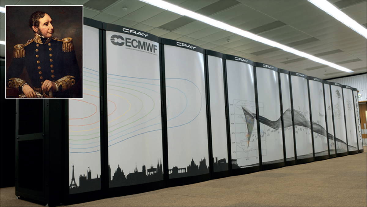
ECMWF (main); DEA PICTURE LIBRARY (inset)
Milestones. 1863: Vice-Admiral Robert Fitzroy used observations of pressure and weather. 1906: Wilhelm Bjerknes said that the laws of physics could be used to calculate forecasts. 1965: operational weather computer made 50,000 calculations per second. 2021: weather computer speeds reach 14,000 trillion calculations per second
The BBC Radio 4 shipping forecast has been broadcast continuously since 1924 except for during the Second World War. That is an indication of its valuable contribution to safety at sea and why it continues to this day. The mechanics of using the service have been covered in many other books and, therefore, will not be repeated here.
We are now in the era of e-weather with many services freely and readily available. There is much duplication with different presentations of the same information. This guide will help sailors to acquire, understand and use that information.
This is a practical handbook and meteorological theory will largely be sidestepped. For example, all we really need to know about the Coriolis effect is Buys Ballots law: In the northern hemisphere, stand with your back to the wind and pressure will be lower to your left than the right. Little will be said about synoptic charts. They are not easy to interpret except in rather general terms. Computer-generated forecasts (GRIB data) are much easier to use, especially for wind directions and strength. Theory will largely be confined to helping understanding of small-scale weather.
To avoid tedious repetition of acronyms and abbreviations, a list is given here. Some may not be used in this book but are included as they may be encountered elsewhere. The list is not exhaustive and more will appear in time.
Abbreviation/acronyms
| AEMet | Spanish weather service |
| BSH | German hydrographic service |
| CAPE | A lightning risk index |
| CMC | Canadian Meteorological Center |
| DMI | Danish weather service |
| DWD | German weather service |
| ECMWF | European Centre for Medium-range Weather Forecasts |
| FNMOC | US Navy Weather centre |
| GMDSS | Global Maritime Distress and Safety System |
| GRIB | GRIdded Binary; output from NWP |
| HMCG | UK Coastguard |
| IMO | International Maritime Organization |
| KNMI | Dutch weather service |
| LAM | Limited Area (NWP) Model |
| MSI | Marine Safety Information |
| Meteoblue | Private weather service based at Basle, Switzerland |
| NAVTEX | NAVigation TEleteXt, a SSB MSI broadcast system |
| NHC | US National Hurricane Center, Miami |
| NMI | Norwegian weather service; see also YR.NO |
| NOAA | Parent body of the US National Weather Service |
| NWP | Numerical Weather Prediction |
| NWS | National Weather Service |
| OPC | NOAA Ocean Prediction Center |
| SMHI | Swedish weather service |
| SOLAS | Safety of Life at Sea international convention |
| SSB | Single sideband radio transmission system |
| SST | Sea Surface Temperature |
| WMO | World Meteorological Organization |
| YR.NO | Joint website of NMI and the Norwegian Broadcasting Corporation |
Global NWP models run by the international meteorological community
ECMWF High resolution, usually just ECMWF
GFS, NOAA
ICON, DWD
UK UM, Unified Model, a multipurpose model
ARPEGE, France
GEM, Canada
NAVGEM, US Navy
NEMS, NOAA multipurpose modelling system.
Some regional and national area models
ICON-EU Regional version of ICON
UK4 Regional version of UM
UKV British Isles version of UM
COAMPS US Navy regional
COSMO German waters version of ICON
AROME French waters
WRF US Research and development model, freeware
NMM/NAM/HRRR US detailed models
HIRLAM European consortium NWP model
HARMONIE and ALARO Derivatives of HIRLAM
Weather forecast terminology
Some terms are agreed internationally, those describing wind, visibility and sea state for example. Words listed here are as used by the UK Met Office. Other countries will use similar words.
Marine forecasts describe winds in Beaufort forces, knots (kt) or metres/second (m/s). Some unofficial marine forecasts may use kilometres/hour (km/h). Douglas scale descriptions are used for sea state.

