OCEANS AND OCEANOGRAPHY
THE LIVING EARTH
OCEANS AND OCEANOGRAPHY
EDITED BY JOHN P. RAFFERTY, ASSOCIATE EDITOR, EARTH AND LIFE SCIENCES

Published in 2011 by Britannica Educational Publishing
(a trademark of Encyclopdia Britannica, Inc.)
in association with Rosen Educational Services, LLC
29 East 21st Street, New York, NY 10010.
Copyright 2011 Encyclopdia Britannica, Inc. Britannica, Encyclopdia Britannica, and the Thistle logo are registered trademarks of Encyclopdia Britannica, Inc. All rights reserved.
Rosen Educational Services materials copyright 2011 Rosen Educational Services, LLC.
All rights reserved.
Distributed exclusively by Rosen Educational Services.
For a listing of additional Britannica Educational Publishing titles, call toll free (800) 237-9932.
First Edition
Britannica Educational Publishing
Michael I. Levy: Executive Editor
J.E. Luebering: Senior Manager
Marilyn L. Barton: Senior Coordinator, Production Control
Steven Bosco: Director, Editorial Technologies
Lisa S. Braucher: Senior Producer and Data Editor
Yvette Charboneau: Senior Copy Editor
Kathy Nakamura: Manager, Media Acquisition
John P. Rafferty: Associate Editor, Earth and Life Sciences
Rosen Educational Services
Jeanne Nagle: Senior Editor
Nelson S: Art Director
Cindy Reiman: Photography Manager
Matthew Cauli: Designer, Cover Design
Introduction by Therese Shea Harasymiw
Library of Congress Cataloging-in-Publication Data
Oceans and oceanography / edited by John P. Rafferty.1st ed.
p. cm.(The living earth)
In association with Britannica Educational Publishing, Rosen Educational Services.
Includes bibliographical references and index.
ISBN 978-1-61530-406-6 (eBook)
1. Oceanography. I. Rafferty, John P.
GC11.2.O258 2011
551.46dc22
2010032151
On the cover: A clown fish swims amid the anemones along the ocean floor. Shutterstock.com
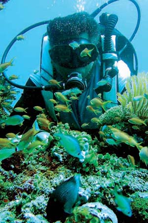
On : A diver examines the many diverse marine life forms located within the Verde sea passage, south of Manila, Philippines. Jay Directo/AFP/Getty Images
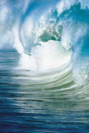
On : A cresting wave. Jean-Paul Nacivet/Photographers Choice/Getty Images
CONTENTS



INTRODUCTION
O f all the planets in the solar system, Earth is singled out as the Blue Planet. This colorful label is indicative of the presence of water on the planets surface. When viewed from space, Earths oceans, which cover nearly three-fourths of the total sphere, appear blue. The sheer preponderance of water makes it easy to comprehend how the oceans influence nearly every life process on Earth. This volume takes a comprehensive look at the worlds oceans, examining them from the tip of their wave crests to the depths of their basins. Topics covered include currents, sea life, the oceans effect on climate, and the science of oceanography.
Although they are, in truth, one continuous body of water, the worlds oceans are commonly referred to in the plural. Earth has three major oceans: the Pacific, the Atlantic, and the Indian Ocean. The Pacific is the largest in area and volume, and the Indian is the smallest. The Arctic Ocean is technically considered part of the northern Atlantic. While the waters surrounding Antarctica are sometimes called the Southern Ocean, they are considered by many to be part of the southern Pacific, Atlantic, and Indian oceans.
The origin of oceanic waters remains something of an unknown, though a few theories offer an explanation. One states that as the planet was forming, its developing crust reacted with water vapor and other gases in the atmosphere to produce liquid water. Of the two kinds of crust that solidified over Earths mantle, the thicker oceanic crust formed a basin for the oceans and served as a cradle for Earths early living organisms. The earliest fossils of algae and bacteria date from 3.3 billion years ago.
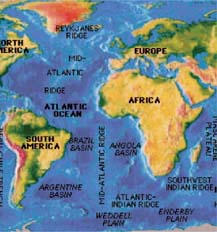
Topographical studies of the ocean floor have revealed that Earths ocean basins possess several terrain features that would be familiar to land dwellers. Similar to its terrestrial counterpart, the ocean floor is covered with hills, mountains, featureless plains, and deep gorges. The majority of the ocean floor, however, lies at depths of between 4,000 metres (13,000 feet) and 5,000 metres (16,500 feet). The Mariana Trench, located in the western part of the North Pacific Ocean, plunges to over 11,000 metres (36,200 feet). Little was known about ocean basins until the development of sonar in the early 1900s. Sound waves emitted by sonar allow marine researchers to detect objects thousands of feet under water. Other tools are also used. Satellites, global positioning systems, radar, and echo-sounder systems are among the most important remote-sensing tools. These tools have been used to map areas several parts of the ocean, the Mid-Atlantic Ridge being one of the most prominent mapped features.
Core samples of sediment from deep areas of the ocean floor have been a boon to the theory that revolves around plate tectonics. The top layer of Earths crust is made up of tectonic plates in constant, albeit slow, movement. Beginning 200 million years ago, the supercontinent Pangeaa land-mass made up of all of Earths continentsbegan to break apart, eventually fragmenting into the present-day continents separated by the oceans. Even today, spreading plates at the bottom of Earths oceans spew molten rock from the mantle, creating new floor. The theory of plate tectonics explains the relative newness of the ocean floor compared to the age of the planet; the floor is constantly recycling itself.
Next page

