RIVERS AND STREAMS
THE LIVING EARTH
RIVERS AND STREAMS
EDITED BY JOHN P. RAFFERTY, ASSOCIATE EDITOR, EARTH AND LIFE SCIENCES

Published in 2011 by Britannica Educational Publishing
(a trademark of Encyclopdia Britannica, Inc.)
in association with Rosen Educational Services, LLC
29 East 21st Street, New York, NY 10010.
Copyright 2011 Encyclopdia Britannica, Inc. Britannica, Encyclopdia Britannica, and the Thistle logo are registered trademarks of Encyclopdia Britannica, Inc. All rights reserved.
Rosen Educational Services materials copyright 2011 Rosen Educational Services, LLC.
All rights reserved.
Distributed exclusively by Rosen Educational Services.
For a listing of additional Britannica Educational Publishing titles, call toll free (800) 237-9932.
First Edition
Britannica Educational Publishing
Michael I. Levy: Executive Editor
J.E. Luebering: Senior Manager
Marilyn L. Barton: Senior Coordinator, Production Control
Steven Bosco: Director, Editorial Technologies
Lisa S. Braucher: Senior Producer and Data Editor
Yvette Charboneau: Senior Copy Editor
Kathy Nakamura: Manager, Media Acquisition
John P. Rafferty: Associate Editor, Earth and Life Sciences
Rosen Educational Services
Heather M. Moore Niver: Editor
Nelson S: Art Director
Cindy Reiman: Photography Manager
Matthew Cauli: Designer, Cover Design
Introduction by Greg Roza
Library of Congress Cataloging-in-Publication Data
Rivers and streams / edited by John P. Rafferty.
p. cm.(Living earth)
In association with Britannica Educational Publishing, Rosen Educational Services.
Includes bibliographical references and index.
ISBN 978-1-61530-411-0 (eBook)
1. Rivers. 2. Stream ecology. I. Rafferty, John P.
GB1203.7.R58 2011
551.483dc22
2010025157
On the cover: Rivers, streams, and even waterfalls such as Brooks Falls in Alaskas Katmai National Park play a major role in commerce, culture, habitat, and diet. Shutterstock.com
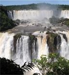
On pages : Iguau Falls on the Iguau River at the Argentina-Brazil border. R. Manley/Superstock
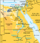
On page x: The longest river on Earth, the Nile, is formed from three main streams: the Blue Nile, the Atbara, and the White Nile. AFP/Getty Images
CONTENTS

INTRODUCTION
R ivers have long played an important role in the cultures and economies of the worlds greatest civilizationsfrom the Mesopotamian societies that took root between the Tigris and Euphrates rivers, to the dramatic rise of New York City at the mouth of the Hudson River. Pioneers searching for viable land on which to settle have typically chosen areas close to major rivers. Rivers offer a convenient source of food, fresh water for agriculture, and a means of transportation. For well-established settlements, rivers are vital for the development of economic and industrial endeavours. This thorough overview of rivers and streams will remove any doubt in the mind of the reader why so many of the worlds largest cities are strategically situated on the banks of major rivers.
Yet, the same civilizations that depend on rivers also risk harming them. Modern societies have altered the way rivers flow using dams to create hydroelectric power and canals to aid transportation and agriculture. Others have created fisheries and factories to aid their economies. These developments benefit the local economies, but they also damage natural habitats and the wildlife that depend on the environmental services of rivers for their survival. Scientists have spent many years studying rivers to help reduce the risks posed by human activity.
Several criteria are used to compare the worlds greatest rivers, including the length of the main stem, the size of the drainage area, and the mean discharge of the rivers flow. However, it is difficult to say exactly which river is the greatest. For example, most people know that the Nile River in Africa is the longest river in the world, but many dont realize that the Amazon River in Brazil has the greatest drainage area and accounts for one-fifth of all the ocean runoff from world rivers.
Many factors affect the distribution and flow of Earths rivers, including terrain, climate, precipitation, glacier melt, water tables, and drainage basins. The manner in which these factors shape a rivers seasonal cycle defines the rivers regime. For example, a river may be slow and shallow during the winter, but swift and deep during spring snowmelt.
The drainage patterns of rivers vary greatly based on the geological makeup of the land. The shape and direction of a river depends on the type of land over which it flows. River formation occurs fastest on weak rocks. Tributaries form along faults. Streams that form fastest often become the main rivers in a network. Movement in Earths crust can create raises or folds that change a rivers course.
American hydraulic engineer Robert E. Horton developed the concept of stream order to better analyze and understand river networks. A river that forms the source of other rivers is known as a first-order river. When two first-order rivers join, the result is a second-order river. Two second-order rivers come together to form a third-order river, and so on. This concept forms the basis for the morphometryor measurementof drainage systems. Morphometry is, in turn, used to study the evolution and the hydraulic geometry of drainage systems.
Next page

