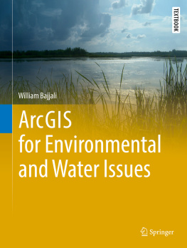
William Bajjali - ArcGIS for Environmental and Water Issues
Here you can read online William Bajjali - ArcGIS for Environmental and Water Issues full text of the book (entire story) in english for free. Download pdf and epub, get meaning, cover and reviews about this ebook. year: 0, publisher: Springer International Publishing, genre: Computer. Description of the work, (preface) as well as reviews are available. Best literature library LitArk.com created for fans of good reading and offers a wide selection of genres:
Romance novel
Science fiction
Adventure
Detective
Science
History
Home and family
Prose
Art
Politics
Computer
Non-fiction
Religion
Business
Children
Humor
Choose a favorite category and find really read worthwhile books. Enjoy immersion in the world of imagination, feel the emotions of the characters or learn something new for yourself, make an fascinating discovery.
- Book:ArcGIS for Environmental and Water Issues
- Author:
- Publisher:Springer International Publishing
- Genre:
- Year:0
- Rating:3 / 5
- Favourites:Add to favourites
- Your mark:
- 60
- 1
- 2
- 3
- 4
- 5
ArcGIS for Environmental and Water Issues: summary, description and annotation
We offer to read an annotation, description, summary or preface (depends on what the author of the book "ArcGIS for Environmental and Water Issues" wrote himself). If you haven't found the necessary information about the book — write in the comments, we will try to find it.
ArcGIS for Environmental and Water Issues — read online for free the complete book (whole text) full work
Below is the text of the book, divided by pages. System saving the place of the last page read, allows you to conveniently read the book "ArcGIS for Environmental and Water Issues" online for free, without having to search again every time where you left off. Put a bookmark, and you can go to the page where you finished reading at any time.
Font size:
Interval:
Bookmark:
The Springer Textbooks series publishes a broad portfolio of textbooks on Earth Sciences, Geography and Environmental Science. Springer textbooks provide comprehensive introductions as well as in-depth knowledge for advanced studies. A clear, reader-friendly layout and features such as end-of-chapter summaries, work examples, exercises, and glossaries help the reader to access the subject. Springer textbooks are essential for students, researchers and applied scientists.
More information about this series at http://www.springer.com/series/15201

This Springer imprint is published by Springer Nature
The registered company is Springer International Publishing AG
The registered company address is: Gewerbestrasse 11, 6330 Cham, Switzerland
The study of geographic information systems (GIS) applications is enlightening, challenging, and very interesting. This workbook was created as a guide to students and professionals on the applications of GIS in the geoscience field. GIS applications is now considered an important course in the curriculum of undergraduate geoscience, environmental, and in some fields of engineering programs. It is a result of several years of experience in applying GIS technology to water resources and environment related problems. The databases and the applications used in the text reflect real world problems from different environmental settings that have been gathered from the authors works in the USA and the Middle-East. Each chapter presents a different set of scenarios and case studies that include an environmental problem that needs a solution. A step-by-step approach was adopted to provide answers and solutions to the problems for the scenarios presented.
The textbook is intended as an introductory course either at the undergraduate level or as a dual-level undergraduate/graduate course, and it can be used as a self-study workbook for professionals in the field of geoscience. It aims to teach students and professionals the various environmental disciplines of mapping and spatial analysis skills using ArcGIS and state of the art methodologies to acquire, visualize, and analyze data.
The book has 18 chapters that cover many topics related to GIS applications. Chapters explains how Mobile GIS (ArcPad) captures field data, where the users use a Trimble Juno T41 device. This chapter has a task that will be achieved in two parts. In part one, the user utilizes ArcGIS desktop to create a project containing the geodatabase and image needed for field collection. Part two instructs users to capture the locations of trees, sidewalks, and buildings on the main University of Wisconsin Superior Campus.
The textbook includes three types of data that have been used in the exercises of the books chapters. The first type of data presented is from actual field data gathered by the author and taken from his published work. The second type of data is manipulated based on real information gathered from different projects in the Middle-East. These data were modified with the aim of protecting the privacy and rules that govern these projects. The third type of data is public domain information and freely available from the Internet to any GIS user. Chapters that include public domain data in the exercises document the data sources.
Many thanks to my students and colleagues from academia and my professional career, both past and present, who have worked with me over the years in the classroom conducting research and carrying out projects. Many of that work and the lessons learned were the motivation for authoring this text.
The online version of this chapter () contains supplementary material, which is available to authorized users.
GIS (Geographic Information System) has great value in our time as it is a comprehensive information system evolved and still developing parallel with the advancing technology. This era of the human kind is characterized as an information age, where the whole world is experiencing and interacting with a new revolution that change our traditional way to look at the things and do a business in completely different approach. The emphasis is on the technology and its use in every activity that range from agriculture, industry, business, social, research and education. The advancement in technology changed our world and our approaches to meet our need to rely completely on the technology and data. The value of information in our time becomes vital and important for development. GIS itself is an important module of the information system. The economy of all industrial countries and many other nations all over the globe, become more dependent on services. This means that the current economy rely more and more on computers, networking, accurate information and data. This shift required a mass of skilled labors that are capable to deal with the technology and data processing.
Font size:
Interval:
Bookmark:
Similar books «ArcGIS for Environmental and Water Issues»
Look at similar books to ArcGIS for Environmental and Water Issues. We have selected literature similar in name and meaning in the hope of providing readers with more options to find new, interesting, not yet read works.
Discussion, reviews of the book ArcGIS for Environmental and Water Issues and just readers' own opinions. Leave your comments, write what you think about the work, its meaning or the main characters. Specify what exactly you liked and what you didn't like, and why you think so.

