• Complain

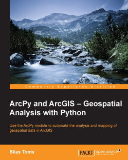
Toms - ArcPy and ArcGIS - geospatial analysis with Python: use the ArcPy module to automate the analysis and mapping of geospatial data in ArcGIS

Here you can read online Toms - ArcPy and ArcGIS - geospatial analysis with Python: use the ArcPy module to automate the analysis and mapping of geospatial data in ArcGIS full text of the book (entire story) in english for free. Download pdf and epub, get meaning, cover and reviews about this ebook. City: Birmingham;UK, year: 2015, publisher: Packt Publishing, genre: Computer. Description of the work, (preface) as well as reviews are available. Best literature library LitArk.com created for fans of good reading and offers a wide selection of genres:

Romance novel Science fiction Adventure Detective Science History Home and family Prose Art Politics Computer Non-fiction Religion Business Children Humor

Choose a favorite category and find really read worthwhile books. Enjoy immersion in the world of imagination, feel the emotions of the characters or learn something new for yourself, make an fascinating discovery.

Toms ArcPy and ArcGIS - geospatial analysis with Python: use the ArcPy module to automate the analysis and mapping of geospatial data in ArcGIS
  • Book:
    ArcPy and ArcGIS - geospatial analysis with Python: use the ArcPy module to automate the analysis and mapping of geospatial data in ArcGIS
  • Author:
  • Publisher:
    Packt Publishing
  • Genre:
  • Year:
    2015
  • City:
    Birmingham;UK
  • Rating:
    3 / 5
  • Favourites:
    Add to favourites
  • Your mark:
    • 60
    • 1
    • 2
    • 3
    • 4
    • 5

ArcPy and ArcGIS - geospatial analysis with Python: use the ArcPy module to automate the analysis and mapping of geospatial data in ArcGIS: summary, description and annotation

We offer to read an annotation, description, summary or preface (depends on what the author of the book "ArcPy and ArcGIS - geospatial analysis with Python: use the ArcPy module to automate the analysis and mapping of geospatial data in ArcGIS" wrote himself). If you haven't found the necessary information about the book — write in the comments, we will try to find it.

ArcGIS allows for complex analyses of geographic information. The ArcPy module is used to script these ArcGIS analyses, providing a productive way to perform geo-analyses and to automate map production.This book will guide you from basic Python scripting to advanced ArcPy script tools. This book starts off with setting up your Python environment, demonstrates a complex ArcPy script tool with multiple iterations, illustrates data access module cursors, and explains how to use ArcPy Geometry classes. Then, you will learn how to output maps using ArcPy.Mapping, and how to create ArcGIS script tools.With the help of this book, you will be able to create repeatable analyses reducing the time-consuming nature of GIS, making you into a GIS professional as powerful as a whole team.

Toms: author's other books


Who wrote ArcPy and ArcGIS - geospatial analysis with Python: use the ArcPy module to automate the analysis and mapping of geospatial data in ArcGIS? Find out the surname, the name of the author of the book and a list of all author's works by series.

ArcPy and ArcGIS - geospatial analysis with Python: use the ArcPy module to automate the analysis and mapping of geospatial data in ArcGIS — read online for free the complete book (whole text) full work

Below is the text of the book, divided by pages. System saving the place of the last page read, allows you to conveniently read the book "ArcPy and ArcGIS - geospatial analysis with Python: use the ArcPy module to automate the analysis and mapping of geospatial data in ArcGIS" online for free, without having to search again every time where you left off. Put a bookmark, and you can go to the page where you finished reading at any time.

Light

Font size:

Reset

Interval:

Bookmark:

Make
ArcPy and ArcGIS Geospatial Analysis with Python

ArcPy and ArcGIS Geospatial Analysis with Python

Copyright 2015 Packt Publishing

All rights reserved. No part of this book may be reproduced, stored in a retrieval system, or transmitted in any form or by any means, without the prior written permission of the publisher, except in the case of brief quotations embedded in critical articles or reviews.

Every effort has been made in the preparation of this book to ensure the accuracy of the information presented. However, the information contained in this book is sold without warranty, either express or implied. Neither the author, nor Packt Publishing, and its dealers and distributors will be held liable for any damages caused or alleged to be caused directly or indirectly by this book.

Packt Publishing has endeavored to provide trademark information about all of the companies and products mentioned in this book by the appropriate use of capitals. However, Packt Publishing cannot guarantee the accuracy of this information.

First published: February 2015

Production reference: 1210215

Published by Packt Publishing Ltd.

Livery Place

35 Livery Street

Birmingham B3 2PB, UK.

ISBN 978-1-78398-866-2

www.packtpub.com

Credits

Author

Silas Toms

Reviewers

Alessio Di Lorenzo

Dara O'Beirne

Mark Pazolli

Marjorie Roswell

Commissioning Editor

Ashwin Nair

Acquisition Editor

Harsha Bharwani

Content Development Editor

Akashdeep Kundu

Technical Editor

Deepti Tuscano

Copy Editors

Aarti Saldanha

Adithi Shetty

Project Coordinator

Milton Dsouza

Proofreaders

Simran Bhogal

Joanna McMahon

Bernadette Watkins

Indexer

Priya Sane

Production Coordinator

Alwin Roy

Cover Work

Alwin Roy

About the Author

Silas Toms is a geospatial programmer and analyst with a love of geography, history, food, and sports. He resides in the San Francisco Bay Area and can't decide which side of the Bay is more beautiful. He received a bachelor's degree in Geography from Humboldt State University and is currently pursuing a master's degree in GIS at San Francisco State University. With a background in GIS analysis for city governments and environmental consulting, Silas loves the combination of GIS and Python for analysis automation and data manipulation.

Working for Arini Geographics, Silas is helping governments understand how GIS can organize and simplify the management of infrastructure and the environment. This dual role as a programmer and analyst allows him to use Python and GIS to quickly produce geospatial data and tools. Combined with web mapping, these tools are transforming how governments work to serve the public. He also teaches workshops on ArcPy and web mapping at the City College of San Francisco, while hoping to one day finish his master's thesis.

Silas has worked as a reviewer on the book Python Geospatial Analysis , Packt Publishing and is working on the book Python Geospatial Development , Packt Publishing to be published in 2015.

I would like to thank my girlfriend, Christine, for her encouragement and patience. I would like to thank my boss, Gabriel Paun, for his inspiration and for pushing me to become a true GIS professional. I would like to thank the faculty at HSU and SFSU for their help along the way, and I would like to thank my family for their belief in me and for never asking me if I was going to become a teacher with my geography degree (even though I have and I love it!).

About the Reviewers

Alessio Di Lorenzo is a marine biologist and has an MSc in Geographical Information Systems (GIS) and Remote Sensing. Since 2006, he has been dealing with the analysis and development of GIS applications dedicated to the study and spread of environmental and epidemiological data. He is experienced in the use of the main proprietary and open source GIS software and programming languages.

Dara O'Beirne is a certified GIS Professional (GISP) with over eight years of GIS and Python experience. Dara earned both his Bachelors and Masters of Arts degrees in geography from San Francisco State University. Dara is currently a GIS Analyst working at Arini Geographics in Santa Clara, CA. Before joining Arini Geographics, Dara was a GIS Analyst and technical lead at Towill Inc., a GIS and Land Surveying company in Northern California. At Towill, Dara played a central role in developing and implementing procedures related to the collection and analysis of LiDAR data for environmental and engineering applications. Prior to Towill, Dara gained his professional GIS experience working for the Golden Gate National Recreation Area managed by the National Park Service, one of the largest urban park systems in the world, which includes National treasures, such as Alcatraz, Muir Woods, and the Marin Headlands. His Master's Thesis examined the errors associated with measuring tree heights in an urban environment with both traditional field methods and airborne LiDAR data.

I would like to thank my wife, Kate, and daughter, Anya O'Beirne, for their patience and assistance during the review of this book.

Marjorie Roswell is a web developer and map maker from Baltimore, MD. She purchased her first GIS in 1991, and built an application to assist citizen callers to the Baltimore Office of Recycling. Recent projects include interactive maps of legislative scores, political endorsements, committees, election data, and advocacy interests.

Her site http://committeemaps.org/ details Congressional committee membership, while the site http://farmbillprimer.org/ is devoted to mapping and charting federal food and farm policy.

Marjorie is the author of Drupal 5 Views Recipes , Packt Publishing . She was the technical reviewer of jQuery UI 1.10, The User Interface Library for jQuery , Packt Publishing .

Mark Pazolli is an engineer and data scientist who uses ArcGIS and Python to help his employers decipher the mountains of data they keep on the assets of the Western Australian electrical network. He has qualifications in Electrical Engineering, Computer Science, and Applied Mathematics. He appreciates excellent design and enjoys building interesting things.

www.PacktPub.com
Support files, eBooks, discount offers, and more

For support files and downloads related to your book, please visit www.PacktPub.com.

Did you know that Packt offers eBook versions of every book published, with PDF and ePub files available? You can upgrade to the eBook version at > for more details.

At www.PacktPub.com, you can also read a collection of free technical articles, sign up for a range of free newsletters and receive exclusive discounts and offers on Packt books and eBooks.

httpswww2packtpubcombookssubscriptionpacktlib Do you need instant - photo 1

https://www2.packtpub.com/books/subscription/packtlib

Do you need instant solutions to your IT questions? PacktLib is Packt's online digital book library. Here, you can search, access, and read Packt's entire library of books.

Why subscribe?
  • Fully searchable across every book published by Packt
Next page
Light

Font size:

Reset

Interval:

Bookmark:

Make

Similar books «ArcPy and ArcGIS - geospatial analysis with Python: use the ArcPy module to automate the analysis and mapping of geospatial data in ArcGIS»

Look at similar books to ArcPy and ArcGIS - geospatial analysis with Python: use the ArcPy module to automate the analysis and mapping of geospatial data in ArcGIS. We have selected literature similar in name and meaning in the hope of providing readers with more options to find new, interesting, not yet read works.


Reviews about «ArcPy and ArcGIS - geospatial analysis with Python: use the ArcPy module to automate the analysis and mapping of geospatial data in ArcGIS»

Discussion, reviews of the book ArcPy and ArcGIS - geospatial analysis with Python: use the ArcPy module to automate the analysis and mapping of geospatial data in ArcGIS and just readers' own opinions. Leave your comments, write what you think about the work, its meaning or the main characters. Specify what exactly you liked and what you didn't like, and why you think so.