• Complain

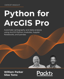
William Parker - Python for ArcGIS Pro: Automate cartography and data analysis using ArcGIS Python modules, Jupyter Notebooks, and pandas

Here you can read online William Parker - Python for ArcGIS Pro: Automate cartography and data analysis using ArcGIS Python modules, Jupyter Notebooks, and pandas full text of the book (entire story) in english for free. Download pdf and epub, get meaning, cover and reviews about this ebook. year: 2022, publisher: Packt Publishing - ebooks Account, genre: Computer. Description of the work, (preface) as well as reviews are available. Best literature library LitArk.com created for fans of good reading and offers a wide selection of genres:

Romance novel Science fiction Adventure Detective Science History Home and family Prose Art Politics Computer Non-fiction Religion Business Children Humor

Choose a favorite category and find really read worthwhile books. Enjoy immersion in the world of imagination, feel the emotions of the characters or learn something new for yourself, make an fascinating discovery.

William Parker Python for ArcGIS Pro: Automate cartography and data analysis using ArcGIS Python modules, Jupyter Notebooks, and pandas
  • Book:
    Python for ArcGIS Pro: Automate cartography and data analysis using ArcGIS Python modules, Jupyter Notebooks, and pandas
  • Author:
  • Publisher:
    Packt Publishing - ebooks Account
  • Genre:
  • Year:
    2022
  • Rating:
    3 / 5
  • Favourites:
    Add to favourites
  • Your mark:
    • 60
    • 1
    • 2
    • 3
    • 4
    • 5

Python for ArcGIS Pro: Automate cartography and data analysis using ArcGIS Python modules, Jupyter Notebooks, and pandas: summary, description and annotation

We offer to read an annotation, description, summary or preface (depends on what the author of the book "Python for ArcGIS Pro: Automate cartography and data analysis using ArcGIS Python modules, Jupyter Notebooks, and pandas" wrote himself). If you haven't found the necessary information about the book — write in the comments, we will try to find it.

Get well versed with the core concepts of ArcGIS Pro through hands-on exercises and real-world case studies

Key Features
  • Master the core components of arcpy for ArcGIS Pro and how to use the ArcGIS API for Python for ArcGIS Online
  • Get practical expertise on each topic with hands-on exercises in every chapter and real-world case studies at the end of the book
  • Understand concepts with respect to Jupyter Notebooks integrated throughout the book
  • Focus on data science using Pandas, SciPy, and ArcGIS Pro for raster and vector analysis
Book Description

Irrespective of ones level of expertise with Esri software, a good command of Python is necessary to drive a geospatial environment. Python proficiency makes even an experienced user of Esri technology/software 510-times as valuable as a non-coding GIS analyst. Python for ArcGIS Pro explains how to incorporate scripting at each step from mapping to data science, databases, and data services.

The book leads the reader through the major uses of Python programming for ArcGIS Pro - map production, online and offline data management, data analyses, and data visualization. It shows various Python programming options for ArcGIS Pro, and how to integrate them together into a smarter workflow. Youll learn how to use popular Python packages such as Jupyter Notebooks and pandas to explore and analyze geospatial data, and how to write data engineering scripts to manage ongoing data processing and data transfers. The book concludes with 3 real-world case studies where youll apply the concepts you studied earlier.

By the end of this book, you will be able to use Python to perform all the major tasks involved with ArcGIS Pro: automating the production of maps for print, managing data between ArcGIS Pro and ArcGIS Online, creating custom script tools for sharing, and then running data analysis on top of the ArcGIS geospatial library, all using Python.

What you will learn
  • Automate map production to make or edit maps at scale
  • Use Python to automatically update data for ArcGIS Online
  • Publishing map layer data to the ArcGIS Online cloud service
  • Automation of data updates and inserts
  • Create custom script tools for use in ArcGIS Pro and for managing data on ArcGIS OnlineCloud integration with Jupyter notebooks for data science with the pandas toolkit
  • Leverage Jupyter Notebooks interface and the Pandas library (with its underlying NumPy module) to make geospatial data science faster and more interesting
Who This Book Is For

This book is for ArcGIS professionals, intermediate ArcGIS Pro users, ArcGIS Pro power users, students, and people who want to move from being a GIS Technician to GIS Analyst; GIS Analyst to GIS Programmers; and GIS Developers/Programmers to GIS Architects.

Basic familiarity with geospatial/GIS syntax, ArcGIS, Python package management and virtual environments, and Data Science (Pandas, Jupyter Notebooks) is preferable.

Table of Contents
  1. Introduction to Python for GIS
  2. Basics of ArcPy
  3. Introduction to the ArcGIS API for Python
  4. Data Access using Cursors
  5. Publishing to ArcGIS Online
  6. ArcToolbox Script Tools
  7. Automated Map Production
  8. Vector Analysis with Pandas
  9. Raster analysis with Pandas
  10. Geospatial Data Science with SciPy
  11. Case Study: ArcGIS Pro Data Management
  12. Case Study: Advanced Map Production
  13. Case Study: Interactive Data Science Web Map

William Parker: author's other books


Who wrote Python for ArcGIS Pro: Automate cartography and data analysis using ArcGIS Python modules, Jupyter Notebooks, and pandas? Find out the surname, the name of the author of the book and a list of all author's works by series.

Python for ArcGIS Pro: Automate cartography and data analysis using ArcGIS Python modules, Jupyter Notebooks, and pandas — read online for free the complete book (whole text) full work

Below is the text of the book, divided by pages. System saving the place of the last page read, allows you to conveniently read the book "Python for ArcGIS Pro: Automate cartography and data analysis using ArcGIS Python modules, Jupyter Notebooks, and pandas" online for free, without having to search again every time where you left off. Put a bookmark, and you can go to the page where you finished reading at any time.

Light

Font size:

Reset

Interval:

Bookmark:

Make
Table of Contents
Python for ArcGIS Pro Copyright 2021 Packt Publishing This is an Early Access - photo 1
Python for ArcGIS Pro

Copyright 2021 Packt Publishing

This is an Early Access product. Every effort has been made in the preparation of this book to ensure the accuracy of the information presented. However, the content and extracts of this book may evolve as it is being developed to ensure it is up-to-date.

All rights reserved. No part of this book may be reproduced, stored in a retrieval system, ortransmitted in any form or by any means, without the prior written permission of the publisher,except in the case of brief quotations embedded in critical articles or reviews.

The information contained in this book is sold without warranty, either express or implied. Neither the author nor Packt Publishing or its dealers and distributors will be held liable for any damages caused or alleged to have been caused directly or indirectly by this book.

Packt Publishing has endeavored to provide trademark information about all of the companies and products mentioned in this book by the appropriate use of capitals. However, Packt Publishing cannot guarantee the accuracy of this information.

Early Access Publication: Python for ArcGIS Pro

Early Access Production Reference: B17951

Published by Packt Publishing Ltd.

Livery Place

35 Livery Street

Birmingham

B3 2PB, UK

ISBN: 978-1-80324-166-1

www.packt.com
Python for ArcGIS Pro: Automate cartography and data analysis using ArcGIS Python modules, ArcGIS Pro Notebooks, Jupyter Notebooks, and pandas

Welcome to Packt Early Access. Were giving you an exclusive preview of this book before it goes on sale. It can take many months to write a book, but our authors have cutting-edge information to share with you today. Early Access gives you an insight into the latest developments by making chapter drafts available. The chapters may be a little rough around the edges right now, but our authors will update them over time. Youll be notified when a new version is ready.

This title is in development, with more chapters still to be written, which means you have the opportunity to have your say about the content. We want to publish books that provide useful information toyou and other customers, so well send questionnaires out to you regularly. All feedback ishelpful, so please be open about your thoughts and opinions. Our editors will work their magic on the text of the book, so wed like your input on the technical elements and your experience as a reader. Well also provide frequent updates on how our authors have changed their chapters based onyour feedback.

You can dip in and out ofthis bookorfollow alongfrom start to finish; Early Access is designed to be flexible. We hope you enjoy getting to know more about the process of writing a Packt book. Join the exploration of new topics by contributing your ideas and see them come to life in print.

  1. Chapter 1: Introduction to Python for GIS
  2. Chapter 2: Basics of ArcPy
  3. Chapter 4: Data Access Using Cursors
  4. Chapter 3: Introduction to the ArcGIS API for Python
  5. Chapter 5: Publishing to ArcGIS Online
  6. Chapter 8: Vector Analysis with Pandas
  7. Chapter 6: ArcToolbox Script Tools
  8. Chapter 9: Raster Analysis with pandas
  9. Chapter 7: Automated Map Production
  10. Chapter 10: Geospatial Data Science with SciPy
  11. Chapter 11: Case Study: ArcGIS Pro Data Management
  12. Chapter 12: Case Study: Advanced Map Production
  13. Chapter 13: Case Study: Interactive Data Science Web Map
Python: The Beginning

Programming with computers is one of the most rewarding and frustrating of human endeavors.

Those rewards can be in the form of money, as we can see with todays high-tech salaries. I would argue, however, that the most rewarding part of mastering programming is to make yourself into a computer power user who can execute both simple and complex applications and analyses, written in reusable code, with ease.

The frustrations will come and go, and it is a good thing: you, like me and millions before you, will learn from each mistake (it helps to be a pedant, perhaps, but not being one myself I cant be sure). You will grow and learn with each exercise in this book, and by asking the right questions and paying close attention you can avoid some of these issues.

If you are an ArcGIS expert or novice, seeking to expand on your skillsets: congratulations, you are in the right place. In this book you will learn how to take your existing GIS expertise (or interest) and multiply its potential using a deceptively simple programming language called Python.

Computer programming is its own vast field that cannot be captured in one chapter, of course. In this chapter I will explain the basic knowledge necessary to read, write and run Python scripts. Well leave the ArcGIS tools for later chapters and focus on Python: its beginnings, its current state, how to use it, and importantly, what Python is and what it is not.

We will cover the following topics:

  • Basics of Python
  • Basics of computer programming
  • Installing and importing modules
  • Writing and executing scripts
Python: Built Different

Guido Van Rossum, the creator of the Python programming language, was frustrated with the state of computer programming in the late 1980s. Programming languages were too complex, and at the same time, too loose with their formatting requirements. This led to large codebases with complex scripts poorly written and rarely documented.

Merely running a simple program could take a long time, as the code would need to be type-checked (variables declared correctly and assigned to the correct data type) and compiled (converted from high-level code written in text files into the assembly language or machine code understood by the CPU).

As the Dutch programmer completed professional work on the ABC programming language, where he had learned much about language design, he decided he wanted to turn his grips about the limits of ABC and other languages into a hobby.

With a masters degree in mathematics and computer science from the University of Amsterdam, his hobbies tended towards the computer, but he did have a love for Monty Python, the British comedy series. So, he combined his passions and created Python, which is now used for all kinds of programmatic solutions. Today Python is everywhere, in the internet and appliances and cars and so much more. Because of its ubiquity and its simplicity, it has been adopted by the GIS software ecosystem as a standard programming tool.

Why Python is different

Because of Van Rossums extensive experience with the state of computer languages in the 1980s, he was well positioned to create a language that solved many of their deficiencies. He added features that he admired from many other languages and added a few of his own. Here is an incomplete list of Python features built to improve on other languages:

IssueImprovementPython Feature
Memory overrunBuilt-in memory managementGarbage collection and memory management
Slow compiler timesOne line testing, dynamic typingPython Interpreter
Unclear error messagesMessages indicating the offending line and affected codeError Traceback
Spaghetti codeClean importation and modularizationImportation
Next page
Light

Font size:

Reset

Interval:

Bookmark:

Make

Similar books «Python for ArcGIS Pro: Automate cartography and data analysis using ArcGIS Python modules, Jupyter Notebooks, and pandas»

Look at similar books to Python for ArcGIS Pro: Automate cartography and data analysis using ArcGIS Python modules, Jupyter Notebooks, and pandas. We have selected literature similar in name and meaning in the hope of providing readers with more options to find new, interesting, not yet read works.


Reviews about «Python for ArcGIS Pro: Automate cartography and data analysis using ArcGIS Python modules, Jupyter Notebooks, and pandas»

Discussion, reviews of the book Python for ArcGIS Pro: Automate cartography and data analysis using ArcGIS Python modules, Jupyter Notebooks, and pandas and just readers' own opinions. Leave your comments, write what you think about the work, its meaning or the main characters. Specify what exactly you liked and what you didn't like, and why you think so.