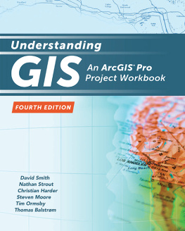

Cover imagery credits: USGS, FAO, NPS, EPA, Esri, DeLorme, TomTom, and other suppliers; topographic basemap Esri, HERE, DeLorme, Intermap, increment P Corp., GEBCO, USGS, FAO, NPS, NRCAN, GeoBase, IGN, Kadaster NL, Ordnance Survey, Esri Japan, METI, Esri China (Hong Kong), swisstopo, MapmyIndia, OpenStreetMap contributors, and the GIS User Community.
Esri Press, 380 New York Street, Redlands, California 92373-8100
Copyright 2017 Esri
All rights reserved. First edition 2011; Second Edition 2013.
21 20 19 18 17 1 2 3 4 5 6 7 8 9 10
Printed in the United States of America
Library of Congress has cataloged the print edition as follows:
Names: Smith, David, 1959 July 5- author. | Strout, Nathan, author. | Harder, Christian, author. | Moore, Steven D., 1956- author. | Ormsby, Tim, author. | Balstrm, Thomas, author.
Title: Understanding GIS : an ArcGIS Pro project workbook / David Smith, Nathan Strout, Christian Harder, Steven D. Moore, Tim Ormsby, Thomas Balstrm.
Description: Third Edition. | Redlands, California : Esri Press, [2017] | Second edition 2013--T.p. verso. | Distributed to the trade in North America by Ingram Publisher Services. | Includes index.
Identifiers: LCCN 2017004606 | ISBN 9781589484832 (Paperback : alk. paper) | e-ISBN 9781589484955
Subjects: LCSH: ArcGIS. | Geographic information systems.
Classification: LCC G70.212 .H358 2017 | DDC 910.285--dc23 LC record available at https://urldefense.proofpoint.com/v2/url?u=https-3A___lccn.loc.gov_2017004606&d=DwIF-g&c=n6-cguzQvX_tUIrZOS_4Og&r=RhmcbAxStnbJpr06ef1onNDeVX-gjVopdqeQ8i7DbIY&m=Qbqt540GuwL_UIDhFFE2ccQBrwfuPjbA-6LT4UlndQI&s=OUapWxcN87cDNZdz30uM6nczGD_DW8acu4f_oUJ9Aa4&e=
The information contained in this document is the exclusive property of Esri unless otherwise noted. This work is protected under United States copyright law and the copyright laws of the given countries of origin and applicable international laws, treaties, and/or conventions. No part of this work may be reproduced or transmitted in any form or by any means, electronic or mechanical, including photocopying or recording, or by any information storage or retrieval system, except as expressly permitted in writing by Esri. All requests should be sent to Attention: Contracts and Legal Services Manager, Esri, 380 New York Street, Redlands, California 92373-8100, USA.
The information contained in this document is subject to change without notice.
US Government Restricted/Limited Rights: Any software, documentation, and/or data delivered hereunder is subject to the terms of the License Agreement. The commercial license rights in the License Agreement strictly govern Licensees use, reproduction, or disclosure of the software, data, and documentation. In no event shall the US Government acquire greater than RESTRICTED/LIMITED RIGHTS. At a minimum, use, duplication, or disclosure by the US Government is subject to restrictions as set forth in FAR 52.227-14 Alternates I, II, and III (DEC 2007); FAR 52.227-19(b) (DEC 2007) and/or FAR 12.211/12.212 (Commercial Technical Data/Computer Software); and DFARS 252.227-7015 (DEC 2011) (Technical Data Commercial Items) and/or DFARS 227.7202 (Commercial Computer Software and Commercial Computer Software Documentation), as applicable. Contractor/Manufacturer is Esri, 380 New York Street, Redlands, CA 92373-8100, USA.
, GIS for Everyone, JTX, MapIt, Maplex, MapObjects, MapStudio, ModelBuilder, MOLE, MPS Atlas, PLTS, Rent-a-Tech, SDE, SML, SourcebookAmerica, SpatiaLABS, Spatial Database Engine, StreetMap, Tapestry, the ARC/INFO logo, the ArcGIS Explorer logo, the ArcGIS logo, the ArcPad logo, the Esri globe logo, the Esri Press logo, The Geographic Advantage, The Geographic Approach, the GIS Day logo, the MapIt logo, The Worlds Leading Desktop GIS, Water Writes, and Your Personal Geographic Information System are trademarks, service marks, or registered marks of Esri in the United States, the European Community, or certain other jurisdictions. CityEngine is a registered trademark of Procedural AG and is distributed under license by Esri. Other companies and products or services mentioned herein may be trademarks, service marks, or registered marks of their respective mark owners.
Ask for Esri Press titles at your local bookstore or order by calling 1-800-447-9778. You can also shop online at www.esri.com/esripress. Outside the United States, contact your local Esri distributor or shop online at eurospanbookstore.com/esri.
Esri Press titles are distributed to the trade by the following:
In North America: | In the United Kingdom, Europe, the Middle East and Africa, Asia, and Australia: |
Ingram Publisher Services | Eurospan Group | Telephone 44(0) 1767 604972 |
Toll-free telephone: 800-648-3104 | 3 Henrietta Street | Fax: 44(0) 1767 6016-40 |
Toll-free fax: 800-838-1149 | London WC2E 8LU | E-mail: |
E-mail: | United Kingdom |
Contents
Index
Foreword
More than 20 years ago, I was involved with a book project here at Esri. We produced and published a software workbook called Understanding GIS: The ARC/INFO Method. We were just a group of people at this little GIS software company in Redlands, California, who saw that the users of our ARC/INFO software needed better guidance on how to use these tools for real analysis projects. Our original goal had been to write a book called Getting Started with ARC/INFO. More than 500 pages later, we realized that we had described a methodology for doing GIS projects in their entirety and needed to change the title.
The key idea was to set up a problem in the book, provide the data, and then let the students work through the whole process. Little did we know that our book would become a worldwide best seller and inspire a generation of technically savvy geographers.
Fast-forward to 2017. GIS has evolved to keep pace with a changing technology landscape. There have been huge innovations in geospatial data models and user interfaces; GIS now lives and breathes on the web. Much has changed. Yet the need for our users to understand how to organize and think about a GIS project persists. This book, Understanding GIS: An ArcGISPro Project Workbook, now in its third edition since 2011, carries on the spirit and method of the original that inspired it. Im especially happy that this new editionfeaturing the latest version of our next-generation ArcGIS Pro softwarewas voluntarily undertaken (and executed with precision) by our friends at the University of Redlands, the college geographically closest to Esri headquarters. Im pleased to say that the new edition carries the torch while also integrating the new paradigm. It is my hope that it will inspire yet another generation of GIS professionals and practitioners.
Clint Brown
Director of Software Products
Esri
Redlands, California
Preface
Whats new in the third edition?
This third edition of Understanding GIS: An ArcGISPro Project Workbook has been completely revised and tested to be compatible with ArcGIS Pro 1.4. New graphics have been created using the Windows 10 operating system. Some steps have changed to reflect changes in how the software works. (available online, as was the case in the first and second editions) has been completely rewritten to reflect the latest advances in the rapidly evolving ArcGISSM Online environment. The demographic data has been updated with 2015 census data. Parcel data has been updated to 2016. The final results of the analysis are updated to an entirely new set of park sites. Numerous small mistakes that came to our attention have been corrected.


