Joos Korstanje
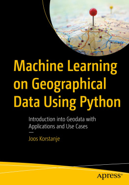
Machine Learning on Geographical Data Using Python
Introduction into Geodata with Applications and Use Cases

The Apress logo.
Joos Korstanje
VIELS MAISONS, France
ISBN 978-1-4842-8286-1 e-ISBN 978-1-4842-8287-8
https://doi.org/10.1007/978-1-4842-8287-8
Joos Korstanje 2022
Apress Standard
The use of general descriptive names, registered names, trademarks, service marks, etc. in this publication does not imply, even in the absence of a specific statement, that such names are exempt from the relevant protective laws and regulations and therefore free for general use.
The publisher, the authors and the editors are safe to assume that the advice and information in this book are believed to be true and accurate at the date of publication. Neither the publisher nor the authors or the editors give a warranty, expressed or implied, with respect to the material contained herein or for any errors or omissions that may have been made. The publisher remains neutral with regard to jurisdictional claims in published maps and institutional affiliations.
This Apress imprint is published by the registered company APress Media, LLC, part of Springer Nature.
The registered company address is: 1 New York Plaza, New York, NY 10004, U.S.A.
Introduction
Spatial data has long been an ignored data type in general data science and statistics courses. Yet at the same time, there is a field of spatial analysis which is strongly developed. Due to differences in tools and approaches, the two fields have long developed in separate environments.
With the popularity of data in many business environments, the importance of treating spatial data is also increasing. The goal of the current book is to bridge the gap between data science and spatial analysis by covering tools of both worlds and showing how to use tools from both to answer use cases.
The book starts with a general introduction to geographical data, including data storage formats, data types, common tools and libraries in Python, and the like. Strong attention is paid to the specificities of spatial data, including coordinate systems and more.
The second part of the book covers a number of methods of the field of spatial analysis. All of this is done in Python. Even though Python is not the most common tool in spatial analysis, the ecosystem has taken large steps in user-friendliness and has great interoperability with machine learning libraries. Python with its rich ecosystem of libraries will be an important tool for spatial analysis in the near future.
The third part of the book covers multiple machine learning use cases on spatial data. In this part of the book, you see that tools from spatial analysis are combined with tools from machine learning and data science to realize more advanced use cases than would be possible in many spatial analysis tools. Specific considerations are needed for applying machine learning to spatial data, due to the specific nature of coordinates and other specific data formats of spatial data.
Source Code
All source code used in the book can be downloaded from github.com/apress/machine-learning-geographic-data-python .
Any source code or other supplementary material referenced by the author in this book is available to readers on GitHub (https://github.com/Apress). For more detailed information, please visit http://www.apress.com/source-code.
Table of Contents
Part I: General Introduction
Part II: GIS Operations
Part III: Machine Learning and Mathematics
About the Author
Joos Korstanje

A photo of Joos Korstanje.
is a data scientist, with over five years of industry experience in developing machine learning tools. He has a double MSc in Applied Data Science and in Environmental Science and has extensive experience working with geodata use cases. He has worked at a number of large companies in the Netherlands and France, developing machine learning for a variety of tools. His experience in writing and teaching has motivated him to write this book on machine learning for geodata with Python.
About the Technical Reviewer
Xiaochi Liu

A photo of Xiaochi Liu.
is a PhD researcher and data scientist at Macquarie University, specializing in machine learning, explainable artificial intelligence, spatial analysis, and their novel application in environmental and public health. He is a programming enthusiast using Python and R to conduct end-to-end data analysis. His current research applies cutting-edge AI technologies to untangle the causal nexus between trace metal contamination and human health to develop evidence-based intervention strategies for mitigating environmental exposure.
The Author(s), under exclusive license to APress Media, LLC, part of Springer Nature 2022
J. Korstanje Machine Learning on Geographical Data Using Python https://doi.org/10.1007/978-1-4842-8287-8_1
1. Introduction to Geodata
Joos Korstanje
(1)
VIELS MAISONS, France
Mapmaking and analysis of the geographical environment around us have been present in nature and human society for a long time. Human maps are well known to all of us: they are a great way to share information about our environment with others.
Yet communicating geographical instructions is not invented only by the human species. Bees, for example, are well known to communicate on food sources with their fellow hive mates. Bees do not make maps, but, just like us, they use a clearly defined communication system.
As geodata is the topic of this book, I find it interesting to share this out-of-the-box geodata system used by honeybees. Geodata in the bee world has two components: distance and direction.
Honeybee distance metricsThe round dance: A food source is present less than 50 meters from the hive.
The sickle dance: Food sources are present between 50 and 150 meters from the hive.
The waggle (a.k.a. wag-tail) dance: Food sources are over 150 meters from the hive. In addition, the duration of the waggle dance is an indicator of how far over 150 meters the source is located.
Honeybee direction metricsAlthough more complicated, the angle of the dance is known to be an indicator of the angle relative to the sun that bees must follow to get to their food source.
As the sun changes location throughout the day, bees will update each other by adapting their communication dances accordingly.

