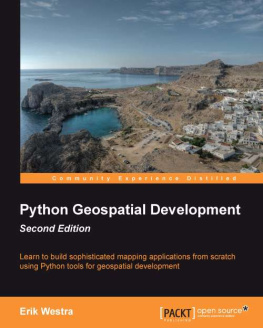
Erik Westra - Python geospatial development
Here you can read online Erik Westra - Python geospatial development full text of the book (entire story) in english for free. Download pdf and epub, get meaning, cover and reviews about this ebook. year: 2013, publisher: Packt Publishing, genre: Computer. Description of the work, (preface) as well as reviews are available. Best literature library LitArk.com created for fans of good reading and offers a wide selection of genres:
Romance novel
Science fiction
Adventure
Detective
Science
History
Home and family
Prose
Art
Politics
Computer
Non-fiction
Religion
Business
Children
Humor
Choose a favorite category and find really read worthwhile books. Enjoy immersion in the world of imagination, feel the emotions of the characters or learn something new for yourself, make an fascinating discovery.

- Book:Python geospatial development
- Author:
- Publisher:Packt Publishing
- Genre:
- Year:2013
- Rating:3 / 5
- Favourites:Add to favourites
- Your mark:
Python geospatial development: summary, description and annotation
We offer to read an annotation, description, summary or preface (depends on what the author of the book "Python geospatial development" wrote himself). If you haven't found the necessary information about the book — write in the comments, we will try to find it.
Erik Westra: author's other books
Who wrote Python geospatial development? Find out the surname, the name of the author of the book and a list of all author's works by series.


Python geospatial development — read online for free the complete book (whole text) full work
Below is the text of the book, divided by pages. System saving the place of the last page read, allows you to conveniently read the book "Python geospatial development" online for free, without having to search again every time where you left off. Put a bookmark, and you can go to the page where you finished reading at any time.
Font size:
Interval:
Bookmark:
Copyright 2013 Packt Publishing
All rights reserved. No part of this book may be reproduced, stored in a retrieval system, or transmitted in any form or by any means, without the prior written permission of the publisher, except in the case of brief quotations embedded in critical articles or reviews.
Every effort has been made in the preparation of this book to ensure the accuracy of the information presented. However, the information contained in this book is sold without warranty, either express or implied. Neither the author, nor Packt Publishing, and its dealers and distributors will be held liable for any damages caused or alleged to be caused directly or indirectly by this book.
Packt Publishing has endeavored to provide trademark information about all of the companies and products mentioned in this book by the appropriate use of capitals. However, Packt Publishing cannot guarantee the accuracy of this information.
First published: December 2012
Second Edition: May 2013
Production Reference: 1170513
Published by Packt Publishing Ltd.
Livery Place
35 Livery Street
Birmingham B3 2PB, UK.
ISBN 978-1-78216-152-3
www.packtpub.com
Cover Image by Karl Moore (<>)
Author
Erik Westra
Reviewers
Will Cadell
Richard Marsden
Silas Toms
Acquisition Editor
Kartikey Pandey
Lead Technical Editor
Susmita Panda
Technical Editors
Sharvari Baet
Meenakshi Gupta
Chirag Jani
Project Coordinator
Arshad Sopariwala
Proofreaders
Stephen Silk
Katherine Tarr
Indexers
Hemangini Bari
Rekha Nair
Tejal Daruwale
Graphics
Ronak Dhruv
Abhinash Sahu
Production Coordinator
Manu Joseph
Cover Work
Manu Joseph
Erik Westra has been a professional software developer for over 25 years, and has worked almost exclusively in Python for the past decade. Erik's early interest in graphical user-interface design led to the development of one of the most advanced urgent courier dispatch systems used by messenger and courier companies worldwide. In recent years, Erik has been involved in the design and implementation of systems matching seekers and providers of goods and services across a range of geographical areas. This work has included the creation of real-time geocoders and map-based views of constantly changing data. Erik is based in New Zealand, and works for companies worldwide.
I would like to thank Ruth, the love of my life, for all of her support and encouragement.
Richard Marsden has over 15 years of professional software development experience. After starting in the field of geophysics and oil exploration, he has spent the last ten years running the Winwaed Software Technology LLC, an independent software vendor. Winwaed specialize in geospatial tools and applications including web applications, and operate the http://www.mapping-tools.com website for tools and add-ins for Microsoft's MapPoint product.
Richard also manages the technical aspects of the EcoMapCostaRica.com project for the Biology Department at the University of Dallas. This includes the website, online field maps, field surveys, and the creation and comparison of panoramic photographs.
Richard is also active in the field of natural language processing, especially with Python's NLTK package.
Will Cadell is a principal consultant with Sparkgeo.com. He builds next generation web mapping applications, primarily using Google Maps, geoDjango, and PostGIS. He has worked in academia, government, and natural resources but now mainly consults for the start-up community in Silicon Valley. His passion has always been the implementation of geographic technology and with over a billion smart, mobile devices in the world it's a great time to be working on the geoweb.
Will lives in Prince George, Northern British Columbia, and when he's not writing code or talking about geographic web technology you can find him on a ski hill with his family.
Silas Toms is a GIS programmer with ICF International. His main professional interests are programming in Python and automation of large-scale environmental impact analyses. He has lived in San Francisco for 6 years while finishing a masters in GIS at San Francisco State University on temperature interpolation. He wishes to thank his girlfriend and his family for being supportive of his many interests.
You might want to visit www.PacktPub.com for support files and downloads related to your book.
Did you know that Packt offers eBook versions of every book published, with PDF and ePub files available? You can upgrade to the eBook version at > for more details.
At www.PacktPub.com, you can also read a collection of free technical articles, sign up for a range of free newsletters and receive exclusive discounts and offers on Packt books and eBooks.

http://PacktLib.PacktPub.com
Do you need instant solutions to your IT questions? PacktLib is Packt's online digital book library. Here, you can access, read and search across Packt's entire library of books.
- Fully searchable across every book published by Packt
- Copy and paste, print and bookmark content
- On demand and accessible via web browser
If you have an account with Packt at www.PacktPub.com, you can use this to access PacktLib today and view nine entirely free books. Simply use your login credentials for immediate access.
With the explosion of map-based websites and spatially-aware devices and applications, geospatial development is becoming increasingly important. The geospatial market is growing rapidly, and as a Python developer you can't afford to be left behind. In today's location-aware world, all commercial Python developers can benefit from an understanding of geospatial concepts and development techniques.
Working with geospatial data can get complicated because you are dealing with mathematical models of the Earth's surface. Since Python is a powerful programming language with high-level toolkits, it is well-suited to geospatial development. This book will familiarize you with the Python tools required for geospatial development. It introduces basic geospatial concepts with a clear, detailed walkthrough of the key concepts such as location, distance, units, projections, datums, and geospatial data formats. We then examine a number of Python libraries and use these with freely-available geospatial data to accomplish a variety of tasks. The book provides an in-depth look at the concept of storing spatial data in a database and how you can use spatial databases as tools to solve a variety of geospatial problems.
It goes into the details of generating maps using the Mapnik map-rendering toolkit, and helps you to build a sophisticated web-based geospatial map editing application using GeoDjango, Mapnik, and PostGIS. By the end of the book, you will be able to integrate spatial features into your applications and build a complete mapping application from scratch.
Font size:
Interval:
Bookmark:
Similar books «Python geospatial development»
Look at similar books to Python geospatial development. We have selected literature similar in name and meaning in the hope of providing readers with more options to find new, interesting, not yet read works.
Discussion, reviews of the book Python geospatial development and just readers' own opinions. Leave your comments, write what you think about the work, its meaning or the main characters. Specify what exactly you liked and what you didn't like, and why you think so.