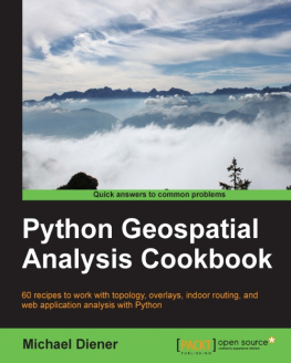
Michael Diener - Python Geospatial Analysis Cookbook
Here you can read online Michael Diener - Python Geospatial Analysis Cookbook full text of the book (entire story) in english for free. Download pdf and epub, get meaning, cover and reviews about this ebook. year: 2015, publisher: Packt Publishing, genre: Home and family. Description of the work, (preface) as well as reviews are available. Best literature library LitArk.com created for fans of good reading and offers a wide selection of genres:
Romance novel
Science fiction
Adventure
Detective
Science
History
Home and family
Prose
Art
Politics
Computer
Non-fiction
Religion
Business
Children
Humor
Choose a favorite category and find really read worthwhile books. Enjoy immersion in the world of imagination, feel the emotions of the characters or learn something new for yourself, make an fascinating discovery.
- Book:Python Geospatial Analysis Cookbook
- Author:
- Publisher:Packt Publishing
- Genre:
- Year:2015
- Rating:4 / 5
- Favourites:Add to favourites
- Your mark:
- 80
- 1
- 2
- 3
- 4
- 5
Python Geospatial Analysis Cookbook: summary, description and annotation
We offer to read an annotation, description, summary or preface (depends on what the author of the book "Python Geospatial Analysis Cookbook" wrote himself). If you haven't found the necessary information about the book — write in the comments, we will try to find it.
Python Geospatial Analysis Cookbook — read online for free the complete book (whole text) full work
Below is the text of the book, divided by pages. System saving the place of the last page read, allows you to conveniently read the book "Python Geospatial Analysis Cookbook" online for free, without having to search again every time where you left off. Put a bookmark, and you can go to the page where you finished reading at any time.
Font size:
Interval:
Bookmark:
Copyright 2015 Packt Publishing
All rights reserved. No part of this book may be reproduced, stored in a retrieval system, or transmitted in any form or by any means, without the prior written permission of the publisher, except in the case of brief quotations embedded in critical articles or reviews.
Every effort has been made in the preparation of this book to ensure the accuracy of the information presented. However, the information contained in this book is sold without warranty, either express or implied. Neither the author, nor Packt Publishing, and its dealers and distributors will be held liable for any damages caused or alleged to be caused directly or indirectly by this book.
Packt Publishing has endeavored to provide trademark information about all of the companies and products mentioned in this book by the appropriate use of capitals. However, Packt Publishing cannot guarantee the accuracy of this information.
First published: November 2015
Production reference: 1251115
Published by Packt Publishing Ltd.
Livery Place
35 Livery Street
Birmingham B3 2PB, UK.
ISBN 978-1-78355-507-9
www.packtpub.com
Author
Michael Diener
Reviewers
Jchym epick
Richard Marsden
Commissioning Editor
Ashwin Nair
Acquisition Editor
Rebecca You
Content Development Editor
Athira Laji
Technical Editor
Chinmay S. Puranik
Copy Editor
Sonia Michelle Cheema
Project Coordinator
Bijal Patel
Proofreader
Safis Editing
Indexer
Hemangini Bari
Graphics
Disha Haria
Production Coordinator
Nilesh Mohite
Cover Work
Nilesh Mohite
Michael Diener graduated from Simon Fraser University, British Columbia, Canada, in 2001 with a bachelor of science degree in geography. He began working in 1995 with Environment Canada as a GIS (Geographic Information Systems) analyst and has continued to work with GIS technologies ever since.
In 2008, he founded a company called GOMOGI that is focused on building web and mobile GIS application with open source tools. In 2011, the focus changed to indoor wayfinding and navigation solutions and building the indrz platform that Michael had envisioned.
From time to time, Michael also holds seminars for organizations wanting to explore or discover the possibilities of how GIS can increase productivity and help better answer spatial questions. He is also the creative head of new product development in his company. His technical skills include working with Python to solve a wide range of spatial problems on a daily basis. Through the years, he has developed many spatial applications with Python, including indrz and golfgis, which are two of the products built by his company, GOMOGI.
He is also lecturer of GIS at the Alpen Adria University, Klagenfurt, where he enjoys teaching students the wonderful powers of GIS and explaining how to solve spatial problems with open source GIS and Python.
I would like to dedicate this book to my family, beginning with my loving wife, Silvia, who encouraged and supported me through the writing of this book. I must also thank my three boys, Noah, Levi, and Jasper, for sacrificing many evenings and weekends of playtime for daddys book time. My parents, Birte and Hartwig, also deserve a big thank you for always believing in methank you for everything.
Jchym epick is an open source GIS software consultant, developer, and user.
Richard Marsden has over 15 years of professional software development experience. After starting in the fields of geophysics and oil exploration, he has spent the last 10 years running the Winwaed Software Technology LLC independent software vendor. Winwaed specializes in geospatial tools and applications, including web applications, and operates the http://www.mapping-tools.com website for tools and add-ins for geospatial products such as Caliper Maptitude and Microsoft MapPoint.
Richard has been a technical reviewer for Python Geospatial Development and Python Geospatial Analysis Essentials both by Erik Westra, and Mastering Python Forensics by Dr. Michael Spreitzenbarth and Dr. Johann Uhrmann all by Packt Publishing.
For support files and downloads related to your book, please visit www.PacktPub.com.
Did you know that Packt offers eBook versions of every book published, with PDF and ePub files available? You can upgrade to the eBook version at > for more details.
At www.PacktPub.com, you can also read a collection of free technical articles, sign up for a range of free newsletters and receive exclusive discounts and offers on Packt books and eBooks.

https://www2.packtpub.com/books/subscription/packtlib
Do you need instant solutions to your IT questions? PacktLib is Packts online digital book library. Here, you can search, access, and read Packts entire library of books.
- Fully searchable across every book published by Packt
- Copy and paste, print, and bookmark content
- On demand and accessible via a web browser
If you have an account with Packt at www.PacktPub.com, you can use this to access PacktLib today and view 9 entirely free books. Simply use your login credentials for immediate access.
Geospatial analysis is not special; it is just different when compared to other types of analysis such as financial market analysis. We work with geometry objects, such as lines, points, and polygons, and connect these geometries to attributes such as business data. We ask "where" question, such as "Where is the nearest pub?", "Where are all my customers located?", and "Where is my competition located?". The other location questions include, "Will this new building cast a shadow over the park?", "What is the shortest way to school?", "What is the safest way to school for my kids?", "Will this building block my view of the mountains?", and "Where is the optimal place to build my next store?". Identify the areas that fire trucks can reach from their station in 5 min, 10 min, or 20 min, and so on.
One thing all these questions have in common is the fact that you need to know where certain objects are located in order to answer them. Without the spatial component, you cannot answer such questions and this is what geospatial analysis is all about.
Geospatial features are laid over each other and patterns or trends are easily identified. This ability to see a pattern or trend is geospatial analysis in its simplest form.
Throughout this book, simple and complex code recipes are provided as small working models that can easily be integrated or expanded into a larger project or model.
Analysis is the fun part of GIS, and involves visualizing relationships, identifying trends, and seeing patterns that are not visible in a spreadsheet.
Font size:
Interval:
Bookmark:
Similar books «Python Geospatial Analysis Cookbook»
Look at similar books to Python Geospatial Analysis Cookbook. We have selected literature similar in name and meaning in the hope of providing readers with more options to find new, interesting, not yet read works.
Discussion, reviews of the book Python Geospatial Analysis Cookbook and just readers' own opinions. Leave your comments, write what you think about the work, its meaning or the main characters. Specify what exactly you liked and what you didn't like, and why you think so.

