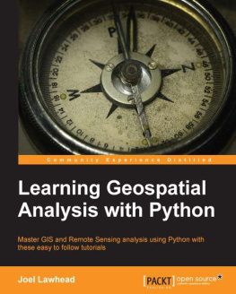
Lawhead - Learning Geospatial Analysis with Python
Here you can read online Lawhead - Learning Geospatial Analysis with Python full text of the book (entire story) in english for free. Download pdf and epub, get meaning, cover and reviews about this ebook. City: Birmingham, year: 2013, publisher: Packt Publishing, genre: Computer. Description of the work, (preface) as well as reviews are available. Best literature library LitArk.com created for fans of good reading and offers a wide selection of genres:
Romance novel
Science fiction
Adventure
Detective
Science
History
Home and family
Prose
Art
Politics
Computer
Non-fiction
Religion
Business
Children
Humor
Choose a favorite category and find really read worthwhile books. Enjoy immersion in the world of imagination, feel the emotions of the characters or learn something new for yourself, make an fascinating discovery.
Learning Geospatial Analysis with Python: summary, description and annotation
We offer to read an annotation, description, summary or preface (depends on what the author of the book "Learning Geospatial Analysis with Python" wrote himself). If you haven't found the necessary information about the book — write in the comments, we will try to find it.
Lawhead: author's other books
Who wrote Learning Geospatial Analysis with Python? Find out the surname, the name of the author of the book and a list of all author's works by series.
Learning Geospatial Analysis with Python — read online for free the complete book (whole text) full work
Below is the text of the book, divided by pages. System saving the place of the last page read, allows you to conveniently read the book "Learning Geospatial Analysis with Python" online for free, without having to search again every time where you left off. Put a bookmark, and you can go to the page where you finished reading at any time.
Font size:
Interval:
Bookmark:
Copyright 2013 Packt Publishing
All rights reserved. No part of this book may be reproduced, stored in a retrieval system, or transmitted in any form or by any means, without the prior written permission of the publisher, except in the case of brief quotations embedded in critical articles or reviews.
Every effort has been made in the preparation of this book to ensure the accuracy of the information presented. However, the information contained in this book is sold without warranty, either express or implied. Neither the author, nor Packt Publishing, and its dealers and distributors will be held liable for any damages caused or alleged to be caused directly or indirectly by this book.
Packt Publishing has endeavored to provide trademark information about all of the companies and products mentioned in this book by the appropriate use of capitals. However, Packt Publishing cannot guarantee the accuracy of this information.
First published: October 2013
Production Reference: 1181013
Published by Packt Publishing Ltd.
Livery Place
35 Livery Street
Birmingham B3 2PB, UK.
ISBN 978-1-78328-113-8
www.packtpub.com
Cover Image by Jarek Blaminsky (<>)
Author
Joel Lawhead
Reviewers
Jorge Samuel Mendes de Jesus
Athanasios Tom Kralidis
Alessandro Pasotti
Acquisition Editor
Joanne Fitzpatrick
Lead Technical Editor
Balaji Naidu
Technical Editors
Pooja Arondekar
Anita Nayak
Anusri Ramchandran
Project Coordinator
Angel Jathanna
Proofreader
Bernadette Watkins
Indexer
Hemangini Bari
Graphics
Abhinash Sahu
Production Coordinator
Shantanu Zagade
Cover Work
Shantanu Zagade
Joel Lawhead is a PMI-certified Project Management Professional (PMP) and the Chief Information Officer (CIO) for NVisionSolutions.com, an award-winning firm specializing in geospatial technology integration and sensor engineering.
He began using Python in 1997 and began combining it with geospatial software development in 2000. He has been published in two editions of the Python Cookbook by O'Reilly. He is also the developer of the widely used open source Python Shapefile Library (PyShp) and maintains the geospatial technical blog GeospatialPython.com and Twitter feed @SpatialPython discussing the use of the Python programming language within the geospatial industry.
In 2011, he reverse engineered and published the undocumented shapefile spatial indexing format and assisted fellow geospatial Python developer, Marc Pfister, in reversing the algorithm used, allowing developers around the world to create better-integrated and more robust geospatial applications involving shapefiles.
He has served as the lead architect, project manager, and co-developer for geospatial applications used by US government agencies including NASA, FEMA, NOAA, the US Navy, as well as many commercial and non-profit organizations. In 2002, he received the international "Esri Special Achievment in GIS" award for work on the Real-time Emergency Action Coordination Tool (REACT) for emergency management using geospatial analysis.
I would like to acknowledge my loving family including my wife Julie and four children Lauren, Will, Lillie, and Lainie who allowed me to write this book after hours. Thank you to my parents who inspired me through their actions to pursue computers, teaching, and writing; all the ingredients needed for a technical book. I would also like to acknowledge the work of the geospatial Python pioneers whose relentless and selfless contributions over the years in developing and publishing code to the geospatial Python body of knowledge made the content of this book possible, including Sean Gillies, Howard Butler, Matthew Perry, Frank Warmerdam, and Marc Pfister.
Jorge Samuel Mendes de Jesus has 15 years of programming experience in the field of Geoinformatics, with focus on Python programming, web services, and spatial databases.
He has a PhD in Geography and Sustainable Development from Ben-Gurion University and has been employed by the Joint Research Center, ISPRA, Plymouth Marine Laboratory and currently works at ISRIC, World Soil Information.
He currently lives in Wageningen, the Netherlands and spends his time learning combat sports and Dutch.
Athanasios Tom Kralidis is a Senior Systems Scientist for the Meteorological Service of Canada, where he provides geospatial technical and architectural leadership in support of MSC's data. His professional background includes key involvement in the development and integration of geospatial web standards, systems and services for the Canadian Geospatial Data Infrastructure (CGDI) with Natural Resources Canada (NRCan), as well as using these principles in architecting RsEau, Canada's water information portal.
He is active in the Open Geospatial Consortium (OGC) community, was lead contributer to the OGC Web Map Context Documents Specification, member of the CGDI Architecture Advisory Board, as well as part of the Canadian Advisory Committee to ISO Technical Committee 211 Geographic Information / Geomatics.
He is a developer on the MapServer, GeoNode and OWSLib open source software projects, and part of the MapServer Project Steering Committee. He is the founder and lead developer of pycsw, an OGC-compliant CSW reference implementation. He is also a charter member of the OGC.
Tom holds a Bachelor's degree in Geography from York University, GIS certification from Algonquin College, and a Master's degree in Geography and Environmental Studies (research and dissertation in Geospatial Web Services / Infrastructure) from Carleton University. He is a Certified Geomatics Specialist (GIS/LIS) with the Canadian Institute of Geomatics.
Alessandro Pasotti is the founder of ItOpen, an Italian web development consultancy focused on web GIS development and accessible websites. He has been programming for over two decades and he is now mainly a web application developer, handling both frontend and backend development.
He fell in love with Linux and free software in 1994 and never turned back. He spends most of his time developing web GIS applications in Python using GeoDjango and JavaScript mapping libraries such as OpenLayers.
You might want to visit www.PacktPub.com for support files and downloads related to your book.
Did you know that Packt offers eBook versions of every book published, with PDF and ePub files available? You can upgrade to the eBook version at > for more details.
At www.PacktPub.com, you can also read a collection of free technical articles, sign up for a range of free newsletters and receive exclusive discounts and offers on Packt books and eBooks.

http://PacktLib.PacktPub.com
Do you need instant solutions to your IT questions? PacktLib is Packt's online digital book library. Here, you can access, read and search across Packt's entire library of books.
Font size:
Interval:
Bookmark:
Similar books «Learning Geospatial Analysis with Python»
Look at similar books to Learning Geospatial Analysis with Python. We have selected literature similar in name and meaning in the hope of providing readers with more options to find new, interesting, not yet read works.
Discussion, reviews of the book Learning Geospatial Analysis with Python and just readers' own opinions. Leave your comments, write what you think about the work, its meaning or the main characters. Specify what exactly you liked and what you didn't like, and why you think so.

