• Complain

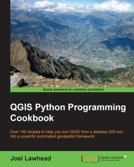
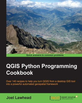
Joel Lawhead - QGIS Python Programming Cookbook

Here you can read online Joel Lawhead - QGIS Python Programming Cookbook full text of the book (entire story) in english for free. Download pdf and epub, get meaning, cover and reviews about this ebook. year: 2015, publisher: Packt Publishing - ebooks Account, genre: Computer. Description of the work, (preface) as well as reviews are available. Best literature library LitArk.com created for fans of good reading and offers a wide selection of genres:

Romance novel Science fiction Adventure Detective Science History Home and family Prose Art Politics Computer Non-fiction Religion Business Children Humor

Choose a favorite category and find really read worthwhile books. Enjoy immersion in the world of imagination, feel the emotions of the characters or learn something new for yourself, make an fascinating discovery.

Joel Lawhead QGIS Python Programming Cookbook
  • Book:
    QGIS Python Programming Cookbook
  • Author:
  • Publisher:
    Packt Publishing - ebooks Account
  • Genre:
  • Year:
    2015
  • Rating:
    5 / 5
  • Favourites:
    Add to favourites
  • Your mark:
    • 100
    • 1
    • 2
    • 3
    • 4
    • 5

QGIS Python Programming Cookbook: summary, description and annotation

We offer to read an annotation, description, summary or preface (depends on what the author of the book "QGIS Python Programming Cookbook" wrote himself). If you haven't found the necessary information about the book — write in the comments, we will try to find it.

Over 140 recipes to help you turn QGIS from a desktop GIS tool into a powerful automated geospatial framework

About This Book
  • Use Python and QGIS to create and transform data, produce appealing GIS visualizations, and build complex map layouts
  • Learn undocumented features of the new QGIS processing module
  • A set of user-friendly recipes that can automate the entire geospatial workflows by connecting Python GIS building blocks into comprehensive processes
Who This Book Is For

If you are a geospatial analyst who wants to learn more about automating everyday GIS tasks or a programmer who is responsible for building GIS applications,this book is for you. The short, reusable recipes make concepts easy to understand. You can build larger applications that are easy to maintain when they are put together.

What You Will Learn
  • Build a library of reusable scripts with ScriptRunner
  • Create, import, and edit geospatial data on disk or in memory
  • Get to know more about dynamic mapping
  • Create and add features to static maps
  • Create a mapbook
  • Reproject a vector layer
  • Geolocate photos on a map
  • Combine multiple rasters into one image
In Detail

QGIS Python Programming will teach you how to write Python code that works with spatial data to automate geoprocessing tasks in QGIS. It will cover topics such as querying and editing vector data and using raster data. You will also learn to create, edit, and optimize a vector layer for faster queries, reproject a vector layer, reduce the number of vertices in a vector layer without losing critical data, and convert a raster to a vector. Following this, you will come across recipes that will help you to compose static maps, create heavily customized maps, and add specialized labels and annotations. Apart from this, the book will also share a few tips and tricks based on different aspects of QGIS.

Joel Lawhead: author's other books


Who wrote QGIS Python Programming Cookbook? Find out the surname, the name of the author of the book and a list of all author's works by series.

QGIS Python Programming Cookbook — read online for free the complete book (whole text) full work

Below is the text of the book, divided by pages. System saving the place of the last page read, allows you to conveniently read the book "QGIS Python Programming Cookbook" online for free, without having to search again every time where you left off. Put a bookmark, and you can go to the page where you finished reading at any time.

Light

Font size:

Reset

Interval:

Bookmark:

Make
QGIS Python Programming Cookbook

Table of Contents
QGIS Python Programming Cookbook

QGIS Python Programming Cookbook

Copyright 2015 Packt Publishing

All rights reserved. No part of this book may be reproduced, stored in a retrieval system, or transmitted in any form or by any means, without the prior written permission of the publisher, except in the case of brief quotations embedded in critical articles or reviews.

Every effort has been made in the preparation of this book to ensure the accuracy of the information presented. However, the information contained in this book is sold without warranty, either express or implied. Neither the author, nor Packt Publishing, and its dealers and distributors will be held liable for any damages caused or alleged to be caused directly or indirectly by this book.

Packt Publishing has endeavored to provide trademark information about all of the companies and products mentioned in this book by the appropriate use of capitals. However, Packt Publishing cannot guarantee the accuracy of this information.

First published: March 2015

Production reference: 1240315

Published by Packt Publishing Ltd.

Livery Place

35 Livery Street

Birmingham B3 2PB, UK.

ISBN 978-1-78398-498-5

www.packtpub.com

Credits

Author

Joel Lawhead

Reviewers

Joshua Arnott

Giuseppe De Marco

Jonathan Gross

Luigi Pirelli

Hiroaki Sengoku

Commissioning Editor

Pramila Balan

Acquisition Editor

Sonali Vernekar

Content Development Editor

Prachi Bisht

Technical Editor

Deepti Tuscano

Copy Editor

Dipti Kapadia

Project Coordinator

Shipra Chawhan

Proofreaders

Safis Editing

Maria Gould

Indexer

Hemangini Bari

Production Coordinator

Nitesh Thakur

Cover Work

Nitesh Thakur

About the Author

Joel Lawhead is a PMI-certified Project Management Professional (PMP) and the Chief Information Officer (CIO) of NVisionSolutions Inc., an award-winning firm that specializes in geospatial technology integration and sensor engineering.

Joel began using Python in 1997 and began combining it with geospatial software development in 2000. He is the author of Learning Geospatial Analysis with Python , Packt Publishing . His Python cookbook recipes were featured in two editions of Python Cookbook , O'Reilly Media . He is also the developer of the widely used, open source Python Shapefile Library (PyShp) and maintains the geospatial technical blog GeospatialPython.com and the Twitter feed @SpatialPython, which discuss the use of the Python programming language within the geospatial industry.

In 2011, Joel reverse engineered and published the undocumented shapefile spatial indexing format and assisted fellow geospatial Python developer, Marc Pfister, in reversing the algorithm used, allowing developers around the world to create better-integrated and more robust geospatial applications involving shapefiles.

Joel served as the lead architect, project manager, and co-developer for geospatial applications used by US government agencies, including NASA, FEMA, NOAA, the US Navy, and many other commercial and non-profit organizations. In 2002, he received the international Esri Special Achievement in GIS award for his work on the Real-Time Emergency Action Coordination Tool (REACT), for emergency management using geospatial analysis.

I would like to acknowledge my beautiful family, including my wife, Julie, and four children, Lauren, Will, Lillie, and Lainie, who allowed me to write yet another book in our limited collective free time. I would also like to acknowledge my employers and coworkers at NVisionSolutions.com, a bright team of people dedicated to working together at the exciting bleeding edge of geospatial technology.

About the Reviewers

Joshua Arnott is an environmental scientist with four years of academic and consultancy experience. His expertise lies in environmental modeling, with a focus on hydrology and geoinformatics. He has contributed to a number of GIS-related open source projects, including QGIS and Shapely. He maintains a blog about programming and GIS at snorfalorpagus.net, and he likes cats just as much as everyone else on the Internet.

Giuseppe De Marco was born in 1973 in Ferentino, Italy. He has a high school certificate in humanities and attained a bachelor's degree in agriculture from the University of Pisa. When he was a small boy, he began to use computers and learn programming languages (BASIC, Pascal, Fortran, and so on). At the university, he began to encounter open source software and the Linux OS, and he developed a deep interest in geography and GIS and other programming languages, such as C++ and Python, by first getting in touch with Esri commercial products and later with GRASS and QGIS. Since the QGIS 1.7.4 release, he's been developing plugins for this software, sometimes purely to seek knowledge and at other times for work. In 2008, he began a professional partnership with two colleagues called Pienocampo (open field), and his plugins are hosted on Pienocampo's website and on the QGIS official repository. At the moment, he lives in his hometown Ferentino and works as a freelance agriculture engineer. His work activities include studying geography, surveying, tree risk assessment, landscaping, bioengineering, and farm consulting. In 2014, he also began to teach other colleagues how to use QGIS and other open source software.

I would like to thank my wife, Fabiola; my little daughter, Anna; my mother, Angela; and my colleagues, Marco De Castris, Ettore Arcangeletti, Luca Grande, and Ivan Solinas.

Jonathan Gross is the author of the Open Source GIS blog, http://opensourcegisblog.blogspot.com/. He has a master's of public health degree in epidemiology from the University of Michigan, Ann Arbor, and a graduate certificate in geographic information systems from Johns Hopkins Advanced Academic Programs. He has done graduate coursework in Python and uses Python for programming small tasks. He is currently an epidemiologist at the Baltimore City Health Department, Maryland, where he performs spatial analysis on health and crime data.

Luigi Pirelli is a freelance software analyst and developer with a honors degree in computer science from the University of Bari.

He has worked for 15 years in satellite ground segmentation and direct ingestion systems for the European Space Agency. Since 2006, he has been involved in the GFOSS world, contributing to QGIS, GRASS, and the MapServer core, and developing and maintaining many QGIS plugins. He actively participates in QGIS Hackmeetings.

He is the founder of the OSGEO Italian local chapter GFOSS.it and now lives in Spain, where he contributes to the GFOSS community. During the past few years, he started teaching PyQGIS by organizing trainings, from basic to advanced level, supporting companies to develop their specific QGIS plugins.

He has coauthored Mastering QGIS , Packt Publishing .

He is the founder of the local hackerspace group, Bricolabs.cc that is focused on all things related to open source hardware. He likes to cycle, repair everything, and train groups on conflict resolution.

Other than this book, he has also contributed to the guide,

Next page
Light

Font size:

Reset

Interval:

Bookmark:

Make

Similar books «QGIS Python Programming Cookbook»

Look at similar books to QGIS Python Programming Cookbook. We have selected literature similar in name and meaning in the hope of providing readers with more options to find new, interesting, not yet read works.


Reviews about «QGIS Python Programming Cookbook»

Discussion, reviews of the book QGIS Python Programming Cookbook and just readers' own opinions. Leave your comments, write what you think about the work, its meaning or the main characters. Specify what exactly you liked and what you didn't like, and why you think so.