• Complain

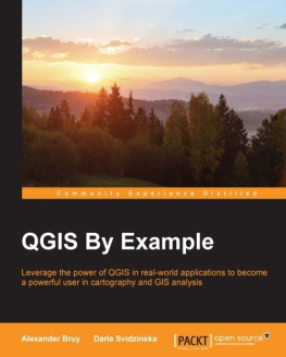
Alexander Bruy - QGIS By Example

Here you can read online Alexander Bruy - QGIS By Example full text of the book (entire story) in english for free. Download pdf and epub, get meaning, cover and reviews about this ebook. year: 2015, publisher: Packt Publishing, genre: Science. Description of the work, (preface) as well as reviews are available. Best literature library LitArk.com created for fans of good reading and offers a wide selection of genres:

Romance novel Science fiction Adventure Detective Science History Home and family Prose Art Politics Computer Non-fiction Religion Business Children Humor

Choose a favorite category and find really read worthwhile books. Enjoy immersion in the world of imagination, feel the emotions of the characters or learn something new for yourself, make an fascinating discovery.

Alexander Bruy QGIS By Example

QGIS By Example: summary, description and annotation

We offer to read an annotation, description, summary or preface (depends on what the author of the book "QGIS By Example" wrote himself). If you haven't found the necessary information about the book — write in the comments, we will try to find it.

Leverage the power of QGIS in real-world applications to become a powerful user in cartography and GIS analysis

About This Book
  • Load and visualize spatial data, create astonishing maps and publish them online, and effectively automate your work with the help of QGIS processing framework
  • Learn about different GIS analysis through detailed real-world examples
  • An example-based guide to solve most common mapping and analysis tasks using real-world datasets
Who This Book Is For

If you are a beginner or an intermediate GIS user, this book is for you. It is ideal for practitioners, data analysts, and application developers who have very little or no familiarity with geospatial data and software.

What You Will Learn
  • Install QGIS and integrate your data into a spatial database to improve data management, speedup access, and processing
  • Design beautiful and informative print maps for a better representation of your data and analysis results
  • Publish your maps on the Internet with the QGIS Cloud hosting
  • Use the Heatmap plugin and hexagonal grids to find hot regions by density analysis
  • Visualize your data in 3D and check object visibility to find the most scenic views
  • Perform suitability analysis to find places that meet your requirements and learn how to use spatial operations
  • Become more productive with the Processing framework by using models and scripts to automate repetitive and complex tasks
  • Develop your own Python plugin to extend QGISs functionality
In Detail

QGIS is a leading user-friendly, cross-platform, open source, desktop geographic information system (GIS). It provides many useful capabilities and features and their number is continuously growing. More and more private users and companies choose QGIS as their primary GIS software because it is very easy to use, feature-rich, extensible, and has a big and constantly growing community.

This book guides you from QGIS installation through data loading, and preparation to performing most common GIS analyses. You will perform different types of GIS analyses including density, visibility, and suitability analysis on practical, real-world data. Finally, you will learn how to become more productive and automate your everyday work with the help of the QGIS Processing framework and by developing your own Python plugins.

By the end of this book, you will have all the necessary knowledge about handling and analyzing spatial data.

Alexander Bruy: author's other books


Who wrote QGIS By Example? Find out the surname, the name of the author of the book and a list of all author's works by series.

QGIS By Example — read online for free the complete book (whole text) full work

Below is the text of the book, divided by pages. System saving the place of the last page read, allows you to conveniently read the book "QGIS By Example" online for free, without having to search again every time where you left off. Put a bookmark, and you can go to the page where you finished reading at any time.

Light

Font size:

Reset

Interval:

Bookmark:

Make
QGIS By Example

Table of Contents
QGIS By Example

QGIS By Example

Copyright 2015 Packt Publishing

All rights reserved. No part of this book may be reproduced, stored in a retrieval system, or transmitted in any form or by any means, without the prior written permission of the publisher, except in the case of brief quotations embedded in critical articles or reviews.

Every effort has been made in the preparation of this book to ensure the accuracy of the information presented. However, the information contained in this book is sold without warranty, either express or implied. Neither the authors nor Packt Publishing, and its dealers and distributors will be held liable for any damages caused or alleged to be caused directly or indirectly by this book.

Packt Publishing has endeavored to provide trademark information about all of the companies and products mentioned in this book by the appropriate use of capitals. However, Packt Publishing cannot guarantee the accuracy of this information.

First published: June 2015

Production reference: 1240615

Published by Packt Publishing Ltd.

Livery Place

35 Livery Street

Birmingham B3 2PB, UK.

ISBN 978-1-78217-467-7

www.packtpub.com

Credits

Authors

Alexander Bruy

Daria Svidzinska

Reviewers

Nyall Dawson

Werner Macho

Commissioning Editor

Julian Ursell

Acquisition Editor

Tushar Gupta

Content Development Editor

Nikhil Potdukhe

Technical Editors

Manan Patel

Rupali R. Shrawane

Copy Editor

Vikrant Phadke

Project Coordinator

Vijay Kushlani

Proofreader

Safis Editing

Indexer

Rekha Nair

Graphics

Abhinash Sahu

Production Coordinator

Melwyn Dsa

Cover Work

Melwyn Dsa

About the Authors

Alexander Bruy is a GFOSS advocate and an open source software developer working on the QGIS project. He also maintains a collection of his personal open source projects. He has been working with QGIS since 2006. Now, he is an OSGeo Charter member and QGIS core developer. Currently, Alexander is a freelance GIS developer and works for companies worldwide.

Daria Svidzinska is an associate professor at the physical geography and geoecology department of the Taras Shevchenko National University of Kyiv, Ukraine. From there, she earned a PhD in geography in 2007. Since then, she has been using FOSS GIS for her research in landscape ecology and spatial planning studies. For the past 5 years, she has been actively involved in academic and professional FOSS GIS teaching and training. In 2014, together with her colleague Alexander Bruy, Daria joined the Geo for All initiative and established an ICA-OSGeo-ISPRS research and education lab at her department (http://lab.osgeo.org.ua/). Its main objective is to promote and enhance education, research, and services in the field of open geospatial science and applications.

I would like to thank my coauthor, Alexander Bruy, for his patience, support, and encouragement. I also thank our reviewers, Werner Macho and Nyall Dawson, for their valuable feedback, and the whole editorial team for making the writing process smooth and efficient.

Special thanks goes to my dear mother for patiently putting up with my long working hours, giving me the inspiration and courage to rise above obstacles and constraints.

About the Reviewers

Nyall Dawson is a core developer of QGIS, responsible for thousands of contributions spanning the print composer, symbology, and labeling improvements. He has a master's degree in geospatial information, and is passionate about quality cartography and effective visual presentation of information.

He runs a freelance development consultancy, which focuses on targeted development of QGIS's features. He posts regular updates about his QGIS development work on his blog, which you can find at http://nyalldawson.net.

Werner Macho is an open source software developer working on the QGIS project. After graduating from the University of Natural Resources and Life Sciences in Vienna, Austria, he worked some time there as a scientist. Due to his work on QGIS, he got an opportunity to work for Kartoza in South Africa, but then he went back to his roots and is currently working in the area of water management in Austria. Werner has been working on QGIS since 2007, when he searched for an open source GIS tool to aid his work in floodwater protection plans.

Still, his private computer remains a restricted zone for proprietary software, as he strongly believes in the power of open source and the GPL.

www.PacktPub.com
Support files, eBooks, discount offers, and more

For support files and downloads related to your book, please visit www.PacktPub.com.

Did you know that Packt offers eBook versions of every book published, with PDF and ePub files available? You can upgrade to the eBook version at > for more details.

At www.PacktPub.com, you can also read a collection of free technical articles, sign up for a range of free newsletters and receive exclusive discounts and offers on Packt books and eBooks.

httpswww2packtpubcombookssubscriptionpacktlib Do you need instant - photo 1

https://www2.packtpub.com/books/subscription/packtlib

Do you need instant solutions to your IT questions? PacktLib is Packt's online digital book library. Here, you can search, access, and read Packt's entire library of books.

Why subscribe?
  • Fully searchable across every book published by Packt
  • Copy and paste, print, and bookmark content
  • On demand and accessible via a web browser
Free access for Packt account holders

If you have an account with Packt at www.PacktPub.com, you can use this to access PacktLib today and view 9 entirely free books. Simply use your login credentials for immediate access.

Preface

Welcome to QGIS By Example . This book will help you understand the capabilities of QGIS, show you how to work with spatial data and perform the most common analyses, and bring your productivity to a new level with the Processing framework.

QGIS is a very popular and user-friendly open source desktop GIS. It provides many useful capabilities and features and their number is continuously growing. It supports a wide range of raster and vector formats, as well as databases and OGC services. It also integrates seamlessly with other FOSSGIS applications. More and more users all over the world choose QGIS as their primary GIS software.

The book will introduce QGIS 2.8.x, and show you how to properly prepare your data for comfortable work, design beautiful maps, and share them with others. It will also show you how to perform different types of analysis and interpret their results. In the final chapters, you will learn how to become more productive by automating repetitive tasks with the QGIS Processing framework, and how to extend the QGIS functionality by developing a Python plugin.

What this book covers

, Handling Your Data , covers the installation of QGIS, introduces its user interface, and shows you how to customize it. In this chapter, you also get to know how to load data from different sources and assemble it in a spatial database.

Next page
Light

Font size:

Reset

Interval:

Bookmark:

Make

Similar books «QGIS By Example»

Look at similar books to QGIS By Example. We have selected literature similar in name and meaning in the hope of providing readers with more options to find new, interesting, not yet read works.


Reviews about «QGIS By Example»

Discussion, reviews of the book QGIS By Example and just readers' own opinions. Leave your comments, write what you think about the work, its meaning or the main characters. Specify what exactly you liked and what you didn't like, and why you think so.