• Complain

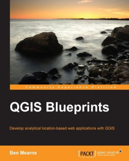
Mearns B. - QGIS Blueprints

Here you can read online Mearns B. - QGIS Blueprints full text of the book (entire story) in english for free. Download pdf and epub, get meaning, cover and reviews about this ebook. genre: Computer. Description of the work, (preface) as well as reviews are available. Best literature library LitArk.com created for fans of good reading and offers a wide selection of genres:

Romance novel Science fiction Adventure Detective Science History Home and family Prose Art Politics Computer Non-fiction Religion Business Children Humor

Choose a favorite category and find really read worthwhile books. Enjoy immersion in the world of imagination, feel the emotions of the characters or learn something new for yourself, make an fascinating discovery.

Mearns B. QGIS Blueprints
  • Book:
    QGIS Blueprints
  • Author:
  • Genre:
  • Rating:
    5 / 5
  • Favourites:
    Add to favourites
  • Your mark:
    • 100
    • 1
    • 2
    • 3
    • 4
    • 5

QGIS Blueprints: summary, description and annotation

We offer to read an annotation, description, summary or preface (depends on what the author of the book "QGIS Blueprints" wrote himself). If you haven't found the necessary information about the book — write in the comments, we will try to find it.

Packt Publishing, 2015. 258 p. ISBN-19: 1785289071, ISBN-13: 978-1-78528-907-1.
Develop analytical location-based web applications with QGIS.QGIS, the worlds most popular free/open source desktop geographic information system software, enables a wide variety of use cases involving location previously only available through expensive specialized commercial software. However, designing and executing a multi-tiered project from scratch on this complex ecosystem remains a significant challenge.This book starts with a primer on QGIS and closely related data, software, and systems. Well guide you through six use-case blueprints for geographic web applications. Each blueprint boils down a complex workflow into steps you can follow to reduce time lost to trial and error.By the end of this book readers should be able to build complex layered applications that visualize multiple data sets, employing different types of visualization, and give end users the ability to interact with and manipulate this data for the purpose of analysis.What You Will Learn:
Review geographic information principles and the application of these principles in the QGIS free/open source ecosystem;
Perform advanced analysis with site selection, hydrologic, and topological networks;
Build performant web applications by tile caching and generating static assets;
Provide collaborative editing capabilities for your team or community;
Develop custom and dynamic analysis and visualization capabilities;
Select the best components from desktop and web, for your use case;
Integrate it with social media and crowdsourcing.Tame geographic information workflows with QGIS blueprints for smart web applications.
Create geographic web applications using QGIS and free/open source software.
Blueprints provide real-world applications covering many use cases.Who This Book Is For:
This book encompasses relatively experienced GIS developers who have a strong grounding in the fundamentals of GIS development. They will have used QGIS before, but are looking to understand how to develop more complex, layered map applications that expose various data sets, utilize different visualizations, and are consumable (usable) by end users iPAD Amazon Kindle, PC , Cool Reader (EPUB), Calibre (EPUB, MOBI, AZW3), Adobe Digital Editions (EPUB), FBReader (EPUB, MOBI, AZW3).

Mearns B.: author's other books


Who wrote QGIS Blueprints? Find out the surname, the name of the author of the book and a list of all author's works by series.

QGIS Blueprints — read online for free the complete book (whole text) full work

Below is the text of the book, divided by pages. System saving the place of the last page read, allows you to conveniently read the book "QGIS Blueprints" online for free, without having to search again every time where you left off. Put a bookmark, and you can go to the page where you finished reading at any time.

Light

Font size:

Reset

Interval:

Bookmark:

Make
QGIS Blueprints

Table of Contents
QGIS Blueprints

QGIS Blueprints

Copyright 2015 Packt Publishing

All rights reserved. No part of this book may be reproduced, stored in a retrieval system, or transmitted in any form or by any means, without the prior written permission of the publisher, except in the case of brief quotations embedded in critical articles or reviews.

Every effort has been made in the preparation of this book to ensure the accuracy of the information presented. However, the information contained in this book is sold without warranty, either express or implied. Neither the author, nor Packt Publishing, and its dealers and distributors will be held liable for any damages caused or alleged to be caused directly or indirectly by this book.

Packt Publishing has endeavored to provide trademark information about all of the companies and products mentioned in this book by the appropriate use of capitals. However, Packt Publishing cannot guarantee the accuracy of this information.

First published: September 2015

Production reference: 1210915

Published by Packt Publishing Ltd.

Livery Place

35 Livery Street

Birmingham B3 2PB, UK.

ISBN 978-1-78528-907-1

www.packtpub.com

Credits

Author

Ben Mearns

Reviewers

Ujaval Gandhi

Fred Gibbs

Gergely Padnyi-Gulys

Abdelghaffar KHORCHANI

Pablo Pardo

Mats Tpel

Acquisition Editor

Divya Poojari

Content Development Editor

Zeeyan Pinheiro

Technical Editor

Humera Shaikh

Copy Editor

Shruti Iyer

Project Coordinator

Suzanne Coutinho

Proofreader

Safis Editing

Indexer

Monica Ajmera Mehta

Production Coordinator

Nilesh R. Mohite

Cover Work

Nilesh R. Mohite

About the Author

Ben Mearns lives in Philadelphia, PA, where he consults, teaches, advises, speaks, and creates around geographic information. At present, he is involved in private practice; previously, he held the positions of the Lead Geospatial Information Consultant and Instructor of GIS for Natural Resource Management at the University of Delaware. Ben has held other GIS and data positions at the University of Pennsylvania, Cartographic Modeling Lab, Princeton University, and Macalester College. He has consulted in private practice on projects in many fields, including research, healthcare, education, and e-commerce.

I would like to thank Catherine Moore and Raiana Mearns for their support during the writing of this book. I am indebted to Professor John Mackenzie, of the University of Delaware, whose GIS curriculum inspired much of the material in this book. I must also acknowledge others at UD: the caring support of my colleagues in IT research computing and CS&S, the UD GIS community, the lima bean research team, the digital humanities community, and many more.

About the Reviewers

Ujaval Gandhi holds a master's degree in the field of geoinformatics from the University of Wisconsin-Madison, and he has 10 years of experience in the field of remote sensing and GIS. Ujaval is passionate about open source software and an active contributor to the QGIS community. He is currently located in Bangalore, India, and works as a tech manager in the aerial imagery team at Google.

Fred Gibbs is an assistant professor of history at the University of New Mexico, where he teaches the intersection of the history of medicine and urban ecologies, particularly the spatial relationships between people, food, health policy, public health, and urban design. In his research, Fred experiments with new, technology-driven methodologies to create and disseminate historical interpretations. His recent work focuses on creating interactive maps to visualize and understand urban spatial experiences and health. Fred coaches students on the history of medicine, food history, urban health, and digital humanities.

Gergely Padnyi-Gulys is a geographic information systems (GIS) developer, web developer, and remote sensing analyst with over 7 years of experience. He specializes in designing and developing web mapping applications and GIS. Gergely is a dedicated user and developer of open source software (OSS) and also an active member of the Hungary OSGeo chapter. He is familiar with both client- and server-side programming.

For more than 4 years, Gergely worked for archaeologists as a GIS engineer and remote sensing analyst, where he contributed to laying the foundations of archaeological predictive modeling in Hungary. After this, he became a Java web developer in a private company. For the last 2 years, Gergely has been working at a state nonprofit corporation as a lead GIS and web developer, where he uses the experience he gained in his previous jobs: combining GIS with development. In the past few years, he dived into plugin development in different programming languages, such as Java for GeoServer and Python for QGIS. Quite recently, Gergely has been dabbling in WebGIS 3D visualization and analysis.

You can follow him on his personal website at www.gpadanyig.com.

Abdelghaffar KHORCHANI has a license degree in geographic information systems (GIS) and a fundamental license of natural science in applied biology and geology. He holds a master's degree in geomatics and planning, and he is also a computer engineer. Currently, Abdelghaffar is pursuing a master's degree in planning and regional development from Laval University, Canada and a PhD in marine sciences from the University of Milano-Biccoca, Italy.

He organized courses in Japan based on the fisheries resource management approach for young leaders. In Spain, Abdelghaffar designed courses that focus on the field use of GIS for scheduling and management. Besides, he has also devised courses on urban administration in Tunisia.

Abdelghaffar has 8 years of experience in the geomatics field and has worked on several projects in the sectors of agriculture, environment, transport, mapping, and so on. Currently, he manages the Ministry of Agriculture & Environment in Tunisia and is responsible for the mapping service in the vessel monitoring system (VMS) project.

Abdelghaffar is also a trainer in the mapping field of GIS, GPS, and computer-aided design (CAD). He is particularly interested in the development of decision support tools.

I would like to specially thank Packt Publishing for giving me the opportunity of reviewing of this book. I would also like to thank my family, especially my parents, for their physical and moral support.

Pablo Pardo is a geographer from Spain. He has an MSc degree in GIS and specialized in natural risk assessment, focusing his thesis on open data quality. Pablo also has a certificate of higher education in software development.

After several years of working as a GIS technician, he is now beginning his freelance career, combining GIS consulting with data analysis and programming. This is the second book Pablo has helped review.

He likes open data, free software, and "geo stuff". You can find more information about him at www.pablopardo.es.

Mats Tpel received his PhD in systematic biology from the University of Gothenburg, where he studied evolutionary and biogeographical patterns in plants using GIS and climate niche modeling. He is currently working as a bioinformatician specialized in de novo genome sequencing. Mats is the lead programmer in the SpeciesGeoCoder project, a tool for large-scale biogeographical data analysis. When not involved in science, he enjoys spending time with the family or fly-fishing along the coast of Sweden.

Next page
Light

Font size:

Reset

Interval:

Bookmark:

Make

Similar books «QGIS Blueprints»

Look at similar books to QGIS Blueprints. We have selected literature similar in name and meaning in the hope of providing readers with more options to find new, interesting, not yet read works.


Reviews about «QGIS Blueprints»

Discussion, reviews of the book QGIS Blueprints and just readers' own opinions. Leave your comments, write what you think about the work, its meaning or the main characters. Specify what exactly you liked and what you didn't like, and why you think so.