• Complain

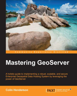
Henderson Colin. - Mastering GeoServer

Here you can read online Henderson Colin. - Mastering GeoServer full text of the book (entire story) in english for free. Download pdf and epub, get meaning, cover and reviews about this ebook. genre: Computer / Science. Description of the work, (preface) as well as reviews are available. Best literature library LitArk.com created for fans of good reading and offers a wide selection of genres:

Romance novel Science fiction Adventure Detective Science History Home and family Prose Art Politics Computer Non-fiction Religion Business Children Humor

Choose a favorite category and find really read worthwhile books. Enjoy immersion in the world of imagination, feel the emotions of the characters or learn something new for yourself, make an fascinating discovery.

Henderson Colin. Mastering GeoServer

Mastering GeoServer: summary, description and annotation

We offer to read an annotation, description, summary or preface (depends on what the author of the book "Mastering GeoServer" wrote himself). If you haven't found the necessary information about the book — write in the comments, we will try to find it.

Packt Publishing, 2014. 420 p. ISBN-10: 1783287691, ISBN-13: 978-1783287697.
GeoServer , , OGS: WMS, WFS, WCS.GeoServer WFS-Transaction ( MapServer). , GeoServer, , .GeoServer Geotools: , Java.Whether you have used GeoServer before or are just starting out with it, this book will give you the skills and knowledge to unlock the value of your spatial information and deliver great looking maps.This book will take you on a journey from installing GeoServer in a production environment through to securing and optimizing it so its ready for use. Along the way, you will learn how to optimize your raster data for efficient delivery, exploit data stored in a spatial database, style data to create great looking maps, use GeoServer as a proxy, create scripts to perform spatial analysis, and monitor the health of your server.Consequently, if you are looking to unlock the potential of GeoServer to deliver powerful desktop and mobile web mapping solutions that exploit spatial and location-based data, the tutorials inside this book will meet your needs for a detailed solution.What You Will Learn:
Install GeoServer in a production environment to make it robust and scalable;
Optimize and exploit your vector and raster datasets from a range of data storage options;
Serve data that conforms to complex schemas;
Utilize proxy data requests to enhance server capabilities or secure data services;
Create great looking maps through alternative approaches for styling and web printing services;
Exploit the spatial analysis capabilities of GeoServer through scripting;
Integrate GeoServer in your corporate security mechanisms;
Monitor the performance and health of your GeoServer instance and optimize it for the production phase.Exploit the power of GeoServer to provide agile, flexible, and low total-cost community projects.
Explore the many different ways that vector and raster data can be exploited to deliver great looking maps.
Extend GeoServers functionality by understanding techniques to work with advanced production system configuration, monitoring, and security.Who This Book Is For
If you are a GIS professional who intends to explore advanced techniques and get more out of GeoServer deployment rather than simply delivering good looking maps, then this book is for you. iPAD Amazon Kindle, PC , Cool Reader (EPUB), Calibre (EPUB, MOBI, AZW3), Adobe Digital Editions (EPUB), FBReader (EPUB, MOBI, AZW3).

Henderson Colin.: author's other books


Who wrote Mastering GeoServer? Find out the surname, the name of the author of the book and a list of all author's works by series.

Mastering GeoServer — read online for free the complete book (whole text) full work

Below is the text of the book, divided by pages. System saving the place of the last page read, allows you to conveniently read the book "Mastering GeoServer" online for free, without having to search again every time where you left off. Put a bookmark, and you can go to the page where you finished reading at any time.

Light

Font size:

Reset

Interval:

Bookmark:

Make
Mastering GeoServer

Table of Contents
Mastering GeoServer

Mastering GeoServer

Copyright 2014 Packt Publishing

All rights reserved. No part of this book may be reproduced, stored in a retrieval system, or transmitted in any form or by any means, without the prior written permission of the publisher, except in the case of brief quotations embedded in critical articles or reviews.

Every effort has been made in the preparation of this book to ensure the accuracy of the information presented. However, the information contained in this book is sold without warranty, either express or implied. Neither the author, nor Packt Publishing, and its dealers and distributors will be held liable for any damages caused or alleged to be caused directly or indirectly by this book.

Packt Publishing has endeavored to provide trademark information about all of the companies and products mentioned in this book by the appropriate use of capitals. However, Packt Publishing cannot guarantee the accuracy of this information.

First published: November 2014

Production reference: 1181114

Published by Packt Publishing Ltd.

Livery Place

35 Livery Street

Birmingham B3 2PB, UK.

ISBN 978-1-78328-769-7

www.packtpub.com

Cover image by Adam Plezer (<>)

Credits

Author

Colin Henderson

Reviewers

Luca De Felice

Stefano Iacovella

Roy A. Justo

Antonio Santiago Prez

Richard Zijlstra

Acquisition Editor

Vinay Argekar

Content Development Editor

Poonam Jain

Technical Editor

Tanvi Bhatt

Copy Editors

Sayanee Mukherjee

Karuna Narayanan

Project Coordinator

Mary Alex

Proofreaders

Ameesha Green

Samantha Lyon

Jonathan Todd

Indexers

Hemangini Bari

Monica Ajmera Mehta

Tejal Soni

Graphics

Ronak Dhruv

Valentina D'silva

Abhinash Sahu

Production Coordinator

Nitesh Thakur

Cover Work

Nitesh Thakur

About the Author

Colin Henderson is a spatial solutions architect with 14 years of experience working on solutions to complex spatial problems. He is currently the Geospatial Systems Capability Lead for Atkins, one of the world's leading design, engineering, and project management consultancies. Although experienced in a wide range of proprietary GIS software, his current focus is on specializing in the integration of open source software in complex enterprise environments. His most recent projects involve the integration of GeoServer with FME Server from Safe Software and the delivery of spatial web-mapping applications through Esri's ArcGIS for the Server platform and Latitude Geographics' Geocortex framework. Colin is the Technical Architect and Lead Developer of Atkins' open source-based spatial integration platform, CIRRUSmaps, a solution built on the best breed of open source spatial software, including PostGIS and OpenLayers, with GeoServer at its heart, and designed from the ground-up for deployment in cloud environments.

A self-confessed techie, Colin enjoys digging deeper to understand technology and software, and then applying this learning to create innovative solutions to problems. When possible, he likes to "pay it forward" by helping others with their problems, through contributions on GIS Stack Exchange, in particular.

I would like to dedicate this book to the memory of my grandfather, John Denis Stevens, who sadly passed away while I was writing and never got to see the finished product. He often liked to say "these computer things will never catch on!"

I would like to thank my parents for buying me my first computer, I really enjoyed breaking it and then trying to get it working again. Without the introduction, my curiosity of all things computers would never have happened.

Finally, I would like to thank my wife, Amy, and children, Evie and Max, for their patience during the writing process; I love you all very much.

About the Reviewers

Luca De Felice is a keen and passionate GIS software engineer. His educational background and working experience are in environmental sciences, with particular emphasis in the field of GIS techniques applied to risk and hazard management and monitoring. During his university studies, he started developing models for the evaluation of flood hazards. This activity continued after his graduation, with his design of GIS to build hydrologic models being applied to sample basins within a European project. For several years, he worked for a public office to contribute to the development of a hydro-geological GIS-based early warning system at the regional/national level. In this context, he learned GIS, IT environment development, database, and web mapping, applied to any kind of environmental data. Moreover, he contributed to several articles and workshops intended to disseminate novel approaches towards the development of GIS-based early warning systems.

He has been working for more than 10 years as a GIS scientific consultant in different technical contexts, where he applies his deep knowledge of GIS and IT computation in practical cases concerning the design and development of GIS-based environmental monitoring systems.

Stefano Iacovella is a longtime GIS developer and consultant living in Rome, Italy. He also routinely works as a GIS course instructor. He has a PhD in Geology. Being very curious, he developed a deep knowledge of IT technologies, mainly focusing on GIS software and related standards. Starting his career as an ESRI employee, he was exposed to, and became confident with proprietary GIS software, mainly the ESRI suite of products.

Over the last 14 years, he became more and more involved with open source software, also integrating it with proprietary software. He loves the open source approach, and really trusts in collaboration and sharing of knowledge. He strongly believes in the open source idea and constantly manages to spread it out, not only in the GIS sector. He has been using GeoServer since release 1.5, configuring, deploying, and hacking it in several projects. Other GFOSS projects he uses and likes are GDAL/OGR, PostGIS, QGIS, and OpenLayers.

He authored two books on GeoServer with Packt Publishing, GeoServer Cookbook , a practical set of recipes to get the most out of the software, and GeoServer Beginner's Guide , a first approach to GeoServer features.

When not playing with maps and geometric shapes, he loves reading about Science, mainly Physics and Maths, riding his bike, and having fun with his wife and his two daughters, Alice and Luisa.

You can contact him at <> or follow him on his Twitter handle @iacovellas.

Roy A. Justo is a geospatial application developer. He was born and raised in Havana, Cuba, and obtained a Bachelor of Science degree in Geography with Honors from the University of Havana. He also earned a Master's degree in Geographic Information Technologies from the Autonomous University of Barcelona. Roy has worked in this field as a teacher and researcher. He also worked in the private sector, creating geospatial solutions for diverse markets. His work has taken him to Munich, Barcelona, Boston, and most recently, New York City. He is currently working at one of the world's largest privately held software firms, where he integrates geospatial functionalities into BI development environments.

Next page
Light

Font size:

Reset

Interval:

Bookmark:

Make

Similar books «Mastering GeoServer»

Look at similar books to Mastering GeoServer. We have selected literature similar in name and meaning in the hope of providing readers with more options to find new, interesting, not yet read works.


Reviews about «Mastering GeoServer»

Discussion, reviews of the book Mastering GeoServer and just readers' own opinions. Leave your comments, write what you think about the work, its meaning or the main characters. Specify what exactly you liked and what you didn't like, and why you think so.