Jack Christie - 52 Best Day Trips from Vancouver
Here you can read online Jack Christie - 52 Best Day Trips from Vancouver full text of the book (entire story) in english for free. Download pdf and epub, get meaning, cover and reviews about this ebook. year: 2011, publisher: Greystone Books, genre: Detective and thriller. Description of the work, (preface) as well as reviews are available. Best literature library LitArk.com created for fans of good reading and offers a wide selection of genres:
Romance novel
Science fiction
Adventure
Detective
Science
History
Home and family
Prose
Art
Politics
Computer
Non-fiction
Religion
Business
Children
Humor
Choose a favorite category and find really read worthwhile books. Enjoy immersion in the world of imagination, feel the emotions of the characters or learn something new for yourself, make an fascinating discovery.
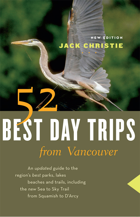
- Book:52 Best Day Trips from Vancouver
- Author:
- Publisher:Greystone Books
- Genre:
- Year:2011
- Rating:5 / 5
- Favourites:Add to favourites
- Your mark:
52 Best Day Trips from Vancouver: summary, description and annotation
We offer to read an annotation, description, summary or preface (depends on what the author of the book "52 Best Day Trips from Vancouver" wrote himself). If you haven't found the necessary information about the book — write in the comments, we will try to find it.
Jack Christie: author's other books
Who wrote 52 Best Day Trips from Vancouver? Find out the surname, the name of the author of the book and a list of all author's works by series.


52 Best Day Trips from Vancouver — read online for free the complete book (whole text) full work
Below is the text of the book, divided by pages. System saving the place of the last page read, allows you to conveniently read the book "52 Best Day Trips from Vancouver" online for free, without having to search again every time where you left off. Put a bookmark, and you can go to the page where you finished reading at any time.
Font size:
Interval:
Bookmark:
JACK CHRISTIE
BEST DAY TRIPS
fromVANCOUVER
NEW EDITION

Copyright 2011 by Jack Christie
11 12 13 14 15 5 4 3 2 1
All rights reserved. No part of this book may be reproduced, stored in a retrieval system or transmitted, in any form or by any means, without the prior written consent of the publisher or a licence from The Canadian Copyright Licensing Agency (Access Copyright). For a copyright licence, visit www.accesscopyright.ca or call toll free to 1-800-893-5777.
Greystone Books
An imprint of D&M Publishers Inc.
2323 Quebec Street, Suite 201
Vancouver BC Canada V5T 4S7
www.greystonebooks.com
Cataloguing data available from Library and Archives Canada
ISBN 978-1-55365-597-8 (pbk.)
ISBN 978-1-55365-598-5 (ebook)
Editing by Iva Cheung
Cover design by Jessica Sullivan and Naomi MacDougall
Cover photograph Darrell Gulin/CORBIS
Photos by Louise Christie
Maps by Kelly Alm and David Lewis
Distributed in the U.S. by Publishers Group West
Every attempt has been made to ensure that the information in this book is accurate and up to date; however, the authors and publisher assume no liability for any loss, damage, inconvenience or injury that may occur to anyone using this book. All outdoor activities involve an element of the unknown and thus an element of risk, and you are solely responsible for your own safety and health at all times. Always check local conditions, know your own limitations and consult a map.
We gratefully acknowledge the financial support of the Canada Council for the Arts, the British Columbia Arts Council, the Province of British Columbia through the Book Publishing Tax Credit and the Government of Canada through the Canada Book Fund for our publishing activities.
For Louise
Contents
BOWEN ISLAND WEST VANCOUVER
NORTH VANCOUVER
COQUITLAM PORT COQUITLAM
PITT MEADOWS MAPLE RIDGE
List of Maps
W HEN THE first edition of Day Trips from Vancouver appeared two decades ago, it helped steer Lower Mainlanders in search of quick access to the neighbouring outdoors. What weve set out to accomplish with this edition of 52 Best Day Trips from Vancouver is to further refine the manner in which information on a variety of activities, including new details on dog walking, is presented. Key data to assist both spur-of-the moment and long-range decision making appear at the outset of each chapter. This format helps readers quickly determine which destination best suits the amount of time at their disposal and the activities they most enjoy on a season-to-season basis. New to this edition is an activities index found at the back of the book, including wheelchair access.
In the past 40 years, the number of both local parks and recreational interests has soared; the amount of leisure time many of us have to enjoy the outdoors has not kept pace. Thus its more important than ever that this time-honoured guide help readers become better organized and informed. With this aim in mind, distances to destinations appear at the opening of each chapter. These are calculated from the bridges that link Vancouver with the North Shore and Richmond, or from the citys eastern boundary with Burnaby.
Readers will also be able to tell at a glance which activities are best suited to each destination. Since Day Trips from Vancouver first appeared, in-line skating, mountain biking, kayaking and snowboarding have grown steadily in popularity, as have the more gentle pastimes of walking, birding and nature observation. Our purpose with this current edition is to provide readers with the most detailed descriptions of trails and pathways suited to each of these pursuits. For car-free city dwellers, detailed transit information, including telephone numbers and Web sites, is listed. Wherever suitable, wheelchair access is also noted with a wheelchair icon ( ) at the beginning of each chapter.
Choosing which destinations to include was a difficult assignment. After all, there are hundreds of trailssuch as the ambitious Sea to Sky Trail to which we devote a new chapterplus that number again of lakes and picnic sites scattered throughout the Lower Mainland. The inventory of provincial, regional and municipal parks continues to grow; we reflect that trend with the inclusion of Coquitlams Colony Farm Regional Park (see ) for the first time in this edition. 52 Best Day Trips from Vancouver isnt intended to be the most exhaustive guide to our region. It does aim to be the most comprehensive look at 19 provincial parks, 18 regional parks, 29 municipal parks and recreation trails, five conservation regions, two BC Hydro recreation sites, two Parks Canada national historic sites, three B.C. Forest Service interpretive forests, plus one outstanding county park in nearby Washington State for good measure. How did we decide? Simple. These are the places we return to time after time, season after season, and that reward us with new approaches and fresh prospects year after year.
Rob Sanders, publisher of Greystone Books, is chiefly responsible for this new endeavour. He gathered the team to make it happen, principally editor Iva Cheung, managing editor Susan Rana and designer Naomi MacDougall. Louise Christie took and organized the photographs, and David Lewis fine-tuned the maps.
Encouragement came from many quarters, including Charlie Smith, Martin Dunphy, Amanda Growe, Janet McDonald, Dan and Matt McLeod and Yolanda Stepien at the Georgia Straight; Mark Forsythe at CBC Radio Ones B.C. Almanac; Jim Reis, Rob Kowalchuk, Johanna Ward and Erin Shaw at Shaw TVs The Express; Christina Moore, Tabetha Boot, Amber Turnau and Ryan Proctor at Whistler-Blackcomb; Janice Greenwood-Fraser, Mika Ryan, Carla Mont and Cindy Burr at the Ministry of Tourism, Culture and the Arts. Valuable assistance was provided by Bonnie Blue, Wendy DeDalt, Doug Petersen and Frieda Schade at Metro Vancouver Parks; Tiina Mack at Surrey Parks; and Katharine Steig and Alex Wallace with the Friends of Cypress Provincial Park. Special thanks to Jon Strocel of upNext Media, webmaster for jackchristie.com.
BOWEN ISLAND
WEST VANCOUVER
NORTH VANCOUVER
> 1
CRIPPEN REGIONAL PARK
Bowen Island
> DISTANCE: 20 km (12.4 mi.) to Horseshoe Bay, northwest of Vancouver via Highway 1/99
> ACTIVITIES: Birding, dog walking, hiking, historic site, nature observation, paddling, picnicking, swimming, viewpoints, walking
> ACCESS: Drive the Upper Levels Highway (Highway 1/99) to the BC Ferries Horseshoe Bay terminal. Round-trip passenger tickets for the Queen of Capilano cost about $10 per person (slightly less during off-peak periods) with reduced fares for children aged 5 to 11; children younger than 5 travel free. There is an extra charge of $2 for bicycles. Call 1-888-223-3779 for sailing information or visit bcferries.com. Note: Allow at least 10 minutes to walk aboard from the BC Ferries ticket office. By car, the round-trip fee is $36, lower in the off-season.
Alternatively, travel to Horseshoe Bay by bus. Call West Vancouver Transit at 604-985-7777 or visit westvancouver.ca for schedule information.
For information on Crippen Regional Park, visit www.metrovancouver.org/services/parks_lscr/regionalparks/Pages/Crippen.aspx. Note: There are no off-leash zones in the park.
I SLANDS DEFINE British Columbias coast. Its probably easier to guess the number of molecules of salt in a bucket of seawater than to try to add up how many islands there are along our coastline. Each island adds its own distinct note to the composition that plays out between the gulfs of Georgia and Alaska. And what an intricate tune it is.
Next pageFont size:
Interval:
Bookmark:
Similar books «52 Best Day Trips from Vancouver»
Look at similar books to 52 Best Day Trips from Vancouver. We have selected literature similar in name and meaning in the hope of providing readers with more options to find new, interesting, not yet read works.
Discussion, reviews of the book 52 Best Day Trips from Vancouver and just readers' own opinions. Leave your comments, write what you think about the work, its meaning or the main characters. Specify what exactly you liked and what you didn't like, and why you think so.