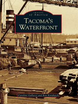
Caroline Gallacci - Tacomas Waterfront
Here you can read online Caroline Gallacci - Tacomas Waterfront full text of the book (entire story) in english for free. Download pdf and epub, get meaning, cover and reviews about this ebook. year: 2006, publisher: Arcadia Publishing Inc., genre: Science fiction. Description of the work, (preface) as well as reviews are available. Best literature library LitArk.com created for fans of good reading and offers a wide selection of genres:
Romance novel
Science fiction
Adventure
Detective
Science
History
Home and family
Prose
Art
Politics
Computer
Non-fiction
Religion
Business
Children
Humor
Choose a favorite category and find really read worthwhile books. Enjoy immersion in the world of imagination, feel the emotions of the characters or learn something new for yourself, make an fascinating discovery.
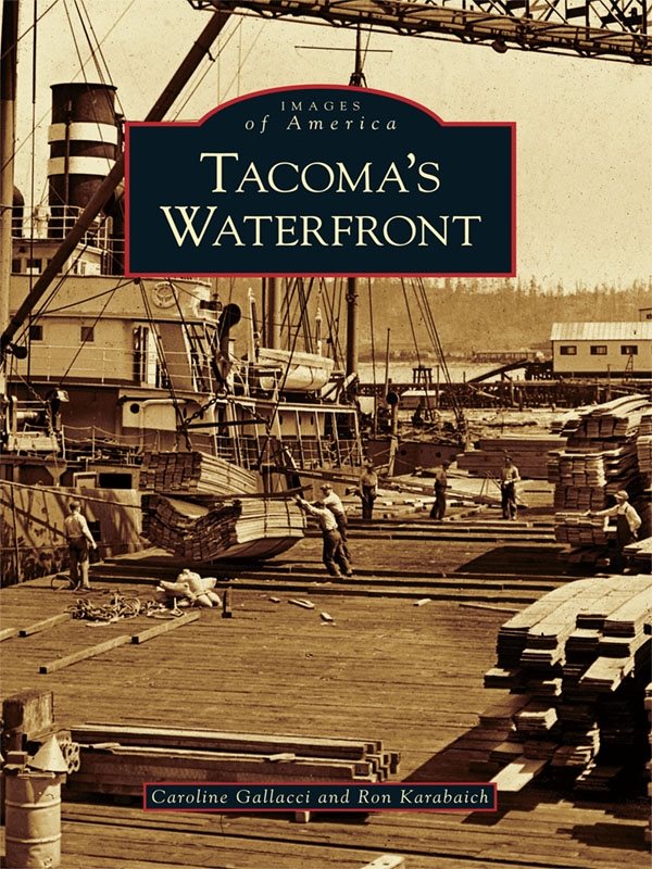
- Book:Tacomas Waterfront
- Author:
- Publisher:Arcadia Publishing Inc.
- Genre:
- Year:2006
- Rating:4 / 5
- Favourites:Add to favourites
- Your mark:
Tacomas Waterfront: summary, description and annotation
We offer to read an annotation, description, summary or preface (depends on what the author of the book "Tacomas Waterfront" wrote himself). If you haven't found the necessary information about the book — write in the comments, we will try to find it.
Caroline Gallacci: author's other books
Who wrote Tacomas Waterfront? Find out the surname, the name of the author of the book and a list of all author's works by series.

Tacomas Waterfront — read online for free the complete book (whole text) full work
Below is the text of the book, divided by pages. System saving the place of the last page read, allows you to conveniently read the book "Tacomas Waterfront" online for free, without having to search again every time where you left off. Put a bookmark, and you can go to the page where you finished reading at any time.
Font size:
Interval:
Bookmark:

Without the Tacoma Public Library Northwest Rooms photograph collections, this history would not have been written. Through the glories of its Web site, it is possible to roam through thousands of images, complete with the historical background needed to detail the rather complex history of the Port of Tacoma. Space requirements for this history do now allow a complete numerical reference for the photographs provided by the library. These are in both the authors and the Tacoma Public Library files. In addition to the librarys resources, the collections of coauthor Ron Karabaich, Thomas R. Stenger, and Jim Frederickson were equally valuable. Rons photographs and Toms extensive collection of Thomas H. Rutter images form a second major part of this waterfront history. Jim has spent all of his long life photographing and writing the history of local railroads.
As a historian who can never remember dates, Caroline Gallacci found her chronology in The City of Destiny and the South Sound (2001) useful in capturing those pesky numbers. To Live in Dignity: Pierce County Labor, 18831989 , compiled by the Pierce County Labor Centennial Committee in 1989, is a valuable resource on the maritime and industrial Unions. Murray Morgans Pugets Sound: A Narrative History of Early Tacoma and the Southern Sound (1979) and Thomas Emerson Riplys Green Timber (1968) are both useful guides to Tacomas past.
Ronald Magden and A. D. Martinson in The Working Waterfront: The Story of Tacomas Ships and Men (1982) provide the bestand onlyhistory of Tacomas industrial port. As the historians historian, Dr. Magden will always be our inspiration, and for that reason we dedicate this book to him.
Find more books like this at
www.imagesofamerica.com
Search for your hometown history, your old
stomping grounds, and even your favorite sports team.
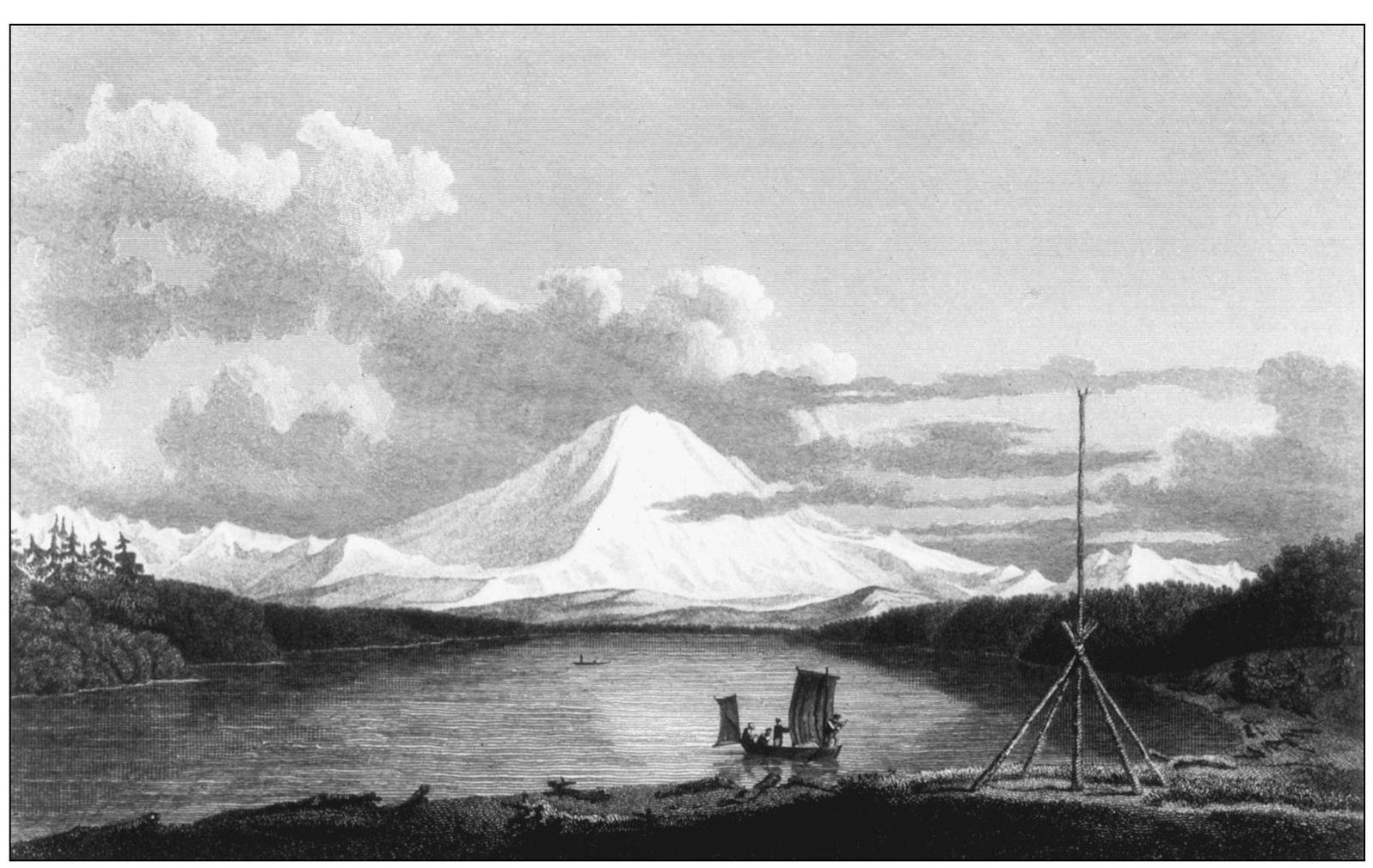
In the spring of 1792, Englands George Vancouver entered what he named Puget Sound as a part of his quest to find the Northwest Passage. During this voyage, he recorded abandoned villages and met Native Americans who displayed the characteristic scars of smallpox. Clearly white mans diseases had arrived before the first inland traders. Vancouver joined some of the survivors for a salmon lunch on a sandy beach now known as Browns Point and asked the locals about the large body of water that seemed to extend to the foothills of the mountain Vancouver named Mount Rainier. One native held Up a hand indicating that it was a bay with many inlets. Not trusting the Native Americans intelligence, the Englishman explored the bay, determined to his satisfaction that it was not the Northwest Passage, and sailed away. Vancouver was so Uninterested in the body of water that he left it without a European name or did not sketch it. John Sykes drew this mountain view from Admiralty Inlet.
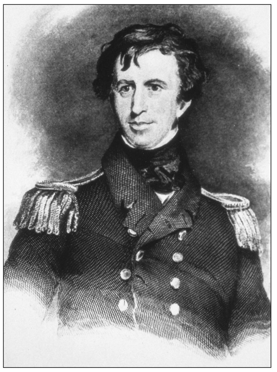
Charles Wilkes and his crew were the first Americans to explore Puget Sound, and it was because of his efforts that the region became part of the United States. He arrived here in 1841, established an observation post overlooking Puget Sound, and sent his crews inland to explore land not seen by Americans since Lewis and Clarks brief visit in 1805.
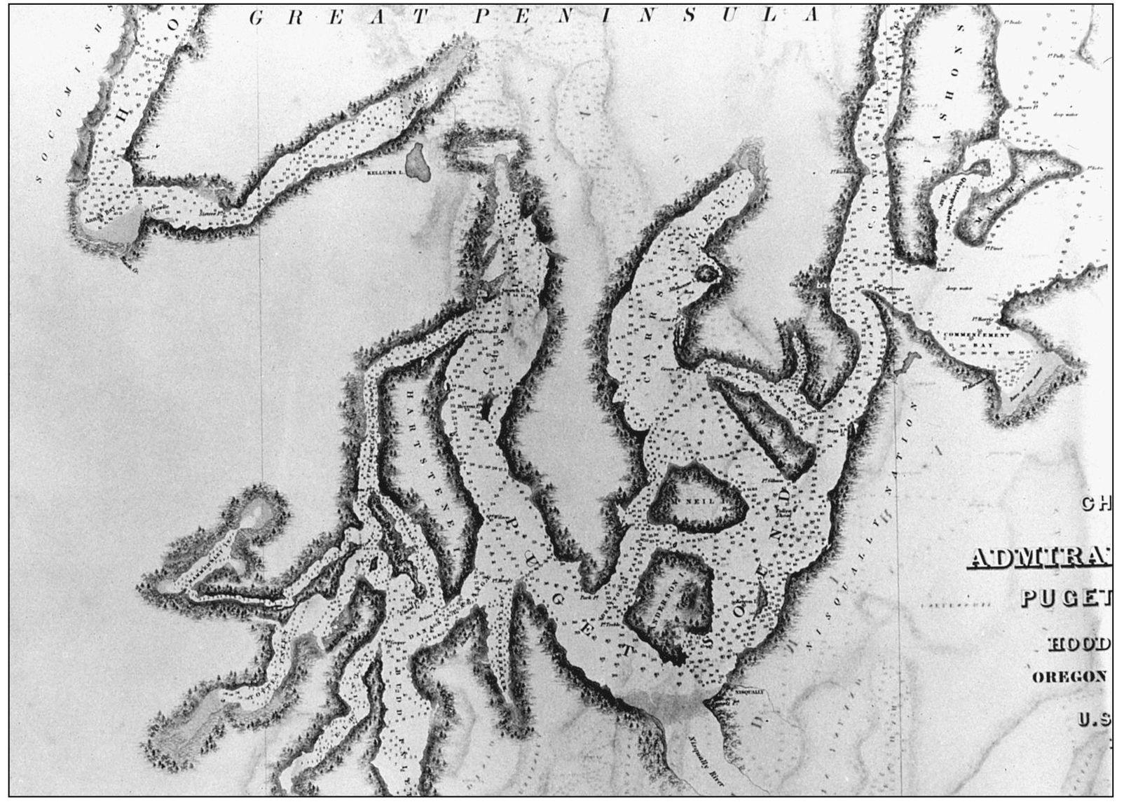
Wilkes also named geographical features neglected by George Vancouver, places such as Anderson and McNeil Islands, and Point Defiance. Even more importantly, he named Commencement Bay. This body of water that has been so crucial to Tacomas history was where Wilkes started his survey of the Pacific Northwest. Commencement Bay is pictured in the Upper right of this map.
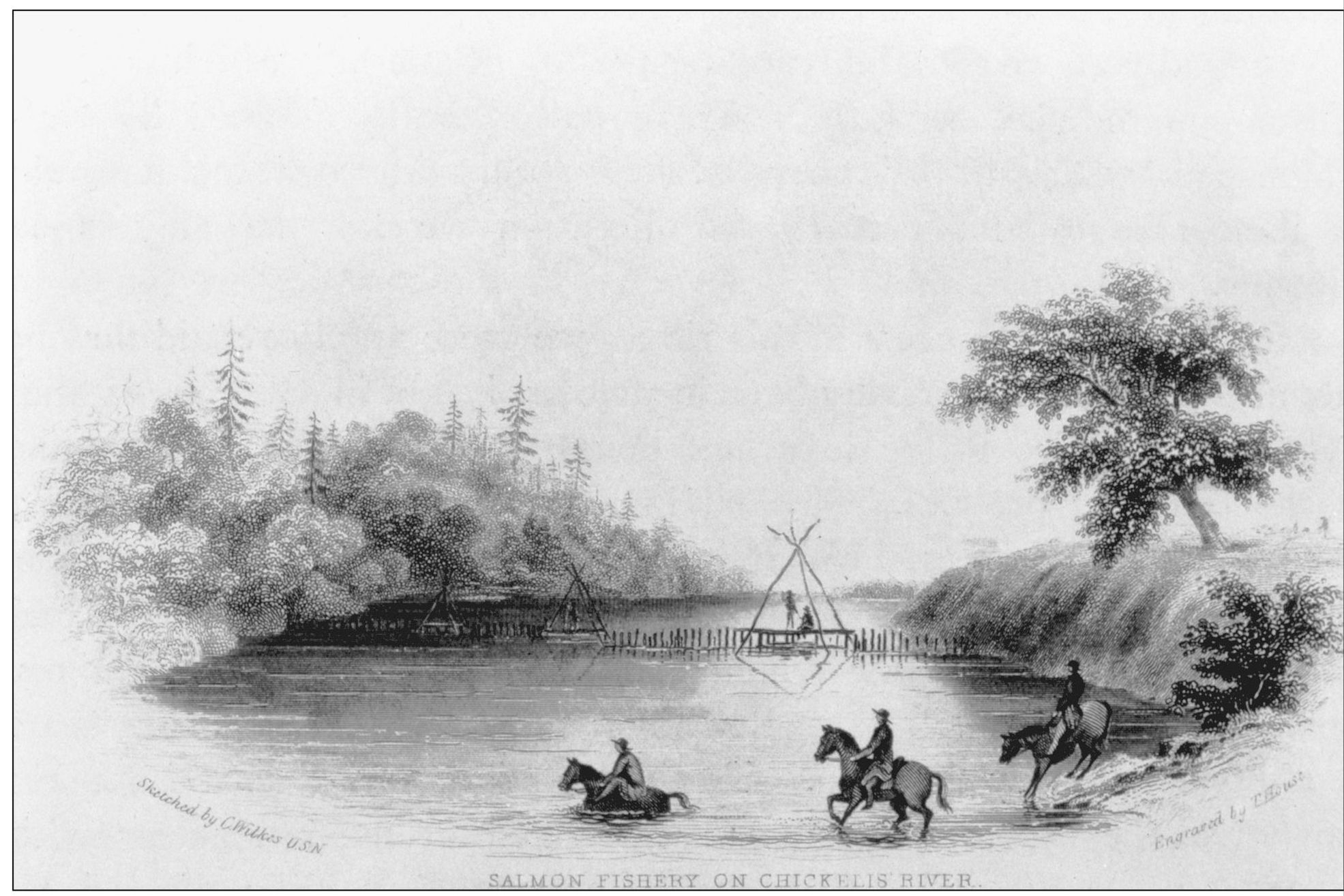
Wilkes, like explorers before him, was inclined to view the Native Americans as a part of the wilderness rather than a people with a distinct culture. Around Commencement Bay, the Puyallup Indians lived near ancient fisheries and hunting grounds. Every river and stream had sites for villages at locations so advantageous that American settlers recycled them into towns and cities. Wilkes did however document significant aspects of Native American life, including this view of early river fishing. The sketch depicts Native Americans on the Chehalis River south of Pierce County, but the Puyallup Indians probably Used the same fishing techniques Upstream from the Commencement Bay delta. Early maps show their salmon fishing locations in the bay, and ethnologists have identified village sites in what is now Tacomas central business district. Sacred and burial sites existed where todays I-705 meets Schuster Parkway. The future site of the Tacoma Smelter was also a Native American burial site.
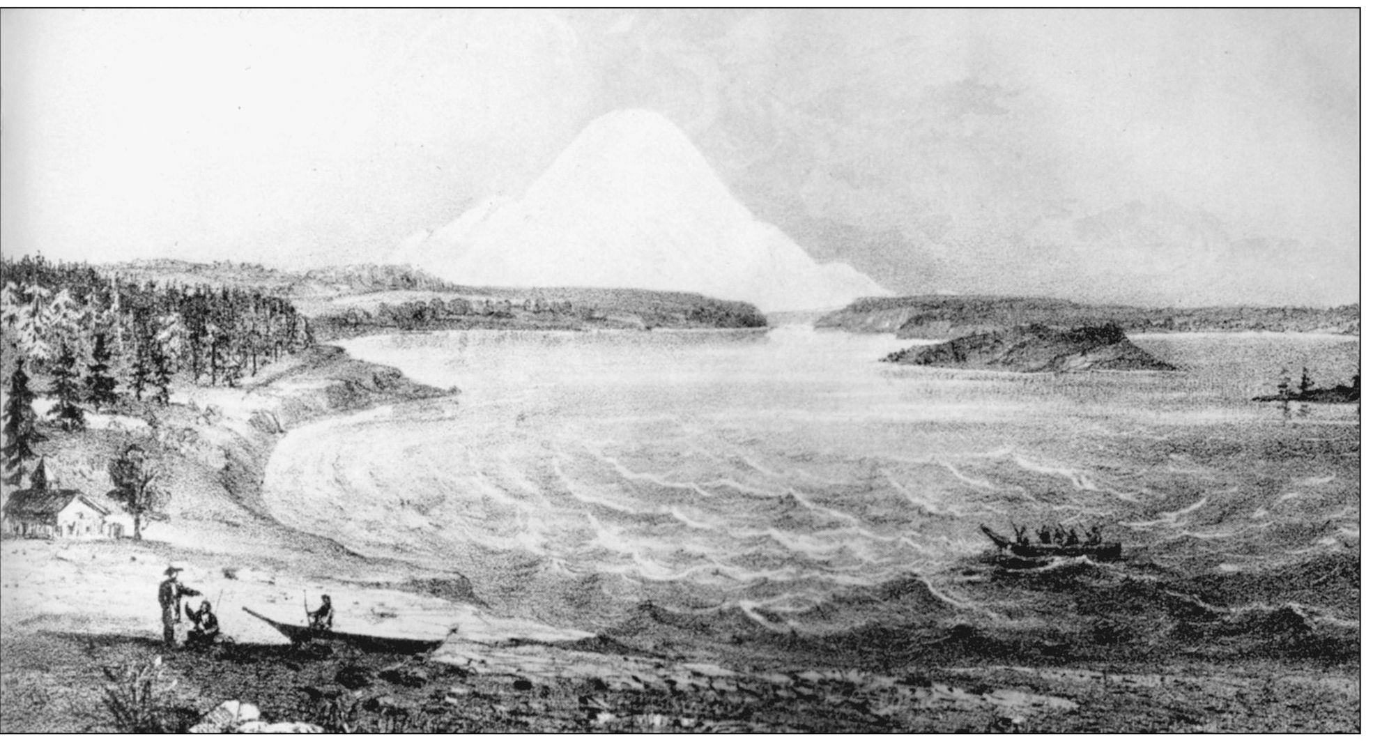
By 1853, Washington was a territory, and a new county named to honor Pres. Franklin Pierce had been formed with Commencement Bay its northern boundary. Congress appointed Isaac I. Stevens both territorial governor and superintendent of Indian affairs. He was also to lead a survey expedition to locate a possible northern route for a tr\anscontinental railroad. Like the explorers who came before, Stevens had his artists along to portray the landscape, in this case a view of Mount Rainier from Whidbey Island. Stevens was also to establish treaties with the Native Americans and to create federal reserves where the Indians would live and be taught the American way of life. There were wars, massacres, and lynchings because of Stevenss treaties, with some tribes Unwilling to sign and others dissatisfied over reservation land that deprived them of their cultural heritage. The Puyallup Tribe was able to renegotiate its treaty to create a reservation that included Commencement Bay land within the delta and along the north shore.
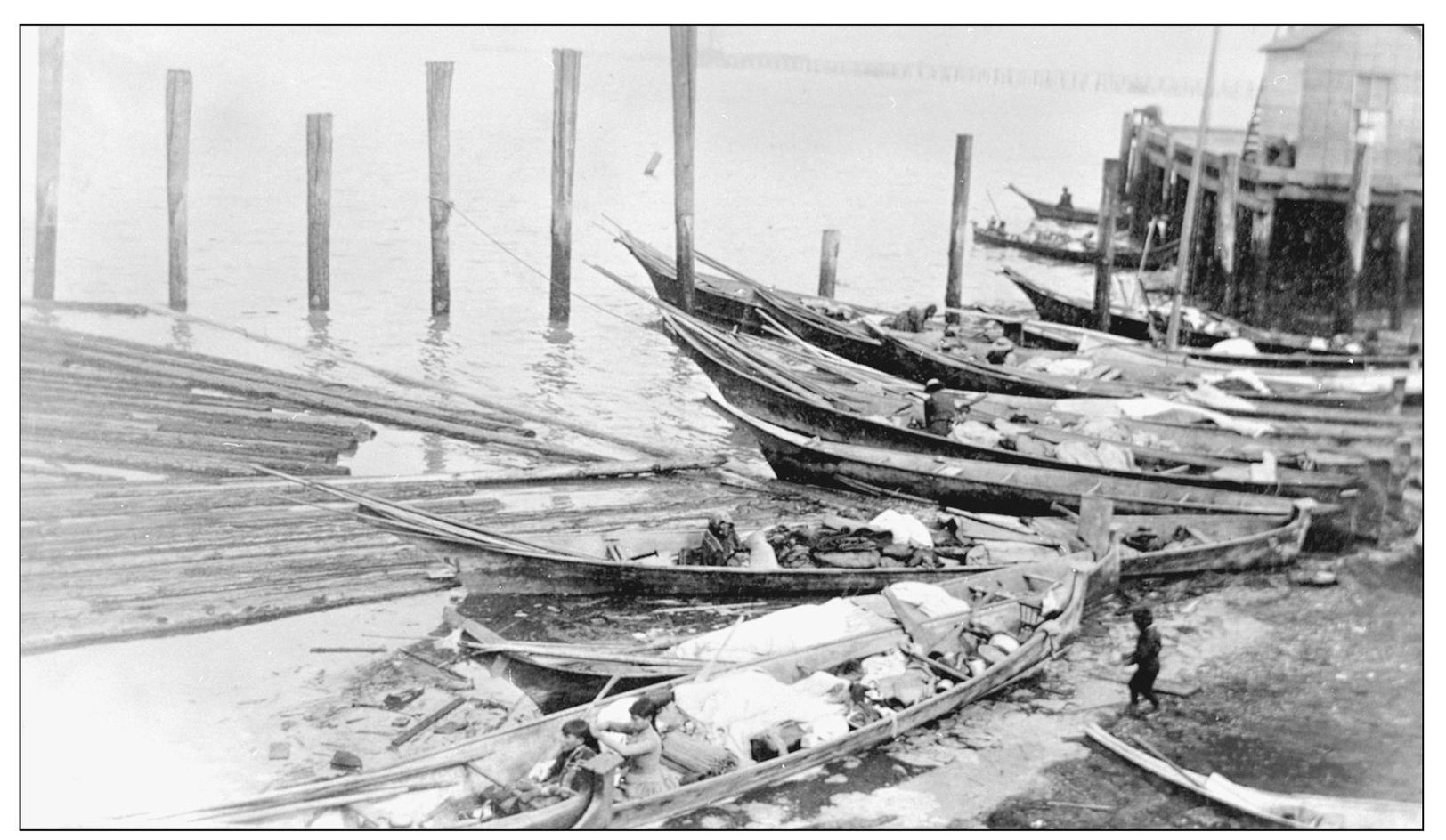
The treaties allowed the Puyallup Indians to Use their historic fishing places located outside reservation land, and it was not Uncommon to find canoes and native fishermen gathered along Tacomas waterfront during the early years. The site for this 1890 photograph is Unknown, although it might be the shoreline near present-day Fifteenth Street, a known location for a major Puyallup Indian village.
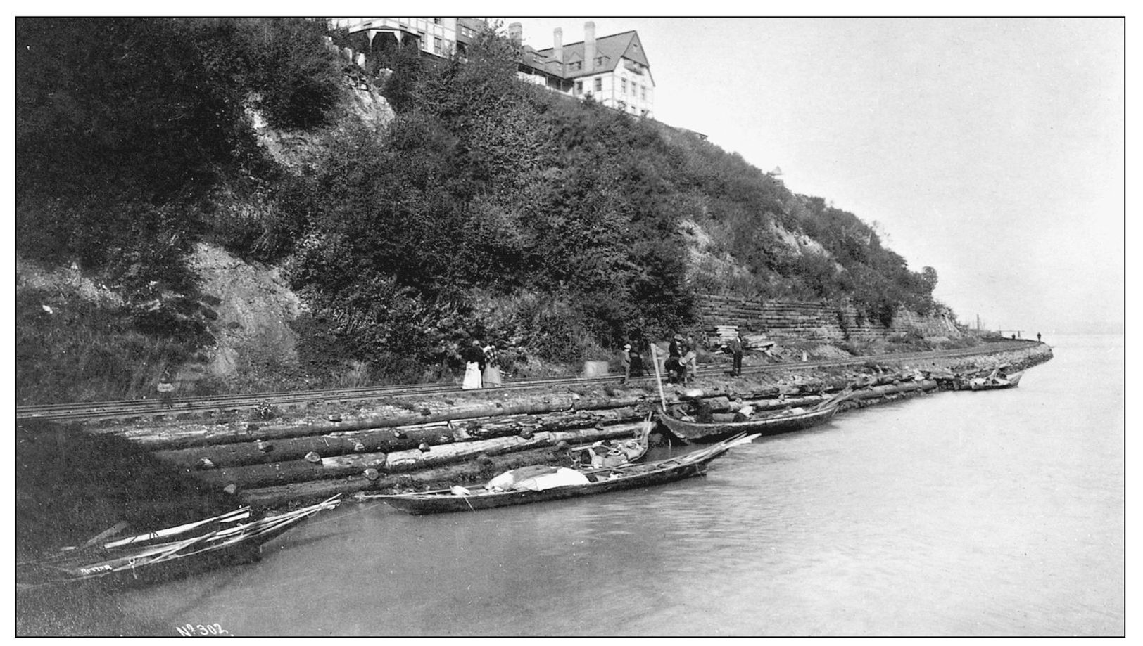
Native American gatherings along the Tacoma shoreline continued for years following the citys founding, always serving as a reminder as to who was here first. Early Tacoma photographer Arthur French captured this unique combination of past and present sometime during the latter years of the 19th century. Ladies and Native Americans pose by the Northern Pacific Railroad tracks. Perched atop the wooded bank is the Tacoma Hotel, completed in 1884.
Font size:
Interval:
Bookmark:
Similar books «Tacomas Waterfront»
Look at similar books to Tacomas Waterfront. We have selected literature similar in name and meaning in the hope of providing readers with more options to find new, interesting, not yet read works.
Discussion, reviews of the book Tacomas Waterfront and just readers' own opinions. Leave your comments, write what you think about the work, its meaning or the main characters. Specify what exactly you liked and what you didn't like, and why you think so.