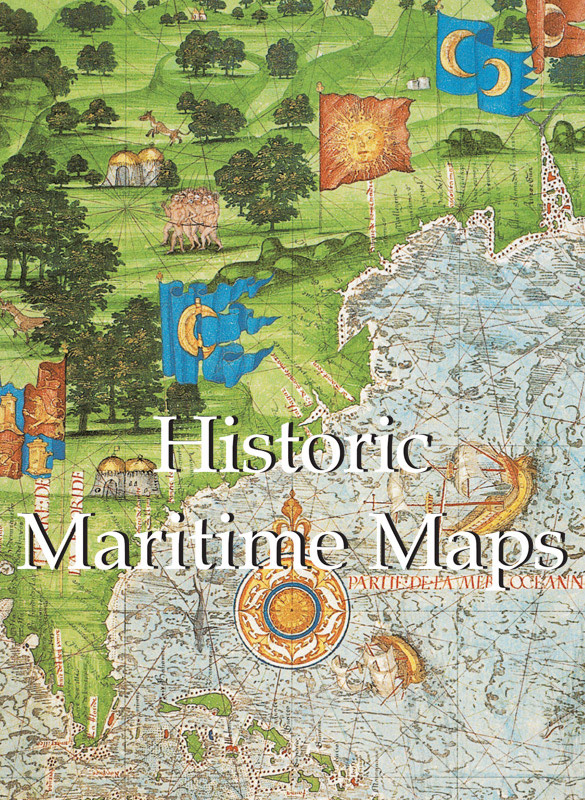
Donald Wigal - Historic Maritime Maps Used for Historic Exploration, 1290–1699
Here you can read online Donald Wigal - Historic Maritime Maps Used for Historic Exploration, 1290–1699 full text of the book (entire story) in english for free. Download pdf and epub, get meaning, cover and reviews about this ebook. City: New York, year: 2000, publisher: Parkstone, genre: History. Description of the work, (preface) as well as reviews are available. Best literature library LitArk.com created for fans of good reading and offers a wide selection of genres:
Romance novel
Science fiction
Adventure
Detective
Science
History
Home and family
Prose
Art
Politics
Computer
Non-fiction
Religion
Business
Children
Humor
Choose a favorite category and find really read worthwhile books. Enjoy immersion in the world of imagination, feel the emotions of the characters or learn something new for yourself, make an fascinating discovery.
- Book:Historic Maritime Maps Used for Historic Exploration, 1290–1699
- Author:
- Publisher:Parkstone
- Genre:
- Year:2000
- City:New York
- Rating:3 / 5
- Favourites:Add to favourites
- Your mark:
Historic Maritime Maps Used for Historic Exploration, 1290–1699: summary, description and annotation
We offer to read an annotation, description, summary or preface (depends on what the author of the book "Historic Maritime Maps Used for Historic Exploration, 1290–1699" wrote himself). If you haven't found the necessary information about the book — write in the comments, we will try to find it.
Donald Wigal: author's other books
Who wrote Historic Maritime Maps Used for Historic Exploration, 1290–1699? Find out the surname, the name of the author of the book and a list of all author's works by series.


Historic Maritime Maps Used for Historic Exploration, 1290–1699 — read online for free the complete book (whole text) full work
Below is the text of the book, divided by pages. System saving the place of the last page read, allows you to conveniently read the book "Historic Maritime Maps Used for Historic Exploration, 1290–1699" online for free, without having to search again every time where you left off. Put a bookmark, and you can go to the page where you finished reading at any time.
Font size:
Interval:
Bookmark:
Author: Donald Wigal
Layout:
Baseline Co Ltd
61A-63A Vo Van Tan Street
th floor
District 3, Ho Chi Minh City
Vietnam
Parkstone Press International, New York, USA
Confidential Concepts, Worldwide, USA
All rights reserved
No part of this publication may be reproduced or adapted without the permission of the copyright holder, throughout the world. Unless otherwise specified, copyrights on the works reproduced lies with the respective photographers. Despite intensive research, it has not always been possible to establish copyright ownership. Where this is the case we would appreciate notification
ISBN: 978-1-78160-855-5
God said, Let the waters under heaven come together into a single mass, and let dry land appear. And so it was.
God called the dry land earth and the mass of waters seas, and God saw that it was good.
Genesis 1: 9-10 (10 th century B.C)
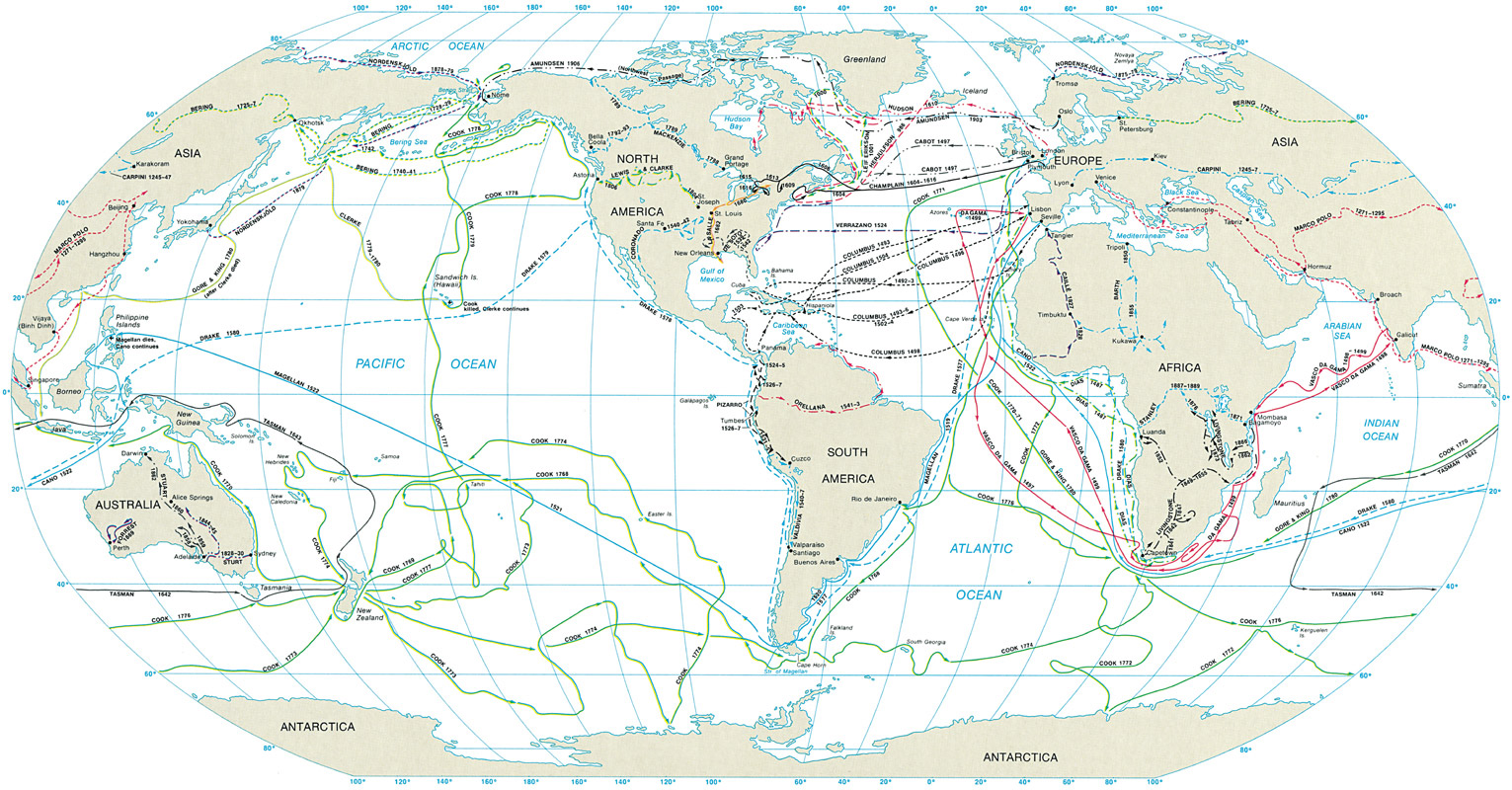
Map of the most principal maritime explorations
About 981: The Viking, Eric the Red, discovers Greenland.
About 1000: Leif Ericsson, nephew of Eric the Red, discovers Vinland, later to be known as North America.
1271-95: Journeys of the Venetian, Marco Polo, in China.
1434: Gil Eanes, from Portugal, crosses Cape Bojador (The North West Coast of Africa, just south of the Canary Islands).
1427: The Portuguese discover the Azores.
1489: Bartholomeu Dias, from Portugal, becomes the first European to cross the Cape of Good Hope successfully.
1492: Christopher Columbus, from Spain, discovers America.
1497: Jean Cabot, from Italy, lands on the coast of North America, in a place that will be later called the New Land.
1497: Vasco da Gama, from Portugal, returns to India by sea, passing by the Cape of Good Hope.
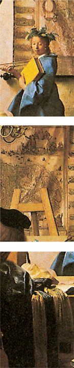
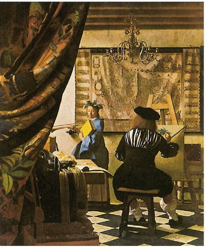
| M aps, even those dating from centuries ago, constantly influence our daily lives. They are one of the things which are part of our daily environment. Throughout history, besides having a utilitarian function, every single map symbolizes the period of time in which it was created. We are often reminded of the romance of antique maritime maps as we see them displayed in museums, or reproductions of them framed on the walls of private houses or institutions. In a Vermeer painting a map may be seen telling a story-within-a-story. In plays and films maps typically set the period. |
The Artist s Studio Johannes Vermeer van Delft (1632-1675), c. 1665 Oil on canvas, 120 x 100 cm Kunsthistorisches Museum, Vienna |
| In fiction they may be called on to remind the reader of a world beyond the story s setting (in Herman Melville s Moby Dick, for example). Each map is, therefore, a priceless snapshot in the on-going album of human kind. This is especially true with antique maps where we can see the world through the eyes of our forebears. While the map maker s vision might later prove to be inadequate, or even incorrect, the unique truth is that his map expresses a story that might not be revealed in any other way. It may well be said that each map maker has effectively traveled in his mind vicariously not only to the envisioned places, but also to the future. |
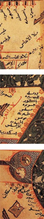
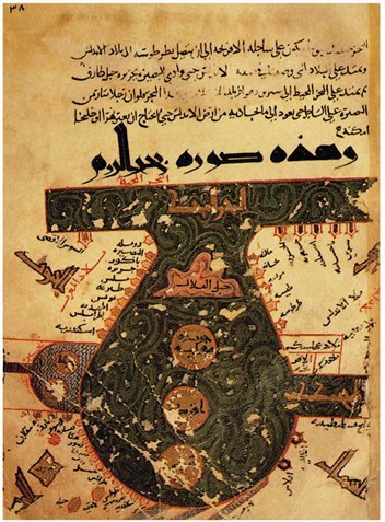
Arab map featuring Arabia as the centre of the world Al-Istakhri th century ational Library, Cairo |
| One such visionary monk was the th century map maker, Fra Mauro. He was certainly responsible for bringing to light the work of several other map makers. In doing so he helped make the transition from the Dark Ages to the beginning of the modern era (c. 1450). Mauro was part of the generation that was at work during the very focus of these significant times, over thirty years before the famous voyage of Christopher Columbus to the New World in 1492. |
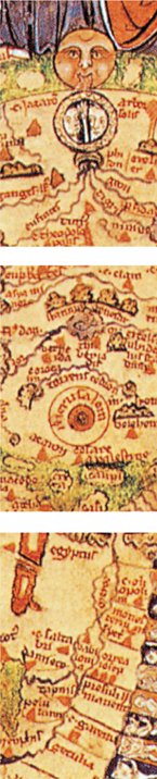
World Map after 1262 in Psalter Map Manuscript, Lon don, Ms-Add 28681 British Library, London |
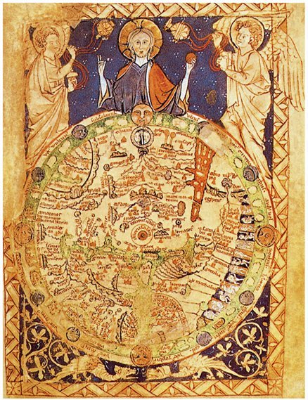
| Mauro probably went largely unnoticed in his monastery on an island within the Laguna Veneta (the lagoon that surrounds Venice). But his new map was destined to demand attention. It was large and round which was unusual almost two metres (six feet) in diameter, yet still very definitely a map and not a global representation. Most of all, he no longer showed Jerusalem as the center of the world. For the Asian part of the map Mauro took his data from the writings of Marco Polo. The rest was based on Ptolemy, or his own contemporary sea-faring charts. Mauro s extraordinary work was completed in 1459. |
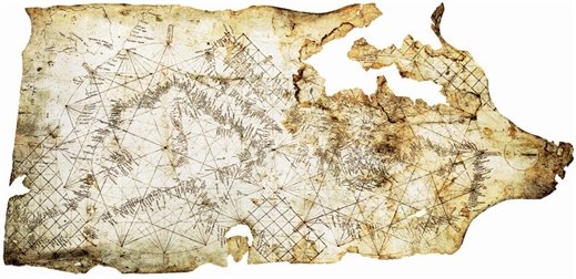
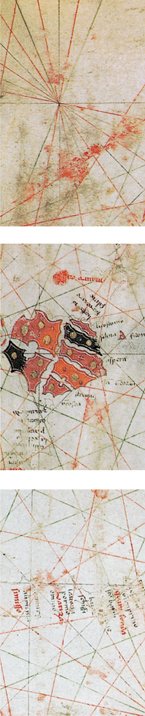
The Pisana map Unknown Artist, 1290 Parchment, x cm Bibliothque nationale de France, Paris |
| Also in transition was the Earth itself, as after all, its surface was being discovered . Its face was also becoming more clearly defined with each new exploration and subsequent map revision. Just twenty years before Mauro s map as if anticipating the need to get such priceless information to the world Gutenberg (1400-1468) developed his revolutionary printing press. The first printed map in 1477 followed the first printed Bible in 1440. Both were documents that would support, in very distinct ways, the emergence of international humanism. |
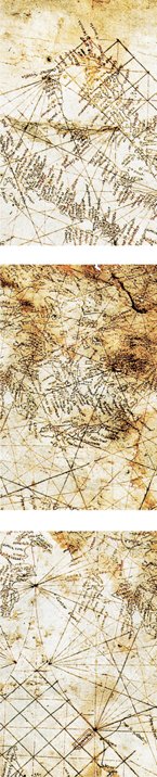
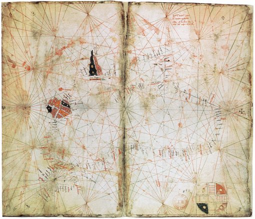
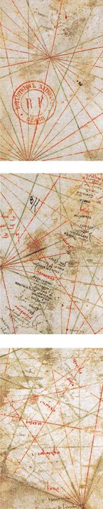
Atlas (Black Sea) Petrus Vesconte, 1313 Parchment, x cm Bibliothque nationale de France, Paris |
|
Font size:
Interval:
Bookmark:
Similar books «Historic Maritime Maps Used for Historic Exploration, 1290–1699»
Look at similar books to Historic Maritime Maps Used for Historic Exploration, 1290–1699. We have selected literature similar in name and meaning in the hope of providing readers with more options to find new, interesting, not yet read works.
Discussion, reviews of the book Historic Maritime Maps Used for Historic Exploration, 1290–1699 and just readers' own opinions. Leave your comments, write what you think about the work, its meaning or the main characters. Specify what exactly you liked and what you didn't like, and why you think so.