The Early Air War in the Pacific
Ten Months That Changed the Course of World War II
RALPH F. WETTERHAHN

McFarland & Company, Inc., Publishers
Jefferson, North Carolina
LIBRARY OF CONGRESS CATALOGUING DATA ARE AVAILABLE
BRITISH LIBRARY CATALOGUING DATA ARE AVAILABLE
e-ISBN: 978-1-4766-3108-0
2020 Ralph F. Wetterhahn. All rights reserved
No part of this book may be reproduced or transmitted in any form or by any means, electronic or mechanical, including photocopying or recording, or by any information storage and retrieval system, without permission in writing from the publisher.
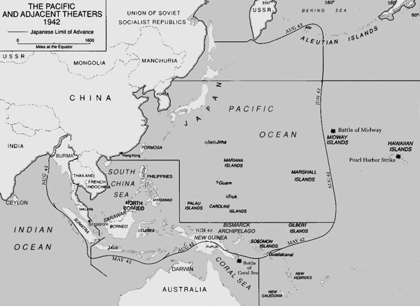
Front cover: (foreground) Japanese Nakajima B5N2 torpedo bomber (U.S. Navy); (background) 1942 map of Pacific Ocean areas (U.S. Army Center of Military History)
McFarland & Company, Inc., Publishers
Box 611, Jefferson, North Carolina 28640
www.mcfarlandpub.com
Acknowledgments
I want to thank all those who helped make this book possible. Of special note are aviation historical expert Bill Evans and Anna Grzeszkiewicz for assistance in research. Also thanks to Wescott and Elizabeth Stone, Spike Nasmyth, Kevin Hamdorf, Ryan Bach, Heather and Brad Blythe, Karl Weltke, and guides Jesse Mendosa, Eric Flores and Jon Mar Benito for their tenacity and help on the Philippine expeditions. On Guadalcanal thanks goes to film director Michael Barnes, sound man Duncan Drummond, and photographer Larry Quesnel, and guide Edilon Gii. The aircraft artwork and maps were done by my son Michael Wetterhahn, professional animator. Finally, thanks to my wife Carol for her boundless support.
Also included is editor Gary Mitchem and those at McFarland who worked on the project.
1
Warhawk and Nate Down, Mariveles Volcano, Bataan Peninsula, Philippines
In the barracks, he always slept in a cot next to mine. Ever since that day, the cot was empty and I miss him a lot.Corporal Satoshi Anabuki, Imperial Japanese Army pilot commenting on his absent friend, Sergeant Toshisada Kurosawa
A cloud layer obscured the rim of Mariveles Volcano at mid-afternoon on February 9, 1942. Scant feet above the dense jungle that enveloped the volcano, two fighters engaged in a heart pounding, high-G slugfest with machine guns blazing. One, a Ki-27 Nate, was flown by Sergeant Toshisada Kurosawa of the Imperial Japanese Army, and the other was an American P-40 Warhawk, piloted by Lieutenant Earl R. Stone.
Beneath the volcano on the southern end of the Bataan Peninsula, thousands of Americas so-called Battling Bastards of Bataan watched what to them was like a Hollywood special as Lieutenant Stone tried to notch his fourth kill of the war. The Americans, their motto No Mama, No Papa, No Uncle Sam, had believed themselves written off by Washington in their fight against the Japanese invaders, yet with gusto they now urged on one of their own.
The two planes circled, popping in and out of the thin cloud layer that blanketed the peak. They traded shots until finally the Nate, its engine damaged, came screaming out of the mist trailing white smoke. Into the clouds they went, only to reappear, but who was now in front? Red tracers arced across the sky as both aircraft approached Cogon Tarac, a spiny ridge that jutted from the side of the volcano. The planes disappeared into the murk, and the sound of gunfire and roaring engines abruptly stopped.
Reports were turned in to General MacArthurs headquarters on Corregidor. One message suggested the two aircraft might have collided in the clouds. When the American pilot failed to return to his base, a search party went to investigate. They found the wreckage of the Nate and claimed they could see, but not reach, the wreckage of the Warhawk higher up on the ridge. Two American soldiers later reported that they came upon the American pilots crash site while fleeing the Japanese after the surrender of Bataan in 1942. They buried the pilots remains and indicated the wreck was high on the mountain. A return trip was made after the war, but when searchers gained access to the area described by the earlier team and the two soldiers, a landslide appeared to have covered the P-40 wreckage and the search was aborted.
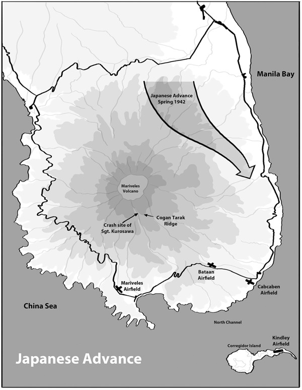
Mariveles Volcano, Bataan Peninsula, Philippines. Depiction shows the location of the crash site of the aircraft flown by Sgt. Kurosawa (map by author).
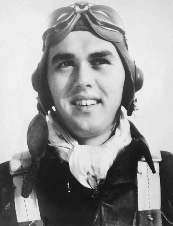
Second Lieutenant Earl Stone in 1942. He logged three aerial victories before his fatal flight on February 9, 1942 (courtesy Wes Stone family).
February 7, 2008, Mariveles Volcano, Bataan
A six-hour climb had preceded a short descent with two Aeta tribesmen to examine the Japanese Ki-27 Nate crash site. Two hours later, exhausted, my 65-year-old legs were cramping from the strain of hanging on for dear life at the impact site beneath Cogon Tarac Ridge. We eventually pulled and shoved our way up a rocky outcropping to our campsite. As the aviation archaeologist in our search team, I and my two helpers rejoined ten Aeta tribesmen, an Australian photographer, and four American aviation buffs.
These other team members, intent on finding the missing P-40 Warhawk, had arrived during our abbreviated search. Hammocks and tents were scattered along the narrow crest of the windswept ridge. Moving about took some care. I found the only flat area remaining and began assembling my one-man tent. My left leg began to cramp from dehydration, the pain intense along the sartorius muscle of my inner thigh. I chugged water and did some stretching until the muscle relaxed, then took my time finishing the tent job.
As darkness descended, I cleaned up the area, slid inside my solitary accommodations, and stretched out atop my sleeping bag. A good nights sleep would have been welcome, but gale-force winds bowed the tent sides, and the thrashing of overhanging foliage became unnerving. After several minutes elapsed, I sat up and tried to slip my legs inside the sleeping bag. The cramping returned with a vengeance, now involving both legs. I lay there in agonizing pain, unable to reach my water bottle, unable to sit up.
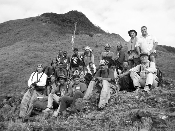
Photograph of first expedition team including 16 Aeta guides and porters, plus four-man search team. Author is on far right, seated.
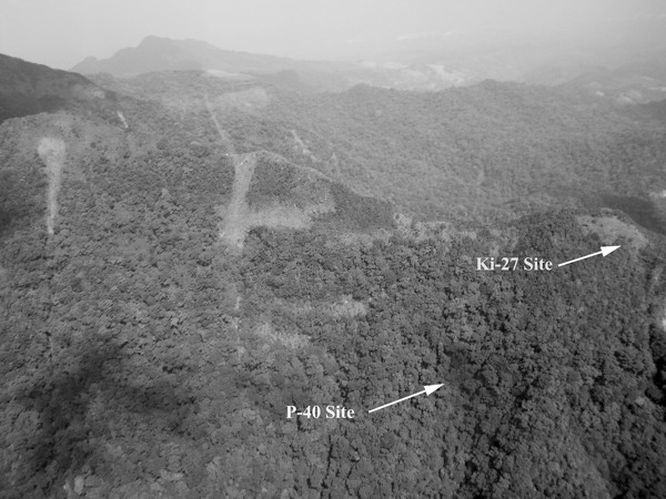
Cogon Tarac Ridge. The camp site for the first expedition was among the trees just above the Ki-27 crash site on the narrow spine of the ridge. The steepness of the terrain is apparent and was a constant safety issue (author photographs).
Next page
