Living off the Land
Agriculture in Wales c. 4001600 AD
Edited by
Rhiannon Comeau and Andy Seaman
Windgather Press is an imprint of Oxbow Books
Published in the United Kingdom in 2019 by
OXBOW BOOKS
The Old Music Hall, 106-108 Cowley Road, Oxford, OX4 1JE
and in the United States by
OXBOW BOOKS
1950 Lawrence Road, Havertown, PA 19083
Windgather Press and the individual contributors 2019
Paperback Edition: ISBN 978-1-91118-839-1
Digital Edition: ISBN 978-1-91118-840-7 (epub)
Kindle Edition: ISBN 978-1-91118-841-4 (mobi)
A CIP record for this book is available from the British Library
All rights reserved. No part of this book may be reproduced or transmitted in any form or by any means, electronic or mechanical including photocopying, recording or by any information storage and retrieval system, without permission from the publisher in writing.
For a complete list of Windgather titles, please contact:
| United Kingdom | United States of America |
| OXBOW BOOKS | OXBOW BOOKS |
| Telephone (01865) 241249 | Telephone (610) 853-9131, Fax (610) 853-9146 |
| Email: | Email: |
| www.oxbowbooks.com | www.casemateacademic.com/oxbow |
Oxbow Books is part of the Casemate group
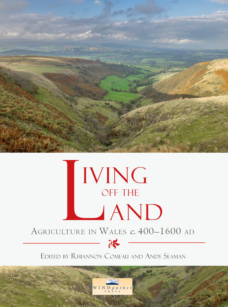
Front cover photograph: Cwm Graig-ddu on the northern edge of the Epynt ( Peter Seaman).
Back cover photograph: Llangorse Lake and Llangasty-Talyllyn ( Peter Seaman).
Contents
Acknowledgements
The publication of this book has been made possible by grants from the Marc Fitch Fund and from the Scouloudi Foundation in association with the Institute of Historical Research. Many individuals also helped in the production of this book. The conference from which most of the chapters derive was held in the School of History, Archaeology and Religion at Cardiff University, and the editors would like to thank Susan Virgo, Alan Lane and particularly Ben Jervis for their support in organising the event. The sessions were chaired by Stuart Wrathmell, Andrew Fleming, and Nancy Edwards. We are grateful for their insightful comments and discussion. We must also thank the individual authors and the team at Oxbow for their patience, goodwill, and speed in answering queries. Sara Elin Roberts provided advice on the Glossary. Finally, we dedicate this book to Wendy Davies and Heather James, two scholars whose profound influences on medieval Wales (and beyond) are attested throughout its pages.
Rhiannon Comeau and Andy Seaman
List of figures
Figure 2.1 Data sets indicative of regional variation in landscape character in the Roman and medieval periods.
Figure 2.2 The percentage of Total Land Pollen from trees and shrubs in the Roman and early medieval periods.
Figure 2.3 Compiled palaeoclimatic proxies for the first millennium AD.
Figure 2.4 The extent to which excavated Romano-British field boundaries across the different regions share the same orientation and/or alignment as historic landscapes characterised by former medieval open fields or closes.
Figure 2.5 Two Romano-British landscapes on very similar orientations to historic landscapes whose character is suggestive of a medieval date: Crickhowell Road and Trowbridge Road in Trowbridge, near Cardiff, on the edge of the Wentlooge Level.
Figure 2.6 Romano-British features on a very similar orientation to the historic landscape at Upper Neeston in Herbrandston in Pembrokeshire.
Figure 3.1 Territorial links in the Anglo-Saxon West Midlands: estate linkages for resource management.
Figure 3.2 Links to Wealden dens.
Figure 3.3 Warwickshire drove-ways and folk groupings.
Figure 3.4 Ardudwy and Meirionnydd showing transhumance links.
Figure 3.5 Llanaber historical land use; arable, meadow, and hafodydd in Llanaber: the field-name evidence.
Figure 3.6a and b Medieval hafodydd sites in Llanaber. Figure 3.7a Long huts above Egryn, Llanaber.
Figure 3.7b Former lodging/dairy house site: Buarth Lluist above Hendre Mynach, Llanaber.
Figure 3.8a Medieval site cut by later field wall. Figure 3.8b A nineteenth-century enclosure wall.
Figure 4.1 Order of cereal types in the eighth-century Irish law tract Bretha Din Chcht , reflecting the relative prestige of each cereal.
Figure 4.2 Distribution map of examined early medieval sites producing archaeobotanical evidence (total sites n=60).
Figure 4.3 Relative occurrence of crop types (total phases of activity n=165).
Figure 4.4 Relative dominance of cereal types (total phases of activity n=79).
Figure 4.5a Distribution map of examined early medieval sites producing zooarchaeological remains (total sites n=115). viii List of figures
Figure 4.5b Distribution of early medieval sites with zooarchaeological remains in Meath/Dublin region.
Figure 4.5c Distribution of early medieval sites with zooarchaeological remains in Galway/Clare region.
Figure 4.6 Minimum numbers of individuals (MNI) percentages for sites where MNI total is >40.
Figure 4.7 Percentages of cattle, sheep, and pig by grade of farmer, according to Crth Gablach .
Figure 6.1 Field systems in north Wales: significant sites mentioned in the text.
Figure 6.2 Ridge and furrow cultivation near Pickhill Hall, Wrexham Maelor.
Figure 6.3 Distribution of Welsh open field cultivation and re-used prehistoric field systems in north-west Wales.
Figure 6.4 Cultivation ridges on the Great Orme above Llandudno.
Figure 6.5 Strip fields associated with a single house site on Ffridd Camen on the western edge of Y Berwyn.
Figure 7.1 The layout and land-use of the farm in 1765.
Figure 7.2 The gentry arrangements from the 1765 map.
Figure 8.1 The medieval cantref and lordship of Cemais, showing case study areas and key locations mentioned in text.
Figure 8.2 Infield-outfield, transhumance and settlement patterns in medieval south Wales.
Figure 8.3 Patterns of pasture rights in medieval Cemais. The numbered hafod sites are named in the text.
Figure 8.4 The northern Preseli hills seen from the Nevern valley. The farmland of Eglwyswen/Whitchurch and Llanfair Nantgwyn is to the left. Hafod Tydfil is the small tree-lined area on the moorland to the right of centre; Carn Goedog is above it.
Figure 8.5 Remains of hafotai at Carn Goedog, looking north over the Nevern valley.
Figure 9.1 The historic county of Brecknock (not including the hundred of Builth) showing the comparatively fertile land between Sennybridge, Crickhowell and Glasbury that is likely to have formed the core of early medieval Brycheiniog.
Figure 9.2 Reconstruction of four uillae/trefi recorded in the Llandaff charters.
Figure 9.3 The early medieval estate at Llangors recorded in charter 146.
Figure 9.4 Section of Llywarch Hens Dyke, looking north. The open pastures of Mynydd Llangorse are to the right.
Figure 9.5 The early medieval estate at Llandeilor-fn recorded in charter 154.
Figure 10.1 Distribution map of pollen studies with detailed, well dated early medieval environmental sequences.
Figure 10.2a Palynological changes in Wales c . 400600 AD (woodland and wetland).
Figure 10.2b Palynological changes in Wales c . 400600 AD (pastoral and arable indicators).
Figure 10.3a Palynological changes in Wales c . 600800 AD (woodland and wetland).
Figure 10.3b Palynological changes in Wales c . 600800 AD (pastoral and arable indicators).


