The Age of Comfort: When Paris Discovered Casualand the
Modern Home Began
The Essence of Style: How the French Invented High Fashion,
Fine Food, Chic Cafs, Style, Sophistication, and Glamour
The Reinvention of Obscenity: Sex, Lies, and Tabloids
in Early Modern France
Ancients Against Moderns: Culture Wars and the Making
of a Fin de Sicle
Tender Geographies: Women and the Origins
of the Novel in France
Fictions of Sappho, 15461937

Copyright 2014 by Joan DeJean
Published by Bloomsbury USA, New York
Bloomsbury is a trademark of Bloomsbury Plc
All rights reserved.
You may not copy, distribute, transmit, reproduce, or otherwise make available this publication (or any part of it) in any form, or by any means (including without limitation electronic, digital, optical, mechanical, photocopying, printing, recording, or otherwise), without the prior written permission of the publisher. Any person who does any unauthorized act in relation to this publication may be liable to criminal prosecution and civil claims for damages. For information, write to Bloomsbury USA, 1385 Broadway, New York, New York, 10018.
LIBRARY OF CONGRESS CATALOGING-IN-PUBLICATION DATA
DeJean, Joan E.
How Paris became Paris : the invention of the modern city / Joan DeJean. First U.S. edition.
pages cm
Includes bibliographical references and index.
eISBN 978-1-62040-113-2
1. Paris (France)History17th century. 2. Paris (France)Description and travel. 3. Paris (France)Social life and customs17th century. 4. Paris (France)GuidebooksHistory17th century. 5. City planningFranceParisHistory17th century.
I. Title.
DC729.D39 2014
944'.361033dc23
2013031527
First U.S. Edition 2014
This electronic edition published in March 2014
Visit www.bloomsbury.com to find out more about our authors and their books
You will find extracts, author interviews, author events and you can sign up for newsletters to be the first to hear about our latest releases and special offers.
MORE PARISIAN HISTORY FROM JOAN DEJEAN
THE AGE OF COMFORT
When Paris Discovered Casualand the Modern Home Began
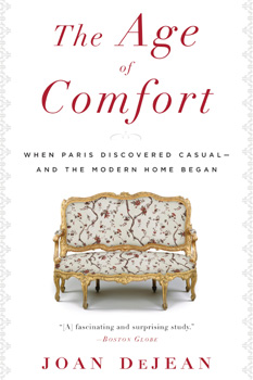
A New York Times Notable Book for Art and Architecture
A book that will surprise, amuse, and gently educate. In fact its just the thing to curl up with inwhat else?an easy chair. ElleDecor.com
It may seem strange to think of the sofa as an agent of cultural change. Yet The Age of Comfort... shows how it not only helped transform the way homes were designed but also struck a blow to longstanding norms of social order. The New York Times
Available everywhere in paperback and as an eBook.
Paperback ISBN: 978-1-60813-230-4
eISBN: 978-1-60813-135-2
www.bloomsbury.com
In memory of
Fannie DeJean Genin (19242012),
who never made it to Paris but would have loved it.
Contents
Capital of the Universe
The Bridge Where Paris Became Modern: The Pont Neuf
Light of the City of Light: The Place des Vosges
Enchanted Island: The le Saint-Louis
City of Revolution: The Fronde
The Open City: The Boulevards, Parks, and Streets of Paris
City of Speed and Light: City Services That Transformed Urban Life
Capitale de la Mode
City of Finance and New Wealth
City of Romance
Making the City Visible: Painting and Mapping the Transformation of Paris
This project began with paintings: the numerous views that depict the new monuments of seventeenth-century Paris. I chose black-and-white details from these early views of the city to illustrate all chapters. Some of the most important of these canvases are also reproduced in color. These images provide a vivid introduction to Paris as it appeared in the seventeenth century to those who watched its invention unfoldand to Paris as they wanted it to be seen by the world outside.
References for all quotations as well as references to relevant secondary sources can be found at the end.
Capital of the Universe
What makes a city great?
Prior to the seventeenth century, the most celebrated European city was one famous for its past. Visitors made pilgrimages to Rome to tour its ancient monuments or its historic churches: they were seeking artistic inspiration and indulgences rather than novelty and excitement. Then, in the seventeenth century, a new model for urban space and urban life was invented, a blueprint for all great cities to come. The modern city as it came to be defined was designed to hold a visitors attention with quite different splendors: contemporary residential architecture and unprecedented urban infrastructure rather than grand palaces and churches. And this remade the urban experience for both the citys inhabitants and its visitors alike. The modern city was oriented to the future rather than the past: speed and movement were its hallmarks.
And, as many Europeans quickly recognized, only one city was truly modern: Paris.
Near the end of the seventeenth century, a new kind of publication began to appear: pocket guidebooks and maps specifically designed for visitors who planned to explore a city on foot. These ancestors of todays guidebooks were created to introduce Europeans to Paris. It was a city that, their authors felt, had become such a revolutionary kind of place that it needed to be seen in this way to be understood. The genre began in 1684 with the first edition of Germain Brices Description nouvelle de ce quil y a de plus intressant et de plus remarquable dans la ville de Paris, soon translated into English as A New Description of Paris, destined to become the best-selling guide to any city until the 1750s.
Brice presented information street by street, neighborhood by neighborhood, so that, as he explained in his preface, in one walk, people can see a number of beautiful things. His guidebooks organizational principle indicates that Bricea native Parisian and longtime professional guide for foreign visitorshad taken stock of the fact that tourism had spread beyond the happy few who traveled in private vehicles from one monument to the next, paying little attention to the surrounding areas since the urban landscape itself was of no particular interest. By the 1680s a new infrastructure had made walking easy, and there were sights aplenty all along the way. The city itself was the monument.
With the 1698 edition, Brices guidebook also included a handy new feature: a fold-out map to guide visitors during their walks. As soon as Paris infrastructure began to evolve at a rapid pace, a golden age began for French cartography. And since the cityscape was in constant flux all during the seventeenth century, new maps were continually issued. Each mapmaker told the story of Paris in a different way, with topographic maps, birds-eye views, portraits.
The first map aimed specifically at the growing numbers of foreigners in the city was published by Nicolas de Fer in 1692. A contemporary periodical described it as especially useful to those who know nothing about the city, and de Fers organization is still being followed in todays tourist maps. On its left side, the map lists the streets of Paris in alphabetical order, and on its right points of interest: churches and palaces, but also bridges and embankments. The map is laid out in squares, numbered 1 to 14 horizontally and A to L vertically, each measured in steps, so that someone can see in a glance how many hell have to take to get from one place to another. De Fer was offering in effect a combined map and guidebook for tourists on footand in 1694, he published a small-format map (nine by twelve inches) that was easily carried about in ones pocket. This detail from that 1694 map shows how convenient it would have been for exploring the new Champs-lyses neighborhood, just then becoming part of the fabric of Paris. No one saw the potential of de Fers innovations more clearly than Bricehence his decision to reissue his own guide in 1698 with a fold-out map and a listing, in alphabetical order, of the streets of the city.


