Hiking Alabama
A Guide to the States Greatest Hiking Adventures
Fourth Edition
Joe Cuhaj
HELP US KEEP THIS GUIDE UP TO DATE
Every effort has been made by the author and editors to make this guide as accurate and useful as possible. However, many things can change after a guide is publishedtrails are rerouted, regulations change, techniques evolve, facilities come under new management, and so on.
We would appreciate hearing from you concerning your experiences with this guide and how you feel it could be improved and kept up to date. While we may not be able to respond to all comments and suggestions, well take them to heart, and well also make certain to share them with the author. Please send your comments and suggestions to the following address:
Globe Pequot Press
Reader Response/Editorial Department
Guilford, CT 06437
Or you may e-mail us at: editorial@GlobePequot.com
Thanks for your input, and happy trails!
To Cora and Steven, find your own path, explore, and revel in life.
Copyright 2001, 2004, 2007, 2014 Morris Book Publishing, LLC
ALL RIGHTS RESERVED. No part of this book may be reproduced or transmitted in any form by any means, electronic or mechanical, including photocopying and recording, or by any information storage and retrieval system, except as may be expressly permitted in writing from the publisher. Requests for permission should be addressed to Globe Pequot Press, Attn: Rights and Permissions Department, 246 Goose Lane, Suite 200, Guilford CT 06437.
FalconGuides is an imprint of Globe Pequot Press.
Falcon, FalconGuides, and Outfit Your Mind are registered trademarks of Morris Book Publishing, LLC.
Photos: Joe Cuhaj
Maps: Alena Joy Pearce Morris Book Publishing, LLC
Acquisitions editor: Katie Benoit Cardoso
Project editor: Julie Marsh
Layout: Sue Murray
ISSN 1545-6080
ISBN 978-0-7627-8729-6
The author and Globe Pequot Press assume no liability for accidents happening to, or injuries sustained by, readers who engage in the activities described in this book.
Contents
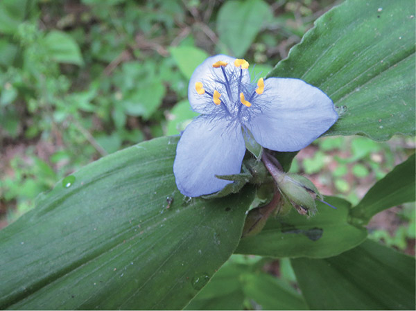
A blue spiderwort blooms along the Borden Creek Trail in the Sipsey Wilderness.
Acknowledgments
First of all, I need to thank all of you, my readers, for the support you have shown me and Hiking Alabama over the years and for making the book so successful. I am truly humbled.
Once again it would be impossible for me to thank all of the hikers, clubs, organizations, agencies, and land managers for their help putting this edition together. Just know that I am very grateful for all of your support and input.
There are several people that I need to single out. They are Chris Smith with Alabamas Forever Wild (Alabama DCNR), Rob Grant with the Alabama Department of Economic and Community Affairs, Jim Felder and Debbie Quinn with the Alabama Trails Commission, Dr. Thomas Wilson at Perry Lakes Park, Judith Adams and Bob Harris with the Alabama State Port Authority, environmental manager for the City of Foley Leslie Gahagan, Julie Day with the Alabama Hiking Trail Society, and Jereme Phillips and Brittany Peterson with the Bon Secour National Wildlife Refuge. Thank you all for putting up with my bajillion questions.
And there is one other person that I cannot leave out. I have to thank my wife, Maggie, who hiked every mile of trail with me for this edition. I seriously couldnt have done it without her and couldnt have had better company.
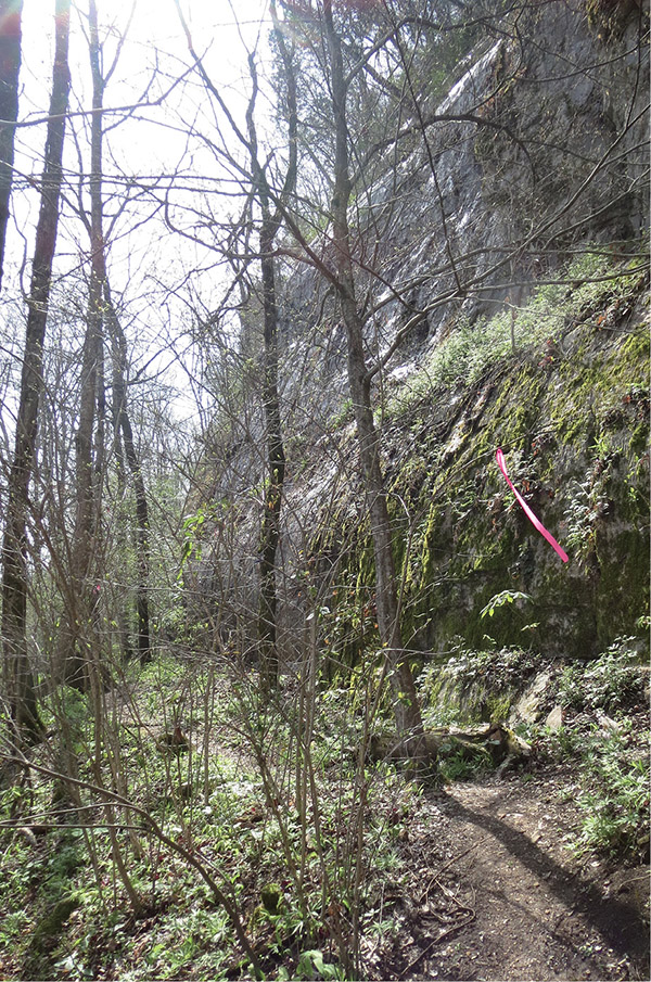
The Cave Mountain Loop trail hugs the base of a tall bluff with a large tupelo swamp on the left ().
Introduction
The last time we met, I mentioned that there was good news for hikers in Alabama, as the states land protection agency, Forever Wild, was purchasing more and more land and turning it over for recreational use. This time there is even better news to report.
In a nutshell, Alabama has truly become a hiking destination. Through the efforts of Forever Wild and the new Alabama Trails Commission (see sidebars included with the hike descriptions) and the emergence of more volunteer trail-building organizations, the number of trails that are available to hike in Alabama has grown exponentially, so much so that it was really tough putting this edition together. Each weekend I would have a schedule of trails that I wanted to hike for the book, and inevitably I would discover a new one that I wanted to hike and include. I had to make some tough decisions, but thats a good problem to havewhich trail to hike.
There is always a downside to everything, and once again weather plays into this edition. Last time it was the remarkable hurricane seasons of 20045 that ravaged the Gulf Coast. This time its tornadoes. In April 2011 strong tornadoes ripped through the North and Central regions of the state. The 2011 storms actually spawned several twisters, including an EF5 that resulted in over 100 fatalities and almost 2,000 injuries. The destruction was devastating. A few major Alabama state parks suffered severe damage, forcing them to close hotels, restaurants, and campgrounds, and several trails were left barren.
But Alabamians are resilient people. The area is returning to normal. The state parks and national forests are back up and running again. Unfortunately, as I mentioned, a few of our favorite trails from the past werent so lucky, and while they are open to hikers, it will take years for the land to recover.
On a brighter note, as I said before, Alabama has become a hiking destination for people from around the country and the world, with many new and exciting adventures available.
If this is your first outing on the trails of Alabama or if you are unfamiliar with the topography of the state, youre in for a surprise. There is literally something for everyone when it comes to hiking here.
The state is divided into four distinct regions: the Highland Rim, the Piedmont Plateau, the Black Belt, and the Coastal Plain. To the extreme north is the Highland Rim. Thousands of years ago the entire region was covered by a shallow ocean. As the waters receded and the land began to rise, ancient shell banks and coral reefs dried out and died, forming the limestone bedrock that makes up the mountains of north and northwest Alabama. Over the years the action of the elements on the soft rock created huge crags, cliffs, and caves. Areas such as Cane Creek Canyon Preserve in Tuscumbia and Borden Creek in the Sipsey Wilderness provide excellent opportunities to explore these mammoth outcroppings and rock shelters that usually come equipped with spectacular waterfalls.
Just as the receding ocean created the Highland Rim, so, too, did it unveil the Piedmont Plateau. As the land thrust upward, forming the southernmost end of the Appalachian mountain chain, it created the highest peaks in the state. Its in this region that youll find Alabamas highest point, Cheaha Mountain, which stands just over 2,400 feet above sea level. Youll also encounter the largest canyon east of the Mississippi, Little River Canyon, carved by the Little River, the longest mountaintop river in the country.


