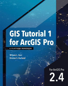
Wilpen L. Gorr - GIS Tutorial 1 for ArcGIS Pro 2.4: A Platform Workbook (GIS Tutorials)
Here you can read online Wilpen L. Gorr - GIS Tutorial 1 for ArcGIS Pro 2.4: A Platform Workbook (GIS Tutorials) full text of the book (entire story) in english for free. Download pdf and epub, get meaning, cover and reviews about this ebook. year: 2020, publisher: Esri Press, genre: Home and family. Description of the work, (preface) as well as reviews are available. Best literature library LitArk.com created for fans of good reading and offers a wide selection of genres:
Romance novel
Science fiction
Adventure
Detective
Science
History
Home and family
Prose
Art
Politics
Computer
Non-fiction
Religion
Business
Children
Humor
Choose a favorite category and find really read worthwhile books. Enjoy immersion in the world of imagination, feel the emotions of the characters or learn something new for yourself, make an fascinating discovery.
- Book:GIS Tutorial 1 for ArcGIS Pro 2.4: A Platform Workbook (GIS Tutorials)
- Author:
- Publisher:Esri Press
- Genre:
- Year:2020
- Rating:5 / 5
- Favourites:Add to favourites
- Your mark:
- 100
- 1
- 2
- 3
- 4
- 5
GIS Tutorial 1 for ArcGIS Pro 2.4: A Platform Workbook (GIS Tutorials): summary, description and annotation
We offer to read an annotation, description, summary or preface (depends on what the author of the book "GIS Tutorial 1 for ArcGIS Pro 2.4: A Platform Workbook (GIS Tutorials)" wrote himself). If you haven't found the necessary information about the book — write in the comments, we will try to find it.
GIS Tutorial 1 for ArcGIS Pro 2.4: A Platform Workbook (GIS Tutorials) — read online for free the complete book (whole text) full work
Below is the text of the book, divided by pages. System saving the place of the last page read, allows you to conveniently read the book "GIS Tutorial 1 for ArcGIS Pro 2.4: A Platform Workbook (GIS Tutorials)" online for free, without having to search again every time where you left off. Put a bookmark, and you can go to the page where you finished reading at any time.
Font size:
Interval:
Bookmark:

Part 1 Using, making, and sharing maps
- Get an introduction to the ArcGIS platform.
- Get an introduction to the ArcGIS Pro user interface.
- Learn to navigate maps.
- Work with tables of attribute data.
- Get an introduction to symbolizing and labeling maps.
- Work with side-by-side 2D and 3D maps.
- Publish a map to ArcGISSM Online.
- Configure maps in ArcGIS Online.
- Use Explorer for ArcGIS on a mobile device.
The ArcGIS platform is an integrated collection of GIS software packages and apps developed by Esri that work seamlessly across desktop computers, the internet, and mobile devices. The tutorials in this first chapter will familiarize you with some major components of this platform: ArcGIS Pro, ArcGIS Online, and Explorer for ArcGIS. Youll use additional ArcGIS apps and packages in other chapters.
ArcGIS Pro, the major package taught in this book, is a 64-bit desktop GIS application that uses the Microsoft ribbon interface for 2D and 3D map authoring, analysis, and web publishing. The interface makes relevant tools visible and available for whatever work youre doing in GIS. ArcGIS Online is Esris cloud solution for interactive web mapping and spatial data sharing. Maps that you create in ArcGIS Pro can be published to ArcGIS Online. Then, once in ArcGIS Online, maps can be accessed in web browsers and in mobile-device apps. Explorer for ArcGIS is a simple interactive viewer for your online maps.
In this chapter, you will work with a finished map that has the locations of urgent health care clinics in Allegheny County, Pennsylvania. These clinics are Federally Qualified Health Centers (FQHCs) that provide subsidized health care for underserved populations and MedExpress clinics that provide private health care. In part, both FQHCs and MedExpress centers are low-cost alternatives to hospital emergency rooms. You will examine the finished maps components while navigating through user interfaces and around mapped features. In the process, youll learn that both the publicly funded and private-sector urgent health care clinics are well-located in interesting spatial patterns.
You must have ArcGIS Pro and the data for this book installed on your computer for this tutorial and the rest of the book. If you are taking a GIS class in a college or university, your instructor will provide access to ArcGIS Pro on computer lab computers or your own computer. If you are not in a class, or in an organization that licenses ArcGIS, you can download ArcGIS Pro: go to http://pro.arcgis.com and sign up for a free trial. The first time you start ArcGIS Pro, you will be prompted to license the software. To license the software, you must have an ArcGIS Online or Portal for ArcGIS account (http://pro.arcgis.com/en/pro-app/get-started/install-and-sign-in-to-arcgis-pro.htm).
Before starting work on your computer, review key terminology for ArcGIS Pro projects and spatial data.
A project is a file, with the extension .aprx, that contains one or more maps and related items. For example, youll open project Tutorial1-1.aprx in ArcGIS Pro after this introduction. The project has two maps, Health Care Clinics and Health Care Clinics_3D, plus other project items.
Font size:
Interval:
Bookmark:
Similar books «GIS Tutorial 1 for ArcGIS Pro 2.4: A Platform Workbook (GIS Tutorials)»
Look at similar books to GIS Tutorial 1 for ArcGIS Pro 2.4: A Platform Workbook (GIS Tutorials). We have selected literature similar in name and meaning in the hope of providing readers with more options to find new, interesting, not yet read works.
Discussion, reviews of the book GIS Tutorial 1 for ArcGIS Pro 2.4: A Platform Workbook (GIS Tutorials) and just readers' own opinions. Leave your comments, write what you think about the work, its meaning or the main characters. Specify what exactly you liked and what you didn't like, and why you think so.


