Frank J. Barrett Jr - Hanover, New Hampshire. Volume II
Here you can read online Frank J. Barrett Jr - Hanover, New Hampshire. Volume II full text of the book (entire story) in english for free. Download pdf and epub, get meaning, cover and reviews about this ebook. City: Hanover (N.H. : Town);New Hampshire;Hanover (Town, year: 1998;2011, publisher: Arcadia Publishing, genre: Home and family. Description of the work, (preface) as well as reviews are available. Best literature library LitArk.com created for fans of good reading and offers a wide selection of genres:
Romance novel
Science fiction
Adventure
Detective
Science
History
Home and family
Prose
Art
Politics
Computer
Non-fiction
Religion
Business
Children
Humor
Choose a favorite category and find really read worthwhile books. Enjoy immersion in the world of imagination, feel the emotions of the characters or learn something new for yourself, make an fascinating discovery.

- Book:Hanover, New Hampshire. Volume II
- Author:
- Publisher:Arcadia Publishing
- Genre:
- Year:1998;2011
- City:Hanover (N.H. : Town);New Hampshire;Hanover (Town
- Rating:5 / 5
- Favourites:Add to favourites
- Your mark:
Hanover, New Hampshire. Volume II: summary, description and annotation
We offer to read an annotation, description, summary or preface (depends on what the author of the book "Hanover, New Hampshire. Volume II" wrote himself). If you haven't found the necessary information about the book — write in the comments, we will try to find it.
Frank J. Barrett Jr: author's other books
Who wrote Hanover, New Hampshire. Volume II? Find out the surname, the name of the author of the book and a list of all author's works by series.


Hanover, New Hampshire. Volume II — read online for free the complete book (whole text) full work
Below is the text of the book, divided by pages. System saving the place of the last page read, allows you to conveniently read the book "Hanover, New Hampshire. Volume II" online for free, without having to search again every time where you left off. Put a bookmark, and you can go to the page where you finished reading at any time.
Font size:
Interval:
Bookmark:
The author would like to thank the following people who have so generously made pictorial material available for my use in compiling this book: Ethel (Elder) Hayes, Gordon Hayes, Tim Bent, Richard Baughman, Elaine Bent, Phoebe (Storrs) Stebbins, Velda (LaBombard) Dickinson, Valma (Fogg) LeBrun, David Nutt, Lois Gardner, Hallie Buskey, Divina (Croall) Dana, Helen LaCoss, Peter Shumway, Edgar Mead, Gladys (Trumbull) Bacon, Barbara Pelton, Macky (Bolleo) Clark, Regina Stanhope, Lois Stanhope, Margaret Boyd Braman, Holly (Fullington) Forward, Glenn Elder, Lester LaBombard, Eunice (Poland) Ballam, Dexter Pierce, Millie (West) Farnham, Sam Doyle, Dorothy Hood, the Hanover Water Works Company, the State of New Hampshire Department of Transportation, and the Dartmouth College Archives.
Find more books like this at
www.imagesofamerica.com
Search for your hometown history, your old
stomping grounds, and even your favorite sports team.
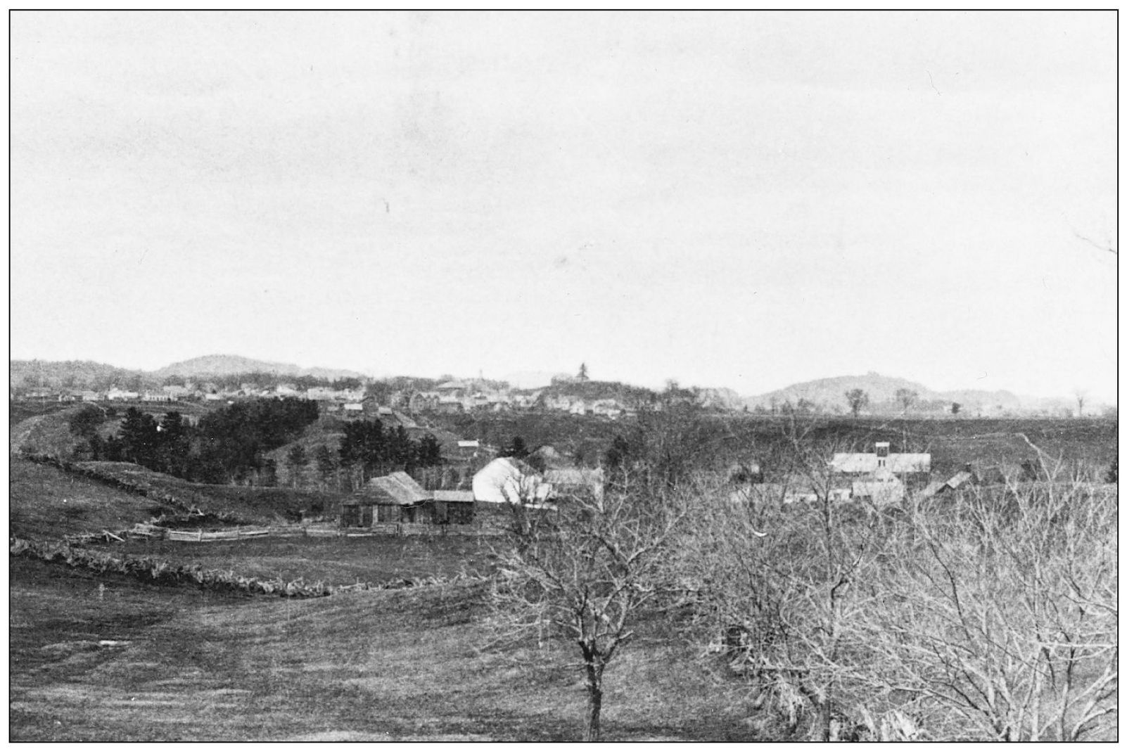
The village of Hanover is seen in the distance of this early photograph taken in 1871 looking north from the West Lebanon Road. Note the primitive stump fence along the road, remaining from colonial times when the land was first cleared. In the mid-ground are Monroe Pikes 90-acre farm, and Joseph Tildens 117-acre spread. Today this is the Wyeth Road/Dunster Drive neighborhood. In the far right can be seen the large barn of the Benton farm situated adjacent to Mink Brook.
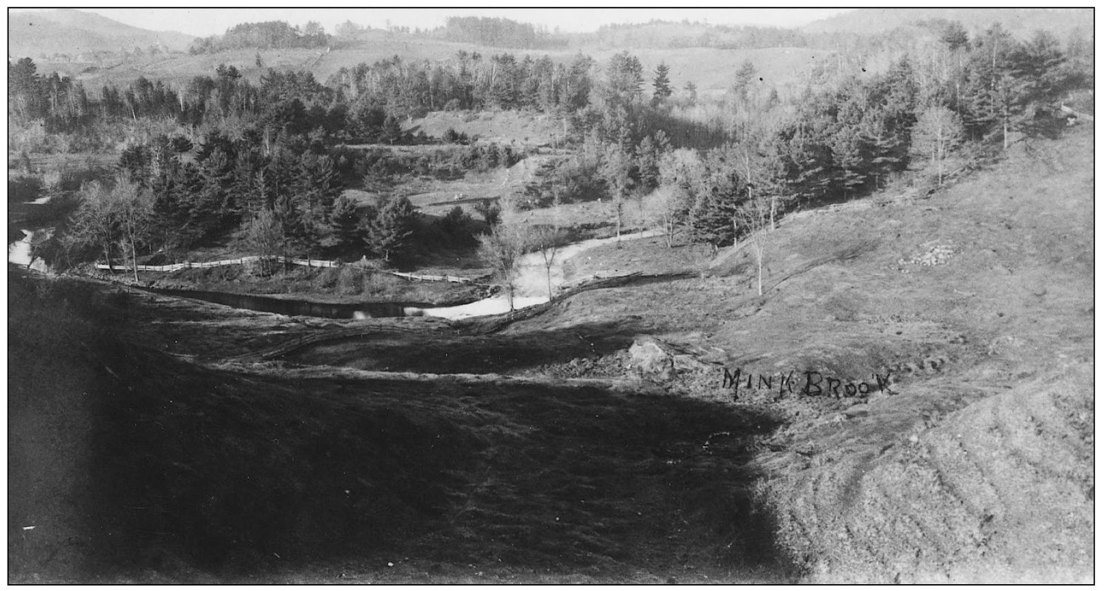
This is a later nineteenth-century view of Mink Brook looking from Pleasant Street. To the left is now located the Pine Knoll Cemetery; and just beyond the bluff to the right is the present Hanover Waste Water Treatment Plant. Since 1950, and the completion of Wilder Dam on the Connecticut River, all of the meadows on both sides of the brook have been flooded and are now under water.
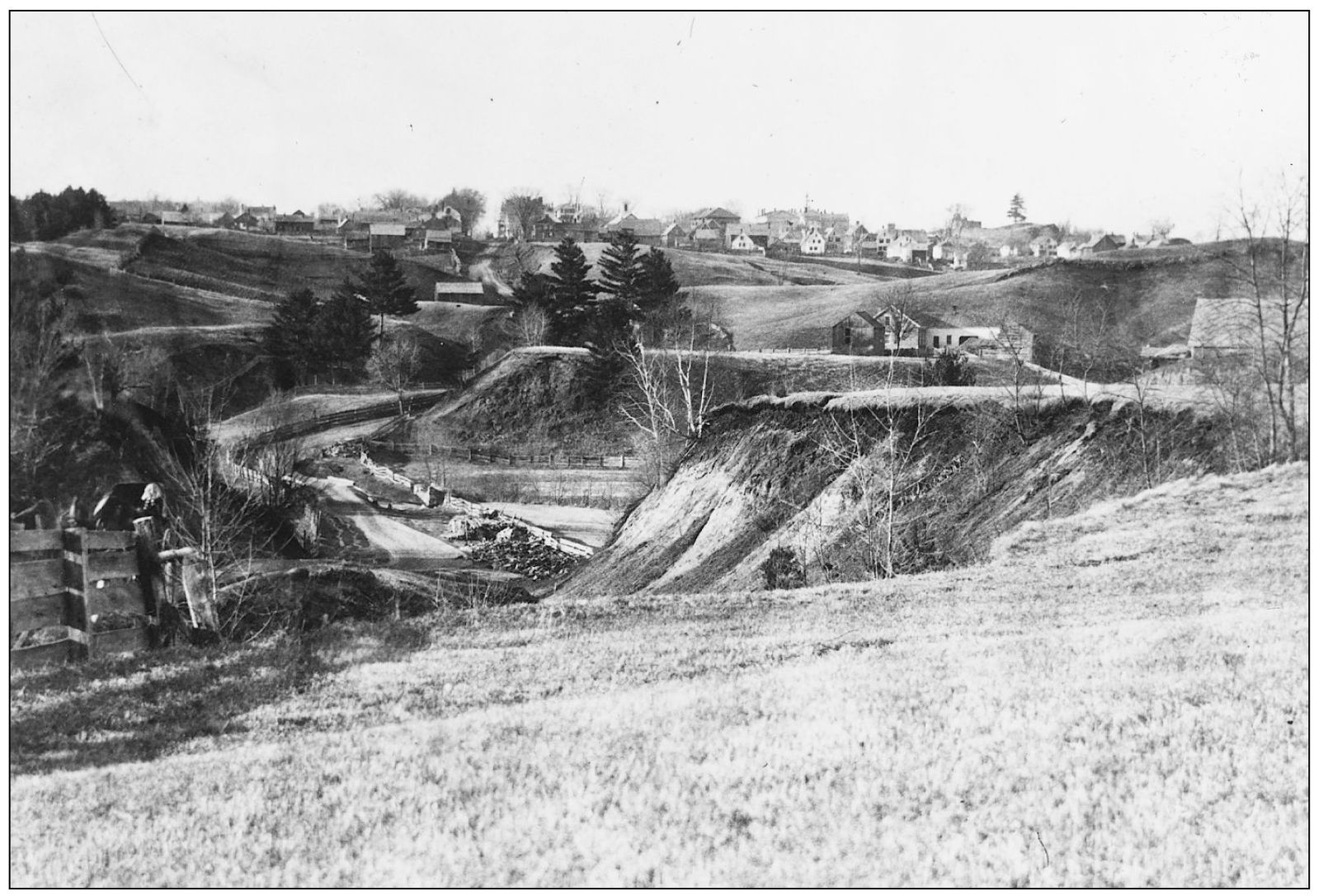
Looking north in 1868 from the present-day Mourlyn Road area, this view shows West Lebanon Road winding its way across the meadows along Mink Brook. To the left is the Charles Benton farmthe brick farmhouse is still standing today at 104 South Main Street. In the distance is the village and Dartmouth College.
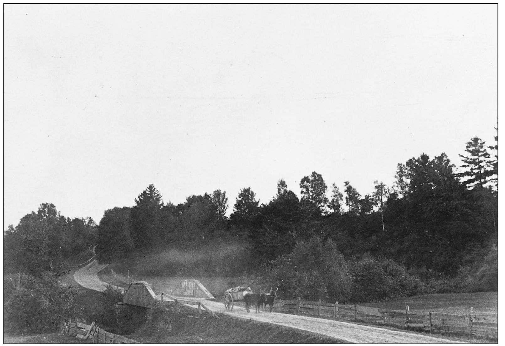
This is a view taken in the early fall of 1888 looking south along the West Lebanon Road. In the foreground are the fields of Charles Bentons farm and the wooden bridge across Mink Brook. The present-day Pine Knoll Cemetery occupies the right-hand bluff; and the Mourlyn Road neighborhood is to the left.
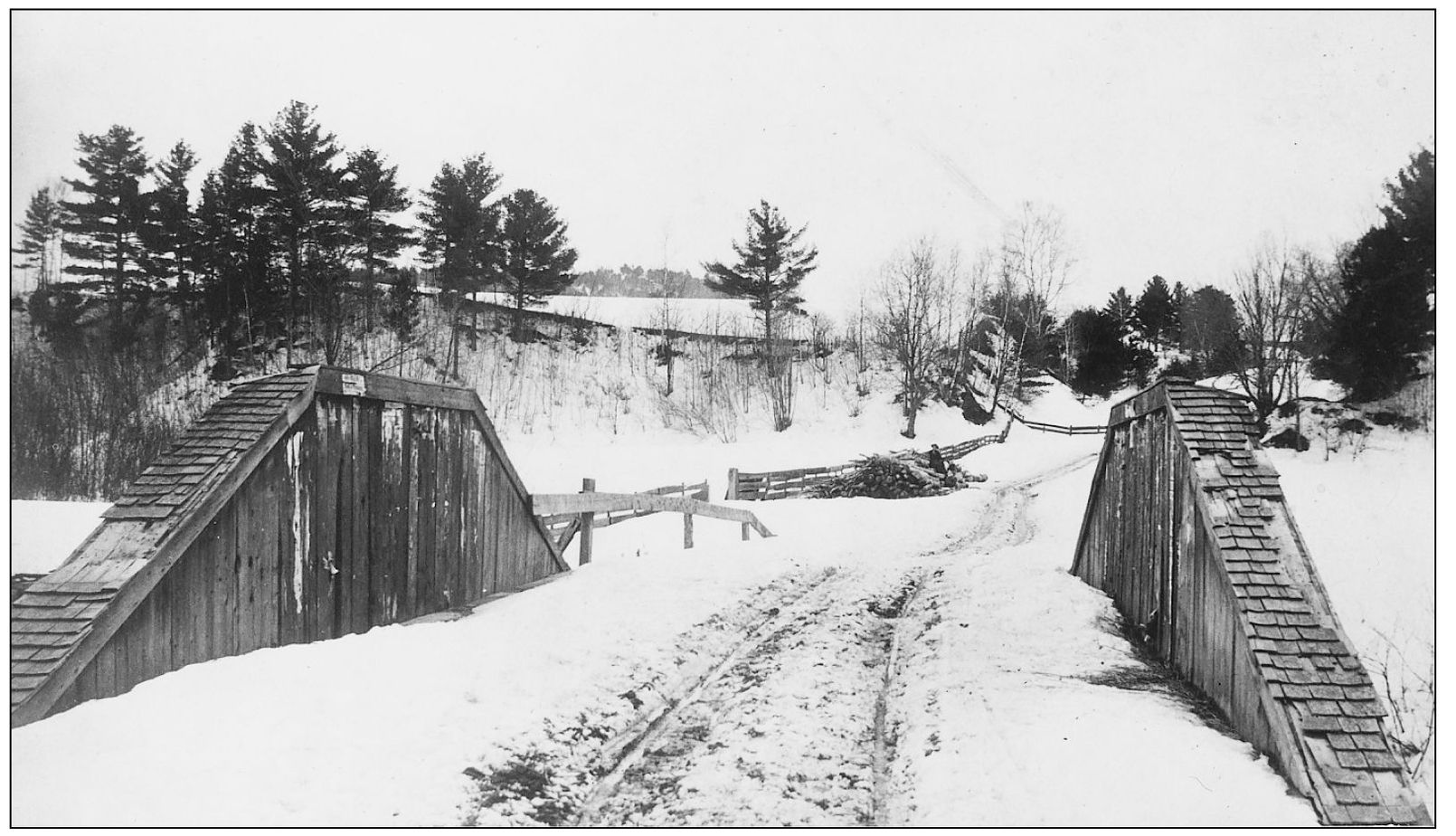
A close-up view of the Mink Brook bridge on the West Lebanon Road in the 1880s shows the wood siding and shingles, which were intended to protect the heavy timber-framed queen post truss bridge structuretypical of the era preceding structural steel and the advent of the automobile age.
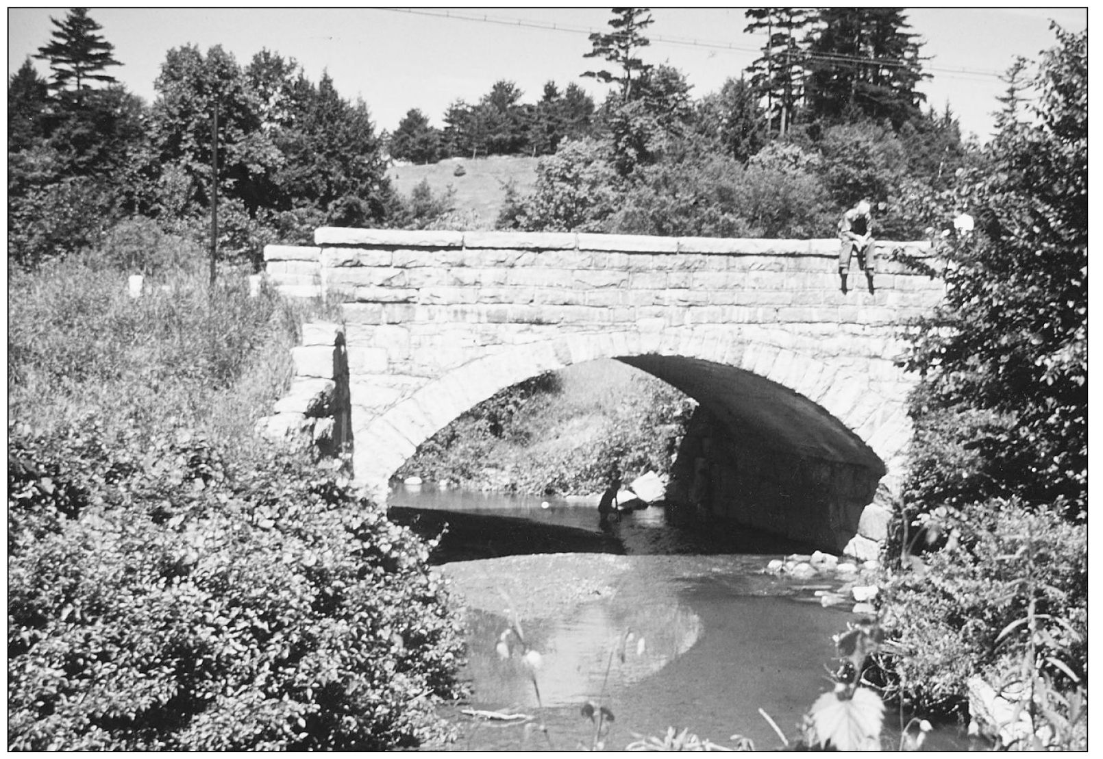
During the summer of 1914, a new stone bridge was constructed across Mink Brook on the West Lebanon Road (see page 40, Volume 1 of this series). However, a mere 26 years later, it was again replacedthis time when the highway was relocated. This view looking west was taken just prior to the bridges demolition in 1940.
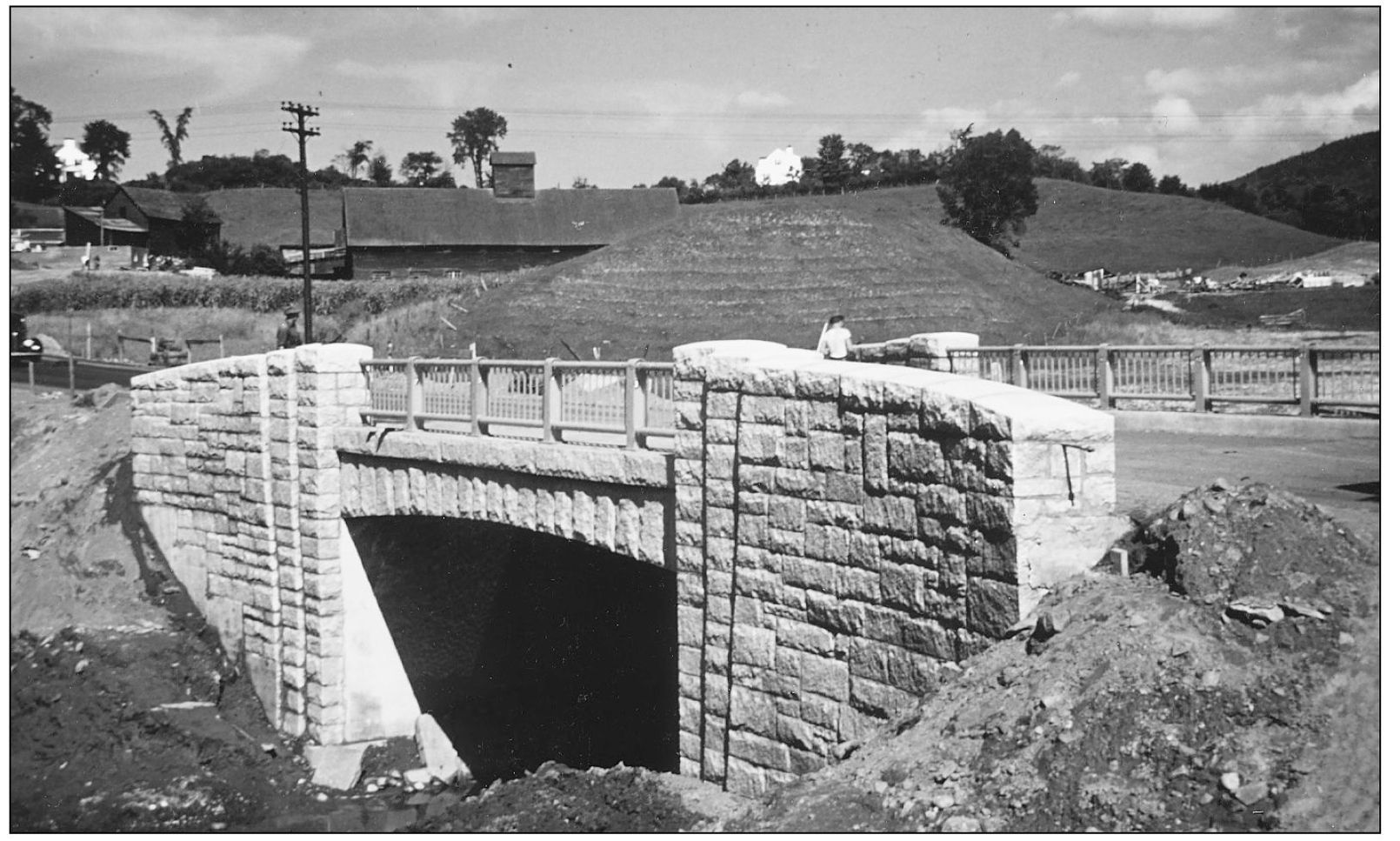
The new Mink Brook bridge appears here just after completion in 1940. With a new bridge and a relocated road, the stream location was also altered and straightened out. In the distance is the Benton farm, by then owned by the Charles Stone family.
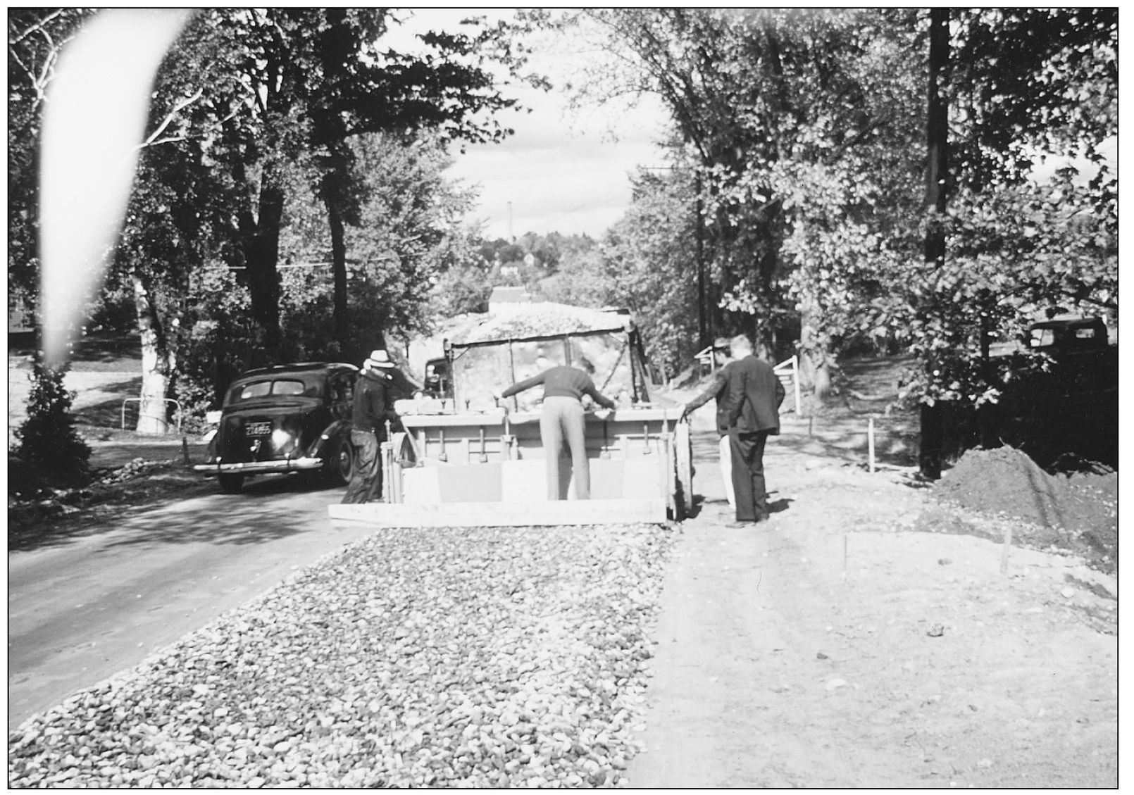
In this photograph, showing modern road building in 1940 just prior to World War II, crushed stone is being spread on the rebuilt West Lebanon Road opposite the entrance to the Wyeth Road neighborhood to the left. Once the stone had been laid down, a thick layer of tar was then applied.
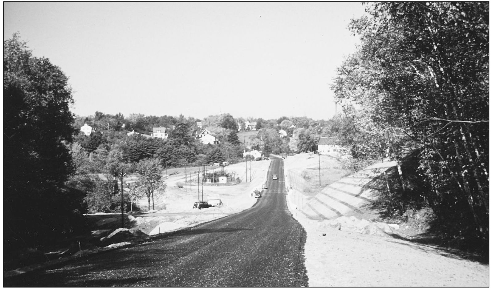
The new West Lebanon Road appears here in 1940. To the left can be seen the old road, and in the distance is downtown Hanover. Compare this view with the earlier photograph on page 10, taken in 1868 from almost the same location.

The Charles Stone farm in 1948 is seen here just prior to the large four-story barn being taken down. Charles Benton originally constructed the four-story, 135-by-45-foot barn in 1852. The white farmhouse had been moved in 1940, when the West Lebanon Road was relocated, and it is still standing at 104 South Main Street.
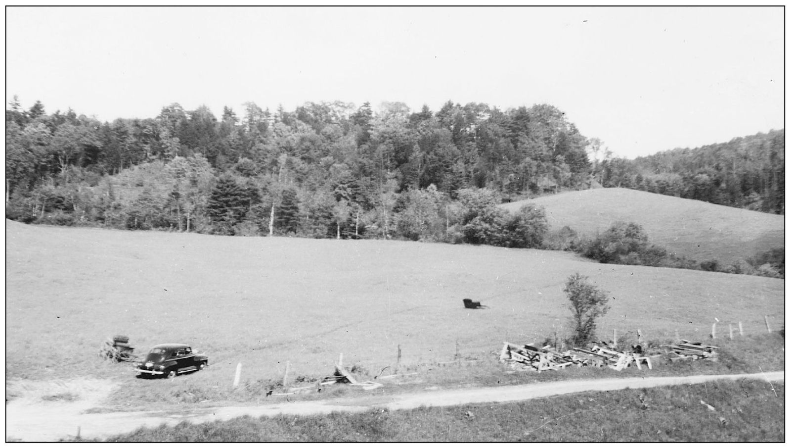
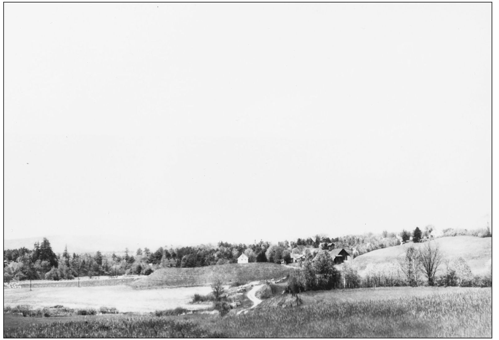
The Mitchell Lane neighborhood now occupies these fields shown in this 1948 view taken looking east from beside the Stone farm barn. The old sleigh was left from the auction of all the farm equipment when the property was sold that year for development.
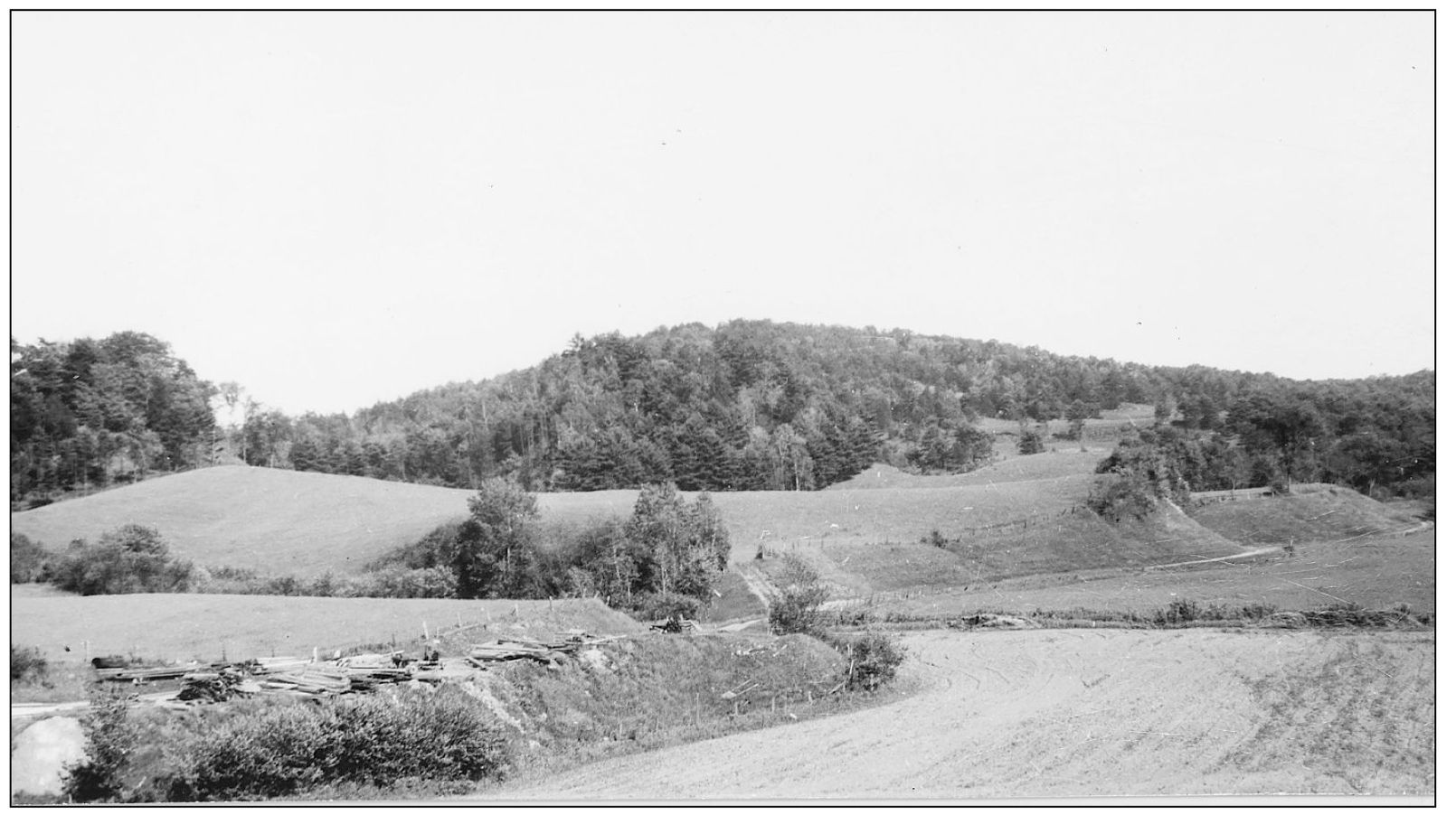
This is another view taken from the same location looking up the Mink Brook Valley. Brook Road now runs through the meadows in the foreground. At one time under the Benton familys ownership, this farm had 324 contiguous acres, 175 of which were in Hanover; and they grazed more then 225 head of Merino sheep.
Looking west in 1948 from the bluff of present-day 10 Brook Road, this view shows the Stone farm buildings in the distance. To the left are the meadows along Mink Brook and the West Lebanon Road cutting across them.
Font size:
Interval:
Bookmark:
Similar books «Hanover, New Hampshire. Volume II»
Look at similar books to Hanover, New Hampshire. Volume II. We have selected literature similar in name and meaning in the hope of providing readers with more options to find new, interesting, not yet read works.
Discussion, reviews of the book Hanover, New Hampshire. Volume II and just readers' own opinions. Leave your comments, write what you think about the work, its meaning or the main characters. Specify what exactly you liked and what you didn't like, and why you think so.