About the Author
Kev Reynolds, author of this guide, is a freelance writer, photojournalist and lecturer who lives in the Kent countryside when not trekking or climbing in distant mountain regions. A prolific compiler of guidebooks, his first title for Cicerone Press appeared in 1978 (Walks & Climbs in the Pyrenees now in its fourth edition); this is his 25th book for the same publisher, with others being researched at present. A member of the Alpine Club, Austrian Alpine Club and Outdoor Writers Guild, his passion for mountains in particular and the countryside in general remains undiminished after 40 years of activity, and he regularly travels throughout Britain to share that enthusiasm through his lectures. Check him out at www.kevreynolds.co.uk .
Other UK Cicerone Guides by Kev Reynolds
The Wealdway & The Vanguard Way
Walking in Kent Vols I & II
The South Downs Way
The North Downs Way
Walking in Sussex
THE COTSWOLD WAY
by
Kev Reynolds

2 POLICE SQUARE, MILNTHORPE, CUMBRIA LA7 7PY
www.cicerone.co.uk
Third edition 2007
ISBN-13: 978-1-85284-552-0
Kev Reynolds 1990, 1994, 2005, 2007
First published 1990
Revised edition 1994
Second edition 2005
ISBN-10: 1-85284-449-3
A catalogue record for this book is available from the British Library
Photos by the author
 This product includes mapping data licensed from Ordnance Survey with the permission of the Controller of Her Majestys Stationery Office. Crown copyright 2003. All rights reserved. Licence number PU100012932.
This book is for my wife, with thanks for her constant loving support, without which Id still be working from Monday to Friday, looking forward to Saturday.
Acknowledgements
To Jo Ronald, Cotswold Way national trail officer, for information, advice and encouragement and, not least, for her efforts (and those of Don Field, alignment officer) in upgrading the route to national trail standards; to the numerous unnamed volunteers who have worked tirelessly over the years to keep the paths open and make the route such a joy to walk; to those who made my overnights at various b&b establishments both welcoming and comfortable; to Derek Roberts, who first walked the route with me, and especially to my wife, for the memorable Cotswold days and many footpath miles we have walked together; and lastly, to the team at Cicerone Press for their continued friendship, and for putting their talents and skills to my advantage. I am grateful to you all.
Kev Reynolds
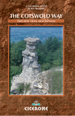
Front cover: The Devils Chimney on Leckhampton Hills scarp face has become a symbol of the Cotswold Way


Hardwood marker posts guide the route throughout
INTRODUCTION
Views were lost in a grey mist of rain that had not let up since breakfast, but needing a hot drink I sank onto a cushion of heather, settled back against a silver birch and dug my flask out of the rucksack. The tea was welcome; the rain and lack of views had not affected my spirits and I was aware of being immensely happy. It was a privilege to be there, to be walking this land of timeless beauty, absorbing its past and present, gleaning experience for tomorrows patchwork of memory. And as I wiped the steam from my glasses I noticed, among the swamps of nodding cowslips that crowded the hillside, early purple orchids standing sentry-like here and there, their helmets tossing minute cascades of spray as raindrops fell upon them...
The soft light of a June evening pushed shadows out of a stand of beech trees. From a pathside bank I watched the patch of darkness spread down the knoll as silvered galleon clouds drifted overhead and a blackbird piped his own last post from a hawthorn bush nearby. At the foot of the slope a roe deer slipped out of the woodland shaw and sprang across the long grass, as though leaping waves. Reluctant to break the spell I delayed my onward walk and sat, content to absorb the moment...
Ramsons, or wild garlic (Allium ursinum), spreads through the woodlands in great carpets, its beautiful white stars giving contrast to its pungent smell
These are just two random vignettes that spill unbidden from a host of memories gathered along the Cotswold Way, but each time Ive walked the route end to end and others when Ive snatched isolated sections for the sheer pleasure of being there Ive been seduced by the regions special attractions. There are the curving bays and spurs of the escarpment, the beech-crowned heights, open breezy commons, deeply cut dry valleys, mile upon mile of drystone walling from which anxious wrens dart and where snails cling limpet-like to the verticals. I think of honey-coloured cottages, roses wild and nurtured, carpets of bluebells, ramsons and wood anemones, kestrels hovering head-down above the cropped turf, larks warbling from dawn to dusk, a cumulus of sheep on the brow of a distant hill. I remember old churches, Civil War battlefields, and the even older burial mounds and hill forts that pepper the route. I recall beams of sunlight shafting onto the River Severn, clouds rolling over the Black Mountains far away. And the peace. Not silence, but peace. The peace of a countryside comfortable with itself.
A walkers landscape is both a powerful stimulant and an inspiration. Certainly that is true where memories and dreams intertwine in a complex of pleasures on completion of the Cotswold Way.
THE COTSWOLD WAY
The Cotswold Way measures 102 miles (164km) on its journey from Chipping Campden to Bath, and its a devious route a switchback, stuttering, to-ing and fro-ing, climbing and falling walk. One moment youre wandering along the scarp edge, with toy-sized farms and villages scattered across the plains far below, the next youre heading down to them to explore a magical village, or a small market town with age in its streets, whose cottages are faintly warm and luminous, as if they knew the trick of keeping the lost sunlight of centuries glimmering about them. Then you head up again, zigzagging back and forth in order to capture the best the wolds can offer.
The national trail acorn symbol adorns Cotswold Way waymarks and signposts
The wolds form part of an extensive belt of oolitic limestone that runs from Dorset in the south to Yorkshire in the north. The highest and broadest part of this belt is an undulating tableland, raised on its western side and draining gently towards the east, down to the Thames Valley and the Oxfordshire Plain. On its western side, where the Cotswold Way goes, the scarp slope falls abruptly to the Severn Plain, revealing its most dramatic features. This sharp-edged tableland has long jutting prows and spurs, time-moulded coombes and island-like outliers, plateaux fuzzed with woodlands and a grid of drystone walls. Numerous mounds provide evidence of a long history of occupation along the very rim of the escarpment, from which early man scanned the broad views, alert to approaching danger. Today the Cotswold wayfarer seeks those same vantage points as highlights of the walk, places on which to sprawl in the grass and dream among the flowers.











 This product includes mapping data licensed from Ordnance Survey with the permission of the Controller of Her Majestys Stationery Office. Crown copyright 2003. All rights reserved. Licence number PU100012932.


