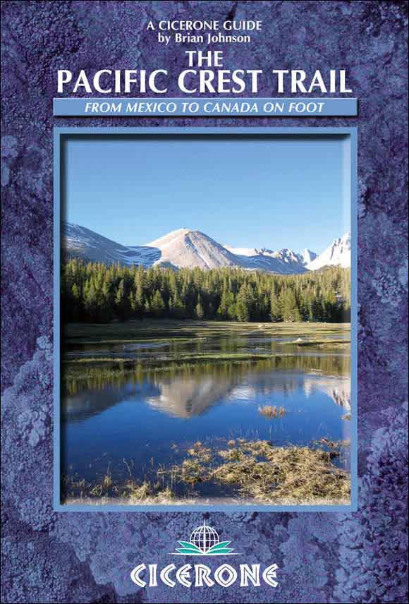
Johnson - The Pacific Crest Trail: a long distance footpath through California, Oregon and Washington
Here you can read online Johnson - The Pacific Crest Trail: a long distance footpath through California, Oregon and Washington full text of the book (entire story) in english for free. Download pdf and epub, get meaning, cover and reviews about this ebook. City: Pacific Crest Trail;United States, year: 2010;2011, publisher: Cicerone Press, genre: Home and family. Description of the work, (preface) as well as reviews are available. Best literature library LitArk.com created for fans of good reading and offers a wide selection of genres:
Romance novel
Science fiction
Adventure
Detective
Science
History
Home and family
Prose
Art
Politics
Computer
Non-fiction
Religion
Business
Children
Humor
Choose a favorite category and find really read worthwhile books. Enjoy immersion in the world of imagination, feel the emotions of the characters or learn something new for yourself, make an fascinating discovery.

- Book:The Pacific Crest Trail: a long distance footpath through California, Oregon and Washington
- Author:
- Publisher:Cicerone Press
- Genre:
- Year:2010;2011
- City:Pacific Crest Trail;United States
- Rating:3 / 5
- Favourites:Add to favourites
- Your mark:
The Pacific Crest Trail: a long distance footpath through California, Oregon and Washington: summary, description and annotation
We offer to read an annotation, description, summary or preface (depends on what the author of the book "The Pacific Crest Trail: a long distance footpath through California, Oregon and Washington" wrote himself). If you haven't found the necessary information about the book — write in the comments, we will try to find it.
The Pacific Crest National Scenic Trail runs for 2650 miles from the Mexican border to Canada through the mountains of California, Oregon and Washington. This book contains a complete set of detailed maps and route description divided into 101 sections. With information for planning a short hike or a thru-hike.
Johnson: author's other books
Who wrote The Pacific Crest Trail: a long distance footpath through California, Oregon and Washington? Find out the surname, the name of the author of the book and a list of all author's works by series.


The Pacific Crest Trail: a long distance footpath through California, Oregon and Washington — read online for free the complete book (whole text) full work
Below is the text of the book, divided by pages. System saving the place of the last page read, allows you to conveniently read the book "The Pacific Crest Trail: a long distance footpath through California, Oregon and Washington" online for free, without having to search again every time where you left off. Put a bookmark, and you can go to the page where you finished reading at any time.
Font size:
Interval:
Bookmark:
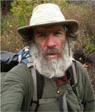
Since taking early retirement from his career as a physics and sports teacher, Brian Johnson has found time for three thru-hikes of the Pacific Crest Trail, a 2700-mile round-Britain walk, two hikes across the Pyrenees from the Atlantic to the Mediterranean and a single summer compleation of the Munros (Scotlands 3000ft mountains).
He has also completed a 2200-mile cycle tour of Spain and France and done multi-week canoe tours in Sweden, France, Spain and Portugal.
In his younger days, Brians main sport was orienteering. He competed at a high level and coached both Bishop Wordsworths School and South-West Junior Orienteering squads. He also surveyed and drew many orienteering maps. A keen climber and hiker, he led school groups in Britain, the Alps, the Pyrenees and California.
As a fanatical sportsman and games player, Brian competed to a high standard at cricket, hockey, bridge and chess. His crowning achievement was winning the 1995/96 World Amateur Chess Championships.
Brian hikes under the trail name Ancient Brit.
Since its foundation 40 years ago, Cicerone has specialised in publishing guidebooks and has built a reputation for quality and reliability. It now publishes nearly 300 guides to the major destinations for outdoor enthusiasts, including Europe, UK and the rest of the world.
Written by leading and committed specialists, Cicerone guides are recognised as the most authoritative. They are full of information, maps and illustrations so that the user can plan and complete a successful and safe trip or expedition be it a long face climb, a walk over Lakeland fells, an alpine cycling tour, a Himalayan trek or a ramble in the countryside.
With a thorough introduction to assist planning, clear diagrams, maps and colour photographs to illustrate the terrain and route, and accurate and detailed text, Cicerone guides are designed for ease of use and access to the information.
If the facts on the ground change, or there is any aspect of a guide that you think we can improve, we are always delighted to hear from you.
Cicerone Press
2 Police Square Milnthorpe Cumbria LA7 7PY
Tel: 015395 62069 Fax: 015395 63417

Local information and conversions
Prices shown in shops are not the prices you pay for goods. The state sales tax needs to be added.
Most federal employees will be on holiday on the following dates during the hiking season. Post offices will be closed and mail will not be moved or sorted so can be disrupted for several days.
Last Monday in May: Memorial Day
July 4: Independence Day (or July 3 or 5 if July 4 falls during a weekend)
First Monday in September: Labour Day
Second Monday in October: Columbus Day
1 mile = 1.6km
1000ft = 305m
1ft = 30.5cm
1in = 2.5cm
1 pint (US) = 0.5 litre
1 quart (US) = 1 litre
1 gallon (US) = 4 litres
1 pound (lb) = 0.45kg
32F = 0C
70F = 21C
100F = 38C
Americans tend to use feet rather than yards for distance (1yd = 3ft).
The instructions with some freeze-dried foods give quantities in terms of cups (1 cup = 240ml).
The US and Canada have an integrated telephone system. To call the US or Canada from most European countries dial 001 followed by the local telephone number. To call abroad from the US or Canada, dial 011 followed by the country code. Country code for United Kingdom:
Useful addresses
Pacific Crest Trail Association
1331, Garden Highway, Sacramento CA95833
(916)-285-1846, www.pcta.org
The associations website has application forms for PCT thru-hike permits, Mount Whitney permits and permits for entry to Canada along the PCT.
Canada Border Services Agency
2 Sumas Way, Abbotsford, BC V2S 8B7, Canada
(604)-504-4690
www.pct77.org/adz
Annual Day Zero PCT Kick Off and a good source of information
www.trailjournals.com
Journals from PCT hikers
www.fire.ca.gov
Fire information in California and California fire permits
www.4jeffrey.net/pct
PCT water reports
www.fs.fed.us/pct
US governments PCT website
www.pctmap.net
PCT maps and GPS waymarks. These are the best maps for the trail.
http://postholer.com
Snow reports and Google map with PCT superimposed
www.hikertrash.net
www.nationalforeststore.com
PCT maps
www.morethanamile.com/pctaorg
PCT information including maps on a CD-ROM
http://maps.nationalgeographic.com/topo
CD-ROM of USGS topographic maps
www.trailquest.net/PCTtrlsvcs.html
Trail town information
PCT forum
www.tarptent.com
Tarp-tents
www.gossamergear.com
www.sixmoondesigns.com
www.golite.com
www.ula-equipment.com
Lightweight gear
Other publications
If you are going to hike the PCT in snowpack you will need more detailed maps than those featured in this guidebook. You could purchase US Forest Service maps, CD-ROMs or download maps from the various websites detailed in Appendix B.
The John Muir Trail Guide, Alan Castle (Cicerone, 2004, updated 2010) Covers Yosemite Valley to Whitney Portal.
www.cicerone.co.uk
The Pacific Crest Trail (three volumes), Ben Schirfin, Thomas Winnett, Jeffrey Schaffer, Ruby Johnson Jenkins and Andy Selters (Wilderness Press, 1973, updated 2003)
A comprehensive guidebook in three heavy volumes with black and white 1:50,000 maps.
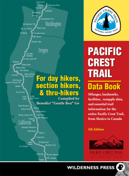
Pacific Crest Trail Data Book, Benedict Gentle Ben Go (Wilderness Press, 1997, updated 2005)
Summarises the information in the guidebooks.
www.wildernesspress.com
The PCT Hikers Handbook, Ray Jardine (AdventureLore Press, 1992)
Advice on hiking the PCT with an emphasis on ultra-lightweight hiking and high daily mileages.
Trail Life: Ray Jardines Lightweight Backpacking, Ray Jardine (AdventureLore, 2009)
The latest incarnation of Jardines PCT Hikers Handbook benefits from the experience of thousands of additional trail miles.
www.adventurelore.com
Yogis PCT Handbook, Jackie Yogi McDonnell (self-published)
Provides the most comprehensive information on towns as well as other trail information (no maps).
www.pcthandbook.com
Pacific Crest Trail Atlas, Erik Asorson (Blackwoods Press, second edition, 2010)
A set of PCT maps in five expensive volumes with brief notes on the route.
www.pctatlas.com
Pocket PCT, Paul Bodnar (self-published, 2009)
Elevation guide to the PCT in three small volumes, with limited water and resupply information.
http://hikethru.com
John Muir Trail Map-Pack (Tom Harrison, 2009)
13 A4 topographic trekking maps, with relief shading and contour intervals at 80m, covering the John Muir and Pacific Crest Trails between Yosemite Valley and Mount Witney.
Font size:
Interval:
Bookmark:
Similar books «The Pacific Crest Trail: a long distance footpath through California, Oregon and Washington»
Look at similar books to The Pacific Crest Trail: a long distance footpath through California, Oregon and Washington. We have selected literature similar in name and meaning in the hope of providing readers with more options to find new, interesting, not yet read works.
Discussion, reviews of the book The Pacific Crest Trail: a long distance footpath through California, Oregon and Washington and just readers' own opinions. Leave your comments, write what you think about the work, its meaning or the main characters. Specify what exactly you liked and what you didn't like, and why you think so.