• Complain

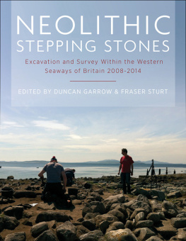
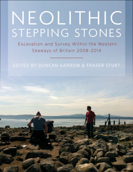
Duncan Garrow - Neolithic Stepping Stones: Excavation and Survey Within the Western Seaways of Britain, 2008-2014

Here you can read online Duncan Garrow - Neolithic Stepping Stones: Excavation and Survey Within the Western Seaways of Britain, 2008-2014 full text of the book (entire story) in english for free. Download pdf and epub, get meaning, cover and reviews about this ebook. year: 2017, publisher: Oxbow Books, genre: Home and family. Description of the work, (preface) as well as reviews are available. Best literature library LitArk.com created for fans of good reading and offers a wide selection of genres:

Romance novel Science fiction Adventure Detective Science History Home and family Prose Art Politics Computer Non-fiction Religion Business Children Humor

Choose a favorite category and find really read worthwhile books. Enjoy immersion in the world of imagination, feel the emotions of the characters or learn something new for yourself, make an fascinating discovery.

Duncan Garrow Neolithic Stepping Stones: Excavation and Survey Within the Western Seaways of Britain, 2008-2014
  • Book:
    Neolithic Stepping Stones: Excavation and Survey Within the Western Seaways of Britain, 2008-2014
  • Author:
  • Publisher:
    Oxbow Books
  • Genre:
  • Year:
    2017
  • Rating:
    4 / 5
  • Favourites:
    Add to favourites
  • Your mark:
    • 80
    • 1
    • 2
    • 3
    • 4
    • 5

Neolithic Stepping Stones: Excavation and Survey Within the Western Seaways of Britain, 2008-2014: summary, description and annotation

We offer to read an annotation, description, summary or preface (depends on what the author of the book "Neolithic Stepping Stones: Excavation and Survey Within the Western Seaways of Britain, 2008-2014" wrote himself). If you haven't found the necessary information about the book — write in the comments, we will try to find it.

The western seaways are an arc of sea extending from the Channel Islands in the south, through the Isles of Scilly around to Orkney in the north. This maritime zone has long been seen as a crucial corridor of interaction during later prehistory. Connections across it potentially led, for example, to the eventual arrival of the Neolithic in Britain, almost 1000 years after it arrived on the near continent. This books primary focus is Early Neolithic settlement on islands within the western seaways sites that offer significant insight into the character of the MesolithicNeolithic transition in this particular maritime zone. It also explores a series of directly related, wider themes: the nature and effects of island-ness in later prehistory; the visibility of material connections across the sea; the extent of Neolithic settlement variability across Britain; and the consequences of geographical biases in research for our understanding of the prehistoric past. At the heart of the book lie the results of three substantial excavations at LEre, Guernsey; Old Quay, St Martins (Isles of Scilly); and An Doirlinn, South Uist. Key findings include: the first major Mesolithic flint assemblage recovered from Scilly; one of the most extensively excavated and long-lasting Neolithic/Bronze Age occupation sites in the Channel Islands; the first substantial Neolithic settlement on Scilly; and the longest sequence of Neolithic/Early Bronze Age occupation on a single site from the Outer Hebrides. In order to contextualize the significance of these findings, we also present an extended discussion and broad synthesis of Mesolithic, Neolithic and Bronze Age archaeology on each island group.Table of Contents1. IntroductionIntroduction to the Stepping Stones projectThe Mesolithic-Neolithic transition in Britain and Ireland: recent debatesThe western seaways: characterising palaeo-oceanographic seascapesThe changing paleogeography of Britain and Ireland, c. 8000-1000 BCEarly Neolithic settlement in Britain and IrelandThe Mesolithic/Neolithic/EBA of the Channel Islands, Isles of Scilly and Outer HebridesAn introduction to the sites: LEre, Old Quay and An DoirlinnThemes: island-ness, connectivity, settlement variability, different traditions of research2. LEree, GuernseyIntroduction to the site at LEreeSurvey and excavation strategyResults: the archaeologyPotteryFlintWorked stone (polished stone ring + quern/rubber)Soils/micromorphEnvironmentalRadiocarbon datingDiscussion3. Old Quay, St Martins, Isles of scillyIntroduction to the site at Old QuayPrevious workResearch objectivesExcavation strategy and methodologyResults: the archaeologyPotteryFlintWorked and utilised stonePumiceSoils/micromorphEnvironmental evidenceRadiocarbon datingDiscussion4. An Doirlinn, South UistIntroduction to the site at An DoirlinnSurvey and excavation strategyResults: the archaeologyPotteryFlintWorked stonePumiceBoneEnvironmental Radiocarbon datingSurvey of OrosayDiscussion5. DiscussionContrasting island NeolithicsThe Stepping Stones project: discussionThemes revisited: island-ness, connectivity, settlement variability, different traditions of research

Duncan Garrow: author's other books


Who wrote Neolithic Stepping Stones: Excavation and Survey Within the Western Seaways of Britain, 2008-2014? Find out the surname, the name of the author of the book and a list of all author's works by series.

Neolithic Stepping Stones: Excavation and Survey Within the Western Seaways of Britain, 2008-2014 — read online for free the complete book (whole text) full work

Below is the text of the book, divided by pages. System saving the place of the last page read, allows you to conveniently read the book "Neolithic Stepping Stones: Excavation and Survey Within the Western Seaways of Britain, 2008-2014" online for free, without having to search again every time where you left off. Put a bookmark, and you can go to the page where you finished reading at any time.

Light

Font size:

Reset

Interval:

Bookmark:

Make
Pagebreaks of the print version
NEOLITHIC STEPPING STONES NEOLITHIC STEPPING STONES E XCAVATION AND S URVEY - photo 1

NEOLITHIC STEPPING STONES

NEOLITHIC STEPPING STONES

E XCAVATION AND S URVEY WITHIN THE W ESTERN S EAWAYS OF B RITAIN , 20082014

DUNCAN GARROW AND FRASER STURT

With contributions by

Hugo Anderson-Whymark, Anwen Cooper, Mike Copper, Elise Fraser,

Charles French, Seren Griffiths, Donovan Hawley, Julie Jones, Ceren Kabukcu,

Anne Pirie, Henrietta Quinnell, John Renouf, Katharine Sawyer, Rob Scaife,

Roger Taylor, Martin Tingle and Jaco Weinstock

Neolithic Stepping Stones Excavation and Survey Within the Western Seaways of Britain 2008-2014 - image 2

Published in the United Kingdom in 2017 by

OXBOW BOOKS

The Old Music Hall, 106108 Cowley Road, Oxford OX4 1JE

and in the United States by

OXBOW BOOKS

1950 Lawrence Road, Havertown, PA 19083

Oxbow Books and the individual contributors 2017

Paperback Edition: ISBN 978-1-78570-347-8

Digital Edition: ISBN 978-1-78570-348-5 (epub)

Kindle Edition: ISBN 978-1-78570-349-2 (mobi)

Library of Congress Cataloging-in-Publication Data

Names: Garrow, Duncan, editor. | Sturt, Fraser, editor.

Title: Neolithic stepping stones : excavation and survey within the western seaways of Britain, 2008-2014 / edited by Duncan Garrow and Fraser Sturt.

Description: Oxford ; Philadelphia : Oxbow Books, 2017. | Includes bibliographical references.

Identifiers: LCCN 2017013347 (print) | LCCN 2017027167 (ebook) | ISBN 9781785703485 (epub) | ISBN 9781785703492 (mobi) | ISBN 9781785703508 (pdf) | ISBN 9781785703478 (paperback)

Subjects: LCSH: Stepping Stones Project. | Neolithic period--Great Britain. | Excavations (Archaeology)--Great Britain. | Archaeological surveying--Great Britain. | Great Britain--Antiquities. | Guernsey--Antiquities. | Isles of Scilly (England)--Antiquities. | South Uist (Scotland)--Antiquities.

Classification: LCC GN776.22.G7 (ebook) | LCC GN776.22.G7 N457 2017 (print) | DDC 936.1--dc23

LC record available at https://lccn.loc.gov/2017013347

All rights reserved. No part of this book may be reproduced or transmitted in any form or by any means, electronic or mechanical including photocopying, recording or by any information storage and retrieval system, without permission from the publisher in writing.

For a complete list of Oxbow titles, please contact:

UNITED KINGDOM

Oxbow Books

Telephone (01865) 241249, Fax (01865) 794449

Email:

www.oxbowbooks.com

UNITED STATES OF AMERICA

Oxbow Books

Telephone (800) 791-9354, Fax (610) 853-9146

Email:

www.casemateacademic.com/oxbow

Oxbow Books is part of the Casemate Group

Front and back cover: Excavation underway at An Doirlinn, South Uist (photos: D. Garrow)

List of figures

Fig. 1.01 Map of the western seaways showing island groups.

Fig. 1.02 Eustatic curve for the study area.

Fig. 1.03 Relative sea-level curves from different parts of the study area.

Fig. 1.04 Overview of the changes that occurred across the whole study region from 9000 BC to AD 1.

Fig. 1.05 Channel Islands palaeogeography.

Fig. 1.06 Isles of Scilly palaeogeography.

Fig. 1.07 Outer Hebrides palaeogeography.

Fig. 2.01 LEre landfall view.

Fig. 2.02 LEre site location.

Fig. 2.03 LEre site location (detailed).

Fig. 2.04 LEree: geographical location at the time of occupation.

Fig. 2.05 Trench 11 under excavation in 2010.

Fig. 2.06 The soil sequence at LEree, Trench 6.

Fig. 2.07 Pottery density plot within buried soils.

Fig. 2.08 Flint density plot within buried soils.

Fig. 2.09 All prehistoric features at LEree.

Fig. 2.10 Trench 11 features.

Fig. 2.11 Hearths F8 and F9, seen in 2009 test pit (top) and hearth F16, seen at edge of 2010 trench (bottom).

Fig. 2.12 Photo of stakeholes and other features at the eastern end of Trench 11.

Fig. 2.13 Ditch F21 in Trench 16.

Fig. 2.14 Middle Neolithic pottery.

Fig. 2.15 Late Neolithic and Chalcolithic (undecorated) pottery.

Fig. 2.16 Chalcolithic (decorated) pottery.

Fig. 2.17 Bronze Age pottery (and sherds from Trench 3).

Fig. 2.1819 Flint.

Fig. 2.20 Polished stone ring.

Fig. 2.21 Quern and rubber-stone.

Fig. 2.22 Particle size analysis and loss on ignition results.

Fig. 2.23 Model output for radiocarbon dated samples at LEre.

Fig. 2.24 Photo showing the different levels in Trench 11.

Fig. 3.01 Old Quay landfall view.

Fig. 3.02 Old Quay site location.

Fig. 3.03 Old Quay site location (detailed).

Fig. 3.04 Old Quay: geographical location at the time of occupation.

Fig. 3.05 Test pits under excavation.

Fig. 3.06 Test pit 28 under excavation in 2013.

Fig. 3.07 Aerial view of Trenches 28, 36 and 37 under excavation in 2014.

Fig. 3.08 Flint density plot within buried soils.

Fig. 3.09 Pottery density plot within buried soils.

Fig. 3.10 Trenches 28, 38, 39 all features.

Fig. 3.11 Trench 28, with all features excavated.

Fig. 3.12 Photo of post-hole F49, half-sectioned.

Fig. 3.13 Trench 19 features.

Fig. 3.14 Photo of Trench 19, looking north-west.

Fig. 3.15 Trench 32 features.

Fig. 3.16 Photo of Trench 32, looking north-east.

Fig. 3.17 Trenches 8, 14 and 25 features.

Fig. 3.18 Roman pit F27, half-sectioned.

Fig. 3.1920 Neolithic pottery.

Fig. 3.21 Bronze Age pottery.

Fig. 3.223.28 Flint.

Fig. 3.29 Stone adze.

Fig. 3.303.33 Worked and utilised stone.

Fig. 3.343.35 Pumice.

Fig. 3.36 Model output for Neolithic radiocarbon dates obtained at Old Quay.

Fig. 3.37 Model output for all radiocarbon dates obtained at Old Quay.

Fig. 4.01 An Doirlinn landfall view.

Fig. 4.02 An Dorilinn site location.

Fig. 4.03 Satellite image of An Dorilinn.

Fig. 4.04 Landscape characterisation map of the Outer Hebrides.

Fig. 4.05 An Doirlinn: geographical location at the time of occupation.

Fig. 4.06 Excavation in progress at An Doirlinn, looking east.

Fig. 4.07 Work underway and section being drawn.

Fig. 4.08 Drawing of south-east facing section prior to excavation.

Fig. 4.09 Photo of cleaned south-east facing section prior to excavation.

Fig. 4.10 Phase 1a plan.

Fig. 4.11 Pit F26, containing the almost complete pot, under excavation.

Fig. 4.12 Hearth F15.

Fig. 4.13 Pot deposit [67].

Fig. 4.14 Phase 1b plan.

Fig. 4.15 Hearth F16.

Fig. 4.16 Phase 2 plan.

Fig. 4.17 Hearths F8/9, looking north.

Fig. 4.18 Pit F11, half-sectioned.

Fig. 4.19 Hearth F5/10, looking south.

Fig. 4.20 Finds densities plan for [41/42/47].

Fig. 4.21 Phase 3 deposits.

Fig. 4.22 Pit F2, looking south-west.

Fig. 4.234.24 Hebridean pottery.

Fig. 4.25 Grooved Ware and Beaker pottery.

Fig. 4.26 Rim types at An Doirlinn.

Fig. 4.27 Sherds by phase.

Fig. 4.28 Phase 1 pottery rim diameters.

Fig. 4.294.31 Flint.

Fig. 4.324.34 Worked stone.

Fig. 4.354.36 Pumice.

Fig. 4.37 Model output for radiocarbon dated phases at An Doirlinn.

Fig. 4.38 Pottery: percentage of total site assembage in each main layer group.

Fig. 4.39 Flint/quartz: percentage of total site assembage in each main layer group.

Fig. 4.40 Timespans of extensively excavated Neolithic/EBA settlement sites in the Outer Hebrides.

List of tables

Table 1.01 Neolithic and EBA pottery typologies and their approximate dates in north-west France

Next page
Light

Font size:

Reset

Interval:

Bookmark:

Make

Similar books «Neolithic Stepping Stones: Excavation and Survey Within the Western Seaways of Britain, 2008-2014»

Look at similar books to Neolithic Stepping Stones: Excavation and Survey Within the Western Seaways of Britain, 2008-2014. We have selected literature similar in name and meaning in the hope of providing readers with more options to find new, interesting, not yet read works.


Reviews about «Neolithic Stepping Stones: Excavation and Survey Within the Western Seaways of Britain, 2008-2014»

Discussion, reviews of the book Neolithic Stepping Stones: Excavation and Survey Within the Western Seaways of Britain, 2008-2014 and just readers' own opinions. Leave your comments, write what you think about the work, its meaning or the main characters. Specify what exactly you liked and what you didn't like, and why you think so.