Contents
KEY TO SYMBOLS

| The route |

| Alternative route |

| Route continuation |

| International boundary |

| Motorway |

| Main roads |

| Other roads |

| Track |

| Footpath |

| Railway/station |

| Funicular/cable railway |

| Cable Car |

| Ski lift/chair lift |

| Airstrip |

| Church/chapel |

| Waterwheel |

| Castle/for |

| Mountain hut |

| Stage start/finish |

| Telephone number |

| Mobile/cell number |

| Email address |

| Opening hours |

| The route |

| Accommodation |

| Restaurant |

| Point of interest |

| Waterfall |

| Pass/bridge |

| Summit (height in metres) |

| 100m contours |

| Built up area |

| Glacier |

|
Scale of route maps |
HOW TO USE THIS BOOK
MAPS This book has been designed so you can walk the Alpe-Adria Trail using the maps included. The route of the Alpe-Adria Trail has been walked, as have some, though not all, of the paths leading off it. If you would like to explore paths in the surrounding area further, we recommend that you look at the alternative maps suggested in each stage.
Scale The maps are at a scale of 1:50,000 (2cm represents 1km).
Orientation All the maps in this guide are oriented page north, that is N is the top of the page as you read it. Compass bearings (north, south, east, west) are abbreviated as N, S, E, W and intermediate bearings (northeast, south-southwest, etc) as NE, SSW, etc.
Symbols A key to the symbols used on the maps is on .
Accommodation In order to keep the maps uncluttered and easy to use, only those accommodation and restaurant options that occur along the route are shown. Other options will be listed at the start and end of each stage.
HEIGHTS AND DISTANCES Throughout this book, elevations are given in metres (m) and distances in kilometres (km).
TIMINGS The timing given in the introduction to each stage refers to an average walking speed, and does not include breaks or stopping time (as a general rule of thumb, add 10mins to every hour, plus time to stop for lunch). In general Ive found the timings given on the AAT app and booklet, and on signposts, to be reasonably accurate, however youll find that some timings in this guidebook do differ from those listed on the AAT app or on signposts.
GRADING Each stage is graded easy/moderate/difficult. A short summary of the terrain and any particular difficulties encountered is given in the introduction to each stage. A profile chart shows elevation and distance.
TRUE RIGHT/LEFT All references to which side (bank) of a river youre on are given as true right/left, that is they refer to the right/left bank as seen when facing downstream.
LANGUAGE The official languages of the region are DE German, SI Slovenian and IT Italian. See from for a selection of words and phrases in each language.
Introduction
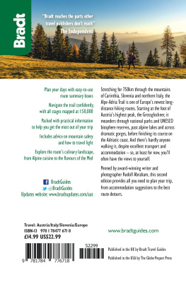
The Alpe-Adria Trail is an epic long-distance hiking route, stretching some 750km through the mountains of Carinthia, Slovenia and northern Italy from the foot of the Grossglockner (at 3,798m, the highest peak in Austria and the Eastern Alps), to Muggia near Trieste on the Adriatic coast. Over its meandering course, it takes in spectacular, unspoilt mountain scenery, alpine lakes, deep gorges, rocky karst and rolling coastal hills. The route passes through a whole raft of specially protected landscapes from national parks and nature reserves to UNESCO biosphere reserves and visits a succession of compelling historical sites, from the UNESCO-listed medieval city of Cividale, to remote pilgrimage churches, and the haunting relics of the Isonzo Front from World War I, still eerily resonant to this day. And theres hardly anyone walking it, despite excellent transport and accommodation so, at least for now (and unlike many of the better-known trails in the region), youll often have the views to yourself. The route is split into 43 stages (including a six-day circular route) and can comfortably be walked in six weeks although its possible to get through the whole thing in not much more than a month, allowing closer to six weeks to cover the route will be more rewarding and allow you the occasional day off from hiking, either to put your feet up, visit local cultural and heritage sites, or (if youre still full of energy) jump on a mountain bike or paddle off in a kayak. Theres a huge amount of scope for lingering and exploring further mountain peaks and architectural gems, alpine railways, wine cellars and traditional festivals without even venturing very far from the main trail, often without leaving it at all.
Next page
