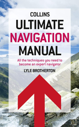
Lyle Brotherton - How to Navigate Without Sat Nav (Collins Shorts, Book 10)
Here you can read online Lyle Brotherton - How to Navigate Without Sat Nav (Collins Shorts, Book 10) full text of the book (entire story) in english for free. Download pdf and epub, get meaning, cover and reviews about this ebook. year: 2012, publisher: HarperCollins Publishers, genre: Home and family. Description of the work, (preface) as well as reviews are available. Best literature library LitArk.com created for fans of good reading and offers a wide selection of genres:
Romance novel
Science fiction
Adventure
Detective
Science
History
Home and family
Prose
Art
Politics
Computer
Non-fiction
Religion
Business
Children
Humor
Choose a favorite category and find really read worthwhile books. Enjoy immersion in the world of imagination, feel the emotions of the characters or learn something new for yourself, make an fascinating discovery.

- Book:How to Navigate Without Sat Nav (Collins Shorts, Book 10)
- Author:
- Publisher:HarperCollins Publishers
- Genre:
- Year:2012
- Rating:4 / 5
- Favourites:Add to favourites
- Your mark:
How to Navigate Without Sat Nav (Collins Shorts, Book 10): summary, description and annotation
We offer to read an annotation, description, summary or preface (depends on what the author of the book "How to Navigate Without Sat Nav (Collins Shorts, Book 10)" wrote himself). If you haven't found the necessary information about the book — write in the comments, we will try to find it.
Lyle Brotherton: author's other books
Who wrote How to Navigate Without Sat Nav (Collins Shorts, Book 10)? Find out the surname, the name of the author of the book and a list of all author's works by series.


How to Navigate Without Sat Nav (Collins Shorts, Book 10) — read online for free the complete book (whole text) full work
Below is the text of the book, divided by pages. System saving the place of the last page read, allows you to conveniently read the book "How to Navigate Without Sat Nav (Collins Shorts, Book 10)" online for free, without having to search again every time where you left off. Put a bookmark, and you can go to the page where you finished reading at any time.
Font size:
Interval:
Bookmark:

Most people will be quite confident of their navigation skills on a warm, clear, summers day or while following a well-marked footpath. The problem is that these scenarios often do not last long: the weather can change in an alarmingly brief time, signs run out, tracks disappear or are impassable.
There is only one way to be really confident in navigating in all conditions, and that is to use micronavigation an easy-to-learn technique of land navigation. You navigate in a series of small distances, called legs, and focus on the immediate features in your landscape to continually ascertain position: this minimises the chance for error.
All navigators make small errors in compass reading, correcting for magnetic declination, and then in both judging distance travelled and how far they have drifted off course. The further you travel on a bearing the greater the error. So by employing short legs these mistakes are continually corrected.
Micronavigation builds upon your innate ability to create a greater awareness of your immediate environment sight, sound, smell and touch and relating this information to the use of robust and reliable non-specialist equipment: a map and baseplate compass.
Micronavigation can be used in the most difficult of terrains including alpine, arctic, desert, forest, Jungle, mountain, shoreline and urban and is employed by specialists varying from search and rescue (SAR) teams to the special Forces.
Micronavigation can also be augmented with, yet is not dependent upon: altimeters, celestial navigation, environmental navigation and global navigation systems (GNS). Different types of navigation may be used in isolation, but just as the Phoenicians relied heavily upon celestial navigation augmented with environmental navigation, today the expert land navigator utilises and combines as many different types as possible.

You will already have a wealth of navigational tools at your disposal which you have been developing and adding to since birth. For example, collecting features that confirm your route is a technique you probably employ everyday travelling to and from work from noting significant traffic junctions, to registering the noise of the train brake as you approach the station from where you will continue the next leg of your journey. My objective (in this short excerpt) is to break with convention and reawaken these innate skills in the natural environment.
From infancy we learn to navigate our environment using all of our senses. Most navigational techniques simply mirror innate skills.

A major step to becoming a skilled navigator is when you stop thinking about yourself as the reference; instead relate the world around you and the orientation and position of everything in it.
To instruct navigation is simply to formalise these skills and extend them with the mastery of man-made tools. One of the single biggest mistakes that people can make when they teach formal navigation with a map and compass is to focus on the use of these tools and to ignore the individuals natural skills.
Learn to use the wealth of information your surroundings offer you in helping determine where you are. Learning to read environmental clues is a key component of micronavigation they are invaluable.
To start with, take a walk on a route you are very familiar with and run through the following check list in the field until it becomes second nature. You will be surprised what else you become aware of add your own observations.


Wind direction often changes frequently over the period of a day so look for permanent signs of the prevailing winds direction, especially trees and shrubs whose branches are bent to shape by the directional wind they can act as radial arms and help you determine the other cardinals of the compass.
Prior to entering an area, determine which way the prevailing winds blow and if they are seasonal. This can be found easily from many sources ranging from meteorological internet sites to local farmers.

Wind speed generally increases the higher you climb and a quick technique to predict the speed in the UK is to count the isobars, if they are 4mb apart (as in Met Office forecasts), covering the UK and allow 16 kph (10 mph) for each isobar: this will be your rough wind speed at about 300 m (1,000 ft) above sea level.


Face the direction the wind is blowing, close your eyes and smell the air. Think carefully about the scents you can detect:
traffic fumes suggest a road
the scent of a forest
farmyard smells
industrial/factory fumes
in urban environments, a tube station/subway entrance.
Now look at your map in the direction of the blowing wind and see if any of these features are present.


As you gain height the temperature of the air decreases. The amount it decreases depends primarily upon the amount of water vapour in the air and the extremes of these are:
Dry air found in deserts and high mountain ranges, temperature changes at an average rate 10 C/1,000 m (<10% relative humidity)
Clammy, muggy air found in rainforests, temperature changes by an average of 5 C/1,000 m (saturated air with >90% relative humidity).
Think about where the climate in the region you will be navigating in fits between the two extremes given above and remember that as you lose height the temperature increases by the same values.
In winter conditions look for where the frost has melted on rocks, this will be the side where the sun has shone the most.


Take note of what you have walked over a marsh, sand, grass or heath and compare it to the vegetation marked on your map. Look for the edges of forests and forest clearings, also the type (coniferous or deciduous), and relate these to where you think you are on the map. Learn the symbols for these different types of vegetation (refer to the legend at the side of your map.
Next pageFont size:
Interval:
Bookmark:
Similar books «How to Navigate Without Sat Nav (Collins Shorts, Book 10)»
Look at similar books to How to Navigate Without Sat Nav (Collins Shorts, Book 10). We have selected literature similar in name and meaning in the hope of providing readers with more options to find new, interesting, not yet read works.
Discussion, reviews of the book How to Navigate Without Sat Nav (Collins Shorts, Book 10) and just readers' own opinions. Leave your comments, write what you think about the work, its meaning or the main characters. Specify what exactly you liked and what you didn't like, and why you think so.