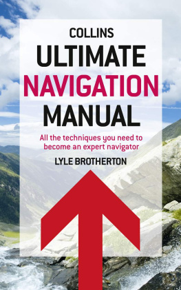
Lyle Brotherton - Ultimate Navigation Manual
Here you can read online Lyle Brotherton - Ultimate Navigation Manual full text of the book (entire story) in english for free. Download pdf and epub, get meaning, cover and reviews about this ebook. year: 2011, publisher: HarperCollins Publishers, genre: Romance novel. Description of the work, (preface) as well as reviews are available. Best literature library LitArk.com created for fans of good reading and offers a wide selection of genres:
Romance novel
Science fiction
Adventure
Detective
Science
History
Home and family
Prose
Art
Politics
Computer
Non-fiction
Religion
Business
Children
Humor
Choose a favorite category and find really read worthwhile books. Enjoy immersion in the world of imagination, feel the emotions of the characters or learn something new for yourself, make an fascinating discovery.

- Book:Ultimate Navigation Manual
- Author:
- Publisher:HarperCollins Publishers
- Genre:
- Year:2011
- Rating:5 / 5
- Favourites:Add to favourites
- Your mark:
Ultimate Navigation Manual: summary, description and annotation
We offer to read an annotation, description, summary or preface (depends on what the author of the book "Ultimate Navigation Manual" wrote himself). If you haven't found the necessary information about the book — write in the comments, we will try to find it.
Lyle Brotherton: author's other books
Who wrote Ultimate Navigation Manual? Find out the surname, the name of the author of the book and a list of all author's works by series.


Ultimate Navigation Manual — read online for free the complete book (whole text) full work
Below is the text of the book, divided by pages. System saving the place of the last page read, allows you to conveniently read the book "Ultimate Navigation Manual" online for free, without having to search again every time where you left off. Put a bookmark, and you can go to the page where you finished reading at any time.
Font size:
Interval:
Bookmark:
THE ULTIMATE
NAVIGATION MANUAL
Lyle F. Brotherton

Contents
Weekend
Weekend
Weekend
Weekend
A ny venture into the outdoors carries with it a risk, from a days walk in the hills to a polar expedition, and good navigation is the foundation of all safe adventure. Navigational errors are the most common contributory cause of mountain accidents, often being the first link in a chain of events that can lead to catastrophe.
Search and rescue teams are regularly called out in the worst weathers and need to reach inaccessible areas quickly and safely. These same requirements apply to anybody who wants to safely enjoy the outdoors. This field instruction manual brings together for the first time Best Practice as used by these teams throughout the world and makes it accessible to everyone.
Planning and preparation underpin any successes I may have had. Make them yours!
Scottish Mountaineering Incidents(19962005), Research Digest , No. 102.

John Cleare/Mountain Camera Picture Library
W hether your interest lies in reaching one of the earths most remote destinations, undertaking your first Duke of Edinburgh outbound challenge or simply enjoying a days walk in the hills, true freedom and safety outdoors depends on proficient navigational skills.
Micronavigation is an extremely accurate system of land navigation for all terrains: Alpine, Arctic, Desert, Forest, Jungle, Mountain, Shoreline and Urban. The techniques can be mastered by anyone from a hiker to a search and rescue (SAR) responder, and are used to navigate competently and securely in every environment and in all conditions.
Encompassing the full range of navigational techniques available, and the thinking and technology which supports them from the direction of the wind and simple compasses, to celestial direction-finding and cutting-edge, global satellite systems this manual brings together for the first time all of these straightforward techniques.
The end result is one of the most comprehensive and easy-to-use navigation manuals ever made available. This book is a landmark in land navigation.
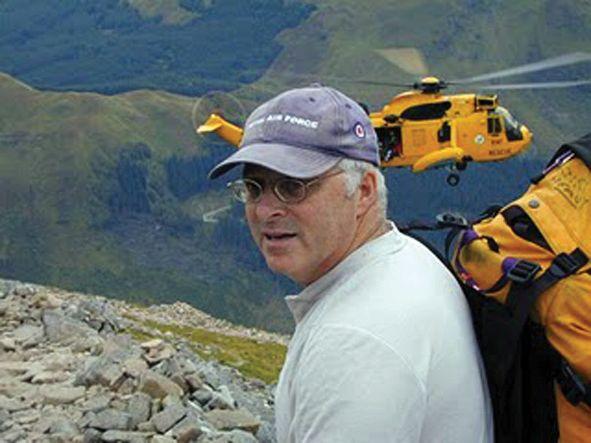
David Heavy Whalley, BEM, MBE and the Distinguished Service Award for Service to Mountain Rescue. Team Leader of RAF Leuchars MRT (Mountain Rescue Team), RAF Kinloss MRT and Deputy Team Leader at RAF Valley MRT, he has taken part in more than 1,000 mountain rescue and air-crash searches including the Lockerbie Pan Am Flight 103 and has helped in saving hundreds, probably thousands, of lives.
Most people will be quite confident of their navigation skills on a warm, clear, summers day or while following a well-marked footpath. The problem is that these scenarios often do not last long: the weather can change in an alarmingly brief time, signs run out, tracks disappear or are impassable.
There is only one way to be really confident in navigating in all conditions, and that is to learn the techniques of micronavigation which are similar to the techniques used in orienteering. With practice, you will soon be able to navigate to all sorts of tiny features on the map even the smallest kink in a contour line in poor visibility from fog to night-time. Micronavigation is a key skill for anyone who wishes to navigate competently and safely.
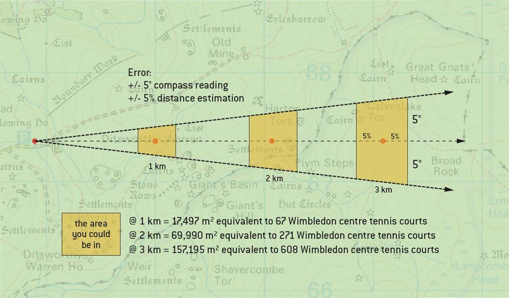
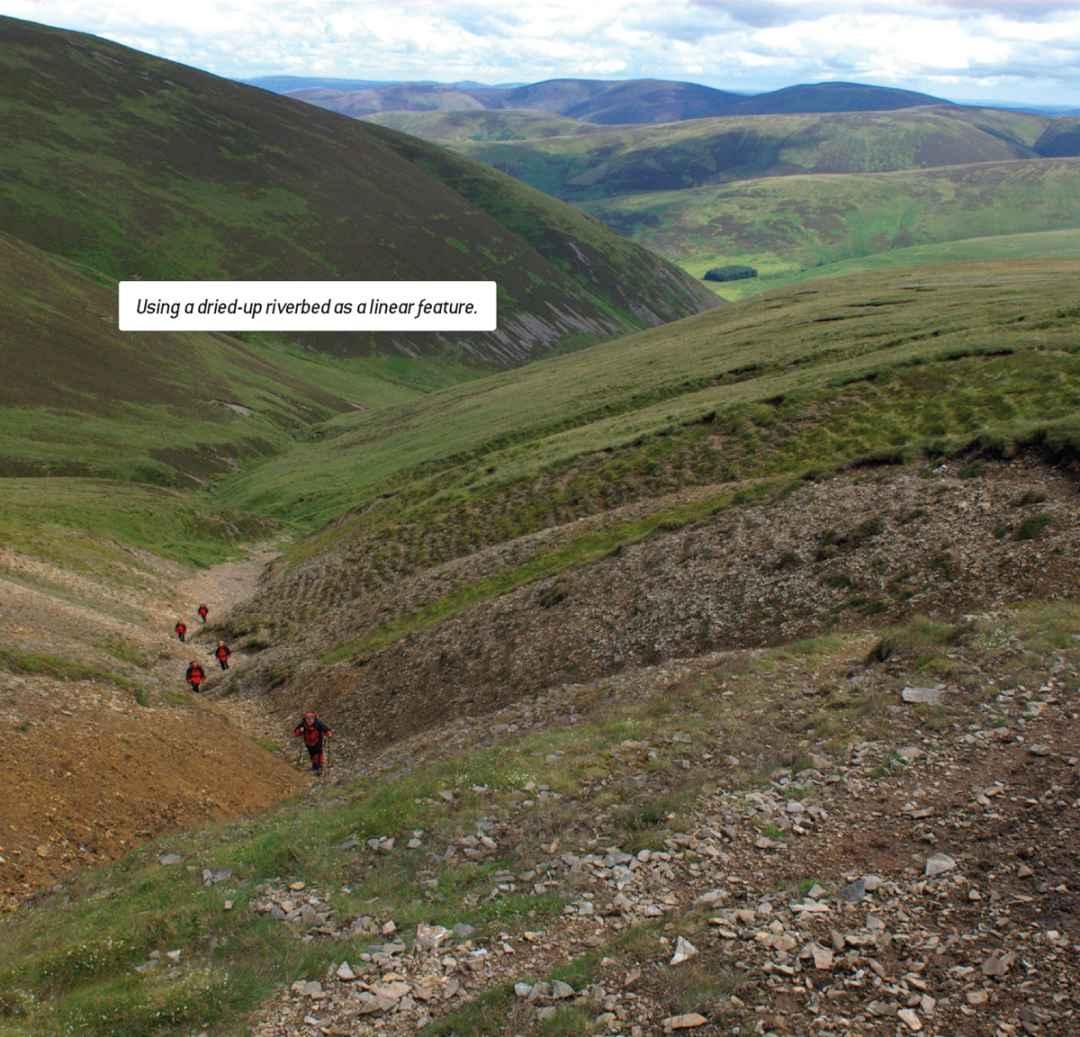
Micronavigation is an easy-to-learn technique of land navigation. You navigate in a series of small distances, called legs, and focus on the immediate features in your landscape to continually ascertain position: this minimises the chance for error.
All navigators make small errors in compass reading, correcting for magnetic declination, and then in both judging distance travelled and how far they have drifted off course. The further you travel on a bearing the greater the error. So by employing short legs these mistakes are continually corrected.
Micronavigation builds upon your innate ability to create a greater awareness of your immediate environment, using your senses of sight, sound, smell and touch and relating this information to the use of robust and reliable non-specialist equipment: a map and baseplate compass.
Micronavigation can be used in the most difficult of terrains including Alpine, Arctic, Desert, Forest, Jungle, Mountain, Shoreline and Urban and is employed by specialists varying from search and rescue (SAR) teams to the Special Forces.
Micronavigation can also be augmented with, yet is not dependent upon: altimeters, celestial navigation, environmental navigation and global navigation systems (GNSS).
Different types of navigation may be used in isolation, but just as the Phoenicians relied heavily upon celestial navigation augmented with environmental navigation, today the expert land navigator utilises and combines as many different types as possible.
 EXPERT TIP
 The more navigational techniques you carry with you in your minds rucksack the more capable and adept navigator you will be.
Follow the instructions in this manual to the letter and you can become an outstanding navigator on land. Do not skip or jump sections : they have been developed from teaching basic navigation to groups of beginners, to advanced navigation to experienced SAR professionals. They work!
This manual takes nothing for granted and you need no prior knowledge of navigation whatsoever.
In the first chapters of this book you are going to build learning scaffolding and construct a simple framework upon which you can further develop your knowledge and skill sets with the more challenging techniques and theory.
Words styled in bold grey type have full explanations elsewhere in this manual.
Sentences in bold italic are essential learning learn them by heart.
EXPERT TIPS are the handy hints and snippets of information to help you to be spot on in your navigation.
EXPERT FACTS are the pieces of information that will help you understand and remember the theory sections.
QUIRKY FACTS are fun but also help you remember the section.
There are only three home-study topics. Theory is kept to an absolute minimum and then only that which is absolutely necessary. Take time and learn these topics: The Three Norths, Mapping Systems and GNSS/Satnav Introduction .
Basic Techniques are highlighted to give you the basics you require to navigate. The more you learn beyond this the greater your repertoire of navigational skills and the more proficient and safer navigator you become.
There are many different types of maps and numerous navigational pieces of equipment from compasses to satnav. This manual is not a discussion document and recommends only map types and equipment which has been used extensively by the author throughout the world, both for pleasure and in SAR.
It dispenses with unnecessary theory and technical jargon. You will only learn what you need to know to micronavigate competently and safely.
Font size:
Interval:
Bookmark:
Similar books «Ultimate Navigation Manual»
Look at similar books to Ultimate Navigation Manual. We have selected literature similar in name and meaning in the hope of providing readers with more options to find new, interesting, not yet read works.
Discussion, reviews of the book Ultimate Navigation Manual and just readers' own opinions. Leave your comments, write what you think about the work, its meaning or the main characters. Specify what exactly you liked and what you didn't like, and why you think so.