IMAGES
of America
AROUND TRONA AND
SEARLES VALLEY

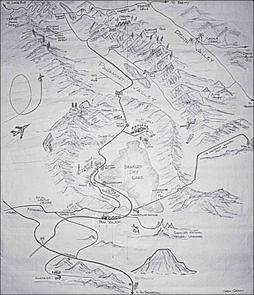
Greg Corrion, a native of Trona and 56-year resident, drew this map of Searles Valley for the Old Guest House Museum so visitors could see the locations of places of interest.
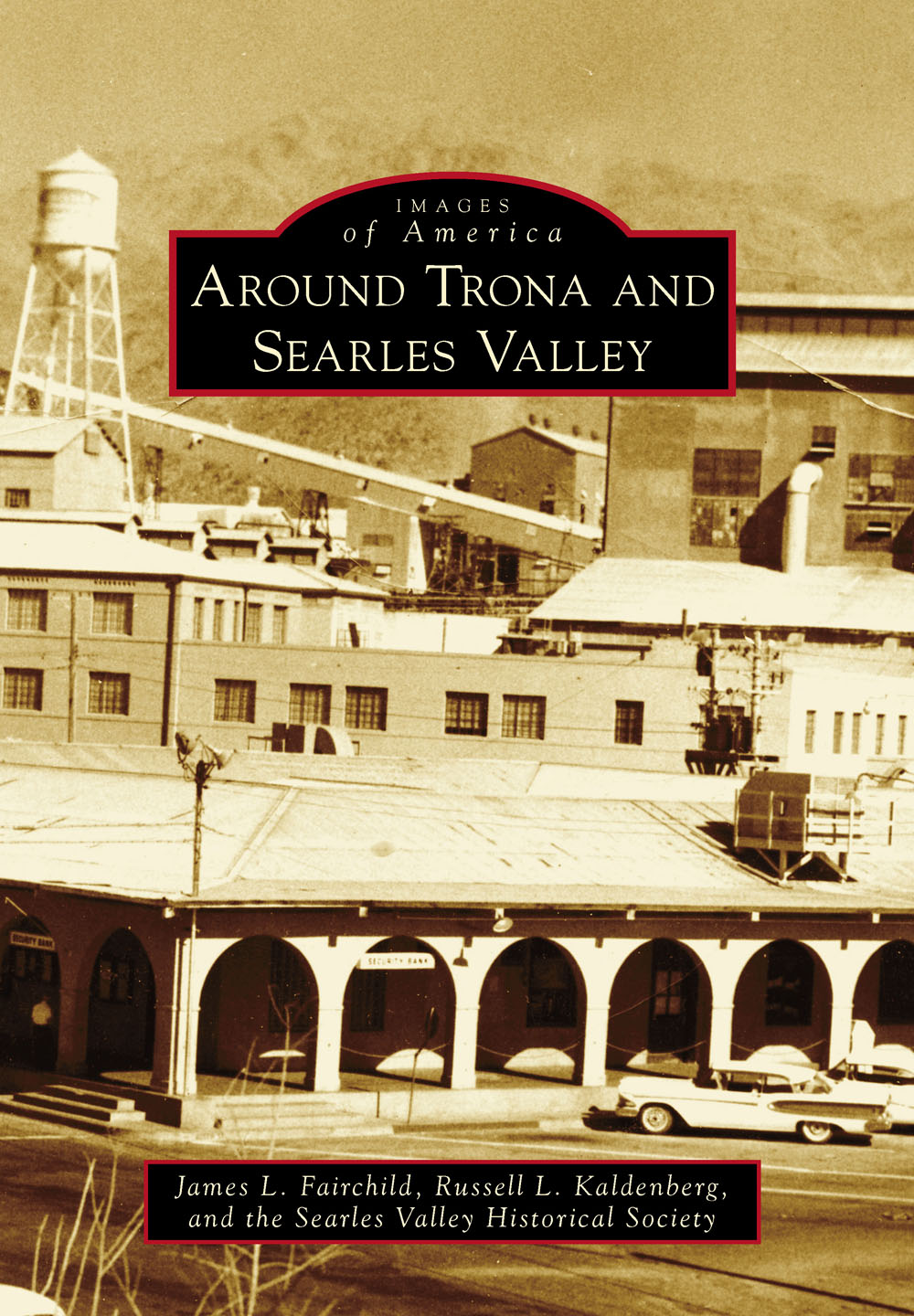
ON THE COVER: This 1959 photograph shows the Trona Plant of American Potash and Chemical Corporation as the backdrop to Austin Hall, with the Argus Range and Trona Peak in the background. For more than 50 years Austin Hall was the heart of Trona, housing many of the businesses in Searles Valley.
IMAGES
of America
AROUND TRONA AND
SEARLES VALLEY
James L. Fairchild, Russell L. Kaldenberg,
and the Searles Valley Historical Society

Copyright 2015 by James L. Fairchild, Russell L. Kaldenberg, and the Searles Valley Historical Society
ISBN 978-1-4671-3399-9
Ebook ISBN 9781439652794
Published by Arcadia Publishing
Charleston, South Carolina
Library of Congress Control Number: 2015935024
For all general information, please contact Arcadia Publishing:
Telephone 843-853-2070
Fax 843-853-0044
E-mail
For customer service and orders:
Toll-Free 1-888-313-2665
Visit us on the Internet at www.arcadiapublishing.com
To Margaret Lit Brush for her tireless work to save the history of Trona as well as the history of all of Searles Valley and Panamint Valley.
CONTENTS
ACKNOWLEDGMENTS
The real genius behind this book is the Searles Valley Historical Society, whose members had the foresight to collect and preserve a vast store of historical documents, photographs, and artifacts of Trona, Searles Valley, and Panamint Valley. These historical materials provide the foundation for this book.
Margaret Lit Brush, president of the Searles Valley Historical Society, curator of the Old Guest House Museum, and 86-year resident of Searles Valley, deserves special thanks for her help in locating obscure photographs, fact checking, and editing all of our text. Thanks also to Bonnie Fairchild for her tireless hours retrieving photographs and information, Judyth Reed for editing suggestions, and Zee Malas for assisting with the photographs.
All photographs are owned by the Searles Valley Historical Society except for those few identified in captions; photographs from the Settle-Dearborn collections are identified as (SD). We thank them for their generosity.
We also appreciate our original editor with Arcadia Publishing, Alyssa Jones, for all of her encouragement, and Matt Todd for his guidance.
INTRODUCTION
Searles Valley is an arid closed basin lying 43 miles east of the south end of the Sierra Nevada Mountains in California. It is bounded on the east and northeast by the Slate Range, on the west by the Argus Range and Spangler Hills, and on the south by the Lava Mountains. Searles (dry) Lake occupies the north-central part of the valley. During those parts of the late Pliocene and Pleistocene periods, precipitation and runoff from the east side of the Sierra Nevada into the Owens River were much greater than at present, and a chain of as many as five large lakes was created, of which Searles Lake was third. In Searles Valley, maximum-depth lakes rose to the 2,280-foot contour, the level of the spillway at the south end of the Slate Range that led overflowing waters to Panamint Valley. That spillway is about 660 feet above the present dry lake surface.
Deposits in the Searles Lake Formation contain numerous fossil snails and clams, especially in Poison Canyon and Salt Wells Valley. These regions were near the main source of inflowing freshwater at the times Searles Valley contained large lakes, and the genera and species of snails and clams all indicate low-salinity environments. The same species of snail has also been found in Panamint Valley to the east, indicating that when Searles Lake contained freshwater, it also overflowed into Panamint Valley. Only one vertebrate fossil has been found, a fish found at a depth of 68 feet in mud that was deposited between 24,000 and 10,500 years ago.
The 14 economically important saline mineral beds in Searles Lake are the products of 150,000 years of wet, glacial epochs separated by brief hot dry periods. When it was wet, the Owens River drained into Searles Valley, carrying over 40 chemical elements in its water. Some of these elements were leached from the rocks in the Sierra Nevada Mountains through glacial erosion, and other elements were the result of extensive volcanism in the Owens and Long Valleys and as far north as the Mono Craters. All dissolved elements were at very low concentrations in the river water. However, over many thousands of years and with a river flow averaging 290,000 gallons every minute, and two-and-a-half to four times that flow during glacial periods, many billions of tons of dissolved materials have been carried by the rivers water. During periods when the river flow was low to moderate, Searles Lake was the terminus lake for the river, so all of the dissolved elements accumulated in Searles Lakes water. During periods of desiccation, these materials were deposited as saline mineral beds.
Searles Lake has remained mostly dry since its most recent desiccation 10,500 years ago, except for a period centered at about 3,500 years ago when the lake surface rose to an elevation of about 1,800 feet, 180 feet above the present dry surface. This last desiccation was when the topmost mineral bed, the 50- to 80-foot thick Upper Salt, was deposited.
Archeological sites occur at several locations in Searles Valley, including at the high-water shoreline, which may mean they are more than 10,000 years old. Other sites date from less than 500 years ago.
Gold and silver miners built the first settlements in Searles Valley, although none were more than a collection of a few shacks or roofed dugouts. These were near their mines, first in the Slate Range and later in the Argus Range. None of their settlements were built to last, and all are now gone, most with little evidence they ever existed. Some of the early settlements and associated mills were burned by Indians, some were salvaged to be moved to other sites, and the rest succumbed to the elements, including flash floods, sun and wind, and vandals. Even the iron machines in their mills and their water pipes are now gone, collected to supply critical materials during World War II. The only exception is the Ruth Mine site in Homewood Canyon, although even there much of the small settlement that once existed is gone.
In 1873, John Searles and his San Bernardino Borax Mining Company started mining borax that was found in the surface mud along the western edge of a dry lake that covers 50 square miles of the floor of Searles Valley. Their first borax mill was burned by Indians in the spring of 1878, but Searles quickly rebuilt his mill at a new site called Borax. This mill was the start of continuous habitation in Searles Valley by nonnative peoples, which has now lasted for more than 137 years.
In 1912, potash was found in the brine in Searles Lake. With the outbreak of World War I, potash became a critical nutrient for the crops needed to feed our country. Two factories were built to process the brine to recover potash, but they had only marginal success. The year 1921 was pivotal for Searles Valley. One of the early potash factories had shut down in February, never to restart. The other factory shut down in May and remained closed the rest of the year. However, the scientists and engineers working for American Trona Corporation persevered and invented ways to make the idle plant one of the most profitable businesses in the country.
Next page


