Eli Burakian - Climbing New Hampshires 48 4,000 Footers: From Casual Hikes to Challenging Ascents
Here you can read online Eli Burakian - Climbing New Hampshires 48 4,000 Footers: From Casual Hikes to Challenging Ascents full text of the book (entire story) in english for free. Download pdf and epub, get meaning, cover and reviews about this ebook. year: 2018, publisher: Falcon Guides, genre: Home and family. Description of the work, (preface) as well as reviews are available. Best literature library LitArk.com created for fans of good reading and offers a wide selection of genres:
Romance novel
Science fiction
Adventure
Detective
Science
History
Home and family
Prose
Art
Politics
Computer
Non-fiction
Religion
Business
Children
Humor
Choose a favorite category and find really read worthwhile books. Enjoy immersion in the world of imagination, feel the emotions of the characters or learn something new for yourself, make an fascinating discovery.

- Book:Climbing New Hampshires 48 4,000 Footers: From Casual Hikes to Challenging Ascents
- Author:
- Publisher:Falcon Guides
- Genre:
- Year:2018
- Rating:3 / 5
- Favourites:Add to favourites
- Your mark:
Climbing New Hampshires 48 4,000 Footers: From Casual Hikes to Challenging Ascents: summary, description and annotation
We offer to read an annotation, description, summary or preface (depends on what the author of the book "Climbing New Hampshires 48 4,000 Footers: From Casual Hikes to Challenging Ascents" wrote himself). If you haven't found the necessary information about the book — write in the comments, we will try to find it.
Look inside to find:
Eli Burakian: author's other books
Who wrote Climbing New Hampshires 48 4,000 Footers: From Casual Hikes to Challenging Ascents? Find out the surname, the name of the author of the book and a list of all author's works by series.


Climbing New Hampshires 48 4,000 Footers: From Casual Hikes to Challenging Ascents — read online for free the complete book (whole text) full work
Below is the text of the book, divided by pages. System saving the place of the last page read, allows you to conveniently read the book "Climbing New Hampshires 48 4,000 Footers: From Casual Hikes to Challenging Ascents" online for free, without having to search again every time where you left off. Put a bookmark, and you can go to the page where you finished reading at any time.
Font size:
Interval:
Bookmark:
Eli Burakian is a photographer and author based out of Brownsville, Vermont. He is author, photographer, or contributor to fifteen books, including his self-published landscape coffee table book, MoosilaukePortrait of a Mountain. He is an avid hiker and ultrarunner and has through-hiked numerous long- and middle-distance trails. He has attempted to break the Long Trail unsupported speed record (FKT; fastest known time) multiple times and is working on a book and podcast series about mountain and trail speed records.
Eli works full-time at Dartmouth College, his alma mater, as the college photographer. More of his work can be seen on his website: eliburakian.com.
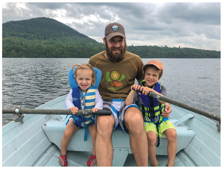
Id like to thank my wife, Julia, and my children, Levon and Ani, for supporting me through the time-consuming process of planning, hiking, mapping, photographing, and writing. Without their support, there is no way I could have completed this project.
I would also like to extend my gratitude to all the authors and website creators whose helpful resources have been invaluable in the process of writing this book. Although Ive hiked all of these mountains many times, there are many who have much more knowledge and experience than me.
Thank you to the friends and family who have joined me for these adventures and to everyone who supports the preservation of wild places. I have endless gratitude to those thousands of souls who have put in the hard work in making and maintaining the trails throughout the region.
Without a doubt, this book would not have been possible without the aid and support of Mike Dickerman and Steven Smith, who, in addition to writing the ultimate resource on the New Hampshire 4,000-footers, The 4000-Footers of the White MountainsA Guide and History, have always been open and willing to answer my questions. I highly encourage anybody visiting the region to stop by Mikes Bondcliff Books retail location in Littleton, New Hampshire, and my favorite store in the whole world, Steves Mountain Wanderer Books and Maps in Lincoln, New Hampshire.
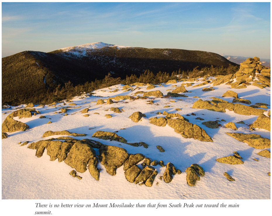
Often called the Entrance to the White Mountains, Mount Moosilauke is the south-westernmost of the 4,000-footers; the broad alpine summit provides amazing views out to the Whites as well as across Vermont and down the Connecticut River Valley. Unlike most of the mountains in the region, which lie within the White Mountain National Forest, most of the land and trails on the mountain are owned and maintained by Dartmouth College, which also runs the Moosilauke Ravine Lodge, rebuilt in 2017.
Distance: 8.1-mile lollipop loop
Summit elevation: 4,802 feet
4,000-footers rank: 10
Elevation gain: 2,500 feet
Difficulty: Moderate
Hiking time: About 4 hours
Trails used: Gorge Brook Trail, Carriage Road, South Peak Spur, Snapper Trail
Views: Excellent
Canine compatibility: Great
Special considerations: Parking is along the side of the road, so the earlier you get there, the less walking you will have to do to reach the trailhead. Reservations are required to eat or stay at the Moosilauke Ravine Lodge.
Finding the trailhead:From I-93, take exit 32 and head west on NH 112 (Kancamagus Highway). In approximately 3 miles, turn left onto NH 118. Go 7.1 miles and turn right onto Ravine Road. Follow this for 1.5 miles to the end of the road, where you can turn around and park along the west side of the road before the service road entrance. From I-91 (south of junction with I-93), take exit 16 and head east on VT 25 South toward Bradford. Go through the lights, and stay on the road as it crosses the bridge into New Hampshire and becomes NH 25. Continue heading east, and at the next light go straight, continuing onto NH 25C. In 13 miles, head left onto Water Street in Warren, near the Warren Rocket. Go just 0.1 mile; turn left at the stop sign onto NH 118 North/NH 25 West, and in 0.6 mile turn right onto NH 118. In 5.9 miles take a left onto Ravine Road. Follow this for 1.5 miles to the end of the road, where you can turn around and park along the west side of the road below the service road (unless you are a guest at the Ravine Lodge). Either follow signs from the turnaround to the trailhead at the river or head down to the Ravine Lodge before walking down to the river to begin the hike. GPS: N43 59.63' / W71 48.89'
The Hike
As the most southwestern of the New Hampshire 4,000-footers, Mount Moosilaukes location and broad summit provide a unique view. You can see far down the Connecticut River Valley and over to the high peaks of Vermont along the central spine of the Green Mountains. The name Moosilauke, which means bald summit, is an Abenaki word that describes the peak aptly.
The traditional route following the Gorge Brook Trail to the summit, then the old Carriage Road to Snapper Trail back down makes for one of the easier hikes in this book. With a short spur to South Peak, youll be rewarded with a second impressive view where you will be unlikely to run into other hikers.
Dartmouth College owns thousands of acres that encompass the east side of Mount Moosilauke. The Ravine Lodge is owned by the college and is staffed by current and former students. Over a thousand incoming first-year students are introduced to Mount Moosilauke and the Ravine Lodge every year before they begin classes as part of the Dartmouth Outing Clubs First Year Trips Program, and many will work and live on the mountain at some point before or after they graduate.
From the parking turnaround at the end of the access road, head straight along a gravel path; in a few hundred feet, make two left turns, following signs down toward the river. (Note: Parking is along the road below the service entrance, and you may have to walk a distance back up the road on busy weekends, when cars can be parked up to 0.5 mile from the turnaround.) You can also take the path down to the Moosilauke Ravine Lodge and follow the road below it to the trail down to the river. Either way, a 0.2-mile hike takes you down to the bridge over the river.
After crossing the bridge over the Baker (or Asquamchumaukee) River, turn left, following signs for the Gorge Brook Trail. In 0.1 mile (0.3 mile from the parking turnaround), turn right (north), following signs for the Gorge Brook Trail. The rocky trail climbs through mixed forest along a wide, eroded route and makes a slight dip before crossing over Gorge Brook at 0.6 mile.
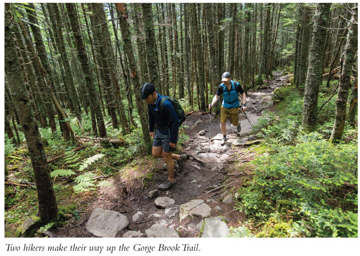
The Gorge Brook Trail, which used to follow the river here until a major washout in 2011 during Tropical Storm Irene, joins the Snapper trail and heads slightly away from the main brook, reaching the new junction at 0.8 mile. Turn right (north) onto the Gorge Brook relocation (called the Wales Carter Connection) as the Snapper Trail continues straight. A winding, fairly easy path heads back up toward the river, rejoining the old route and crossing a bridge at 1.3 miles. The Gorge Brook Trail continues along a sometimes-muddy section by the east bank of the brook, reaching the Ross McKenny Forest plaque at 1.6 miles.
Font size:
Interval:
Bookmark:
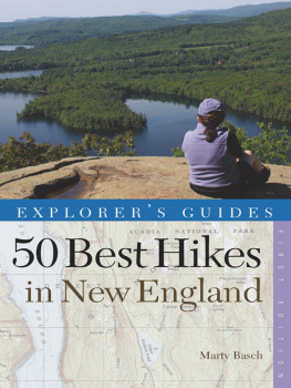
Similar books «Climbing New Hampshires 48 4,000 Footers: From Casual Hikes to Challenging Ascents»
Look at similar books to Climbing New Hampshires 48 4,000 Footers: From Casual Hikes to Challenging Ascents. We have selected literature similar in name and meaning in the hope of providing readers with more options to find new, interesting, not yet read works.
Discussion, reviews of the book Climbing New Hampshires 48 4,000 Footers: From Casual Hikes to Challenging Ascents and just readers' own opinions. Leave your comments, write what you think about the work, its meaning or the main characters. Specify what exactly you liked and what you didn't like, and why you think so.