Best Easy Day Hikes Series
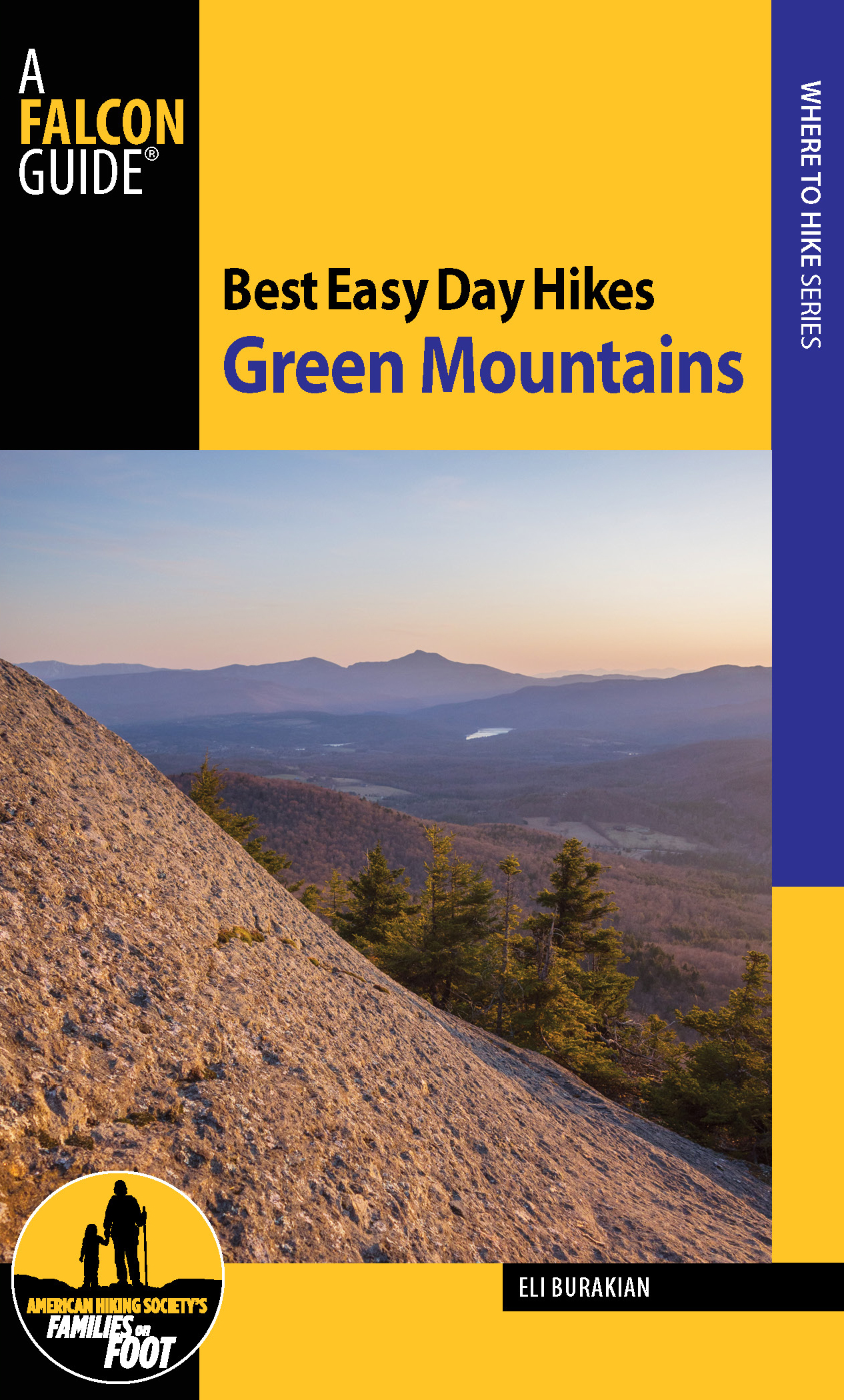
Best Easy Day Hikes Green Mountains
Eli Burakian
Copyright 2014 Morris Book Publishing, LLC
ALL RIGHTS RESERVED. No part of this book may be reproduced or transmitted in any form by any means, electronic or mechanical, including photocopying and recording, or by any information storage and retrieval system, except as may be expressly permitted in writing from the publisher. Requests for permission should be addressed to Globe Pequot Press, Attn: Rights and Permissions Department, PO Box 480, Guilford, CT 06437.
FalconGuides is an imprint of Globe Pequot Press.
Falcon, FalconGuides, and Outfit Your Mind are registered trademarks of Morris Book Publishing, LLC.
Project editor: Julie Marsh
Layout: Sue Murray
Maps: Melissa Baker Morris Book Publishing, LLC
Library of Congress Cataloging-in-Publication Data is available on file.
ISBN 978-1-4930-1029-5
The author and Globe Pequot Press assume no liability for accidents happening to, or injuries sustained by, readers who engage in the activities described in this book.
Contents
Acknowledgments
Id like to thank my wife, first and foremost, for putting up with me while I worked on this book during any available hours. Thanks go to my hiking companions, especially Tigran and Otis, who, with their combined eight legs, manage to put in twice the distance on every hike going back and forth and back and forth and... Im also very appreciative of all the hard work that went into creating and maintaining these trails, so I send my dearest thanks to those who helped in any way.
Introduction
The Green Mountains of Vermont are part of the Appalachian Mountain Range, which runs all the way from Georgia up through Maine and into Quebec and Newfoundland. Specifically, the Green Mountains refer to the north-southrunning range from northern Massachusetts up through the middle of Vermont. Although there are mountains from a few other ranges and some lone peaks in the state, the term Green Mountains generally refers to all the mountains in Vermont, and that is how it is being used in this book.
These Appalachian Mountains used to be much larger, but over hundreds of millions of years, the mountains have been eroded down to the core. Dont let the diminutive elevation of these peaks fool you, though, as the terrain in Vermont can be some of the most challenging in the country. The trails in Vermont tend to be fairly steep, with continuous rocks and roots to be aware of. Luckily, there are also many trails for which the reward is well worth the effort, and the hikes in this book tend to focus on maximizing the reward-to-effort ratio.
This region was inhabited for hundreds of years by Native Americans from the Abenaki culture. Eventually, years of farming and grazing by European settlers and their descendants in Vermont led to a landscape that was more than 80 percent open land by the turn of the twentieth century. As settlers continued moving west and farming became an increasingly small part of the American economy, the Vermont forests grew back, and they now comprise the same percentage of land in the state that grazing land once occupied.
The result of this is hundreds of miles of stone walls crisscrossing the landscape, deep within forests that were once grazing land. Additionally, logging roads of various ages provide paths in the woods, some of which have shifted to those used by hikers and bikers. You will see evidence of this in many of the hikes in this book.
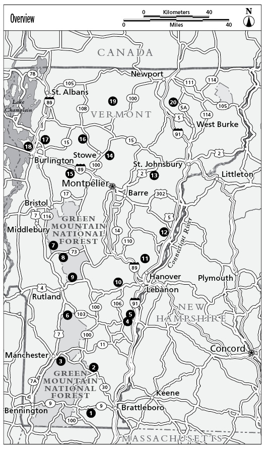
The Green Mountains run north-south through the middle of the state. To the west, much of the state is flanked by Lake Champlain and the Champlain Valley. Farm fields rise dramatically as you progress inland, leading to the steep western slopes of the range. To the east, the Connecticut River Valley creates the border between Vermont and New Hampshire, and in the north on a clear day from the summits in Vermont, the White Mountains of New Hampshire can be seen reaching into the sky. Along the spine of the Greens, five mountains manage to poke their heads above 4,000 feet: Killington Peak, Mt. Abraham, Mt. Ellen, Camels Hump, and Mt. Mansfield. The summits and ridgelines of the high mountain peaks are often exposed to crazy weather and embody everything that makes Vermonts weather interesting, only more so than in the lower valleys.
In addition to this main range of mountains, other mountains pop up around the state, such as Mt. Equinox, which is part of the Taconic Range, and Mt. Ascutney, which is a monadnock, or lone peak thought to be the remnant of an ancient volcano.
The hiking in Vermont is very varied, ranging from flat walks around lakes to wind-exposed ridgelines to steep trails zigzagging through the forest. A 272-mile long-distance hiking trail, called the Long Trail, traverses the high peaks of the Green Mountains and stretches from the Massachusetts border in the south to the border of Quebec in the north. The Appalachian Trail, a much longer trail that extends from Georgia to Maine, follows the southern 100 miles of the Long Trail and then turns east just north of Killington for 46 miles into New Hampshire. Many day hikes use these trails as part of a loop. Additionally, many hundreds of trails exist in the state parks, conserved land, and national forests throughout Vermont.
Use this book to begin your adventure, and for ideas to explore. Be willing to use these as jumping-off points, and use other resources available in books, magazines, and online to discover more places to hike, as well as bike, boat, or ski, among many other fun activities. Most important, take your time and enjoy the beauty of Vermont in all its guises.
The Nature of the Green Mountains
The hikes in this book are fairly gentle in nature, but all hikes in Vermont require a careful eye on the weather. The trails are generally well maintained, but be prepared on even the easiest hikes to step over roots, small streams, and rocks. Understanding your environment will not only make for a safer hike, it will make for a more enjoyable one as well.
Weather
As with most mountainous areas, weather can be very changeable and severe. It is important to look at the weather ahead of your hike. Some hikes might be fine in the rain, while others could become a bit dangerous.
Bad weather can come in from any direction, but much of the time the weather patterns flow from the west. When moist air, along with the extra moisture from Lake Champlain, hits the western side of the Green Mountains, the air is forced up in elevation. As the air rises, then so does the relative humidity, and once the air is saturated, precipitation will follow. This is called the orographic effect and explains why mountains often receive much more precipitation than the surrounding lowlands in the form of both rain and snow.
Additionally, high places are often windier, as the air can flow more freely above the surface, picking up speed. Often summits and ridges are exposed, making the wind feel even more severe. Wind chill is nothing to take lightly, and a nice spring day can quickly feel much colder if the wind picks up.
Rain can occur in any month, and snow usually falls between November and April. That being said, leftover winter snow or even fresh snow can be found near the high peaks well into June and as early as October.


