

Walking Twin Cities: 34 tours exploring historic neighborhoods, lakeside parks, gangster hideouts, dive bars, and cultural centers of Minneapolis and St. Paul
1st EDITION 2009
Copyright 2009 by Holly Day and Sherman Wick
Cover photos copyright 2009 by Holly Day and Sherman Wick
Interior photos: Holly Day and Sherman Wick
Maps: Bart Wright, Lohnes+Wright
Book and cover design and layout: Larry B. Van Dyke and Annie Long
ISBN 978-0-89997-483-5
Manufactured in Canada
| Published by: | Wilderness Press |
| 1345 8th Street |
| Berkeley, CA 94710 |
| (800) 443-7227; FAX (510) 558-1696 |
| info@wildernesspress.com |
| www.wildernesspress.com |
Visit our website for a complete listing of our books and for ordering information.
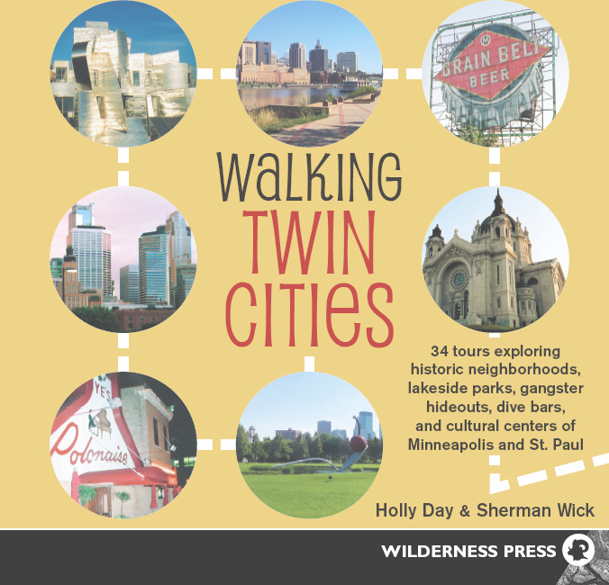
Cover photos : Front, clockwise from bottom center Spoonbridge and Cherry, Loring Park; Nyes Polonaise Room; Downtown Minneapolis; Weisman Art Museum; downtown St. Paul; Grain Belt Beer sign; the Cathedral of St. Paul. Back, clockwise from upper right: view from Stone Arch bridge; Old St. Anthony; Mill City Museum
Frontispiece : Prospect Park Witchs Hat Water Tower
All rights reserved. No part of this book may be reproduced in any form, or by any means electronic, mechanical, recording, or otherwise, without written permission from the publisher, except for brief quotations used in reviews.
SAFETY NOTICE: Although Wilderness Press and the authors have made every attempt to ensure that the information in this book is accurate at press time, they are not responsible for any loss, damage, injury, or inconvenience that may occur to anyone while using this book. You are responsible for your own safety and health while following the walking trips described here. Always check local conditions, know your own limitations, and consult a map.
To our grandmothers: Dorothy, Clara, Vera, and Joyce, for their guidance and inspiration

Cafesjians Carousel
ACKNOWLEDGMENTS
This book began on a frigid day in January and ended on a sweltering day in July. All of the days that came between only reaffirmed our love-hate relationship with Minnesotas unpredictable weather. Our biggest thanks go to our two children: Wolfgang, who was saddled with many hours of babysitting his little sister while we wrote the book, and Astrid, who went from begging to come along when we first started this endeavor to screaming, I dont wanna go! whenever we mentioned going for a walk. Wed also like to thank our parents, Rita Wick and Tom and Elvy Day, for babysitting during deadlines, as well as Mike and Laura Wick and Katharine and Mark Tondra. A big thank you goes to our agent, Matt Wagner, and all the people at Wilderness Press for making this book possible.
AUTHORS NOTE
Minnesotans love to talk about the weatherspend any time here, and youll understand why. A sunny summertime morning can easily turn into a rainy afternoon, and snow can surprise you as late as early May. A good rule of thumb is to check the forecast before heading out, and to make sure you dress sensibly according to the time of year. Another thing to keep in mind is that as cities evolve, landmarks change. Weve tried to mention only landmarks that were sure will stand the test of time, but you never can account for bad city planning or gentrification.
One thing to note: when navigating Minneapolis, its especially important to pay attention to St., Ave., N., S., N.E., S.E., etc. on the street signs. The citys laid out in a nice, neat grid, but newcomers not used to streets bearing multiple names can get easily lost. St. Pauls a little trickier, due to its poorly plotted street design adapted to a much more difficult, hilly topography. This is why we recommend visitors and residents alike use the map in the Hudsons Twin City Street Atlas; we have included Hudsons coordinates for all of the walks in this book.
We hope this book inspires you to investigate the great possibilities the Twin Cities offer. Happy trails!
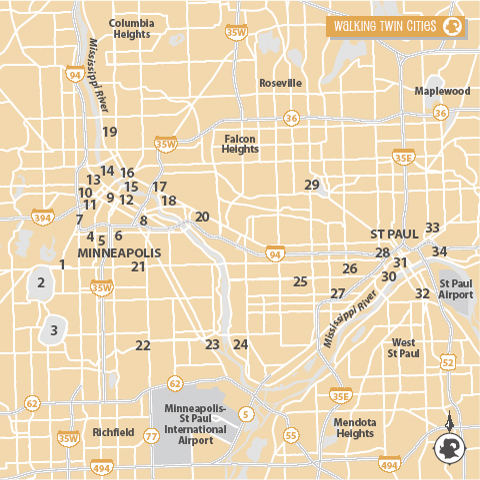
NUMBERS ON THIS LOCATOR MAP CORRESPOND TO WALK NUMBERS.
INTRODUCTION
Even though theyre often lumped together, the Twin Cities are two distinct cities with very different histories. Minneapolis is the Mill City, the City of Lakes, composed mostly of flat prairies. St. Paul is the Capital City, built on rolling hills and high river bluffs.
Culturally, the cities have their differences, too. Minneapolis is home to world-renowned theatres and modern art galleries, while St. Paul is the home of many of the states institutions, from the seat of government to the seat of the Roman Catholic Archdiocese of St. Paul and Minneapolis. Minneapolis is a newer city, which is reflected in the architecture and overall vibe, while St. Pauls older neighborhoods feature some of the most intact Victorian-era houses in the country. Because of their locations on the west and east sides of the Mississippi River, critics say that Minneapolis is more like a modern West Coast city, while St. Paul is akin to a historic East Coast city.
Both cities are linked by the Mississippi Riverthe same force that shaped their origins. St. Paul developed earlier, mostly because it was more easily accessible via the river. Another similarity between the two cities is the foresight by the Victorians who succeeded the cities founders to invest money into their communitiesboth cities set aside large tracts of land for public use all along the rivers and lakes. Some of the most beautiful parks were plotted in the early days of the cities.
Even today there are big differences between the cities. For example, St. Paulites, gluttons for punishment, host the annual Winter Carnival during the coldest time of the year. Minneapolitans take the easy way out by celebrating the Aquatennial Festival each summer. Despite having their city festivals at opposite ends of the solstice, Minnesotans love the outdoors. Even with the notoriously fierce winters, Minnesotans statistically spend more time outside than most.
Whether youre interested in art, culture, history, or nature, theres a walk in this book designed for your interests. We hope that it serves not only as a guidebook for (re)discovering the Twin Cities, but as a springboard for additional explorations.

UPTOWN: COOL PLACE FOR FUN IN THE HOT SUMMER SUN
BOUNDARIES: 31st St. W., Irving Ave. S., 26th St. W., Fremont Ave. S.
HUDSONS TWIN CITY STREET ATLAS COORDINATES: Map 394; 1D
DISTANCE: Approx. 1 miles
DIFFICULTY: Easy
PARKING: Free parking on the Mall

